#Contributing Writers
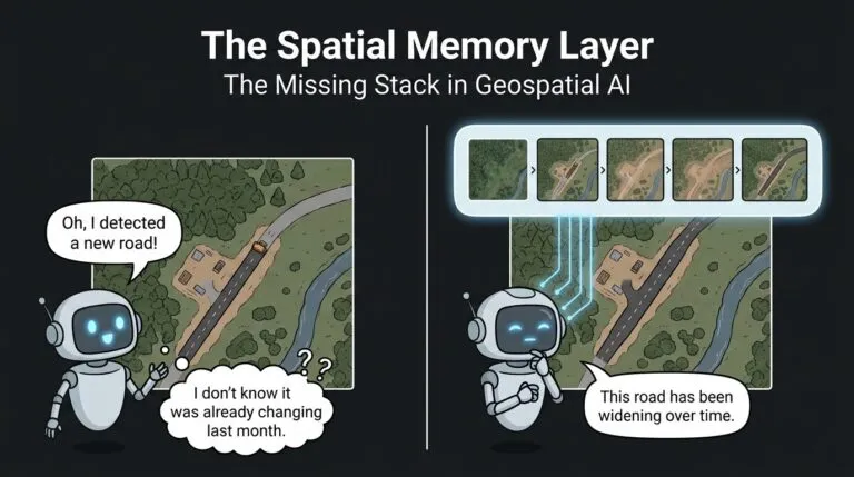
The Spatial Memory Layer: The Missing Stack in Geospatial AI
GeoAI is making progress in extracting information from satellite and aerial imagery. Current models can detect buildings, delineate roads, classify land cover, and map flood extent. Recent Earth obse…

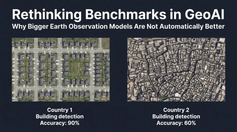
Rethinking Benchmarks in GeoAI: Why Bigger Earth Observation Models Are Not Automatically Better
For years, many Earth observation systems were trained to perform specific tasks: detect buildings, map roads, classify land cover, or segment floodwater. Now the field is moving toward larger geospat…


Search