
TomTom Cuts 200 Roles as It Reorganizes Around Automated Driving and Location Intelligence

TomTom is splitting its business into three divisions and targeting €21 million in annual savings. The reorganization makes its growth thesis unusually clear: navigation pays the bills today, while automated driving and AI-ready location intelligence are expected to deliver tomorrow’s expansion.
TomTom is reorganizing around three divisions, Automated Driving, Location Intelligence and Navigation, in a move that will affect approximately 200 jobs worldwide.
The Amsterdam-based mapping company says the new structure will reduce management layers and bring decisions closer to product execution. It expects the changes to produce about €21 million in annualized savings. Yet the announcement is more than a cost-cutting exercise. It sets out a sharper answer to a strategic question TomTom has faced for years: where does an established mapmaker find growth after consumer satnav hardware?
The answer is now explicit. Navigation remains the commercial backbone, but TomTom is placing its future growth bets on automated driving and enterprise location intelligence, both increasingly shaped by artificial intelligence.
A strategic reset under revenue pressure
The reorganization arrived alongside TomTom’s third-quarter 2026 results. Group revenue fell 6% year over year to €129 million. Location Technology revenue declined 3% to €115 million, while automotive operational revenue dropped 19% to €68 million.
TomTom reported an operating result of €6 million, equivalent to a 5% margin, and net cash of €239 million. The company raised its expected full-year operating margin from 3% to approximately 4%, even after including a €15 million restructuring charge expected in the fourth quarter. Excluding that one-time charge, it expects a margin of about 7%.
The market focused on the weak top line. Reuters reported that quarterly revenue missed the company-provided analyst consensus of €131 million and TomTom’s shares fell about 5% after the results. ING analyst Marc Hesselink pointed to continued weakness in automotive and an enterprise revenue miss.
TomTom also narrowed its 2026 revenue forecast to between €505 million and €530 million, from a previous range of €495 million to €555 million. The midpoint is lower, even as the profitability outlook improves.
That combination matters. TomTom is becoming leaner faster than it is becoming larger.
Three divisions, one shared map
Under the new structure, Navigation remains the unit closest to TomTom’s established business. Chief executive Mike Schoofs described it as the company’s backbone and the source of most current revenue.
Automated Driving will concentrate the technology used to support higher levels of vehicle automation. This includes high-definition and continuously updated geographic representations that complement vehicle sensors with information about road geometry, lanes, rules and conditions beyond immediate sensor range.
Location Intelligence will serve enterprises and developers that need map data, routing, traffic analysis and place intelligence inside applications or analytical workflows. This is where TomTom expects AI to shorten the path between raw geographic data and a usable answer.
All three units rely on the same underlying assets: TomTom’s maps, traffic data, location technology and AI capabilities. The reorganization therefore does not represent a breakup of the map stack. It is an attempt to package that shared stack around customer groups with different buying cycles and product needs.
The location layer for AI agents
TomTom has started presenting its maps not only as data for visual interfaces, but as context that software agents can query.
During the quarter, the company expanded its Microsoft collaboration to make location intelligence available to AI agents built with Microsoft Fabric and Microsoft Foundry. It also launched a Maps MCP Server in Anthropic’s Claude connector directory. MCP, or Model Context Protocol, allows an AI system to call external tools and retrieve structured information instead of relying only on knowledge embedded in a language model.
For location technology, this matters because many seemingly simple questions require live and spatially precise data. A model asked to identify reachable facilities, compare routes or analyze activity around a site needs geocoding, routing, travel-time calculations and current place information. A general language model cannot reliably infer those details from text alone.
TomTom’s enterprise opportunity is to make those capabilities easy for agents to access while preserving the accuracy, coverage and update discipline expected from a production mapping service.
Schoofs told Reuters that revenue from AI-related location intelligence should emerge faster in enterprise markets than in automotive. That assessment reflects the different deployment cycles. A developer can add an API or agent connector relatively quickly. A mapping component destined for a production vehicle can face years of engineering, validation and model-cycle planning.
Automated driving is a longer bet
TomTom remains optimistic that automated driving is moving from experimentation toward commercial programs. Its recent initiatives include collaborations with Microsoft, Mitsubishi Electric and DeepRoute.ai.
The case for maps in automated driving is also becoming more nuanced. Some autonomy companies have promoted map-light or mapless systems, but vehicles still operate inside a geographic and regulatory context. Road layouts, speed rules, lane restrictions and local driving conventions change by market. A continuously updated map can provide context and redundancy even when AI perception handles the immediate scene.
However, the 19% decline in automotive operational revenue shows why this cannot be treated as near-term proof of growth. Automotive contracts are large but slow, and a partnership announcement does not guarantee production volume.
What to watch next
TomTom says it expects Location Technology revenue to return to growth in 2027. That is now the key test of the reorganization.
Investors and customers should watch for three kinds of evidence. First, TomTom needs to identify production deployments that turn automated-driving partnerships into recurring revenue. Second, it needs to show that agent-facing location tools create meaningful enterprise usage rather than experimental integrations. Third, it must demonstrate that reducing approximately 6% of its workforce does not weaken map quality, customer support or the pace of product development.
TomTom’s new organization tells a coherent story: navigation funds the present, automated driving offers a long-cycle opportunity, and location intelligence for AI could grow sooner. The third-quarter figures also show the burden of proof. Efficiency has improved, but the company still needs revenue growth to validate the strategy.


#Business
Next article
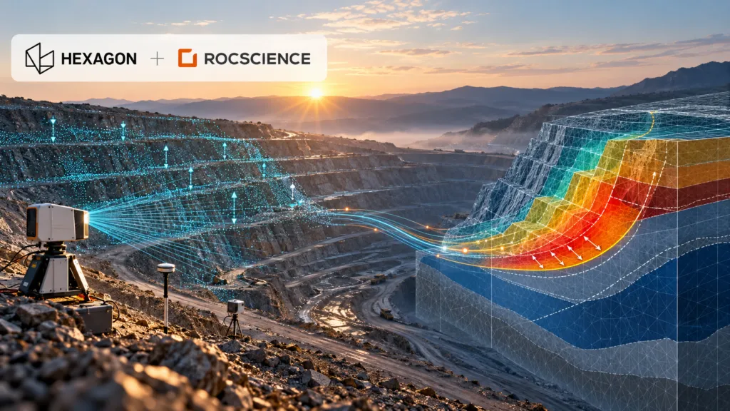
Hexagon has agreed to acquire geotechnical software specialist Rocscience for $535 million. The headline is another sizeable industrial-software transaction. The more important story is what Hexagon is trying to connect: continuous measurements of the physical world with models that predict how rock, soil and infrastructure will behave.
If that connection works, it could make geotechnical digital twins far more operational. If it does not, Hexagon will have paid a premium for an established software portfolio without resolving the difficult engineering, liability and interoperability questions between observation and prediction.
A premium price for trusted engineering software
Rocscience develops software for slope stability, finite-element analysis, tunnels, foundations, groundwater and related engineering problems. Its products include Slide2, Slide3, RS2 and RS3, and the company says customers use its software in about 125 countries.
According to Hexagon’s announcement, Rocscience is expected to approach $50 million in 2026 revenue, with more than 80% coming from annual recurring revenue and EBITAC margins above 40%. The $535 million enterprise value therefore represents roughly 10.7 times expected revenue. That is a substantial multiple, even for a profitable software company with sticky engineering workflows.
The deal is expected to close in the fourth quarter of 2026. Rocscience will join the Radar & Monitoring Division inside Hexagon’s Infrastructure & Geospatial business.
That organisational placement is revealing. Hexagon is not putting Rocscience beside generic design software. It is placing predictive modelling next to the instruments and platforms that observe ground movement.
The integration story did not begin with the acquisition
Hexagon describes a future in which sensor data automatically updates and calibrates engineering models. That remains a company claim, not a demonstrated end-to-end production capability. But the relationship has technical history.
Rocscience and Hexagon-owned IDS GeoRadar began integrating deformation-monitoring data in 2018. By 2019, engineers could bring live radar data into Slide3 and RS3. A later integration allowed Slide3 safety maps to be viewed with displacement information inside the IDS Guardian monitoring environment. The stated goal was already a “monitoring-to-modeling” workflow.
The acquisition therefore converts an existing partnership into a controlled product stack. Hexagon’s GeoMonitoring Hub can already combine radar, total-station, GNSS and third-party sensor data. Rocscience adds the analytical layer used to test possible failure surfaces, stress conditions and ground behaviour.
For an open-pit mine, the potential value is clear. Radar may detect accelerating movement on a slope, while a geotechnical model helps engineers interpret what that movement means under different geological and groundwater assumptions. Reducing the manual exchange between these systems could shorten the time between detection, interpretation and intervention.
Competition is already building connected subsurface platforms
Hexagon is not entering an empty market. Bentley’s Seequent business connects geological data and interpretation with GeoStudio and PLAXIS analysis through Seequent Central. Itasca competes in advanced geomechanical simulation with FLAC3D, 3DEC and related tools. In mine monitoring, Orica’s GroundProbe combines slope-stability radars with its MonitorIQ analysis platform and specialist services.
Rocscience has also been building its own broader platform. Since partnering with TA Associates in 2023, it has acquired DIANA for nonlinear structural analysis, 3GSM for rock-mass characterisation and blast analysis, 2SI for structural engineering, Rockfield for geomechanics, and Aquanty for surface-water and groundwater modelling.
Hexagon is consequently buying more than four familiar geotechnical applications. It is acquiring the beginnings of a multi-disciplinary engineering platform with access to structural, geological and hydrological workflows.
The hard part is governing the feedback loop
A live model is not automatically a reliable model. Sensor measurements contain noise and gaps. Numerical models depend on assumptions about materials, groundwater, geometry and boundary conditions. Automatically recalibrating a model can create false confidence if engineers cannot trace which observations changed which parameters.
That makes auditability critical. Customers will need version histories, uncertainty reporting, human approval gates and clear responsibility for automated recommendations. They will also want to know whether Hexagon will preserve support for third-party sensors and open data exchange, or use the acquisition to favour its own hardware.
Public practitioner reaction so far offers little independent guidance. Rocscience’s LinkedIn announcement attracted enthusiasm, but discussion was overwhelmingly congratulatory. Broader geotechnical forums show that engineers value Rocscience’s usability while relying on alternatives such as PLAXIS, GeoStudio and Itasca for different modelling requirements. That diversity matters because safety-critical modelling benefits from independent methods and cross-checks.
Hexagon has a credible technical rationale and an unusually clear integration starting point. What it has not yet shown is a delivery roadmap, pricing strategy or operational evidence that continuous sensor-to-model feedback improves decisions at scale.
At $535 million, that proof is now the central test of the deal.

