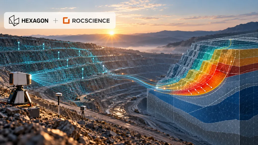

Hexagon has agreed to acquire geotechnical software specialist Rocscience for $535 million. The headline is another sizeable industrial-software transaction. The more important story is what Hexagon is trying to connect: continuous measurements of the physical world with models that predict how rock, soil and infrastructure will behave.
If that connection works, it could make geotechnical digital twins far more operational. If it does not, Hexagon will have paid a premium for an established software portfolio without resolving the difficult engineering, liability and interoperability questions between observation and prediction.
A premium price for trusted engineering software
Rocscience develops software for slope stability, finite-element analysis, tunnels, foundations, groundwater and related engineering problems. Its products include Slide2, Slide3, RS2 and RS3, and the company says customers use its software in about 125 countries.
According to Hexagon’s announcement, Rocscience is expected to approach $50 million in 2026 revenue, with more than 80% coming from annual recurring revenue and EBITAC margins above 40%. The $535 million enterprise value therefore represents roughly 10.7 times expected revenue. That is a substantial multiple, even for a profitable software company with sticky engineering workflows.
The deal is expected to close in the fourth quarter of 2026. Rocscience will join the Radar & Monitoring Division inside Hexagon’s Infrastructure & Geospatial business.
That organisational placement is revealing. Hexagon is not putting Rocscience beside generic design software. It is placing predictive modelling next to the instruments and platforms that observe ground movement.
The integration story did not begin with the acquisition
Hexagon describes a future in which sensor data automatically updates and calibrates engineering models. That remains a company claim, not a demonstrated end-to-end production capability. But the relationship has technical history.
Rocscience and Hexagon-owned IDS GeoRadar began integrating deformation-monitoring data in 2018. By 2019, engineers could bring live radar data into Slide3 and RS3. A later integration allowed Slide3 safety maps to be viewed with displacement information inside the IDS Guardian monitoring environment. The stated goal was already a “monitoring-to-modeling” workflow.
The acquisition therefore converts an existing partnership into a controlled product stack. Hexagon’s GeoMonitoring Hub can already combine radar, total-station, GNSS and third-party sensor data. Rocscience adds the analytical layer used to test possible failure surfaces, stress conditions and ground behaviour.
For an open-pit mine, the potential value is clear. Radar may detect accelerating movement on a slope, while a geotechnical model helps engineers interpret what that movement means under different geological and groundwater assumptions. Reducing the manual exchange between these systems could shorten the time between detection, interpretation and intervention.
Competition is already building connected subsurface platforms
Hexagon is not entering an empty market. Bentley’s Seequent business connects geological data and interpretation with GeoStudio and PLAXIS analysis through Seequent Central. Itasca competes in advanced geomechanical simulation with FLAC3D, 3DEC and related tools. In mine monitoring, Orica’s GroundProbe combines slope-stability radars with its MonitorIQ analysis platform and specialist services.
Rocscience has also been building its own broader platform. Since partnering with TA Associates in 2023, it has acquired DIANA for nonlinear structural analysis, 3GSM for rock-mass characterisation and blast analysis, 2SI for structural engineering, Rockfield for geomechanics, and Aquanty for surface-water and groundwater modelling.
Hexagon is consequently buying more than four familiar geotechnical applications. It is acquiring the beginnings of a multi-disciplinary engineering platform with access to structural, geological and hydrological workflows.
The hard part is governing the feedback loop
A live model is not automatically a reliable model. Sensor measurements contain noise and gaps. Numerical models depend on assumptions about materials, groundwater, geometry and boundary conditions. Automatically recalibrating a model can create false confidence if engineers cannot trace which observations changed which parameters.
That makes auditability critical. Customers will need version histories, uncertainty reporting, human approval gates and clear responsibility for automated recommendations. They will also want to know whether Hexagon will preserve support for third-party sensors and open data exchange, or use the acquisition to favour its own hardware.
Public practitioner reaction so far offers little independent guidance. Rocscience’s LinkedIn announcement attracted enthusiasm, but discussion was overwhelmingly congratulatory. Broader geotechnical forums show that engineers value Rocscience’s usability while relying on alternatives such as PLAXIS, GeoStudio and Itasca for different modelling requirements. That diversity matters because safety-critical modelling benefits from independent methods and cross-checks.
Hexagon has a credible technical rationale and an unusually clear integration starting point. What it has not yet shown is a delivery roadmap, pricing strategy or operational evidence that continuous sensor-to-model feedback improves decisions at scale.
At $535 million, that proof is now the central test of the deal.



#Business
Next article
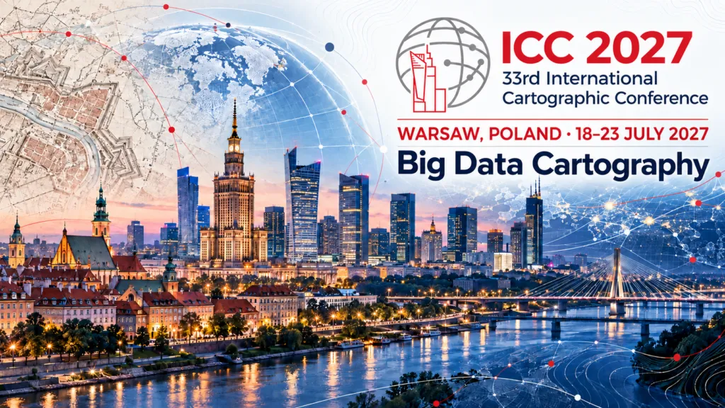
What Is a Map in 2027? 33rd International Cartographic Conference 2027 Brings the Question Back to Warsaw
A map no longer has to be something we look at.
An autonomous car can use a map that no passenger will ever see. A robot can navigate through a structured spatial model built for computation rather than visual interpretation. AI systems increasingly process geographic representations as part of their reasoning. At the same time, people still depend on beautifully designed paper maps, atlases and interactive visualizations.
So what exactly counts as a map today?
Geoawesome explored this question in 2021, reporting on international research into how people understand the term map. Based on nearly 900 respondents, the study found that the public already understood maps more broadly than the traditional idea of a flat graphical representation of geographic space.
Maps were increasingly seen as models of geographic reality and carriers of spatial information. A visible graphic was not always considered essential. Respondents also largely accepted that a map’s user does not have to be human. It can be a machine.
Five years later, Geoawesome returned to that idea in Maps for Machines: A Paradigm Shift in Cartography. The discussion around high-definition maps for autonomous vehicles showed how far the transformation had progressed. Some of today’s most advanced maps are not primarily designed to be seen. They are designed to be processed.
This is not the end of traditional cartography. It is an expansion of its role.
From map images to intelligent spatial models
That expansion sits at the heart of the featured theme for the 33rd International Cartographic Conference, which will take place in Warsaw from 18 to 23 July 2027:
Big Data Cartography: Understanding More Than Ever Before
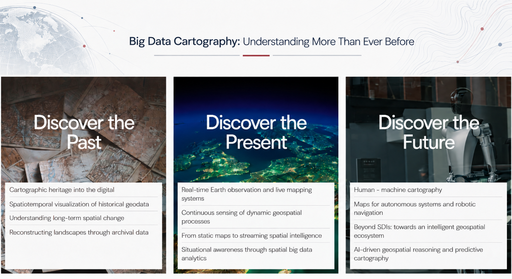
The phrase is deliberately broader than big data. Cartography can help us discover the past by integrating historical maps, archives and spatiotemporal data. It can help us observe the present through Earth observation, sensors, real-time mapping and continuously updated spatial information. Increasingly, it also allows us to explore possible futures through GeoAI, predictive modelling, digital twins and intelligent geospatial systems.
The growth of spatial data is not simply allowing us to map more. It is allowing us to understand more.
That understanding is no longer created exclusively for people. The emerging geospatial ecosystem must communicate spatial knowledge among humans, machines and increasingly autonomous AI systems. Cartography is becoming part of a much larger technological transformation.
Where does cartography go next?
The shift raises fundamental questions:
- What makes a spatial dataset a map?
- Is visualization still a necessary part of cartography?
- What happens when the primary map user is an algorithm, autonomous vehicle or robot?
- Where is the boundary between cartography, GIScience, GeoAI and spatial systems engineering?
Most importantly, what is the unique contribution of cartographic knowledge when machines increasingly analyse, interpret and act on geographic information?
ICC 2027 is not presenting these questions as settled. The organizers expect the program to include a dedicated debate about the future development of cartography. Human-machine cartography, autonomous systems, GeoAI and the changing meaning of maps are precisely the issues that make such a debate necessary.
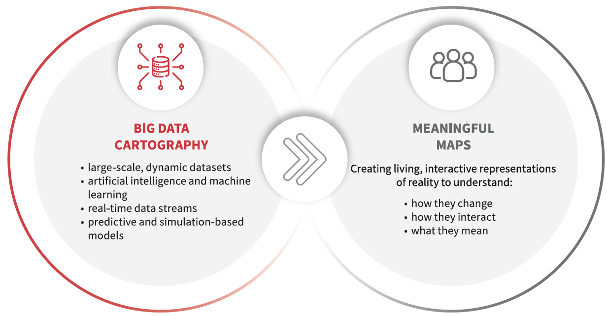
The conference remains equally committed to cartography in its full diversity. Traditional map design, visualization, atlases, cartographic heritage, cognition, education and the established fields of cartography and GIScience remain central to its 50-topic program. The goal is not to replace one understanding of cartography with another, but to ask how much larger the field is becoming.
A conversation for the whole geospatial community
This discussion should reach beyond the traditional cartographic community because modern data-driven systems often rely on cartographic principles without naming them as such.
Developers of navigation applications, mobility platforms, digital twins, dashboards, location-based services, autonomous systems and virtual environments may not describe themselves as cartographers. Yet many of the problems they solve are fundamentally cartographic: how to model geographic reality, structure spatial knowledge and communicate it effectively.
ICC 2027 aims to bring together cartographers, GIS specialists, GeoAI researchers, Earth observation experts, navigation and autonomy developers, digital twin specialists, computer scientists, smart-city professionals and geospatial industry leaders. All of them increasingly face the same challenge: turning growing volumes of spatial data into meaningful representations of the world for humans or machines.
The conference will be held across the University of Warsaw and Warsaw University of Technology, with the 21st General Assembly of the International Cartographic Association taking place alongside it. It will be the first ICC in Warsaw since 1982.
For prospective speakers, the submission system opens on 15 October 2026. Full papers are due on 20 November, abstracts on 1 December, and acceptance notifications are planned for 1 February 2027.
After 45 years, the global cartographic community is returning to Warsaw. There may be no better moment to revisit one of the discipline’s oldest questions: what is a map?
The answer is changing faster than ever.
Learn more at icc2027.org.


