The EU Put a 24-Hour Delay on Copernicus Data. Open Earth Observation Just Became Conditional

A 24-hour delay may not sound like much. For Earth observation, it can change the role of satellite data completely.
In July 2026, the European Union decided to delay the release of Sentinel-1 and Sentinel-2 data covering part of the Sea of Oman. The restriction was introduced after a request from the United States and was justified on security grounds.
The data is still available. This is not a full blackout. But users cannot access it until 24 hours after acquisition.
That difference matters. Imagery that might help track an unfolding situation becomes a record of what happened yesterday.
The decision is limited to one region and two Sentinel missions. Yet it raises a much larger question for the geospatial industry: how open is open Earth observation data when security interests enter the picture?
What has been confirmed
The legal basis is Council Decision 2026/1716, adopted on July 13 and published on July 14, 2026.
The decision instructs the European Commission to delay Sentinel-1 and Sentinel-2 data concerning a specific area in the Sea of Oman for 24 hours from acquisition.
According to the document:
- US authorities requested the restriction on May 26.
- The request went through the EU Space Threat Response Architecture.
- The EU Political and Security Committee supported the measure on June 10.
- The stated goal is to stop EU space data from being used in ways that could threaten the EU, its member states or their allies.
- The European Commission is responsible for implementing the restriction.
The Commission later told Euractiv that the measure would remain in place for as long as necessary.
This is the official explanation. The public documents do not provide evidence that Sentinel data had already been used to threaten European or allied operations.
They also leave several important questions unanswered.
The exact boundary of the restricted area has not been published. There is no public end date, review date or clear description of what would cause the restriction to be removed. It is also unclear whether similar requests have been approved before.
Why Sentinel data matters in this region
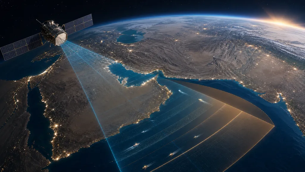
Sentinel-1 carries a synthetic aperture radar instrument. It can observe the surface during the day or at night and through cloud cover. This makes it useful for detecting ships, changes to infrastructure and unusual activity at sea.
Sentinel-2 provides optical imagery that can add visual context when the sky is clear.
Together, these missions support maritime monitoring, journalism, academic research, environmental analysis and open-source investigations.
The Sea of Oman is also the entrance to the Strait of Hormuz, one of the world’s most important shipping routes. Timely imagery from this area can help analysts examine vessel movements, port activity and changes around coastal infrastructure.
Recent research has demonstrated how Sentinel-1 can be used to study changes in shipping around the Strait of Hormuz without depending entirely on cooperative ship-tracking signals.
Open-source investigators have also shown what radar data can reveal during conflict. Bellingcat developed a tool based on Sentinel-1 to identify possible damage in Iran and the Gulf. The method does not provide the detail of very high-resolution commercial imagery, but it can show significant changes across large areas.
This is why the 24-hour rule is meaningful. It reduces the value of Copernicus for monitoring fast events, while preserving its value for later analysis and documentation.
A delay, not a blackout
There is a valid security argument for delaying sensitive imagery.
Satellite data can reveal the location of ships, temporary infrastructure, logistical activity or changes near military sites. Even medium-resolution data can become more useful when combined with ship signals, social media, drone footage and other sources.
A delay can limit this immediate value without permanently removing the public record.
Alexander Gunkel, CEO of Space4Good, described this tension well in a LinkedIn discussion. Open imagery supports researchers, journalists and civil society, but during a conflict it can also expose movements and vulnerabilities. From this perspective, 24 hours may separate operational intelligence from historical evidence.
This is probably the strongest argument in support of the EU decision.
It is also less restrictive than some measures applied to commercial imagery during the Iran conflict. Planet and Vantor restricted access to selected high-resolution images, according to reporting by The Washington Post and Ars Technica.
The Copernicus data will still appear after the delay. Researchers will still be able to study it. Journalists will still be able to use it to verify past events.
But calling the measure limited does not answer the governance questions around it.
Open data was never without security rules
Copernicus is built around free, full and open access. However, this principle has always included security exceptions.
The EU Space Programme Regulation requires Copernicus to follow an open data policy while taking security needs into account.
The more detailed Copernicus data restriction rules allow the Commission to limit access when the security of the EU or its member states could be affected. They also say that restrictions should interrupt data access as little as possible.
Legally, the EU appears to be acting within an existing framework.
What is new is the visibility of that framework.
For most users, Copernicus has functioned as dependable public infrastructure. Data arrives, platforms process it and applications are built on top of it. Security exceptions may exist in the legal text, but they rarely enter everyday product planning.
This decision makes those exceptions real.
The industry risk is larger than one missing day
Aravind Ravichandran, founder of TerraWatch, raised the business side of the issue in his LinkedIn commentary.
His main point was not that the EU lacks the right to restrict access. It was that the limits remain unclear. How long can a restriction continue? What criteria are used? Who can request one? What level of evidence is required?
For companies building services on Copernicus data, these are not abstract policy questions.
A maritime intelligence service, automated monitoring platform or GeoAI agent may assume that Sentinel data will be available on a predictable schedule. If access can change during the exact events that create the greatest demand, the product needs a fallback.
This could mean adding commercial data, using more than one public satellite program, keeping older observations available locally or clearly warning customers that real-time coverage is not guaranteed.
The official Copernicus Data Space documentation gives an expected publication time of up to 24 hours for Sentinel-1 and Sentinel-2 products. In practice, data can arrive much faster. A previous Copernicus Data Space annual report reported average Sentinel-1 publication in less than three hours during most of 2023.
The new rule sets a minimum 24-hour wait from acquisition in the affected area. For users accustomed to receiving data within a few hours, that is a clear operational change.
Transparency is the weak point
The public discussion is divided, but not simply between people who support security and people who support open data.
Andrzej Kotarski of the Polish Astronautical Society noted on LinkedIn that the decision does not say when the restriction took effect or when it will be reviewed.
Reddit discussions in r/technology and r/europe show a similar split.
Some participants see 24 hours as a reasonable safety measure that can protect current operations. Others worry that an open-ended restriction requested by another government creates a precedent for reducing public visibility during conflict.
These are opinions, not proof of either harm or safety. But they point to a real gap in the EU’s approach.
A security exception can be both justified and poorly explained.
The EU could reduce uncertainty by publishing the general boundary of the affected area, the date the measure became active, a review schedule and basic information about how necessity is tested. It could do this without revealing sensitive operational details.
Independent oversight would also help. If access to public satellite infrastructure is restricted, users should know that someone outside the immediate security process can review whether the measure remains necessary and proportionate.
The bigger lesson for Earth observation
The most important outcome of this decision is not the loss of 24 hours of imagery over one part of the Sea of Oman.
It is the recognition that open satellite data is conditional infrastructure.
Copernicus remains one of the strongest open Earth observation programs in the world. This decision does not change that overnight. It does show that access can be adjusted when political and security pressure is high.
That creates three lessons for the industry.
First, open data users need contingency plans. A free and dependable source can still have regional or temporary limits.
Second, Europe needs clearer public rules for applying security exceptions. Trust depends not only on whether restrictions are legal, but also on whether they are narrow, reviewed and explained.
Third, the geospatial industry must take part in this discussion. The rules should not be shaped only by defence officials or satellite operators. Researchers, journalists, downstream companies, civil society groups and open-source investigators are also affected.
The EU has chosen a middle path. It did not permanently remove the data, but it did remove much of its immediate value.
Whether this remains a narrow exception or becomes a model for future restrictions will matter far beyond the Sea of Oman.



#News
Next article
The Living Library: Where Historical and Current Satellite Imagery Comes Alive

In today’s geospatial environment, access to satellite imagery is no longer the challenge. The real challenge is finding the right imagery quickly, accessing it in the format you need, and seamlessly integrating it into existing workflows. The Living Library can help make the imagery you need, quick and easy to access with interoperability into multiple workflows.
The Living Library is Airbus’ curated, cloud-based archive of premium optical satellite imagery, designed to provide geospatial professionals with rapid access to both recent and historical Earth observation data. Unlike traditional archives that require users to search, order, and wait for delivery, the Living Library offers imagery that is immediately available through streaming, download, APIs, and GIS integrations. The archive is continuously updated with new acquisitions every day, ensuring users have access to both fresh imagery and historical context.
Why Historical Context Matters
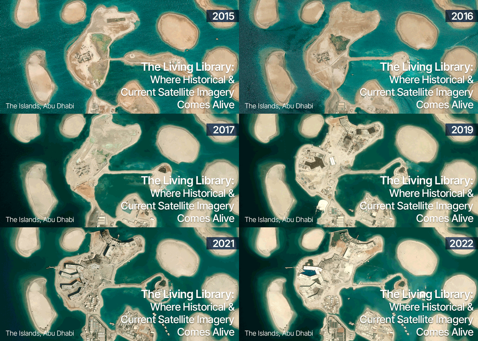
A current image can tell you what exists today. A historical archive helps explain how it got there.
Whether monitoring urban expansion, tracking infrastructure development, assessing environmental change, or supporting defense and security operations, understanding change over time is often just as important as understanding current conditions.
The Living Library provides access to curated Airbus imagery at resolutions ranging from 30 cm, 50 cm and 1.5 m resolution data. Subscribers can explore years of historical observations while also benefiting from newly acquired imagery that is added on a daily basis.
For organizations that routinely perform change detection, validation, site monitoring, or training and simulation activities, this temporal depth transforms imagery from a static dataset into a dynamic source of intelligence.
More Than an Archive
What makes the Living Library different from a traditional imagery archive is accessibility.
Users can search, view, stream, and download imagery directly from the cloud without managing large data repositories or waiting for custom production workflows. Access to imagery is flexible, allowing organizations to incorporate premium satellite data directly into their existing operational environments.
This flexibility enables a variety of workflows:
- Stream imagery directly into GIS applications for rapid visualization and analysis.
- Download full-resolution imagery for advanced processing
- Access data programmatically through APIs to automate geospatial processes.
- Integrate satellite imagery into enterprise mapping and decision-support systems.
A key capability of the Living Library that keeps users informed about new imagery over their area of interest is the “Alert on AOI” feature. Within OneAtlas, users can simply draw an AOI and activate an alert, after which they will receive an email notification whenever new imagery becomes available for that location. While new acquisitions are not guaranteed, users are automatically notified as soon as relevant data enters the archive
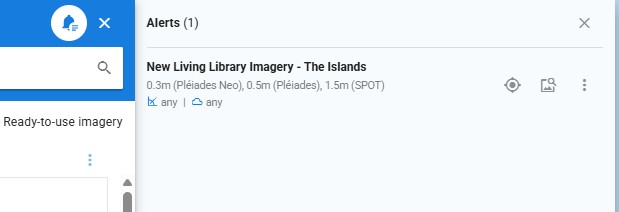
Users can set up an Alert on AOI to get notified when there is a new image over your AOI.
Complementing the Airbus Basemap
While the Living Library provides access to individual image acquisitions across time, the Airbus Global Basemap delivers a seamless, ready-to-use view of the world.
The Global Basemap provides worldwide coverage of up-to-date imagery that can be streamed or downloaded, creating a consistent foundation for mapping, visualization, and analysis. The Global Basemap is a ready-to-use layer with 30cm resolution over urban areas, 50cm and 1.5m resolution over the rest of the Earth’s landmass. Together, the two services provide a powerful combination: a current, globally consistent basemap for operational awareness and a historical imagery archive for temporal analysis and validation.
Users can move from a global view of current conditions to detailed historical imagery for a specific location in just a few clicks, helping answer both “What is here today?” and “How has it changed over time?”
Airbus offers more than just a Global Basemap, with a portfolio that includes global, regional, and customized basemap products that balance resolution, coverage, refresh frequency, and performance to meet diverse user requirements.
Bringing Imagery Directly into ArcGIS Pro
One of the biggest barriers to imagery adoption has traditionally been workflow complexity. Geospatial professionals often need to leave their GIS environment to search, order, and manage imagery.
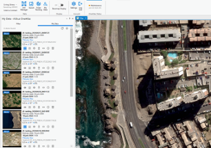
Airbus is helping simplify that process through its expanding integration options, including a new ArcGIS add-in that allows users to discover and access Airbus imagery directly within their ArcGIS environment. Combined with the Living Library subscription service, users can search historical imagery and bring premium satellite data into their projects without switching platforms.
The result is a more streamlined experience that reduces the time between identifying a need for imagery and putting that imagery to work.
The Future of Imagery Access
As satellite constellations continue to generate increasing volumes of data, success will depend less on the amount of imagery available and more on how easily organizations can access and use it.
The Living Library moves beyond traditional imagery archives by providing on-demand access to both historical and current satellite data. Through streaming, downloads, APIs, and ArcGIS integration, users can quickly find, access, and analyze imagery without disrupting their existing workflows.
For geospatial professionals, the value isn’t simply having access to imagery. It’s having the right imagery, at the right time, in the right place within their workflow.
To learn more about Airbus Imagery Services, including the Living Library and Imagery Basemaps, please visit our website.


