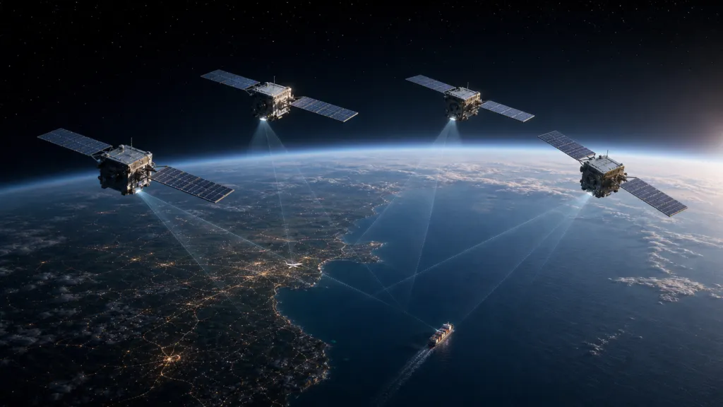

Mitsubishi Electric has invested $10 million in Array Labs, a US startup developing radar satellites that could track aircraft and ships from space.
The investment anchors a new $21 million funding round. The companies will also work together on tracking services for defense and security customers in the Asia-Pacific region.
The partnership reflects a wider change in Earth observation. Most satellites collect images of the ground. Array Labs wants to add something more dynamic: information about what is moving, where it is going and how activity changes over time.
Moving beyond satellite images
Array Labs is developing Airborne Moving Target Indication, or AMTI, from space.
AMTI uses radar observations to detect and follow moving aircraft. Similar technology has traditionally been installed on ground stations and surveillance aircraft. Moving it into orbit could provide coverage over remote areas and contested airspace where conventional systems are limited or vulnerable.
The demand appears real. The US Space Force recently awarded SpaceX a $4.16 billion agreement for its own space-based airborne tracking programme. The military sees orbital radar as an additional layer—not a complete replacement for aircraft and ground sensors.
Supporters of Array Labs see the company as part of this emerging market. They argue that the investment is especially important because Mitsubishi brings more than money. It has experience in radar, satellite manufacturing and government defense programmes, as well as relationships across Asia.
From this perspective, the deal could help Array Labs move from research contracts to products that governments can actually procure and operate.
Several satellites working together
Array Labs’ approach uses groups of smaller radar satellites flying in formation. They are designed to work together as one distributed sensor.
Observing the same target from different positions could improve three-dimensional mapping and moving-object detection. It could also allow customers to purchase dedicated radar payloads or sovereign satellite clusters instead of relying entirely on a shared commercial constellation.
Array Labs has received research contracts involving DARPA, the US Navy and the US Air Force. Mitsubishi also says the company has completed successful airborne tests of its technology.
However, the most important capability has not yet been demonstrated in space.
The current plan is to launch radar satellites in stages during 2027 and 2028. Until then, claims about tracking performance, coverage and commercial readiness remain projections.
The difficult questions
The technical challenge is considerable. Several satellites must know their relative positions, synchronize their radar observations and combine large volumes of data quickly.
Coverage is another issue. A satellite in low Earth orbit only sees a location for a limited time. Continuous tracking would require a larger constellation, fast communications and a ground system capable of producing reliable tracks with little delay.
Array Labs has not disclosed how many satellites would be needed for persistent regional coverage. It has also not published detection ranges, target sizes, false-alarm rates or performance under electronic interference.
Skeptics will therefore see the partnership as a promising development programme rather than an operational breakthrough.
There is also a policy perspective. Governments increasingly want greater control over satellite intelligence, particularly for defense. Mitsubishi could help Array Labs offer systems tailored to individual countries. At the same time, a strong defense focus may restrict wider access to the technology and its data.
Why the deal matters
The investment does not mean that reliable aircraft tracking from orbit has arrived. It shows that established defense and satellite companies believe the capability is important enough to fund.
If Array Labs can prove its system in orbit, it could help move Earth observation beyond occasional images and toward a more continuous understanding of activity on land, at sea and in the air.
The next major milestone is not another funding round. It is a successful orbital demonstration.


#Business
Next article

FOSS4G:UK 2026: Registration, Call for Talks and Sponsorship Are Now Open

Join the UK’s open source geospatial community in Leeds on 12–13 October 2026.
FOSS4G:UK returns to Horizon Leeds this October for two days of inspiring talks, practical workshops, networking and collaboration. Whether you’re a developer, researcher, consultant, public sector professional, student or enthusiastic user of open source geospatial technology, there’s something for you at FOSS4G:UK.
From discovering the latest projects and technologies to meeting the people behind them, FOSS4G:UK is where the UK open geospatial community comes together.
Register Today
Registration is now open, with ticket options to suit everyone.
- Early Bird two-day tickets are available until 31 July (or until sold out).
- Single-day tickets are available if you can only attend one day.
- Discounted tickets are offered to help make the conference accessible to students, under-represented groups, people on lower incomes and anyone for whom the full ticket price would otherwise be a barrier.
- Conference social tickets are available even if you’re not attending the conference itself.
Share Your Knowledge
The FOSS4G:UK agenda is created by the community, and we’d love you to be part of it.
We’re looking for submissions in three formats:
- Hands-on workshops
- 20-minute conference talks
- 5-minute lightning talks
Whether you’re demonstrating open source tools, presenting research, sharing lessons learned or showcasing an exciting project, we want to hear your story.
Never spoken at a conference before? Don’t let that stop you. FOSS4G:UK has a long tradition of welcoming and supporting first-time speakers.
The Call for Talks closes on 31 July.
Become a Sponsor
Support one of the UK’s leading open source geospatial events while raising your organisation’s profile.
We’re currently looking for:
- Gold Sponsors
- Silver Sponsors
- Two exclusive sponsors for the conference social event
Sponsoring FOSS4G:UK puts your organisation in front of an engaged audience of developers, consultants, researchers, practitioners and decision-makers who are passionate about open technologies.
A Community Event
“FOSS4G:UK has always been about bringing people together to share knowledge, collaborate and strengthen the open geospatial community. Whether you’re attending for the first time, presenting your work or supporting the event as a sponsor, every contribution helps make the conference what it is. It’s very exciting to be involved in putting this event on, and we’re looking forward to welcoming both familiar faces and newcomers to Leeds this October.”
— Alastair, on behalf of the FOSS4G:UK 2026 Organising Committee
Why People Keep Coming Back
Last year’s event (FOSS4G:UK 2025) received fantastic feedback from across the community. Some of what we received includes:
“Fantastic event, thanks for organising!”
“It was beyond my expectations and really enjoyable.”
“The openness of the presenters and attendees is excellent, and the networking is invaluable.”
“Great engagement from speakers, sponsors and delegates made for a lot of interaction, learning and excitement.”
“Very happy to see lots of new faces and first-time presenters.”
“Fantastic, would definitely come again.”
We’re building on that success to make FOSS4G:UK 2026 even better.
Did you like this post? Read more and subscribe to our monthly newsletter!


