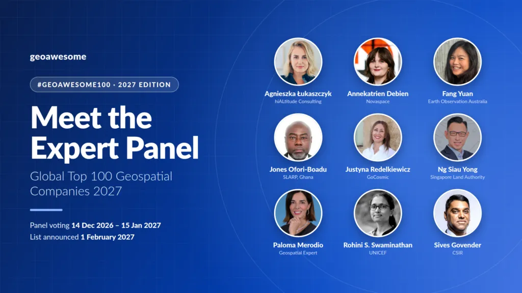

Meet the Expert Panel for the Global Top 100 Geospatial Companies 2027
Nine experts from government, industry, research, and international organizations will review the community shortlist and decide the final #Geoawesome100 list for 2027.






The experts are back
We are excited to introduce the first nine members of the expert panel that will review the Global Top 100 Geospatial Companies 2027. Together, they bring perspectives from national mapping and land agencies, the UN system, space agencies and programmes, research institutions, and the private sector across five continents.
Last year we tried something new. For the 2026 edition, we handed the process entirely to the geospatial community, and more than 125 professionals signed up to help decide which organizations should be recognized. It showed us how much the community cares about this list, and it gave us valuable insight into which companies practitioners see as pushing the industry forward.
It also confirmed something we have long believed: the list is strongest when broad community insight is combined with deep, independent expert review. That is why the 2027 edition uses a community + expert hybrid model. The community helps surface candidates and shape the shortlist. Our expert panel then evaluates that shortlist and casts the final votes.
Meet the 2027 panel
Panelists are listed alphabetically by first name. More experts will join in the coming weeks, so check back for updates.
Dr. Agnieszka Łukaszczyk
Founder & CEO
hiALtitude Consulting
Dr. Agnieszka Łukaszczyk is a senior space industry executive and internationally recognized expert in space policy, government affairs, and space security. She is the Founder and CEO of hiALtitude Consulting, advising governments, international organizations, and commercial space actors on regulatory strategy, geopolitical risk, and institutional engagement.
She serves as Head of Institutional Relations for the International Astronautical Congress 2027 (IAC2027) in Poznań, leading high-level stakeholder engagement for one of the world’s premier space gatherings. She is also a Senior Advisor at Andart Global and Renaissance Strategic Advisors, providing strategic counsel at the intersection of space, security, and international policy.
Previously, Dr. Łukaszczyk was Vice President for Government Affairs, EMEA at Planet, where she led policy and government engagement across Europe, the Middle East, and Africa. She held multiple roles at the European Commission focused on space policy, space security, and Earth observation. She also served as Brussels Office Director for the Secure World Foundation, was a Research Fellow at the European Space Policy Institute and the Chair and Executive Director at Space Generation Advisory Council.
She holds a PhD in Space Security from the Polish Defence Academy, along with advanced degrees in Management of Space in New Economies and International Politics. Her executive education includes studies at Saïd Business School, University of Oxford, Warsaw School of Economics and the American University.
Annekatrien Debien
Partner, Earth Observation & PNT
Novaspace · Belgium
Annekatrien Debien is a Partner at Novaspace, where she leads Earth Observation (EO) and Positioning, Navigation and Timing (PNT) activities. She has over 15 years of experience across Europe’s EO industry and institutions, with a background in bioscience engineering, a master’s in Earth Observation and an Executive MBA focused on entrepreneurship.
She is passionate about helping people put space applications to practical use, and understanding how geospatial data can improve business processes and make everyday life easier and safer. Her experience ranges from creating training materials for developers and entrepreneurs and helping end users explore the benefits of EO, to developing SAR-based services for maritime surveillance, sea ice monitoring and deforestation monitoring.
Dr. Fang Yuan
President
Earth Observation Australia · Australia
Dr. Fang Yuan is an Earth observation scientist, independent consultant and President of Earth Observation Australia. She provides scientific, technical and strategic advice, drawing on leadership experience across government, industry and international initiatives.
Fang has led multidisciplinary teams and the development of satellite-based environmental information services. She brings a practical perspective on how geospatial technologies translate into useful services and support better decisions.
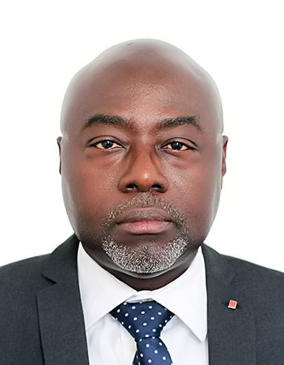
Surv. Jones Ofori-Boadu
Project Director, Strategic Land Administration Reform Project (SLARP)
Ministry of Lands and Natural Resources · Ghana
Surv. Jones Ofori-Boadu is currently the Project Director for the Strategic Land Administration Reform Project (SLARP) under the Ministry of Lands and Natural Resources of Ghana.
He holds a BSc in Geomatic Engineering, an MSc in Geographic Information Systems (GIS) and an MBA in Project Management. He is a Fellow of the Ghana Institution of Surveyors (GhIS) and a member of the International Federation of Surveyors (FIG).
Justyna Redelkiewicz
Founder
GoCosmic & 3 Hazel Tree Partners
Justyna Redelkiewicz is the founder of GoCosmic and 3 Hazel Tree Partners, boutique firms delivering strategic advisory across space, AI, and cybersecurity. At the European Union Agency for the Space Programme, she led the €1 billion CASSINI initiative, driving entrepreneurship and innovation across Europe’s space sector. A recognized pioneer in applying space technologies on Earth, she bridges cutting-edge innovation with real-world impact.
She is an active angel investor in space startups and works with Depo Ventures to advance private investment in next-generation technologies. Justyna collaborates with the AGH University of Science and Technology and served as a visiting professor at the International Space University. She is also Head of Entrepreneurship at Women in Aerospace Europe, where she champions innovation and leadership in the space ecosystem.
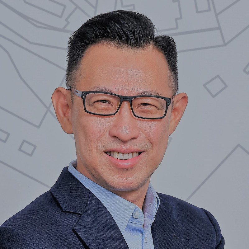
Ng Siau Yong
Director, GeoSpatial and Data Division & Chief Data Officer
Singapore Land Authority (SLA) · Singapore
Ng Siau Yong is the Director of the GeoSpatial and Data Division and Chief Data Officer at the Singapore Land Authority (SLA). He is a member of the UN Committee of Experts on Global Geospatial Information Management (UN-GGIM) and currently chairs its National Institutional Arrangements Working Group.
Trained as an urban planner, Siau Yong started his career with the Singapore Urban Redevelopment Authority (URA). He later served the Ministry of National Development (MND) and the Ministry of Law (MinLaw) in various capacities. At SLA, he first served as Director, Strategic Planning and Policy, and later as Director, Land Asset Management Services, before taking on his current portfolio.
Siau Yong has also been actively involved in tertiary education, serving the National University of Singapore (NUS) for many years as an Adjunct Associate Professor teaching Urban Planning and Urban Policy in undergraduate and postgraduate programmes.
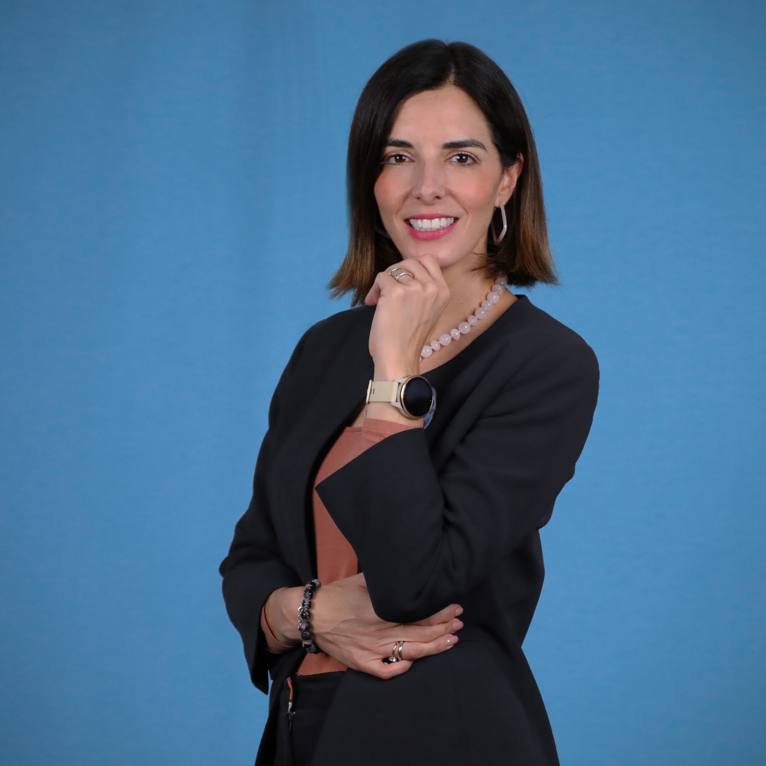
Paloma Merodio
Geospatial Expert
Mexico
Paloma Merodio is Assistant Vice President of Data Analysis & Intelligence at AT&T Mexico. She is an economist and data leader with more than 19 years of experience driving innovation across data analytics, digital transformation, business intelligence, geospatial information management, public policy evaluation, and the use of data to advance sustainable development.
Before joining AT&T Mexico, Paloma held senior leadership roles in Mexico’s national statistical system, including Vice President of INEGI, the National Institute of Statistics and Geography. She also served as Global Co-Chair of the United Nations Committee of Experts on Global Geospatial Information Management, where she contributed to strengthening the role of geospatial data in decision-making at the global level.
Her career spans the private and public sector, multilateral organizations, and international development. She has led the monitoring and evaluation of social programs at Sedesol and the Mexican Social Security Institute, and has worked as a consultant on projects for the World Bank, IFC, and other international organizations.
Paloma holds a bachelor’s degree in economics with special honors from ITAM, a Master in Public Administration in International Development from Harvard Kennedy School, and a PhD in Economics with honorable mention from UNAM. Her career has been recognized with the Geospatial World Leadership Award as “Geospatial Ambassador” at the Geospatial World Forum 2025 in Madrid.
Rohini Sampoornam Swaminathan
Statistics and Monitoring Manager, WASH, Climate and Environment
UNICEF
Rohini Sampoornam Swaminathan has nearly 15 years of experience in developing geospatial applications for humanitarian and developmental sectors. She currently serves as the Statistics and Monitoring Manager with the WASH, Climate and Environment data unit at UNICEF.
Her previous roles include Head of the Geospatial section at the UN World Food Programme and diverse geospatial roles with UNDP, WHO, UN Satellite Center, and NASA DEVELOP program. Her expertise includes leading geospatial emergency responses, climate risk analysis, exploring GeoAI solutions, national capacity strengthening and technical coordination. Rohini holds an MBA, an M.S. in Geomatics and a B.E. in Geoinformatics.
Sives Govender
Head, Spatial Information Systems Group
CSIR · South Africa
Sives Govender is a geospatial scientist and research leader who heads the Spatial Information Systems group at the CSIR, South Africa. With extensive experience spanning geospatial science, GIS, Earth observation, and spatial data infrastructure, he has led major African and international initiatives that use geospatial information to support sustainable development, environmental stewardship, and evidence-based policy.
He has played key leadership roles in the African Union’s GMES & Africa programme, South Africa’s OCIMS initiative, and EIS-Africa, while coordinating the influential AfricaGIS Conference. Sives is widely recognised for advancing geospatial innovation, partnerships, and capacity development across Africa.
More panelists coming soon
We will add more experts to the panel in the coming weeks. Check back here for updates.
How the 2027 list comes together
As in every edition, the list is not a ranking. All 100 companies will be published in alphabetical order, so each one is recognized equally. Panelists are not given rigid criteria. Each applies their own expertise and independent judgment. The companies that appear most consistently tend to combine technological excellence with clear, real-world impact.
Nominations are still open
Know a company that deserves a spot on the 2027 list, whether an established leader or a startup making geospatial more accessible, useful, and trusted? Submit your nomination by Friday, 27 November 2026.
Frequently asked questions
What does the expert panel do?
The panel reviews the community-informed shortlist and casts the final votes that decide which organizations make the Global Top 100 Geospatial Companies 2027.
How is the 2027 process different from 2026?
The 2026 edition was decided entirely by the community, with more than 125 professionals taking part. For 2027, we are moving to a community + expert hybrid model: the community helps surface and shortlist candidates, and the expert panel makes the final call.
Are there fixed selection criteria?
There is no single formula. Panelists apply their own expertise and independent judgment. Companies that appear consistently tend to combine technological excellence with clear, real-world impact.
Is the list a ranking?
No. As in every edition, the Top 100 will be published alphabetically to recognize all 100 companies equally.
Is the panel final?
Not yet. We will add more experts in the coming weeks, and this page will be updated as new panelists join.
Can my company still be nominated?
Yes. Nominations remain open until Friday, 27 November 2026.
Who can I contact with questions?
Reach out to Muthu Kumar at muthu@geoawesome.com.
A big thank you to every panelist for giving their time and expertise to the community. We can’t wait to share the results on Monday, 1 February 2027. Until then, follow along with #Geoawesome100.



#Business
Next article

TomTom Cuts 200 Roles as It Reorganizes Around Automated Driving and Location Intelligence
TomTom is splitting its business into three divisions and targeting €21 million in annual savings. The reorganization makes its growth thesis unusually clear: navigation pays the bills today, while automated driving and AI-ready location intelligence are expected to deliver tomorrow’s expansion.
TomTom is reorganizing around three divisions, Automated Driving, Location Intelligence and Navigation, in a move that will affect approximately 200 jobs worldwide.
The Amsterdam-based mapping company says the new structure will reduce management layers and bring decisions closer to product execution. It expects the changes to produce about €21 million in annualized savings. Yet the announcement is more than a cost-cutting exercise. It sets out a sharper answer to a strategic question TomTom has faced for years: where does an established mapmaker find growth after consumer satnav hardware?
The answer is now explicit. Navigation remains the commercial backbone, but TomTom is placing its future growth bets on automated driving and enterprise location intelligence, both increasingly shaped by artificial intelligence.
A strategic reset under revenue pressure
The reorganization arrived alongside TomTom’s third-quarter 2026 results. Group revenue fell 6% year over year to €129 million. Location Technology revenue declined 3% to €115 million, while automotive operational revenue dropped 19% to €68 million.
TomTom reported an operating result of €6 million, equivalent to a 5% margin, and net cash of €239 million. The company raised its expected full-year operating margin from 3% to approximately 4%, even after including a €15 million restructuring charge expected in the fourth quarter. Excluding that one-time charge, it expects a margin of about 7%.
The market focused on the weak top line. Reuters reported that quarterly revenue missed the company-provided analyst consensus of €131 million and TomTom’s shares fell about 5% after the results. ING analyst Marc Hesselink pointed to continued weakness in automotive and an enterprise revenue miss.
TomTom also narrowed its 2026 revenue forecast to between €505 million and €530 million, from a previous range of €495 million to €555 million. The midpoint is lower, even as the profitability outlook improves.
That combination matters. TomTom is becoming leaner faster than it is becoming larger.
Three divisions, one shared map
Under the new structure, Navigation remains the unit closest to TomTom’s established business. Chief executive Mike Schoofs described it as the company’s backbone and the source of most current revenue.
Automated Driving will concentrate the technology used to support higher levels of vehicle automation. This includes high-definition and continuously updated geographic representations that complement vehicle sensors with information about road geometry, lanes, rules and conditions beyond immediate sensor range.
Location Intelligence will serve enterprises and developers that need map data, routing, traffic analysis and place intelligence inside applications or analytical workflows. This is where TomTom expects AI to shorten the path between raw geographic data and a usable answer.
All three units rely on the same underlying assets: TomTom’s maps, traffic data, location technology and AI capabilities. The reorganization therefore does not represent a breakup of the map stack. It is an attempt to package that shared stack around customer groups with different buying cycles and product needs.
The location layer for AI agents
TomTom has started presenting its maps not only as data for visual interfaces, but as context that software agents can query.
During the quarter, the company expanded its Microsoft collaboration to make location intelligence available to AI agents built with Microsoft Fabric and Microsoft Foundry. It also launched a Maps MCP Server in Anthropic’s Claude connector directory. MCP, or Model Context Protocol, allows an AI system to call external tools and retrieve structured information instead of relying only on knowledge embedded in a language model.
For location technology, this matters because many seemingly simple questions require live and spatially precise data. A model asked to identify reachable facilities, compare routes or analyze activity around a site needs geocoding, routing, travel-time calculations and current place information. A general language model cannot reliably infer those details from text alone.
TomTom’s enterprise opportunity is to make those capabilities easy for agents to access while preserving the accuracy, coverage and update discipline expected from a production mapping service.
Schoofs told Reuters that revenue from AI-related location intelligence should emerge faster in enterprise markets than in automotive. That assessment reflects the different deployment cycles. A developer can add an API or agent connector relatively quickly. A mapping component destined for a production vehicle can face years of engineering, validation and model-cycle planning.
Automated driving is a longer bet
TomTom remains optimistic that automated driving is moving from experimentation toward commercial programs. Its recent initiatives include collaborations with Microsoft, Mitsubishi Electric and DeepRoute.ai.
The case for maps in automated driving is also becoming more nuanced. Some autonomy companies have promoted map-light or mapless systems, but vehicles still operate inside a geographic and regulatory context. Road layouts, speed rules, lane restrictions and local driving conventions change by market. A continuously updated map can provide context and redundancy even when AI perception handles the immediate scene.
However, the 19% decline in automotive operational revenue shows why this cannot be treated as near-term proof of growth. Automotive contracts are large but slow, and a partnership announcement does not guarantee production volume.
What to watch next
TomTom says it expects Location Technology revenue to return to growth in 2027. That is now the key test of the reorganization.
Investors and customers should watch for three kinds of evidence. First, TomTom needs to identify production deployments that turn automated-driving partnerships into recurring revenue. Second, it needs to show that agent-facing location tools create meaningful enterprise usage rather than experimental integrations. Third, it must demonstrate that reducing approximately 6% of its workforce does not weaken map quality, customer support or the pace of product development.
TomTom’s new organization tells a coherent story: navigation funds the present, automated driving offers a long-cycle opportunity, and location intelligence for AI could grow sooner. The third-quarter figures also show the burden of proof. Efficiency has improved, but the company still needs revenue growth to validate the strategy.


