

Google has released the most substantial public evaluation yet of its experimental Geospatial Reasoning Agent. The headline is not simply that Gemini can operate geospatial tools. It is that Google has started to measure what happens when a language model is given domain-specific data, specialist models, explicit planning and a workspace for processing planetary-scale information.
The results support a growing belief across GeoAI: access to the right tools matters more than fluent conversation. They also reveal why geospatial agents are not ready to replace expert judgment.
From chatbot to analytical system
The agent links Gemini with 23 skills and 62 tools, according to Google’s technical report. These include Google Earth Engine, Maps Platform and Data Commons, alongside Earth AI capabilities for weather, floods, population dynamics and satellite embeddings.
Before execution, the full system creates a plan. It then processes large datasets in a separate spatial workspace instead of forcing coordinates, rasters and intermediate results into the model’s context window. Google says users can inspect the plan and sources, and can add private CSV, GeoJSON or cloud-table data.
That architecture is more consequential than the chat interface. It treats the language model as an orchestrator of spatial methods, rather than pretending the model already contains a GIS.
What the benchmarks show
Google compared four configurations: a standalone Gemini model, Gemini with basic search and maps tools, Gemini with Earth AI tools but no initial plan, and the complete agent.
On GeoExpertQueries, which contains open-ended tasks created by geospatial specialists, the full agent using Gemini 3.8 Flash scored 62.7. The tools-only configuration scored 52, while the basic baseline was close to 3. On GeoKTools, a more deterministic test requiring one to four tools, the full agent reached 85.9, versus 41 for the strongest baseline. Google also reports scores above 80 on the community-developed CBGB coding benchmark, where the baselines remained below 20.
Those are large gains. They suggest specialist capabilities are doing most of the work, with explicit planning adding value on longer, less structured analyses. Interestingly, the less expensive Gemini 3.8 Flash configuration outperformed Gemini 3.1 Pro across all four reported benchmarks. Google estimates token inference costs at about $0.20 per GeoExpertQueries task for Flash, excluding external data and computation.
The evaluation also deserves credit for exposing a saturated benchmark. A standalone model scored 93.6 on UnivEARTH, probably because source material and answers were already available online. That makes the benchmark a weak discriminator of real spatial reasoning.
The most important limitation
The 62.7 score is easy to overread. GeoExpertQueries contains 101 tasks, with 76 held out for testing. Its automatic evaluator compares the agent’s trace with expert-authored workflows. It explicitly does not establish whether the final numbers, arithmetic or conclusions are correct, and it does not penalize missing maps or charts.
In other words, the benchmark asks whether the agent followed a credible analytical route, not whether it arrived safely. Google itself describes the outputs as strong first drafts for expert review, not authoritative answers.
That distinction is critical in public health, disaster response and infrastructure planning. A plausible workflow can still use the wrong boundary, date, denominator or spatial resolution. Releasing only the development splits of the two new benchmarks also limits independent reproduction of the headline results.
A stronger competitive signal
The broader market is moving in the same direction. Esri is developing agents built around authoritative ArcGIS data and controlled workflows. CARTO has exposed platform capabilities through the Model Context Protocol. Academic projects such as GeoNatureAgent are testing open, fixed-tool environments with strict pass-or-fail checks.
Google’s advantage is the breadth of its proprietary planetary data and models. Its disadvantage is that many organizations will not want a single vendor to mediate their data, reasoning and infrastructure. Governance, reproducibility and portability may matter as much as benchmark performance.
Public discussion has so far focused more on access to the experimental Ask Google Earth experience and agent-to-agent API than on validation. That imbalance is telling. The most urgent question is not whether an agent can produce an impressive map quickly. It is whether another analyst can reproduce the result, inspect every assumption and know when the system is wrong.
Google has not solved that problem. But by publishing a comparative evaluation and stating the limits clearly, it has given the geospatial industry a more useful starting point than another polished demo.
Disclosure of claims: Benchmark values, partner examples and cost estimates are reported by Google and have not been independently reproduced for this article. Benchmark design details are confirmed in Google’s published technical report. Experimental access remains limited.
How do you like this article? Read more and subscribe to our monthly newsletter!

#GeoAI



Next article
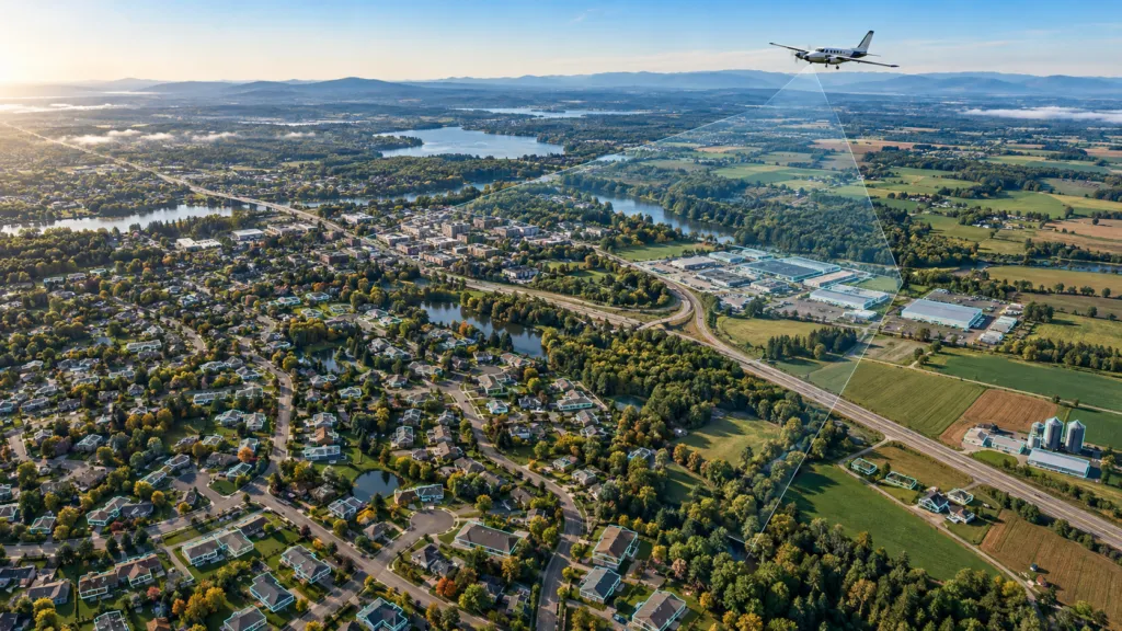
Nearmap has announced an unusually ambitious expansion of its US aerial program. Beginning in January 2027, the company plans to combine a new product called Nearmap Reach with its existing Core program to cover 97% of the US population and 95% of US buildings with 4 cm imagery.
If delivered as described, this would turn detail previously associated with selected urban programs into a broadly available annual layer. Nearmap wants customers to treat national-scale imagery and more than 130 AI-derived property layers as one operational product.
For insurers, governments and construction teams, that could reduce the gap between seeing a property and acting on it. It could also intensify competition with Vexcel and EagleView.
What Nearmap has actually announced
According to the company’s October announcement, Reach will add annual capture outside the metropolitan footprint served by Nearmap Core. Core will continue to cover about 88% of the US population, with some metropolitan areas refreshed up to three times per year.
Nearmap says the combined programs will deliver 4 cm ground sampling distance around 95% of US buildings. The imagery and AI layers will use its standard delivery channels. The expansion relies on its next-generation HyperCamera4 aerial system.
These are product plans, not delivered coverage. Capture is scheduled to start in January 2027, and Nearmap has not yet published detailed flight plans or timing. The announcement also omits price, total land area, delivery latency and independent accuracy measures for the AI layers.
Population and building percentages should not be confused with geographic coverage. A program can reach almost every person and structure while leaving large, sparsely populated areas uncaptured.
Where the claim fits competitively
Nearmap calls Reach the first and only annual 4 cm program at this scale. The resolution claim is the differentiator, not the widest existing footprint.
Vexcel says its current US library covers 99.6% of the population across 50 states. Its 2026 collection plan targets a refresh of 95% of the population and 122 million households: 1.53 million square kilometers at 7.5 cm and 3.64 million at 15 cm, with as many as three urban collections. Vexcel also offers orthogonal, oblique and multispectral imagery, elevation products, 3D city data and AI-derived features.
EagleView emphasizes a different moat. Its Vault archive spans more than 25 years and, according to the company, covers 96% of the US population. Its strength is not just current orthophotography but historical, oblique and property-measurement workflows.
Nearmap therefore is not entering an empty market and is not claiming the largest historical library. Its proposed advantage is a consistent combination of 4 cm detail, broad annual refresh and analytics across most of the built environment.
Nor does 4 cm mean competitors cannot produce sharper data. EagleView advertises imagery down to one-inch ground sampling distance in selected locations. The challenge is uniform quality at scale.
Why four centimeters can matter
At 4 cm, one pixel represents four centimeters on the ground. That does not guarantee object detection, but it provides more evidence for roof features, pavement markings and small changes than 7.5 cm or 15 cm imagery.
The business case becomes stronger when the capture is repeated consistently. An insurer could screen a broader book of properties using the same inputs. A local government could monitor more assets without commissioning separate flights. Construction teams could compare conditions across dispersed sites.
Still, a national AI layer is only useful if its errors are understood. Performance may vary with season, shadows, vegetation, roofing materials and regional building styles. Nearmap has not supplied validation statistics for the 130-plus layers in this announcement. Customers will need per-layer accuracy, capture dates, confidence information and clear rules for human review.
Practitioner discussions also underline that resolution is only one purchasing criterion. Positional accuracy, leaf-on or leaf-off timing, oblique views, spectral bands, archive depth, licensing terms and integration can outweigh a small difference in pixel size.
The bigger shift: imagery becomes infrastructure
The announcement reflects an aerial-imagery market moving away from occasional basemaps toward continuously refreshed decision infrastructure. The winning vendor may not be the one with the sharpest image in a sample. It may be the one that delivers consistent coverage, defensible analytics and predictable access across an entire portfolio.
Nearmap Reach raises that ambition. But until flights begin and customers can assess completeness, latency, accuracy and cost, it remains a 2027 execution promise. The next meaningful evidence will be the capture plan, independent product testing and proof that the AI layers remain reliable beyond the metropolitan areas where such systems are usually developed first.
Disclosure of claims: Coverage, resolution, refresh cadence and AI-layer counts are company claims from Nearmap, Vexcel and EagleView. The planned start date and current product footprints are confirmed in their published materials; future delivery and performance have not been independently verified.
How do you like this article? Read more and subscribe to our monthly newsletter!


