EASA Updates GNSS Guidance as Jamming and Spoofing Surge – What Geospatial Professionals Need to Know

For most of us, GPS is one of those technologies that simply works. We use it to navigate, survey land, fly drones, track assets and synchronise infrastructure, rarely thinking about the signals travelling more than 20,000 kilometres from space.
But across parts of Europe and the Middle East, those signals can no longer be taken for granted.
On 3 July 2026, the European Union Aviation Safety Agency published the fourth revision of its safety bulletin on GNSS outages and alterations. The update reflects a problem that has moved far beyond occasional signal loss. According to EASA, incidents are becoming more severe, more sophisticated and more disruptive to aviation operations.
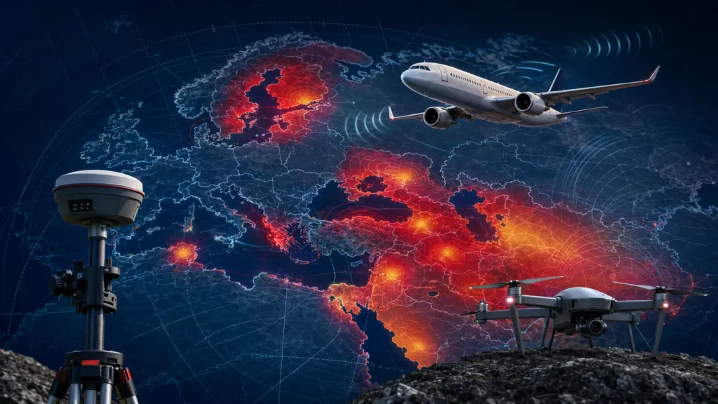
The most affected areas include the Baltic Sea, Eastern Europe, the Mediterranean, the Black Sea and the Middle East. These are no longer isolated dots on an interference map. They form large, persistent zones through which hundreds of commercial aircraft pass every day.
Jamming and spoofing are not the same
The two terms are often used together, but they describe different threats.
Jamming is the simpler one. A transmitter overwhelms the weak signals arriving from navigation satellites, preventing a receiver from calculating its position. It is disruptive, but usually obvious: the receiver loses satellites, accuracy deteriorates or the position disappears completely.
Spoofing is more dangerous because the receiver continues working. It simply produces the wrong answer.
A false signal can make an aircraft, ship, drone or surveying instrument believe it is somewhere else. In aviation, EASA lists symptoms including incorrect position, differences between ground speed and airspeed, time shifts, false terrain warnings and errors in systems that combine GNSS with inertial navigation.
As GNSS researcher Todd Humphreys from the University of Texas explained to IEEE Spectrum, modern spoofing has become increasingly sophisticated and widespread. In parts of the Eastern Mediterranean, aircraft may be shown at locations such as Beirut or Cairo even though they are hundreds of kilometres away.
This is what makes spoofing particularly difficult: a missing position is easier to handle than a convincing but false one.
How big is the problem?
One widely quoted benchmark showed the number of European flights encountering GNSS interference rising from approximately 200 per day in the first quarter of 2024 to around 900 per day in the second quarter. The figure is still frequently used, although it should be treated as a historical benchmark rather than a current daily count.
Other indicators suggest that the problem has continued to grow. IATA reported that GPS signal-loss events increased by 220% between 2021 and 2024 and warned that geopolitical tensions make a reversal unlikely in the near future. EUROCONTROL has estimated that up to 38% of European en-route traffic operates through regions that are intermittently but regularly affected by radio-frequency interference.
EASA’s own monitoring page now combines aircraft reports with ADS-B data to identify affected Flight Information Regions. In its 30-day ranking published on 15 July 2026, Ankara, Istanbul, Warsaw, Tallinn, Riga, Helsinki and Vilnius were among the affected European regions. Jeddah, the Emirates, Damascus, Muscat, Amman, Baghdad, Tehran, Beirut and Cairo appeared among the Middle Eastern hotspots. The dashboard is updated regularly.
There have also been real operational consequences. Finnair temporarily suspended flights to Tartu in 2024 after interference prevented two aircraft from completing their approaches. In January 2025, a Ryanair flight approaching Vilnius was diverted to Warsaw following GPS interference. Pilots had reported more than 800 interference cases around Vilnius during the final three months of 2024, compared with 124 over the same period one year earlier, according to Reuters.
That does not mean aircraft are suddenly unable to fly. Commercial airliners combine GNSS with inertial systems, ground-based navigation aids, radar and air traffic control. But losing one layer increases workload, reduces capacity and can make some approaches unavailable.
What has EASA changed?
The new EASA Safety Information Bulletin focuses on making the response more consistent.
It introduces clearer phraseology between pilots and air traffic controllers, expands operational and training recommendations and gives Electronic Flight Bags a more significant role. Near-real-time interference maps displayed on cockpit tablets could help crews anticipate problems before entering an affected area.
EASA also wants air navigation providers to keep traditional infrastructure such as ILS, DME and VOR operational. In other words, Europe should not dismantle all its old navigation systems before reliable alternatives are ready.
The aviation industry generally welcomed the update. SeRo Systems, which develops GNSS interference monitoring solutions, described the recognition of near-real-time maps as an important step. However, the company also pointed out that similar guidance is needed for air traffic control and ground operations, where decisions still depend heavily on local procedures and experience.
There is also a more critical perspective. Navigation policy expert Dana Goward has argued that many recommendations from EASA and IATA remain relatively general and repeat ideas discussed in previous workshops. The organisations can recommend reporting, backups and better coordination, but implementation ultimately depends on national authorities, infrastructure providers and individual companies.
That distinction matters. Guidance improves preparedness, but it does not stop the interference source.
What geospatial professionals need to know
Aviation is receiving most of the attention because the consequences are easy to imagine. However, the same signals support surveying, mapping, precision agriculture, construction, autonomous machines, maritime operations and drone flights.
The first lesson is that an RTK fix should no longer be treated as unquestionable proof of position. Corrections can improve accuracy, but they do not automatically protect a receiver against intentional interference. A system can potentially produce a precise-looking result based on manipulated observations.
Surveyors and drone operators working near known hotspots should therefore introduce independent checks. These may include control points, repeat observations, inertial sensors, visual positioning, total stations or comparisons with previously surveyed features. Raw observations and quality indicators should also be stored so that suspicious results can be reviewed later.
For autonomous systems, the question is even more basic: what will the vehicle do when GNSS disappears or starts lying? A safe system needs a degraded operating mode, not only a more expensive receiver.
Multi-frequency and multi-constellation equipment helps, but it is not a complete solution. Several constellations use nearby frequency bands and can be affected by the same interference source. Greater resilience will come from combining different sensors and positioning methods rather than relying on more satellites alone.
Galileo’s Open Service Navigation Message Authentication is an important development. Operational since July 2025, OSNMA allows compatible receivers to verify that navigation data genuinely comes from Galileo. It makes spoofing more difficult, but it does not prevent jamming and should still be combined with other receiver checks and sensors. EUSPA describes it as an added layer of protection, not a standalone answer.
From accuracy to resilience
For decades, the geospatial industry concentrated on making positioning more accurate, faster and cheaper. The next challenge is different.
We now need to know whether a position can be trusted.
EASA’s July update is primarily an aviation document, but its message applies far beyond the cockpit. GNSS interference is no longer an unusual event limited to military environments. It is becoming part of the operating conditions for civilian technology.
For geospatial professionals, resilience must therefore become a standard design requirement—alongside accuracy, availability and cost.


#Science

Next article

HERE Technologies and Esri have announced a three-year agreement to jointly develop location analytics and visualization capabilities for artificial intelligence applications.
Unveiled at the 2026 Esri User Conference, the agreement combines HERE’s mapping, traffic and mobility data with Esri’s ArcGIS platform. The companies say the resulting capabilities will allow engineering teams and AI systems to analyze live and historical location information.
The collaboration extends a relationship lasting more than 20 years. What makes this phase noteworthy is its explicit focus on AI agents—not simply analysts working with maps and dashboards.
Giving AI systems spatial context
Generative AI can process enormous amounts of text, but operating in the physical world requires an understanding of where things are, how places connect and how conditions change over time.
A logistics agent cannot recommend a dependable route based only on an address. It may need current traffic, vehicle restrictions, historical travel patterns and an authoritative road network. An infrastructure agent may need to connect asset records with environmental conditions, nearby construction and access routes.
HERE brings frequently updated map and mobility content, while ArcGIS provides technology for managing, analyzing and visualizing spatial information. According to the announcement, the planned capabilities will support reporting, decision-making and agentic workflows across several industries.
Reliability matters more than fluency
The partnership points toward a broader shift: geospatial information is becoming context that software agents can query and potentially act upon.
That creates opportunities in transportation, logistics, public services, insurance and infrastructure management. But access to spatial data alone does not make an AI system trustworthy.
An agent must know when data was collected, what it represents, how accurate it is and whether it is suitable for a particular decision. Live traffic data and historical mobility patterns may be highly useful for route planning, for example, but inappropriate for conclusions they were never designed to support.
This makes provenance, temporal accuracy and human oversight as important as the AI interface itself. Spatially fluent answers can still be wrong if an agent uses outdated maps, combines incompatible datasets or misunderstands geographic scale.
The announcement leaves several practical questions unanswered. The companies have not yet provided a detailed release schedule, pricing structure or complete technical architecture. It is also unclear how organizations will audit agent decisions or control access to sensitive location information.
The significance of the agreement therefore lies less in another promise to “add AI” to GIS. HERE and Esri are positioning authoritative location data and spatial analytics as grounding infrastructure for AI systems.
Whether that produces genuine operational value will depend on something less fashionable but more important: making every automated conclusion traceable to reliable spatial evidence.


