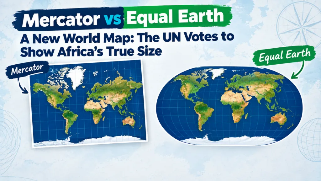

The General Assembly has voted 164 to 1 to steer the world away from the 456-year-old Mercator projection and toward equal-area maps, led by Togo on behalf of the African Union. Here is what the resolution actually says, why it happened now, and what it means for anyone who makes maps for a living.
The resolution does not ban the Mercator projection or force anyone to use a single map. What it does is encourage governments, schools, international organisations and technology companies to reach for an equal-area projection, chiefly Equal Earth, whenever the size of a country or continent actually matters. It also explicitly keeps Mercator’s licence for maritime and aerial navigation, where preserving angles and bearings is the whole point.
In practice, that shifts the default mental map most people carry around: one that inflates Europe, North America and Russia at high latitudes, toward one that preserves area and makes Africa, Latin America and South Asia look far closer to their true proportions.
What exactly changed
The UN did not mandate a single map for everyone. Instead, the resolution:
- Encourages governments, schools, international organisations and tech companies to use equal-area projections, such as Equal Earth, whenever representing geographic size matters.
- Recommends Equal Earth, launched in 2018 by an international team of cartographers, as the preferred alternative for general-purpose world maps.
- Acknowledges that Mercator remains appropriate for maritime and aerial navigation, where preserving angles and bearings is critical.
Why now: the politics behind the projection
The resolution was put forward by Togo on behalf of the African Union, following the AU’s own adoption of the Equal Earth map earlier in 2026. Sponsors argue that the Mercator projection has caused a lasting, symbolic minimisation of Africa and other equatorial regions in the public imagination, a distortion they say has subtly shaped perceptions of development needs, investment potential, geopolitical weight and even environmental responsibility.
“A fair world begins with a fair map.”
Robert Dussey, Togolese Foreign Minister, at the UN General Assembly
France’s Foreign Minister, Jean-Noel Barrot, announced that France would abandon Mercator in official communications in favour of more accurate representations.
“Changing the map obviously doesn’t change the world. But correcting a representation that distorts it is already an act of truth.”
Jean-Noel Barrot, French Foreign Minister
The United States cast the sole vote against the resolution. Its mission to the UN called the debate a distraction from “genuine problems of international peace, prosperity, or good relations” and objected to the resolution’s language of “cognitive justice” and reparations.
Mercator vs Equal Earth
Gerardus Mercator designed his projection in 1569 for one job: keeping compass bearings straight for sailors. To do that, it stretches land the further it sits from the equator and compresses land near it. The best-known result is that Greenland appears almost as large as Africa on a standard Mercator map, when Africa is in fact roughly 14 times larger.
Equal Earth, introduced in 2018 by cartographers Bojan Savric, Bernhard Jenny and Tom Patterson, takes the opposite priority: it preserves each landmass’s area relative to the others, while keeping shapes recognisable enough to still look like a normal world map rather than an abstract distortion. On it, Africa and South America expand toward their true scale, and Greenland and other high-latitude landmasses shrink to size.
| Mercator (1569) | Equal Earth (2018) | |
|---|---|---|
| Designed for | Marine and aerial navigation; preserves angles and compass bearings | General-purpose world maps; preserves relative area |
| What it distorts | Area, especially far from the equator | Shape, especially near the poles |
| Africa vs Greenland | Look similar in size | Africa renders roughly 14× larger, matching reality |
| UN’s recommended use | Navigation only | Education, media, policy, general reference |
How big are these landmasses, really?
Actual land area, not screen area. This is the ranking that Mercator’s projection obscures and Equal Earth is built to preserve.
Land area figures are standard geographic reference values, rounded to the nearest 0.1 million km².
What this means for geospatial practice
For GIS and Earth observation professionals, the resolution puts high-level political weight behind something the field has known for a long time: no projection is neutral. Every one of them encodes a choice about what to preserve, whether that is navigation, area, shape, distance or direction. Equal-area projections should be the default whenever a map is communicating size, density or distribution, such as population, emissions or land cover. Mercator and Web Mercator remain genuinely useful for web basemaps and navigation, but they should be labelled as fit for that purpose rather than presented as a “true” picture of the world.
Three things worth doing this week
- Audit which projection your public-facing maps use versus what you use internally for analysis. A projection chosen for a GIS workflow is rarely the right one for a slide or a press release.
- Produce Equal Earth versions of your key global figures for papers, posters and outreach, alongside whatever projection the analysis itself required.
- Document projection choices explicitly in captions and methods sections, rather than leaving readers to assume the map is a neutral representation.
What happens next
The resolution is non-binding, but it sets a clear normative direction.
Sources
- CNN: UN votes to adopt new map that makes our world look very different
- BBC: UN votes to adopt new world map to reflect Africa’s true size
- RTE: UN adopts map reform to show true scale of continents
- UPI: U.N. to vote to adopt new, more accurate world map
- The National News: US opposes UN adoption of map showing Africa’s true size
- WTAQ: UN approves resolution in support of map that shows Africa’s true size
Did you like this post? Read more and subscribe to our monthly newsletter!



#News

Next article
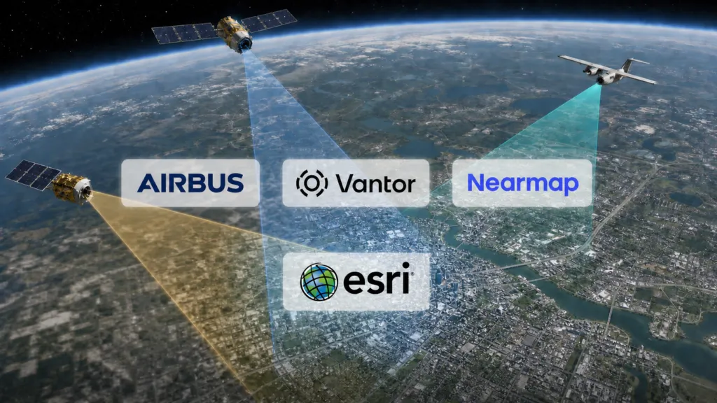
Esri is significantly rebuilding the commercial imagery foundation underneath ArcGIS World Imagery. The initiative brings together 30cm urban satellite basemaps from Airbus, Vantor’s global Vivid Mosaic and 20cm aerial imagery from Nearmap.
At first glance, the Airbus and Vantor agreements may appear redundant. Both companies operate very-high-resolution optical satellite businesses, both sell global basemaps, and both compete for government and commercial Earth-observation customers.
But Esri is not selecting a single winner. It is assembling a multi-provider supply chain in which the three companies perform different—and sometimes overlapping—roles.
Vantor remains the global satellite foundation. Airbus adds another large portfolio of refreshed urban mosaics. Nearmap supplies higher-resolution aerial coverage in selected metropolitan markets. Local and national mapping agencies continue to contribute even sharper orthophotos through Esri’s Community Maps programme.
The result should be a more resilient and geographically varied World Imagery service. It does not, however, eliminate the limitations that practitioners encounter when using a visualization basemap as if it were an analytical image archive.
What each provider will supply
The three agreements differ in coverage, resolution and refresh commitments.
| Provider | Contribution to World Imagery | Coverage | Announced refresh |
|---|---|---|---|
| Vantor | Global Vivid Mosaic foundation; 30cm or better urban coverage; HD 15cm upgrades | Global base, committed refresh for 800 cities; 40 major cities and capitals upgraded to HD 15cm | Esri receives refreshed coverage quarterly |
| Airbus | Curated, color-balanced 30cm satellite basemaps | Approximately 2,000 cities worldwide | “Committed refresh,” but cadence not disclosed |
| Nearmap | 20cm vertical aerial imagery | 200 metropolitan areas in the US, Canada, Australia and New Zealand | Every 6–12 months |
| Community Maps | Authoritative aerial orthophotos from public and local contributors | Varies by contributor | Contributor-dependent |
The rollout begins in the second half of 2026 and forms part of a World Imagery buildout continuing through 2029. Esri’s technical overview provides more detail than its later Airbus announcement.
The published numbers should not be added together and interpreted as 3,040 unique cities. Esri has not released the city lists or disclosed how much the Airbus, Vantor and Nearmap footprints overlap.
It has also not explained the selection logic used where multiple suppliers cover the same location. Factors may include currency, resolution, visual consistency, licensing and geometric quality, but that is an inference rather than a published hierarchy.
Vantor remains the global foundation
Vantor—formerly Maxar Intelligence—is not being displaced by Airbus. It remains Esri’s largest satellite-imagery provider and the global base beneath World Imagery.
A new multi-year, multimillion-dollar agreement gives Esri quarterly access to refreshed Vivid Mosaic coverage. Vantor uses automated building and road change detection to prioritize areas where new collection is likely to be most valuable. High-demand and urban areas will be delivered at 30cm resolution. Vantor says its relationship with Esri now spans more than 25 years.
Esri says Vantor will provide committed refreshes for 800 cities at 30cm or better. Forty major cities and capitals will receive an HD 15cm product beginning in the second half of 2026.
That “15cm” description needs qualification. Vantor explicitly states that its HD process upscales 30cm imagery to 15cm clarity. It is therefore not equivalent to a sensor capturing native 15cm ground samples. Image processing may improve the visual definition of edges and features, but it does not create the same underlying ground information as native acquisition at twice the spatial resolution.
Vantor’s wider commercial Vivid product claims more than nine million square kilometres of 15cm HD coverage and 136 million square kilometres of 30cm global coverage, excluding Antarctica. It also says more than 30 million square kilometres of changing or high-interest territory are refreshed annually. Those are vendor claims for the wider Vivid portfolio, not guarantees that every part of World Imagery receives the same update frequency. Vantor product specifications
Airbus adds urban depth—and competitive leverage
Airbus will provide 30cm basemap imagery for approximately 2,000 cities. Its mosaics are designed to minimize cloud, haze, abrupt colour changes and seasonal discontinuities between adjoining scenes.
This is an important distinction. A satellite basemap is not simply a collection of the newest available images. It is a processed mosaic optimized to look spatially continuous. Producing that visual consistency can require selecting scenes from different dates and adjusting colour and radiometry.
Airbus’s general Global Basemap specification provides 30cm imagery over cities, 50cm coverage over other urban areas and large regions, and 1.5m coverage across the remaining landmass. The company specifies geolocation accuracy of no worse than five metres CE90 for most of the globe and cloud cover of no more than two percent over urban areas. Airbus basemap specifications
The underlying 30cm imagery can include Pléiades Neo data, but neither Airbus nor Esri has said that every city delivered to World Imagery will consist exclusively of newly captured Pléiades Neo scenes. “Committed refresh” also remains undefined: no annual, quarterly or maximum-age commitment has been published.
Why add Airbus when Vantor already supplies comparable resolution? The likely strategic benefits for Esri are broader sourcing, fewer geographic gaps and less dependency on one global supplier. Competition between providers may also improve pricing and refresh commitments.
For Airbus, World Imagery is a distribution channel into hundreds of thousands of ArcGIS organizations. The free basemap layer can introduce users to Airbus imagery before they purchase source scenes, tasking, downloads or analytical rights.
Nearmap is the aerial layer—but not the full Nearmap product
Nearmap occupies a different position. It is the exclusive commercial aerial-imagery provider in the new arrangement, supplying 20cm vertical imagery across 200 metropolitan areas in four countries.
The imagery will appear automatically at supported zoom levels in ArcGIS Online, ArcGIS Pro and ArcGIS Enterprise, without an additional Nearmap login or subscription. Updates are promised every six to twelve months. Nearmap’s announcement
But the Living Atlas contribution is intentionally below Nearmap’s premium specification. Nearmap’s current vertical product targets approximately 5.5cm ground sampling, while World Imagery receives a generalized 20cm layer. Direct subscribers retain access to the highest-resolution captures, more frequent collection, historical imagery, APIs, AI property intelligence and enterprise integrations.
This makes the World Imagery agreement both a data-supply arrangement and a product funnel. ArcGIS users receive a better default basemap; organizations requiring measurement, change analysis or property intelligence are still directed toward a commercial Nearmap subscription.
Provenance remains a consequential concern
An April 2026 Esri Community discussion found that metadata associated with a World Imagery Wayback tile could describe the tile-layer build rather than expose the precise acquisition date of every source image within the mosaic. The accepted guidance recommended Sentinel-2 or Landsat layers when a defensible acquisition date is essential. Esri Community discussion
This shows that “fresher imagery” is only part of the user requirement. Practitioners also need predictable alignment, consistent behaviour between scales and source-level metadata.
A better basemap is not automatically better analytical data
Esri promotes World Imagery for workflows extending from visual context to GeoAI. That positioning requires care.
Esri’s own technical documentation warns that basemap radiometry is heavily modified for visual appearance and that tall objects are geometrically reliable primarily where they meet the ground. It advises caution when extracting features and notes that basemaps may be out of date because of the time and expense involved in producing them. Esri imagery guidance
A color-balanced mosaic can be excellent for visualization, digitizing, planning and general feature interpretation. It may be unsuitable for spectral analysis, precise temporal change detection or measurements requiring documented acquisition geometry.
Licensing adds another boundary. World Imagery can be used in ArcGIS maps and exported in limited tile packages for offline ArcGIS applications, but it is not an unrestricted source-image archive. Esri’s export service is designed for relatively small basemap-tile packages and permits up to 150,000 tiles per request. Users cannot assume that they may scrape, redistribute or train commercial models on imagery simply because it is visible in a public basemap. World Imagery export terms
The strategic shift
The larger change is not the arrival of another imagery supplier. It is Esri’s decision to treat the basemap as a managed, multi-provider infrastructure layer.
Vantor supplies scale and a continuously refreshed global foundation. Airbus contributes another large urban portfolio and reduces concentration around one satellite provider. Nearmap adds aerial detail where commercial demand is strongest. Public mapping agencies can still supersede all three with local orthophotos as sharp as 3cm.
For most users, that should make the default ArcGIS backdrop more useful without requiring them to understand the imagery market.
For analytical users, the obligation runs in the opposite direction. As World Imagery becomes more visually seamless, it may become harder—not easier—to recognize changes in provider, acquisition date, processing and licensing. The real test of Esri’s strategy will therefore be whether provenance improves alongside resolution.
Until those details are clearer, World Imagery should be treated as an increasingly capable visual and mapping foundation—not as a homogeneous global dataset.


