Supergeo Technologies belongs to one of the global companies in providing GIS software and solutions. The new mobile GIS software version SuperSurv 3.1a now supports high definition mobile Android devices. It will be also available for iOS users in the Apple Store.
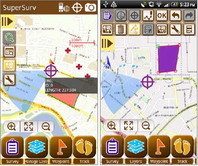
SuperSurv was developed to accomplish field tasks including data display and manipulation functions, enabling field workforce to capture data, position, overlay maps, as well as edit map service published by SuperGIS Server online. The collected data features (polygons, points, lines) can be saved in commonly used vector formats like *.shp and *.geo.
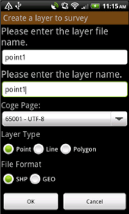
The newest version of Supersurv 3.1a primarily enhances the connection of SuperGIS Server 3.1a, which permits users to edit, query and measure features online and to synchronize the update feature and attribute data with the server. Also, Online Map Tool in built in SuperSurv 3.1a to support OpenStreetMap as reference basemap for field surveys. To efficiently display the attribute data in different languages in other GIS applications, code page can be added while users are creating a new layer.
The built in Online Map Tool provides webmaps such as OpenStreetMaps or Google Maps and is able to adopt them for spatial data collection without pre-generating cache-maps.
Code page settings are also added in “Creating a new layer”. This function facilitates spatial data collection globally, when the attribute data in different languages can be read and applied easily.
Supergeo Technologies: Supersurv


