#Environment #Featured #Ideas

The most complete global map of forests available yet

Very interesting research has been published in Nature magazine. Researchers created the most detailed map of forests around the world. All the previous attempts to estimate the number have been done based on satellite images. The number of trees around the world was estimated at the level of 400 billion. Although remote imaging reveals a lot about where forests are, it doesn’t give an answer to how dense the forest is.

This time researches decided to take a dual approach. They gathered data from various existing ground-based counts of trees covering about 430,000 hectares around the world. These counts allowed them to improve tree-density estimates from satellite imagery. Then the researchers applied those density estimates to areas that lack of high quality ground data.

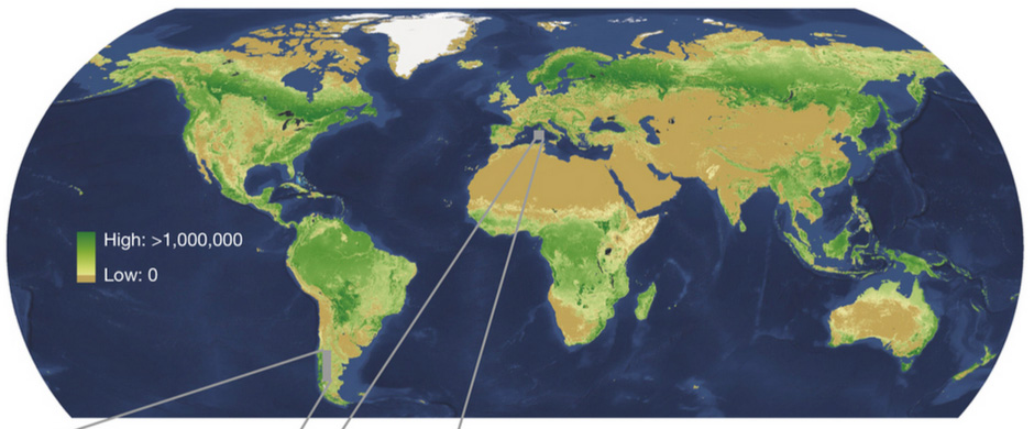
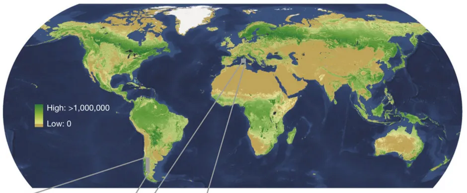
With this approach researchers calculated that the actual number of trees around the world is at the level of 3 trillion, so 8 times higher than previously counted. The result of this research has been published in the form of the density map.

Tree-map-Geoawesomeness

The highest tree densities, calculated in stems per hectare, were found in the boreal forests of North America, Scandinavia and Russia. These forests are typically tightly packed with skinny conifers and hold roughly 750 billion trees, 24% of the global total. Tropical and subtropical forests, with the greatest area of forested land, are home to 1.3 trillion trees, or 43% of the total.

The study also estimated that we are cutting 12 billion trees a year. With that paste we will grub up the whole planet in less than 300 years… Frightening!

Source: Nature

Say thanks for this article (0)
The community is supported by:
Become a sponsor
#Environment
#Environment
Global Canopy Height Estimation with 1 meter resolution!
Sebastian Walczak 04.29.2024
AWESOME 3
#Contributing Writers #Environment #Fun #Satellites #Science
Super-Resolution for Satellite Imagery Explained
Sebastian Walczak & Nikita Marwaha Kraetzig 07.18.2024
AWESOME 2
#Business #Environment #Ideas #Satellites
China’s Smart Agriculture Boom Has Tech Potential but Requires Affordable Solutions
Nianhua Liu 05.9.2024
AWESOME 3
Next article
#Business #Environment

Google will map air quality in California

Google-Aclima-Car-Geoawesomeness

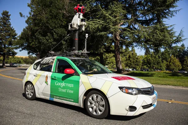
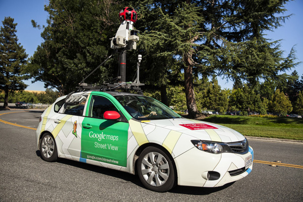
In August we’ve reported that Google is using its Street View cars for more than just mapping road network features around the world. Together with a start-up called Aclima it installed in environmental sensors on the rooftop of mapping cars which allowed for analysis and detection of air pollution.

The pilot has been running in Denver and Colorado where cars collected 750 hours of data over the course of a month. Some of the data from this trial was published on Aclima’s website.

Yesterday we’ve learned that according to Google the results achieved were successful enough to continue the project. The company is now expanding the program to California. The mapping starts immediately in Los Angeles, San Francisco, and the Central Valley.

Google says these three major metropolitan areas were selected because with nearly 30 million registered vehicles, managing the air quality in the state is a big challenge. The plan is that this data will eventually be overlaid on Google Earth and Google Maps, and it will also made available to scientists and air quality experts.

Cool project.

Source: Google Green Blog

Read on
Search