
The 2026 EO Industry Report Launches Live, and You’re Invited
Geoawesome Team · July 2026 · 4 min read
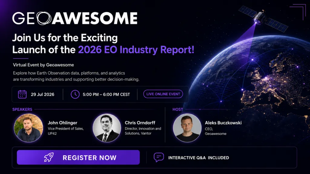
Earth observation stopped being a niche technical field. It’s now infrastructure for how we track climate change, plan cities, manage resources, and respond to disasters. On 29 July, we’re putting a full year of that progress into one report and launching it live.
Satellite imagery and geospatial analytics have never been more accessible. The harder question has always been what happens after the data is delivered: who uses it, for what decisions, and with what results. The 2026 EO Industry Report is built around that question, looking across sectors at how EO data, platforms, and analytics are actually being put to work, not just where the technology theoretically could go.
We’re launching it with a live virtual event, and you’re invited to be in the room when it happens.
What’s in the report
The report covers how organizations across industries are using Earth observation to make real decisions: climate monitoring and environmental change, urban development and planning, precision agriculture, resource management, and disaster response. It’s grounded in what’s happening on the ground and from orbit right now, not projections about what might happen someday.
“The gap between data existing and data driving a decision is where most of the value gets lost, or found.”
Why the 2026 EO Industry Report exists
Why join the launch, live
This is a one-hour virtual event, not just a report drop. You’ll get a keynote address from a leading voice in Earth observation setting up why this moment matters, a panel discussion focusing on the findings, and a live Q&A where you can put your own questions to the people building in this space.
Join the launch
29 July 2026 · 5:00–6:00 PM CEST · Virtual · Free
29 July 2026 · 5 PM CEST · No cost to attend
Bring a colleague who works with spatial data, and one who’s just curious about what Earth observation actually does. We’ll see you there.
EO Industry Report
Live Event
Geoawesome
July 2026
How do you like this article? Read more and subscribe to our monthly newsletter!



#Events


Next article
Spatial Intelligence Is Becoming an Agent. Where Do You Stand?

Spatial Intelligence Is Becoming an Agent. Where Do You Stand?
Geoawesome Team · July 2026 · 7 min read
The question that keeps surfacing at every geo conference, summit, and community call this year is the same one: when does spatial intelligence stop being a layer and start being the reasoning itself?
For decades, the answer was: not yet. GIS required portals, experts, and deliberate workflows. You had to know where the data lived, how to access it, and how to translate a question into a query. The interface between curiosity and geospatial insight was friction – necessary, accepted, and largely invisible to the people who’d learned to live with it.
That friction is dissolving. Fast.
Two products. One shift.
At OGC Connect Helsinki in June 2026, Javier de la Torre of CARTO demonstrated something that stopped the room. He typed a single question about new data centers going up in Finland – reportedly for Microsoft – and what they might mean for power, water, and forests nearby. No portal. No layer picker. No GIS specialist stands between the question and the answer.
The agent took it from there. It found candidate sites on its own. Without being told a single dataset name, it reached into the National Land Survey of Finland, the Finnish Environment Institute, Copernicus, Statistics Finland, and Eurostat – sources it was never pointed toward – pulled what it needed, and came back with a complete spatial analysis, every number linked to its source.
“No portal. No layer picker. No GIS specialist in the loop.”
Javier de la Torre, CARTO – OGC Connect Helsinki, June 2026 · He called it: disintermediation
The same week, GIS Cloud publicly released a suite of generative AI tools that take a different but complementary approach. Instead of an autonomous agent operating without supervision, GIS Cloud has embedded natural language directly into its GIS platform – letting users describe what they want to do in plain language and having the platform handle the GIS operations behind the scenes. Spatial queries. Form generation. Voice input. Photo-to-record extraction. MCP integration with Claude. All human-in-the-loop by design – but the barrier to entry is completely gone.
Two very different products. The same underlying shift.
The numbers behind the shift
This isn’t just demo season. The foundations are genuinely moving.
WGIC’s Horizons 2026 report named geospatial as “critical digital infrastructure” – not a specialist layer tucked behind GIS workflows, but a foundation that other systems build on top of. The ITU has described geospatial large language models as introducing “a transformative paradigm in which natural language becomes the interface to spatial intelligence.” Put those things together and the bottleneck quietly moves. It’s no longer can the model do this. It’s do we have the reference data, provenance, and standards to let it do this responsibly.
Cherie Wong, Mapbox’s SVP of Location Services, made a version of this point at The Next Geo in April 2026: maps have stopped being static visual products – they’ve become programmable systems, more like cloud infrastructure than pictures. Her sharper point, and the one worth sitting with: AI doesn’t reduce the need for reliable mapping infrastructure. It raises the bar for it. Agents are only as trustworthy as the spatial data they’re quietly standing on.
The question we can’t answer alone
The Helsinki demo already answered “does this work.” It works. Convincingly. What it didn’t answer – what no single demo, report, or benchmark can – is whether we, the people who build and depend on spatial systems, are ready to let an agent act on our behalf without a human checking its work first.
That answer isn’t the same for everyone. It depends on your domain – flood risk modelling is not the same trust calculus as retail site selection. It depends on your data quality, your regulatory environment, and how much of an explainability gap you can live with when something goes wrong. A benchmark score doesn’t settle any of that.
Only the community actually doing the work can.
Tell us where you stand
7 questions · under 2 minutes · no login needed · closes July 20, 2026
Open until July 20, 2026 · No login required · Results published in the August edition
This isn’t a data collection exercise. It’s how we figure out, together, what we actually think about the line we’re all about to cross.
Send it to the colleague who’s already building this stuff – and the one who thinks it’s overhyped. We want both.
How do you like this article? Read more and subscribe to our monthly newsletter!


