#Ideas

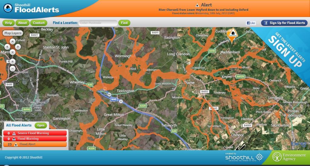
Real-time Flood Mapping by Shoothill in UK.

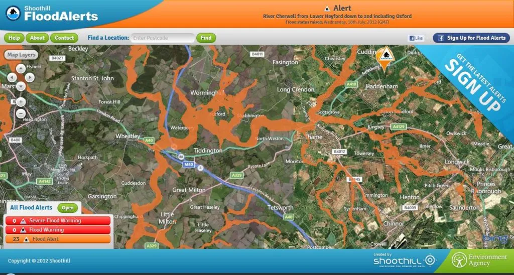
Great service has been launched in England and Wales by Shoothill – a software developers specialized in Microsoft services (e.g Bing Map+Silverlight for that new service). FloodAlerts is a free to use web mapping service using data provided by the Environment Agency. It is the first service (as far I’m know) that graphically represents the flood risk with every 15 minutes updates.

Of course one could have objections how the hell would governmental agency have such a high resolution data for whole two countries… Nonetheless the result is pretty amazing. And even more amazing (and award winning – The  Guardian Innovation Nation Awards) is their Facebook app where users can register any location they want to monitor and if a relevant alert is issued, they then receive a notification on their Facebook wall and to their email address. Simple and simply great idea. I love it.

Check it out:

source: Shoothill

Say thanks for this article (0)
The community is supported by:
Become a sponsor
#Ideas
#Business #Environment #Ideas #Satellites
China’s Smart Agriculture Boom Has Tech Potential but Requires Affordable Solutions
Nianhua Liu 05.9.2024
AWESOME 3
#Fun #Ideas
The INSPIRE Directive Explained: Simplifying Geospatial Data Sharing Across Europe
Sebastian Walczak & Nikita Marwaha Kraetzig 09.23.2024
AWESOME 1
#Featured #Fun #Ideas #News #Science
Exploring the Metaverse: Insights from Hexagon LIVE Italy
Luca Lupattelli and Simone Oppici 12.11.2024
AWESOME 8
Next article
#Ideas

Geo-Journalism: The power of Geospatial Technology, helping to uncover Evil!

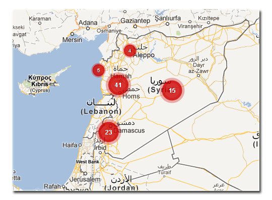
The Syrian government military forces  according to Social Networking  Technology Project are massively using sexual violence and gang raping as a weapon of war but social networking and geo-technologies are busy exposing their evil deeds to the global public.

Kudos to the power of the Geo-technologies and Social Networking, ”the evil that men commit in the secret are now been exposed by Geo-tech and Social Network”.
The map below is a crowd-sourced map helping to show you the massive sexual violence been carried out by the Syrian army according to ‘ Women Under Siege‘  documentary.


Source : Women Under Siege

Read on
Search