

Procore is not simply buying a drone-mapping company. Its planned $845 million acquisition of DroneDeploy is a bet that continuous visual awareness of the physical jobsite will become essential infrastructure for construction AI.
The construction management software company announced the all-cash transaction on July 29, 2026. Subject to regulatory approval and other closing conditions, it expects the deal to close later this year. Procore says DroneDeploy has been used on more than three million jobsites across over 180 countries. Those adoption figures come from the companies and have not been independently audited. Read Procore’s acquisition announcement.
The strategic logic goes well beyond aerial imagery. DroneDeploy has spent years expanding from drone mapping into a broader reality-capture platform incorporating 360-degree cameras, mobile devices and ground robots. Its 2022 acquisition of StructionSite was particularly important, giving the company a stronger position in interior and ground-level documentation rather than limiting it to outdoor aerial surveys.
Construction AI acquires a perception layer
Procore wants to connect that perception layer directly to the project records, drawings, schedules, RFIs and workflows already managed inside its platform. In the company’s vision, cameras and robots would routinely inspect a site, AI would interpret what has changed, and Procore’s software would initiate the relevant workflow.
That could mean identifying work that is behind schedule, documenting a safety issue, comparing installed conditions with a BIM model or alerting a project team when observed progress does not match the plan. This is the difference between AI that answers questions about stored documents and AI that can respond to events in the physical world.
From integration to ownership
The acquisition does not begin from zero. DroneDeploy already supports importing Procore drawings, sending imagery and exports into Procore, and synchronizing field notes with Procore Observations. The existing integration is documented here.
DroneDeploy’s July product release also introduced two-way Procore and Autodesk synchronization, AI-assisted progress tracking and a robotic capture agent. The deal therefore converts an established integration into a unified product and data strategy.
Procore says the combined businesses would connect nearly 400 million photos, more than 126 million drawings and over 10 million recent RFIs, submittals and inspections with DroneDeploy’s approximately 20 trillion square feet of visual data. DroneDeploy also reports tens of millions of user annotations and more than 100,000 labeled safety issues.
These are company-supplied metrics, but they help explain the price. Domain-specific AI depends not only on model capability but on access to correctly contextualized data. DroneDeploy supplies evidence of what physically happened; Procore supplies information about what was supposed to happen and the business workflow that follows.
A significant acquisition for Procore
The $845 million price is substantial relative to Procore’s current business. The company reported $375 million in second-quarter revenue, 16% annual growth and $65 million in quarterly free cash flow. Its full-year revenue forecast is approximately $1.51 billion. See Procore’s second-quarter results.
Reports indicate that Procore arranged up to $700 million of bridge financing associated with the transaction. The acquisition is not contingent on obtaining that financing, although Procore’s public announcement does not state the facility’s amount. Goldman Sachs is advising Procore, while Citi is advising DroneDeploy.
The claim that the purchase price is roughly six times DroneDeploy’s lifetime funding needs qualification. The frequently quoted $142 million total dates from DroneDeploy’s 2021 Series E. The company subsequently raised another $15 million in 2025, while current funding databases track approximately $156 million in total financing. On that basis, the acquisition price is closer to 5.4 times known capital raised—still an exceptional outcome for a reality-capture company.
The larger platform shift
The deal belongs to a wider consolidation of construction technology. Major platforms increasingly want to own the data and intelligence layers surrounding their core systems instead of relying entirely on specialist integrations. Procore itself acquired vertical-AI company Datagrid earlier this year, while Autodesk and Trimble have continued buying workflow and AI businesses.
For specialist geospatial companies, the message is mixed. Spatial capture is moving into mission-critical enterprise workflows. Drone imagery, point clouds and 360-degree documentation are becoming inputs for schedule intelligence, quality control, claims management and automated decision-making.
At the same time, tighter platform ownership can reduce customer choice. Standalone DroneDeploy users will want clarity about future pricing, support for competing construction platforms, data portability and whether mapping and surveying capabilities will receive the same attention as Procore-specific workflows.
Public discussion among UAV-mapping and construction practitioners reflects both sides. Some users see the combination as a natural extension of an already useful integration and expect Procore’s resources to accelerate development. Others worry about consolidation, subscription pricing and DroneDeploy’s gradual movement away from its roots as a general-purpose mapping platform. These opinions are anecdotal, but they identify the questions Procore must answer after closing.
The acquisition’s real test will not be whether Procore can place DroneDeploy imagery inside another dashboard. It will be whether the combined platform can turn repeated spatial observations into trustworthy, auditable actions without removing the human judgment required on complex construction sites.
If it succeeds, the transaction may mark the point at which reality capture stopped being a construction add-on and became part of the industry’s operating system.



#Business
Next article
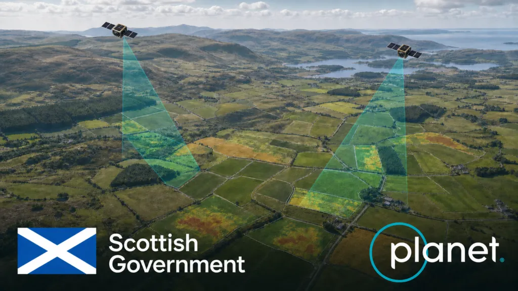
Scotland has selected Planet for a seven-figure agricultural monitoring project that reaches beyond the familiar task of buying satellite images. The one-year agreement combines PlanetScope data with advanced analytics intended to support the Scottish Government’s Agricultural Reform Route Map through 2026.
According to Planet’s corporate disclosure, the award was secured with reseller Computacenter by the Scottish Government’s Agricultural and Rural Economy Directorate. Planet says its archive and AI analysis will help assess progress toward sustainable food production, biodiversity and lower emissions.
The contract value, beyond being described as seven figures, has not been disclosed. Nor have the parties published detailed accuracy thresholds, the precise analytics to be delivered, or how automated findings will be reviewed. Those gaps matter because Scotland is testing more than another Earth-observation dataset: it is exploring how continuous geospatial evidence could become part of agricultural administration.
From satellite images to operational evidence
Public authorities have used satellite imagery in agriculture for years. What is changing is the procurement model. Agencies are increasingly buying an operational monitoring capability: frequent imagery, historical baselines, automated classification and alerts, delivered within a workflow that can influence policy implementation.
Scotland’s own 2026 spending review identifies satellite area-monitoring trials as a route to workforce efficiency. A separate government advisory note says agricultural reform monitoring should align with climate and biodiversity objectives, including indicators for soil health, water quality and greenhouse-gas emissions.
Satellite observations cannot measure all those outcomes directly. They can, however, provide repeatable evidence of land cover, crop development, mowing, bare soil, vegetation change and other observable activity. The critical step is linking those signals to policy indicators without overstating what a pixel or model can prove.
A wider European procurement pattern
Scotland is outside the EU’s Common Agricultural Policy, but its direction resembles changes across Europe. The CAP Area Monitoring System has pushed paying agencies toward automated, parcel-scale checks using Copernicus Sentinel data. The European Commission describes the system as a way to reduce physical inspections, identify errors earlier and simplify reporting.
That public-data foundation is now supporting a market for commercial layers and managed services. Planet markets an Area Monitoring Service for European paying agencies, while the Copernicus Data Space lists a broader ecosystem of CAP monitoring services.
Recent Planet deals illustrate the pattern. In May, the Czech State Agricultural Intervention Fund signed a two-year, seven-figure contract for imagery and AI-powered analytics supporting an agricultural payments system covering about 25,000 holdings. Wales has expanded its use of Planet data from trials toward routine systems for agriculture, water and land-use monitoring. These are not identical procurements, but collectively they show governments moving from experiments toward recurring operational capacity.
The real test is auditability
The attraction is straightforward: satellites can observe large territories repeatedly, while automated analysis can direct staff toward the cases that need attention. The risks are equally clear. Cloud cover, small parcels, mixed land use and differences between an observed activity and a policy outcome can create uncertainty. A model may flag change without explaining its cause.
For that reason, the most important questions are institutional rather than spectral. Will farmers be able to see and challenge the evidence used in a decision? How will confidence scores and ambiguous cases be handled? Which observations come from commercial data, which from public Copernicus missions, and can the process continue if a supplier changes?
Scotland’s project should therefore be judged on more than model accuracy. Its strategic value will depend on whether the government builds an explainable monitoring system with clear human review, proportionate ground verification and durable data governance.
The wider European lesson is that satellite monitoring is becoming infrastructure for agricultural administration. Planet’s Scottish award is another sign that the competitive battleground is shifting from selling imagery to delivering trusted, policy-ready evidence. The companies that succeed will not simply observe land more often; they will make automated observations accountable enough for public decisions.


