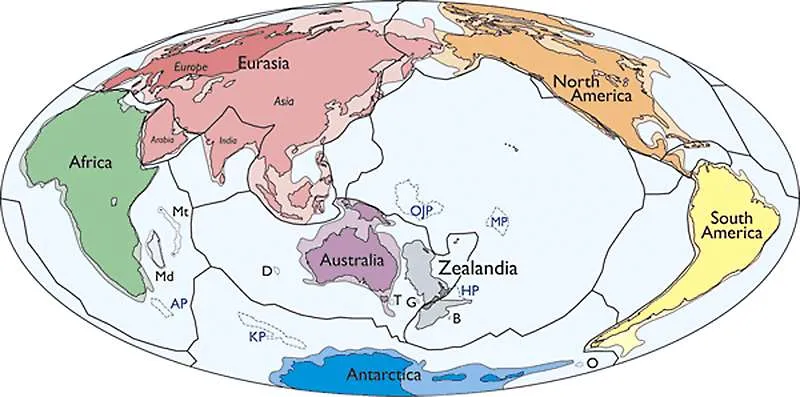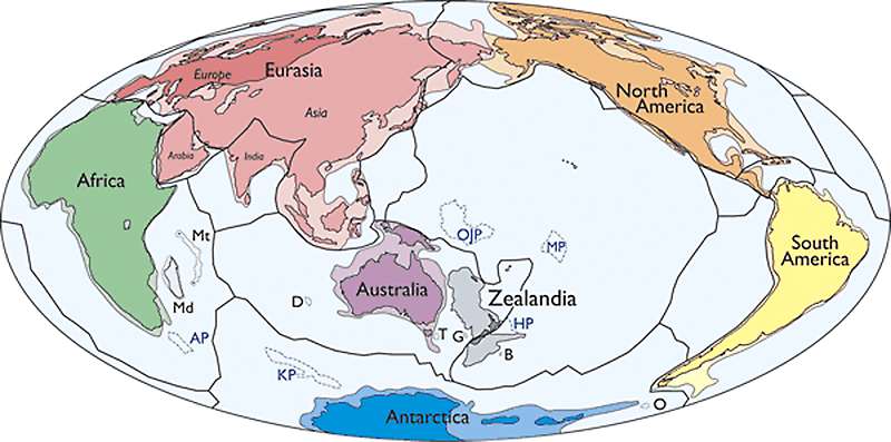
Scientists discovered a new continent and called it Zealandia
Researchers claim to have discovered a new continent mostly submerged beneath the South Pacific. Scientists behind the study say that New Zealand and New Caledonia aren’t regular island chains but they’re a part of a single, 4.9 million-square-kilometer (1.89 million-square-mile) slab of continental crust that’s distinct from Australia. According to the study, the 94% of Zealandia currently submerged broke away from Australia and sank 60-85 million years ago.
Geologists named the structure Zealandia and said it is a distinct geological entity that meets all the criteria applied to Earth’s seven other continents. It has an elevation above the surrounding area, distinctive geology, a well-defined area and a crust much thicker than that found on the ocean floor.
In a paper published in the Geological Society of America’s Journal, GSA Today, they said: “This is not a sudden discovery, but a gradual realization; as recently as 10 years ago we would not have had the accumulated data or confidence in interpretation to write this paper”.
While there is no scientific body that formally recognizes continents, the scientists would like Zealandia to become an accepted part of how the Earth is viewed.


