#Business #Featured

Global Top 100 Geospatial Companies – 2022 Edition

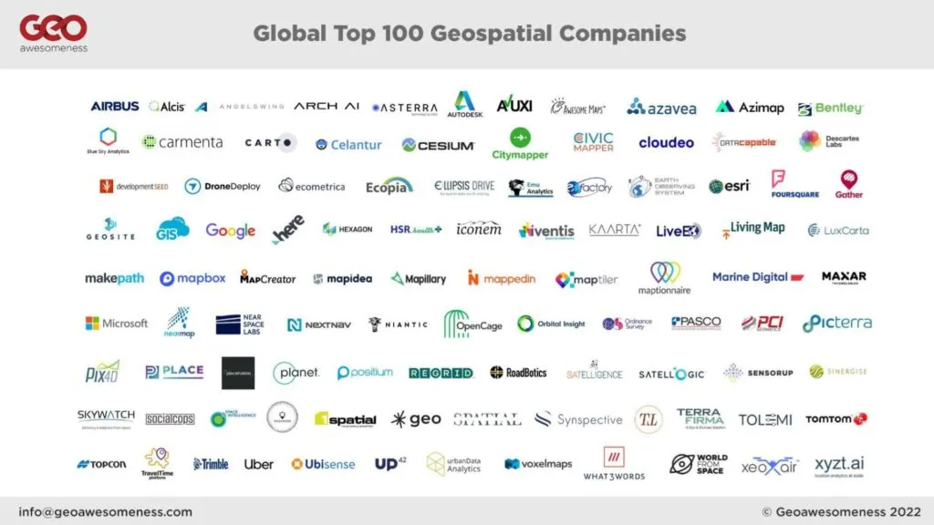
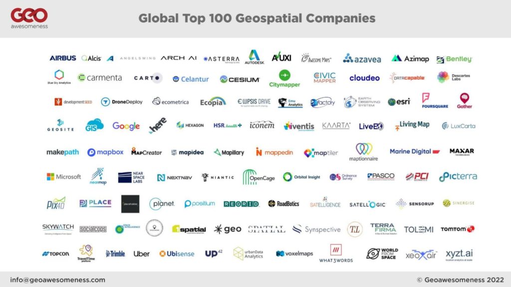
What are the top geospatial companies in the world right now in 2022? Since 2016, Geoawesomeness has been compiling THE list of the top 100 geospatial companies in the world.

The annual list is an essential source of information about companies that are utilising geospatial data and tools to solve problems and is aimed to help our community make sense of the ever-changing geospatial industry ecosystem.

Geoawesomeness is pleased to announce our #GlobalTop100Geo 2022 Edition. Hope you find the list useful.

If you have any questions regarding the list, please review the FAQ section at the bottom of this post. If you have further questions, comments and/or would like to collaborate with the team, feel free to reach us at info@geoawesomeness.com

Global Top 100 Geospatial Companies - 2022 Edition

Global Top 100 Geospatial Companies – 2022 Edition

Company Website Company Name Additional Info
www.1spatial.com 1Spatial New entrant
www.intelligence-airbusds.com Airbus New entrant
https://www.alcis.org/ Alcis Holdings Ltd New entrant
https://angelswing.io/ ANGELSWING Past winner – 2021
www.archai.io ArchAI New entrant
https://asterra.io/ ASTERRA New entrant
https://www.autodesk.com Autodesk Past winner – 2019 and 2021
https://www.avuxi.com Avuxi Past winner – 2019 and 2021
https://awesome-maps.com Awesome Maps Past winner – 2019 and 2021
https://www.azavea.com/ Azavea Past winner – 2021
https://www.azimap.com/ Azimap Past winner – 2019 and 2021
https://www.bentley.com/en Bentley Past winner – 2019 and 2021
https://blueskyhq.in/ Blue Sky Analytics New entrant
www.carmenta.com Carmenta Geospatial Technologies New entrant
https://carto.com/ CARTO Past winner – 2019 and 2021
www.celantur.com Celantur New entrant
https://cesium.com/ Cesium Past winner – 2021
https://citymapper.com/ CityMapper Past winner – 2019 and 2021
civicmapper.com CivicMapper New entrant
www.cloudeo.group cloudeo AG New entrant
https://datacapable.com DataCapable Past winner – 2019 and 2021
https://descarteslabs.com Descartes Labs Past winner – 2021
developmentseed.org Development Seed Past winner – 2019 and 2021
DroneDeploy.com DroneDeploy Past winner – 2019 and 2021
https://ecometrica.com/ Ecometrica New entrant
https://www.ecopiatech.com/ Ecopia AI New entrant
https://ellipsis-drive.com/ Ellipsis Drive New entrant
www.emu-analytics.com Emu Analytics New entrant
https://eofactory.ai EOfactory New entrant
https://eos.com/ EOS Data Analytics Past winner – 2021
www.esri.com ESRI Past winner – 2019 and 2021
https://foursquare.com/ Foursquare Past winner – 2019 and 2021
https://web.archive.org/web/20220119131813/https://gatherhub.org/ Gather Past winner – 2019 and 2021
geosite.io Geosite, Inc. New entrant
www.giscloud.com GIS Cloud Past winner – 2019 and 2021
https://www.google.com/?client=safari Google Past winner – 2019 and 2021
https://www.here.com Here Past winner – 2019 and 2021
Hexagon.com Hexagon Past winner – 2019 and 2021
https://hsr.health/ HSR.Health New entrant
https://web.archive.org/web/20230311040202/https://www.iconem.com/en/ Iconem New entrant
www.iventis.co.uk Iventis New entrant
Kaarta Past winner – 2021
http://live-eo.com/ LiveEO New entrant
http://livingmap.com/ Living Map Past winner – 2019
www.luxcarta.com LuxCarta New entrant
https://makepath.com/ makepath New entrant
https://www.mapbox.com/ Mapbox Past winner – 2019 and 2021
mapcreator.io Mapcreator Past winner – 2021
https://www.mapidea.com/ Mapidea Past winner – 2021
https://www.mapillary.com/ Mapillary Past winner – 2019 and 2021
www.mappedin.com Mappedin Past winner – 2021
https://maptiler.com MapTiler Past winner – 2019 and 2021
https://maptionnaire.com/ Maptionnaire Past winner – 2019 and 2021
https://www.marine-digital.com Marine Digital New entrant
https://www.maxar.com Maxar Technologies (formerly Digital Globe) New entrant
https://www.microsoft.com/en-us/maps Microsoft Past winner – 2021
https://nearspacelabs.com/ Near Space Labs New entrant
https://www.nearmap.com/us/en Nearmap Past winner – 2021
www.nextnav.com NextNav Past winner – 2021
https://nianticlabs.com/ Niantic Past winner – 2021
https://opencagedata.com OpenCage GmbH Past winner – 2019 and 2021
https://orbitalinsight.com/ Orbital Insight Past winner – 2019 and 2021
https://www.ordnancesurvey.co.uk/ Ordnance Survey Past winner – 2019
https://www.pasco.co.jp/eng/ PASCO CORPORATION New entrant
http://www.pcigeomatics.com/ PCI Geomatics Past winner – 2019 and 2021
www.picterra.ch Picterra Past winner – 2021
https://www.pix4d.com/about-us Pix4D Past winner – 2019
https://www.thisisplace.org PLACE New entrant
https://placeholder-labs.com Placeholder Labs New entrant
https://www.planet.com/ Planet Past winner – 2019 and 2021
https://positium.com/ Positium New entrant
https://regrid.com Regrid New entrant
https://www.roadbotics.com/ RoadBotics New entrant
www.satelligence.com Satelligence Past winner – 2019 and 2021
www.satellogic.com Satellogic New entrant
https://sensorup.com/ SensorUp Past winner – 2019 and 2021
https://www.sinergise.com/ Sinergise New entrant
https://www.skywatch.com/ Skywatch Past winner – 2021
https://socialcops.com/ SocialCops Past winner – 2019 and 2021
https://www.space-intelligence.com/ Space Intelligence Ltd New entrant
https://www.space4good.com/ Space4Good New entrant
www.sparkgeo.com Sparkgeo Past winner – 2019 and 2021
https://www.spatial.ai/ Spatial AI Past winner – 2019 and 2021
https://synspective.com/ Synspective Inc. New entrant
https://technatium.com/ TECHNATIUM New entrant
https://www.terrafirmaidc.co.uk/ Terrafirma – A Dye & Durham Solution New entrant
https://www.tolemi.com Tolemi New entrant
https://www.tomtom.com/ TomTom Past winner – 2019 and 2021
https://www.topconpositioning.com/ Topcon Positioning Past winner – 2021
https://traveltime.com/ TravelTime Past winner – 2021
https://www.trimble.com/ Trimble Past winner – 2019 and 2021
https://www.uber.com/ Uber Past winner – 2019 and 2021
https://ubisense.com/ Ubisense Past winner – 2019 and 2021
www.up42.com UP42 Past winner – 2021
https://urbandataanalytics.com Urban Data Analytics Past winner – 2019 and 2021
https://www.voxelmaps.com/ Voxelmaps New entrant
https://what3words.com/ What3Words Past winner – 2019 and 2021
https://worldfrom.space/en/ World from Space New entrant
www.xeoair.com Xeo Air New entrant
www.xyzt.ai xyzt.ai New entrant

Frequently Asked Questions

How can I ensure my company is considered and potentially makes it to the 2023 list? 

As the age old saying goes ‘out of sight, out of mind’ – if you don’t nominate your company then its very likely that your company isn’t considered. Therefore the best chance you have to ensure that your company makes it to the 2023 list is to ensure that you or a member of your company answer a few questions via our form.

Who decided the list? What was the process?

The list was decided based on the votes by 12 Geospatial experts from all over the world.

Companies nominated themselves via the online form. In addition to the official nominations, each panelist was also empowered to make further recommendations. Nominations and the company database used for 2019 and 2021 were also considered. A final pool of companies was complied and the experts reviewed all the details and cast their individual votes. The individual votes were tallied and the final global top 100 companies list was published.

Each panelist brings a unique perspective and has her/his strength in a specific area of the geospatial industry. Therefore each panelist was free to review the list through their unique prism. Company size, revenue, growth, X-factor, positive impact on society, diversity, longevity, open source contributions, and many more factors were considered. We are aware that one size doesn’t fit all.

Here are the experts who decided the 2022 list:

  • Dr. Nadine Alameh, CEO of Open Geospatial Consortium
  • Denise McKenzie, Chair of the Association for Geographic Information in UK
  • Justyna Redelkiewicz, Head of Section Consumer Solutions, Market and Technology at the European Union Agency for Space Programme (EUSPA)
  • Carly Morris, Head of Geovation at Ordnance Survey
  • Eldrige de melo, Director at Satellogic
  • Olivia Powell, International Lead at The Geospatial Commission in Cabinet Office and Co- founder and Director at Women+ in Geospatial
  • Sives Govender, Research Group Leader, CSIR, South Africa and Co- founder and coordinator of Environmental Information System-Africa
  • Jonathan Neufeld, CEO of TECTERRA
  • Osamu Ochiai, Senior Engineer, Manager for Satellite Applications and Operation Center at Japan Aerospace Exploration Agency
  • Ng Siau Yong, Director of GeoSpatial and Data Division & Chief Data Officer at the Singapore Land Authority

and

Whom do I contact in case of questions or clarifications? 

Please send us an email at info@geoawesomeness.com


Did you like this post on top geospatial companies? Read more and subscribe to our monthly newsletter!

Say thanks for this article (3)
The community is supported by:
Become a sponsor
#Business
#Business #Featured
The Earth Observation Hub Report: 2024 Industry Trends and Analysis
Avatar for Muthukumar Kumar
Muthukumar Kumar 03.13.2024
AWESOME 4
#Business #Featured
How 15 Centimeter Satellite Imagery is Changing the Mapping Game
Aleks Buczkowski 12.2.2024
AWESOME 8
#Business #Fun #Ideas #Science
Next Generation Map Navigation: Is It Based on AR Smart Glasses?
Nianhua Liu 07.19.2024
AWESOME 2
Next article
#Business

Why understanding point clouds is key to maximising LiDAR technology

Have you tried out 3D scanning tech yet? It’s well worth a look for anyone who is in the architectural, engineering and construction space, as well as facilities managers and a whole range of other industries.

It’s a great time to try 3D laser scanners as they are becoming much more widely available and affordable on the market. A range of scanners exist, from tripod-mounted to handheld scanners; the latest iPhone 12 Pro even includes 3D scanning technology in the phone’s camera, though they aren’t detailed enough for more than quick checks on small elements of a project.

If you have already tried it out, you’ll no doubt have seen the scans you can generate – also known as point clouds. They look pretty simple – but in truth, there’s a lot to understand about point clouds if you’re to get the best value out of them, and by extension your investment in 3D scanning tech.

What are point clouds?

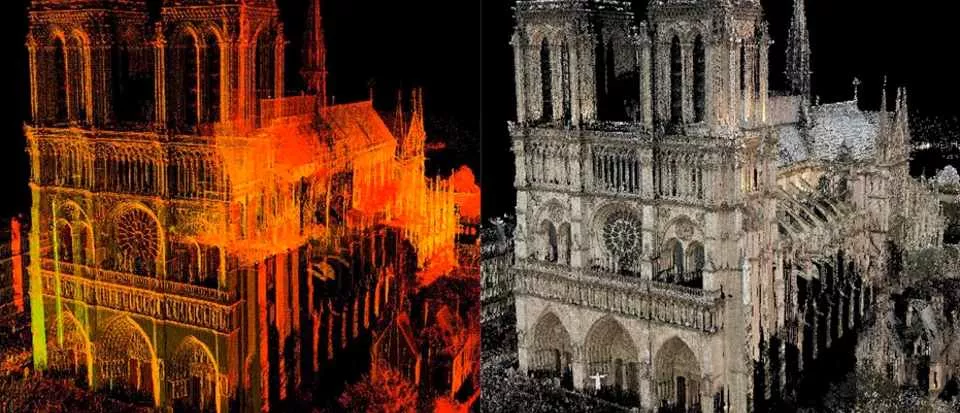
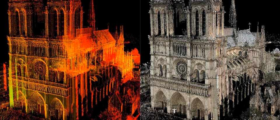
Point clouds are, in essence, very simple. They are datasets that are made up of ‘points.’ Each point represents something – a part of a wall, window, or wire, for instance – and the point contains information on where that part is in space. Together, these points form an image of whatever you had scanned.

Millions of points make up a point cloud – billions, if you are scanning a large building or complex. Viewed from a distance in point cloud software, they look a bit like impressionist paintings – and up close, you can see all the individual points that make up the scan.

On their own, point clouds don’t do much – you need point cloud software to extract value from that data.

What is point cloud software?

Point clouds require specialist software to view and manipulate then. Firstly, before point cloud data can be viewed it must be ‘registered’ so that the data all lines up and looks like the object or space you have scanned. This is especially important if you are stitching multiple point clouds together.

Because every point has data about where it is in space, you can also use point clouds to take incredibly accurate measurements of a space, calculate volumes, and more. Again, point cloud software is needed to do this.

Point cloud software can also provide a way for you to use point cloud data in other software applications. For AEC professionals, for instance, point cloud data is incredibly useful in 3D design tools as the basis for their designs. Construction firms may also want to feed point cloud data into their BIM plans, so they can compare as-built conditions with their plans as construction unfolds. Facilities managers can also use point clouds to get accurate floorplans of their buildings, and to help them plan projects – for instance, rearranging machinery on a factory floor for manufacturing a new product.

This is arguably one of the most important functions of point cloud software. But point clouds are often very large files – so large in fact, that they require specialist computers to work with. This is because most point clouds are actually made up of multiple scans. The lasers from 3D laser scanners can’t penetrate through walls, meaning that to capture the entirety of a structure, multiple scans are often required. Those point clouds are then stitched togther. The right point cloud software converts those point clouds into a smaller and more usable format that’s compatible with other software packages. Without point cloud software, it’s very hard or even impossible to use point cloud data – making the investment in 3D laser scanners a waste.

Where can I get point cloud software?

Most 3D scanners will come with their own software, which will allow you to do some things with your point clouds, including registering them and taking measurements from them. However, if you want to export your point cloud data to other applications such as Revit, you will likely need additional point cloud software to handle the process. There is a variety of ways in which point cloud data can be made to work with other applications, some of which are more complicated than others – the right software can make the process much smoother by automating some elements, such as classifying points (identifying them as walls, cables, or similar) or creating usable BIM objects from the data that can be used in lots of 3D design applicatons.

Whatever methodology you use, it’s important to understand that finding ways to use your point cloud data is an essential part of maximising the benefits of 3D laser scanners. The information scanners can generate, and therefore the value they can provide professionals in a range of industries, is immense – but only if those professionals have the tools to make use of the data the scanners output. Most scanners will come with their own software for registering point clouds, but those applications won’t often talk to other downstream systems easily. Therefore, it’s important to find software that seamlessly integrates with whatever hardware you are using. Once that part of the process is in place, there’s no stopping you from unleashing the potential of LiDAR and point clouds.

Author Bio:
Mark Senior
Mark has a strong background in Building Construction and Land Surveying. He has been at the forefront of significant technology changes in the Geospatial industry over the last 25 years. He is the business director at PointFuse, a leading BIM Coordination software. He has been involved with PointFuse since its conception, shaping its development from bleeding edge technology to the successful commercial solution it is today.
Read on
Search