The Ocean GIS Initiative: Taking GIS underwater
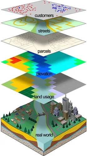
As geographers and Geo-information technologists, we are well aware of the potential and applications of GIS. It is amazing how a technology that took shape in the 1960’s based on a simple concept of overlaying maps is now at the forefront of what we are defining as the “Geospatial Revolution“. I wonder if even Dr. Roger Tomlinson expected his idea and the project “Canada Geographic Information System” would one day lead to the explosion of GIS technology and its application in various domains ranging from agriculture to crime control and so on. Dr. Tomlinson, the “father of GIS” deserves all the credit for his idea but personally I believe it was Dr. Dana Tomlin’s work “the Map algebra” that made GIS such an effective technology that it is today. But in spite of all the development over the last few decades, GIS technology was largely limited to being used on land.
A few years back, I was working on a GIS project that involved GIS research in the ocean environment. This was at a time when almost no GIS software, open-source or otherwise had any special toolbox for applications that involved the Oceans! The first question I had was:
How different is using the GIS software for land and ocean based projects?
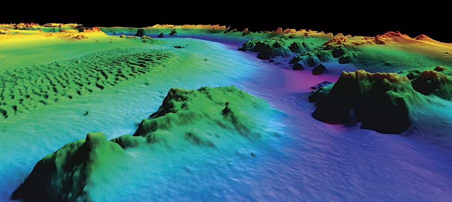
 Based on my experience, I wouldn’t say it is totally different but surely was very different from using GIS for land-based applications and projects. Let me elaborate, consider a GIS project where height information plays a crucial role like in the case of Landslide Hazard mapping. The steeper the slope, the greater the hazard (disregarding all other factors for the sake of simplicity). Now calculating the slope on land where all height information is positive seems a relatively easy task, right? Performing the same operation for an Ocean GIS project would end up resulting in a million errors and roadblocks simply because all the height information would be negative numbers and inverting the numbers doesn’t help in the absolute sense.
It is simply not possible to assign the same dimension for the same problem on Land and Ocean. My team that was working on this Ocean GIS research a few years ago was facing issues like this and many others. We were not wanting to build an entirely new GIS software and so we had to circumvent the problem using smaller extensions. I’m sure many GIS applications for Oceans did not take off simply because there were no turn-key solutions available. Lack of commercial applications and interest was one of the main reasons why GIS softwares did not have any solutions for Ocean GIS.
But not anymore! With the boom in shipping industry, underwater internet cables, besides government regulations regarding oil spills and the potential of minerals underwater (which was the reasons why I started the research in the first place) have all made Ocean GIS an interesting requirement.
ArcGIS toolbox for Maritime Applications is probably the only complete solution that exists right now that would have made my research few years back much more simplier. It is interesting to note the number of projects that ESRI has taken up in its “Ocean GIS Initiative” that will not only aid in Ocean GIS application but also assist in understanding the complex world of water that surrounds us. Over 90% of cargo is shipped via Ships and at least a hundred million people world over depend on the oceans for their living. Oil spills and other disasters in the past could not be modelled using GIS but now we have the means to model them.
GIS is now scaling greater depths than ever before. What do you think?


