Last year I wrote about how computer vision is helping us harness the power of machines to understand the world, and how for updating maps this process is faster and more accurate than what we could ever accomplish manually. This year, we can expect that to expand to more types of data, novel ways to combine sensors, and improved accuracy. Behind all of this is deep learning.
Deep learning is a machine learning method and a type of artificial intelligence that is changing the game for the geospatial industry. Deep learning was called the next evolution of machine learning when it started dominating industry benchmarks a few years ago. The goal with deep learning is to develop algorithms that allow computers to essentially learn patterns and replicate processes.
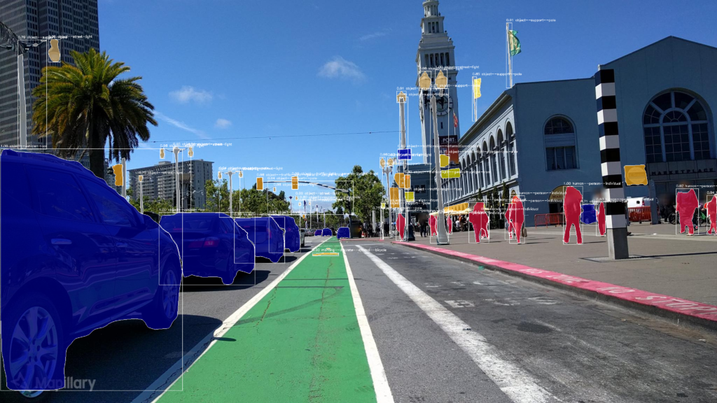
Although deep learning has been used for some time now, industries like maps and automotive are just beginning to scratch the surface of what’s possible with this technology. In the world of maps, deep neural networks are already used, for instance, by Mapillary to detect and position real-world objects derived from 2D images and by Development Seed’s Skynet to extract buildings from satellite and drone imagery. At Facebook, neural networks are used with satellite images to detect changes over time in order to quantify the impacts of natural disasters on man-made structures.

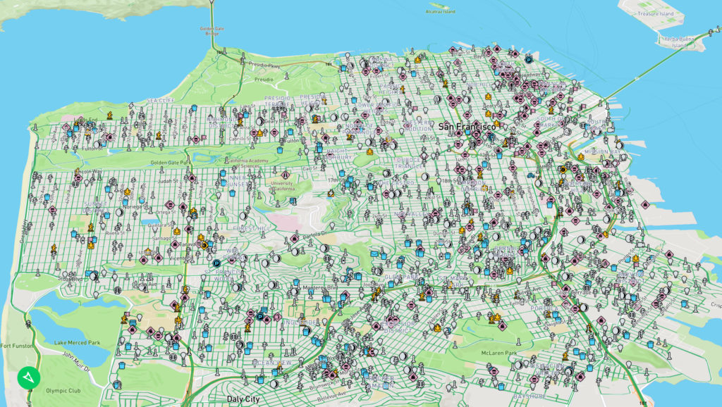
Mapillary uses deep learning to extract map features like traffic signs, utility poles, street lamps, and many others from street-level images, before positioning and placing them onto the map
As this technology continues to grow and develop, the accuracy of these detections will become even more precise. Now more efficient GPUs, some deployed to cloud platforms like AWS, are allowing us to train these networks much quicker, giving us more accurate predictions than ever before. Memory-efficient modules were developed in 2018 that further decreased the cost associated with training deep neural network models, helping to make artificial intelligence more accessible than ever before.

Highly accurate maps are more important than ever as we move towards a future with autonomous vehicles
This is great news for maps. The pressure on maps, when it comes to accuracy, precision, and update frequency, has never been higher. This is especially true as we move towards HD maps to accommodate for autonomous vehicles and deliveries. Robust training data is a crucial part of the puzzle to develop deep learning algorithms for autonomous vehicles. With simple onboard cameras and deep learning, they can update and improve their maps continuously. Deep learning is paving the way for real-time mapmaking using cameras. Many people are wondering where self-driving cars are. We still don’t have comprehensive enough maps for autonomous vehicles to be deployed more broadly and that will remain the case at the end of 2019. At that time, however, we are going to be able to provide real-time map updates with cameras to HD maps. In our rapidly changing world, deep learning and large-scale image collection are the keys to providing location data in a scalable way.


