

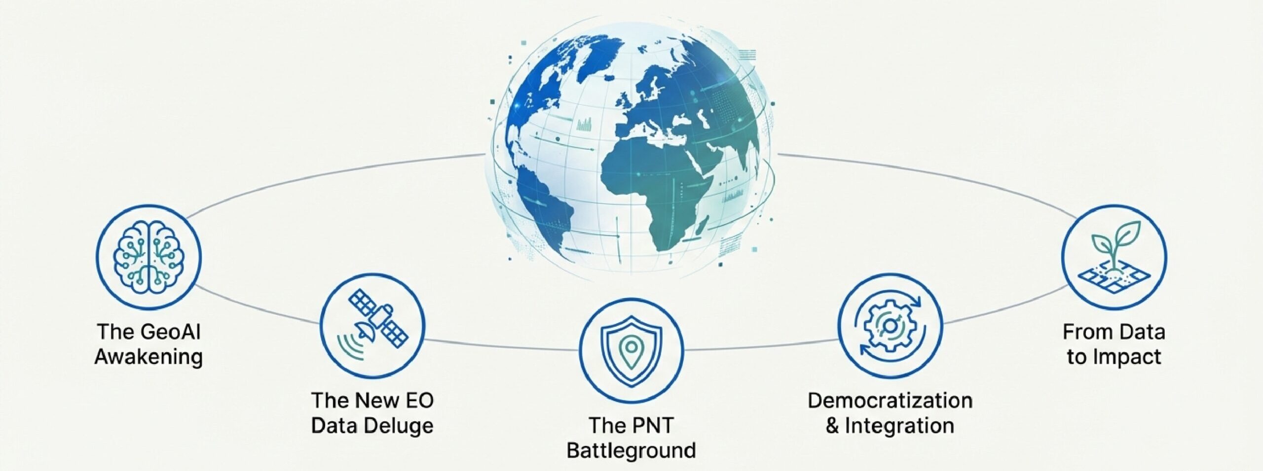
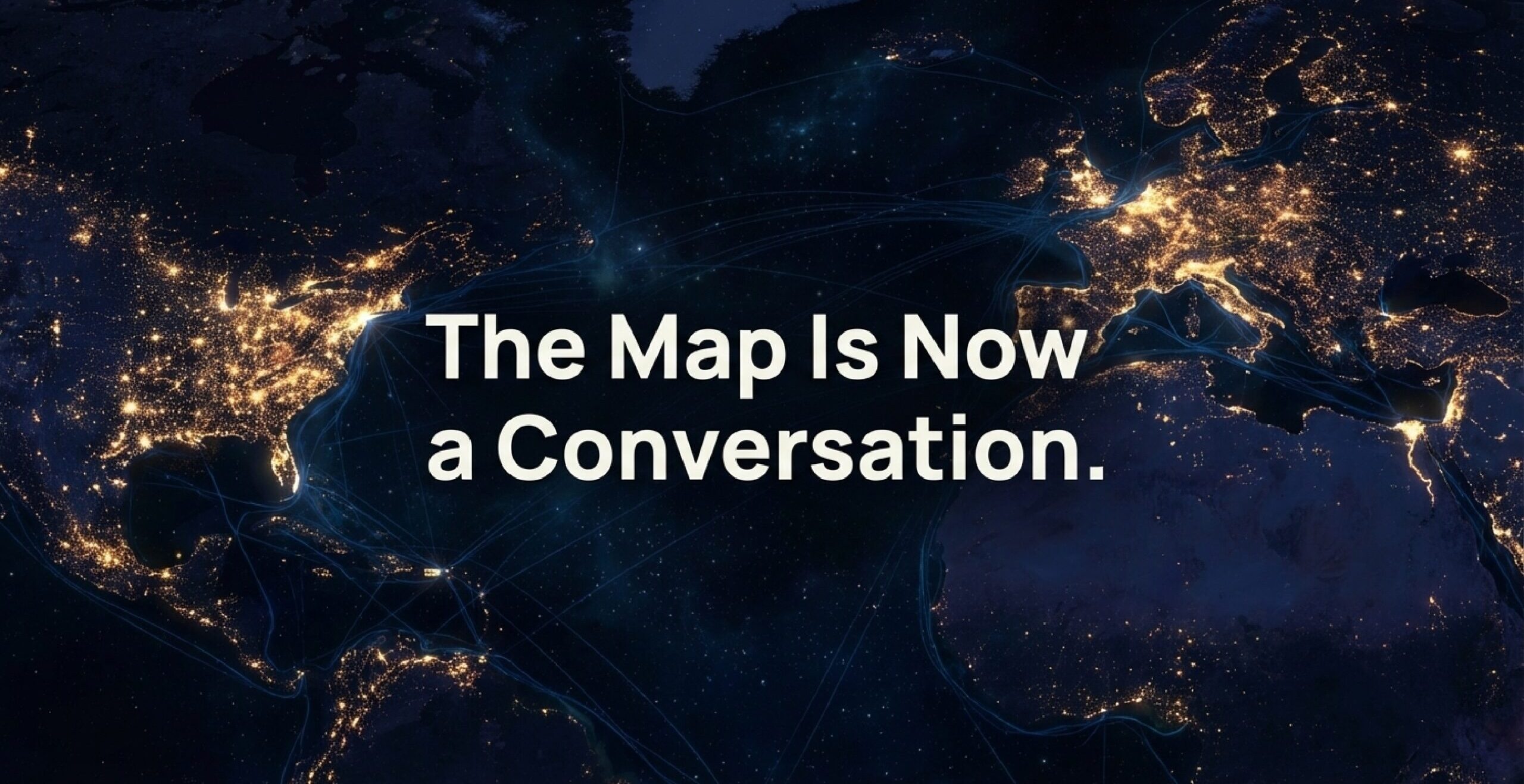
Introduction: The Map Is Now a Conversation
The convergence of Earth Observation, Positioning, Navigation, and Timing – PNT, and Artificial Intelligence is driving a new era of geospatial intelligence, commonly known as “GeoAI”. Beyond traditional mapping, this fusion enables predictive analytics, automated monitoring, and strategic insights on a global scale. Organizations that adopt GeoAI gain points in innovation, efficiency, and decision-making.
This summary showcases the core technology pillars, the GeoAI revolution, and its sector-specific applications, drawing on insights from this year’s web sources, with direct links to supporting references.
Key Technologies
A. Earth Observation (EO)
EO has evolved into a global utility. Public programs like the Copernicus program, including Sentinel-1D and Sentinel-6B, provide continuous environmental monitoring. NASA’s Landsat program delivers decades-long archives of Earth imagery.
Commercial EO has grown rapidly, with companies like Novaspace, BlackSky, ICEYE, and Vantor (formerly Maxar) providing high-resolution imagery, SAR for all-weather monitoring (Windward.ai), and hyperspectral data (Spacenews).
Positioning, Navigation, and Timing (PNT)
GNSS systems, including Galileo, underpin autonomous vehicles, precision agriculture, and financial networks. Resilient alternatives are emerging to mitigate jamming and spoofing threats (GPS World, InsideGNSS).
Emerging methods include:
- Quantum sensing independent of satellites (InsideGNSS)
- 5G-based positioning in urban environments (IEEE Spectrum)
- Advanced inertial & visual navigation combining IMUs and cameras (GPS World)
C. Geographic Information Systems (GIS)
GIS platforms like ArcGIS and QGIS integrate spatial data for advanced analysis. 3D geospatial data and LiDAR support urban planning, infrastructure management, and digital twins (Forbes).
GeoAI Revolution
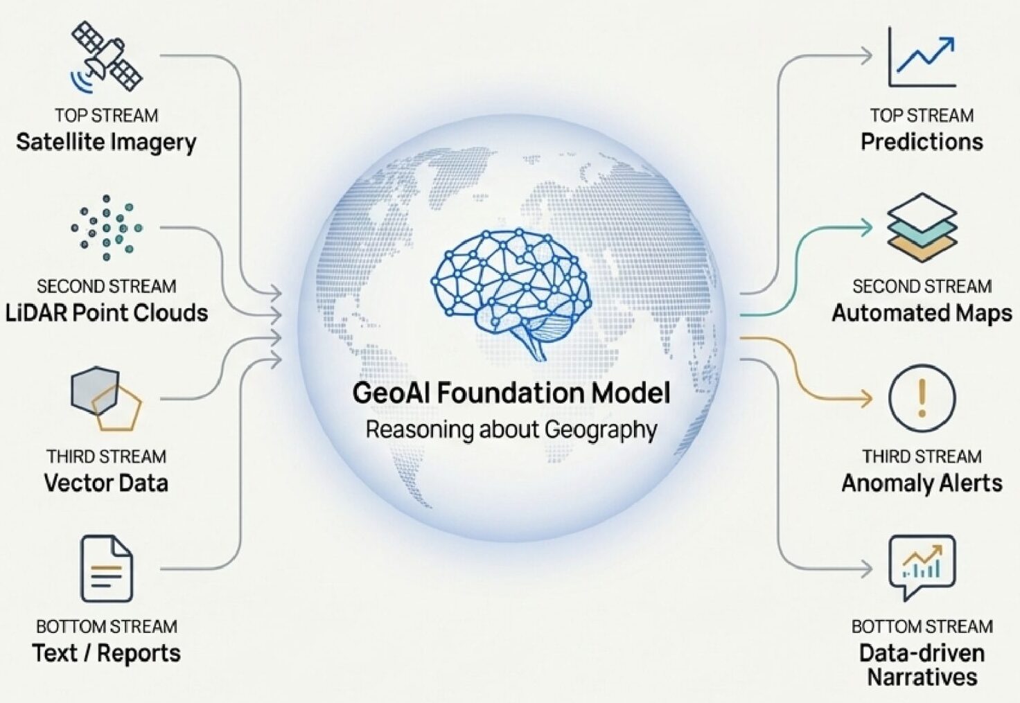
Foundation Models
Large-scale AI models like IBM’s Prithvi and Google’s AlphaEarth enable automated change detection (Esri), object recognition (IEEE Spectrum), and land-use classification (Google Research).
Cloud platforms like AWS Open Data and Microsoft Planetary Computer provide the computational power for these models.
Predictive Analytics
GeoAI shifts focus from descriptive to predictive mapping:
- Weather forecasting: Google WeatherNext
- Flood & wildfire risk: IBM AI
- Earthquake aftershocks: BGS AI
Automation extends to building footprints, road networks, and digital terrain models (Esri).
Sector Highlights
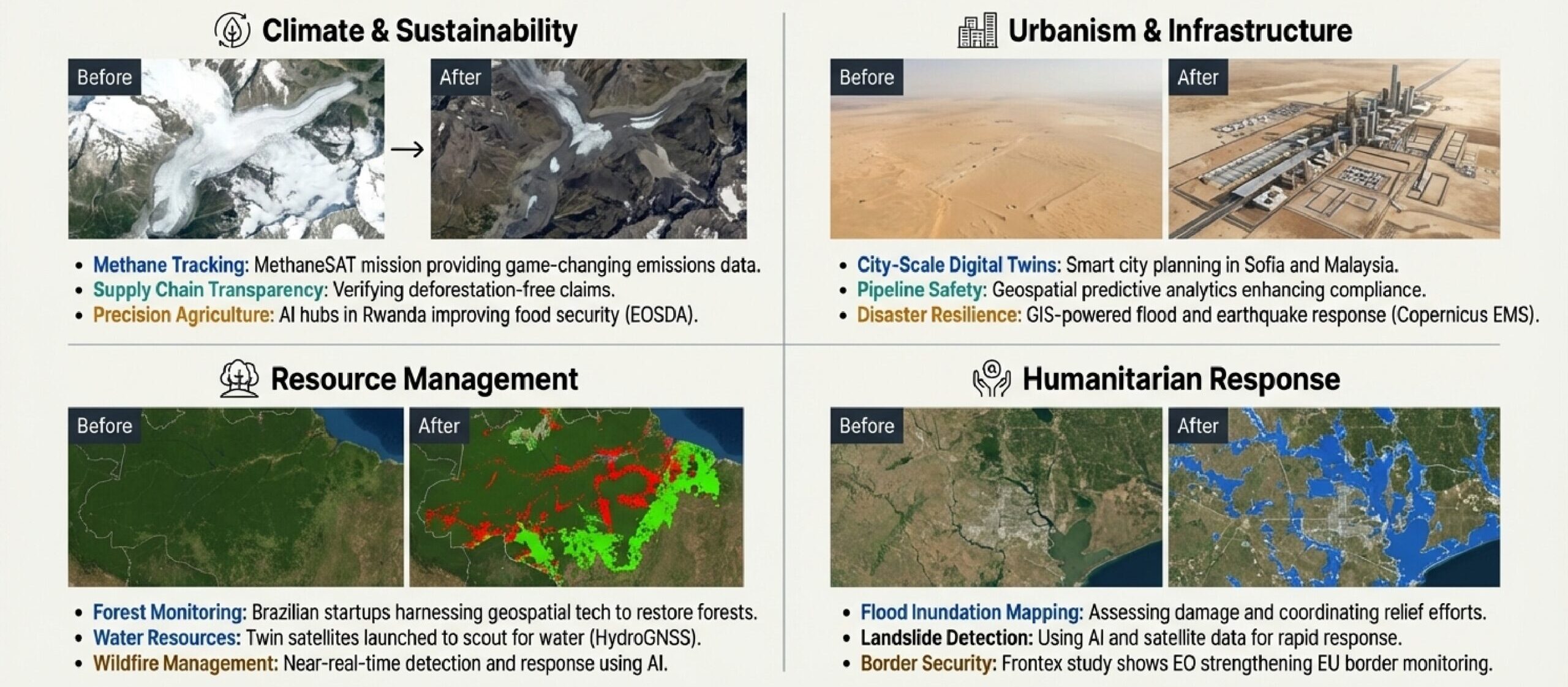
Climate & Environment
EO and AI track ocean warming, glacier melt, and deforestation. Disaster response uses Copernicus EMS and AI (Cam.ac.uk).
Defense & Security
Commercial satellites (AINvest, ICEYE) combined with AI (Windward.ai) enhance monitoring and sovereign intelligence (EENewsEurope).
Smart Cities
Digital twins in Sofia (BTA) and Dublin (SmartCitiesWorld) optimize traffic, energy, and planning. GIS applications improve noise mapping and public transit.
Market & Strategy
- Geospatial analytics projected over USD 590B by 2035 (IndustryToday)
- GNSS market over USD 450B by 2032 (NewsTrail)
- ESA investment (ScienceBusiness)
- Private sector growth (CNBC)
Challenges include data access (Spacenews), GNSS vulnerabilities (Forbes), workforce gaps (GeoWeek), and ethics (Esri).
Conclusion
In 2025, GeoAI and advanced geospatial systems began reshaping industries, delivering predictive, automated, and strategic insights. The map is no longer just a reference: it’s a conversation. To stay ahead, organizations must embrace AI, invest in resilient PNT, and leverage geospatial technologies to tackle global challenges such as climate change, disaster resilience, and sustainable development.
Did you like this post? Follow us on our social media channels!
Read more and subscribe to our monthly newsletter!

#GeoAI


Next article
Tech for Earth: Earth as a Living Digital Nervous System
Building on the themes of our previous coverage in Tech for Earth, the past month has seen a convergence of space technology, artificial intelligence, and cartographic innovation. Currently, the field is producing real-time, decision-ready intelligence designed to address climate resilience, infrastructure safety, and environmental protection. This evolution is creating what can be described as a “living digital nervous system,” where multiple technologies – once considered separately – are now intersecting through real-world and spatial information.
Orbital Vision: The Completion of the Sentinel-1 Family
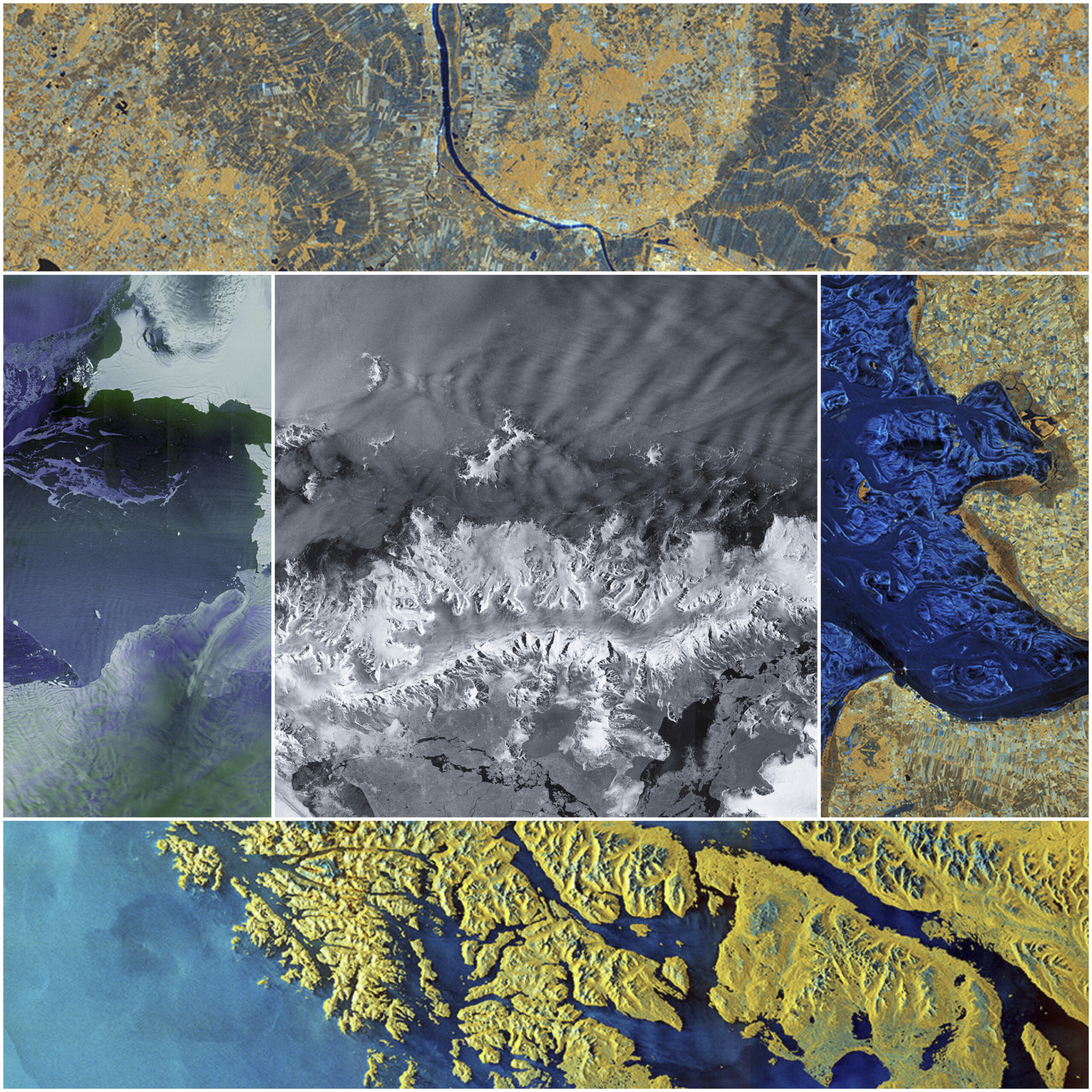
A major milestone for the European Space Programme occurred on November 4, 2025, with the successful launch of the Copernicus Sentinel-1D satellite aboard an Ariane 6 rocket. This satellite completes the first generation of the Sentinel-1 constellation, ensuring radar data continuity for the next decade. Remarkably, Sentinel-1D delivered its first high-resolution radar images within just 50 hours of launch, a feat believed to be a new record for space-based radar. These “first light” images captured the fragile beauty of the Antarctic Peninsula and the Thwaites Glacier, as well as the southern tip of South America and the city of Bremen, Germany.
The Sentinel-1 mission provides a “radar vision” that can penetrate thick cloud cover, fog, and rain, acquiring images day or night. This capability is essential for tracking subtle changes in tropical forests, monitoring volcanic activity, and quantifying ground deformation after earthquakes. In tandem with this radar expansion, the EU Space Programme is also preparing for the launch of Copernicus Sentinel-6B, which will continue a thirty-year legacy of centimeter-precision sea-level monitoring. This mission is dedicated to coastal cities like Rotterdam and Venice that face increasing flood risks as global sea levels rise at record rates.
AI-Powered Environmental Intelligence
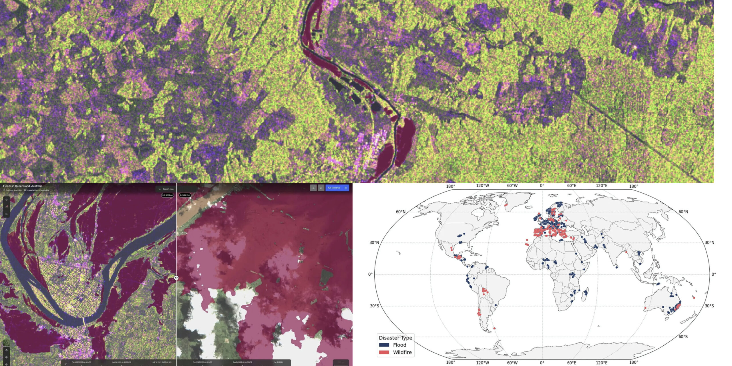
The integration of generative AI and geospatial data has reached new heights with several major releases. IBM and the European Space Agency (ESA) have open-sourced ImpactMesh, the first global multi-modal dataset for analyzing extreme floods and wildfires. By fusing radar, optical, and elevation data from the last decade, their fine-tuned TerraMind model can now produce burn scar maps with 5% higher accuracy than traditional methods. These models are designed to improve disaster preparedness by allowing responders to see through storm clouds or smoky fires that typically block optical sensors.
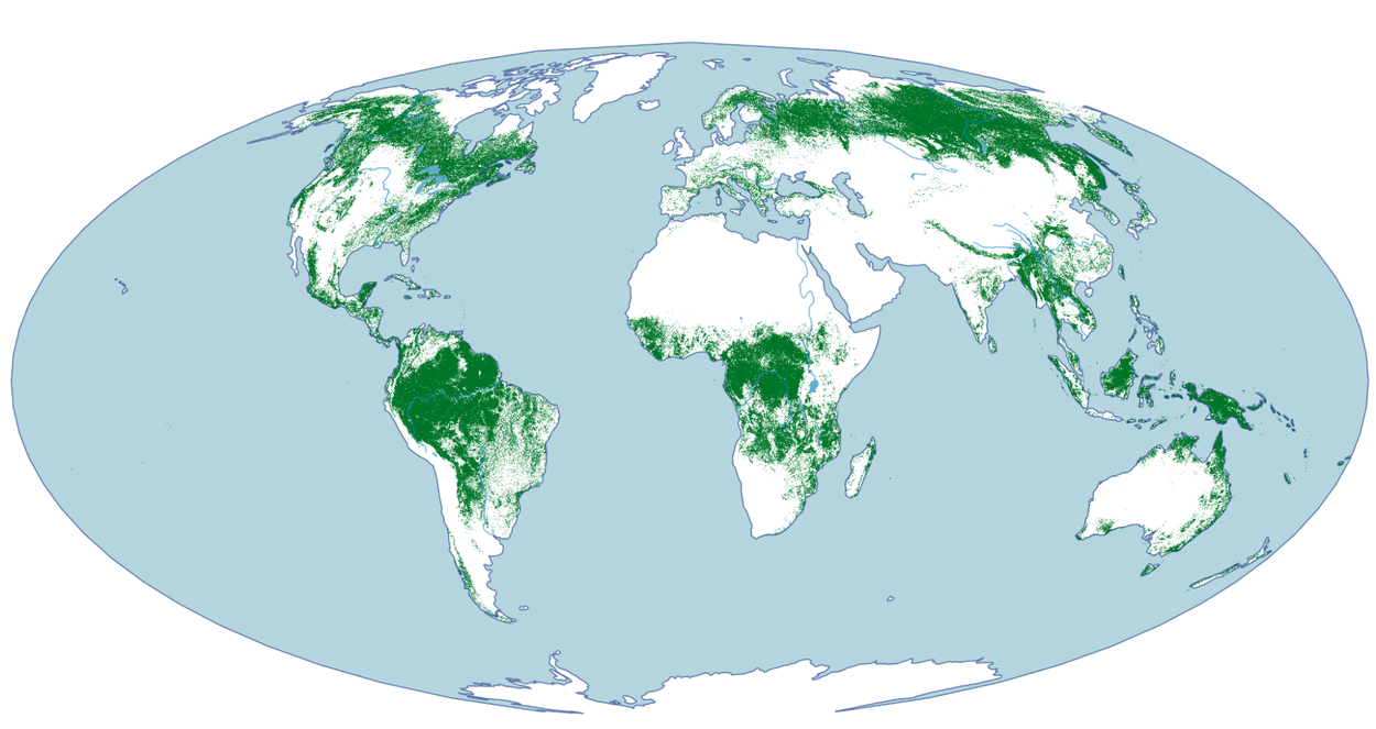
In the realm of meteorology, Google DeepMind introduced WeatherNext 2, an AI forecasting model capable of generating hundreds of possible weather scenarios in under a minute. It is 8x faster than previous versions and provides hourly resolution, surpassing previous state-of-the-art models on 99.9% of variables such as temperature, wind, and humidity. Furthermore, in a move for biodiversity, Google Research and DeepMind released a 10-meter resolution map that distinguishes natural forests from commercial plantations. This dataset is useful for compliance with the EU Regulation on Deforestation-free Products (EUDR), ensuring that products like coffee and cocoa sold in the EU do not contribute to the degradation of biodiversity-rich ecosystems.
The Advent of Autonomous and Agentic GIS
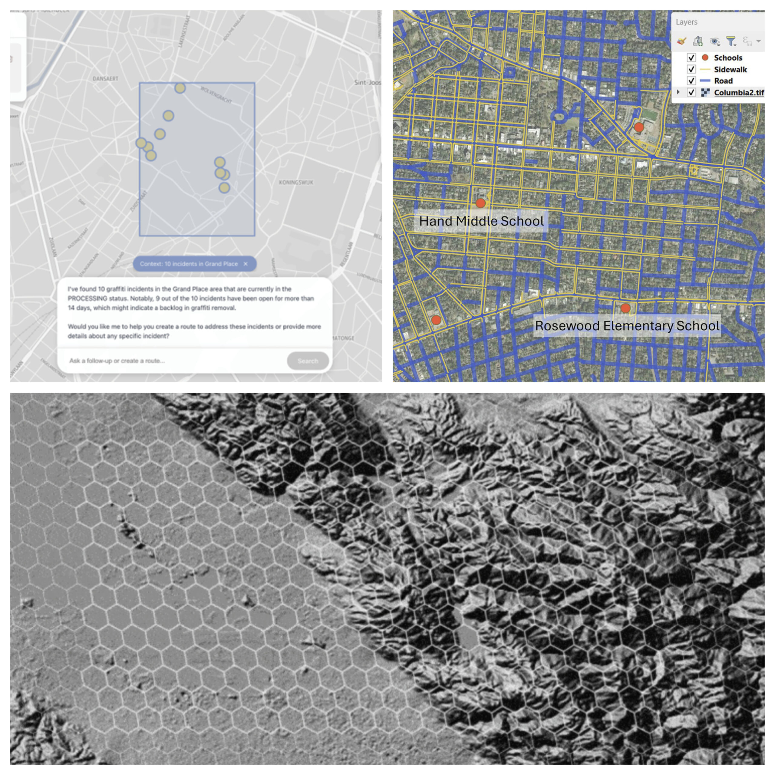
In the field of Geographic Information Systems, we can notice the rise of autonomous AI agents. A multi-institutional team led by Penn State researchers demonstrated agents capable of performing complex geospatial tasks with minimal human oversight. Their LLM-Find agent can autonomously retrieve specific geospatial datasets based on natural language prompts, while the GIS Copilot completed over 100 multi-step spatial tasks with an 86% success rate. This suggests a future where non-experts can perform sophisticated spatial analysis through conversational interactions.
Complementing this, AWS and Foursquare have introduced geospatial AI agents that enable domain experts to answer complex spatial questions in minutes instead of months. By using the H3 hierarchical spatial grid as a universal join key, these agents can combine disparate datasets – such as property insurance records and climate risk projections – without requiring custom data engineering. Similarly, the Strands Agents framework is being used in the public sector to help government workers manage incident reports and optimize resource routing through simple conversational requests.
Infrastructure Safety and Urban Resilience
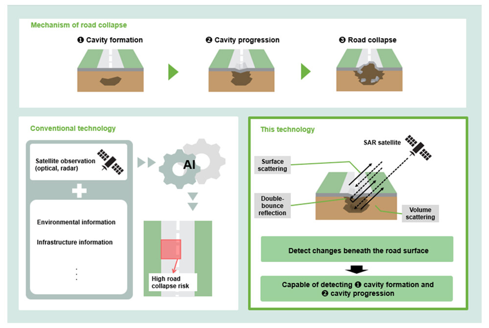
Technological breakthroughs are also being applied to immediate human safety concerns. NTT successfully demonstrated a world-first method for detecting early signs of underground road cave-ins using reflected radio waves from SAR satellites. By analyzing radio waves capable of penetrating asphalt, this technology can identify potential cavities beneath the surface without the need for on-site survey vehicles, a move expected to reduce inspection costs by approximately 85%.
In Europe, nations are deploying GIS-based noise maps to combat the “silent killer” of noise pollution, which is linked to thousands of premature deaths and an annual economic loss of $111 billion. These maps, such as those maintained by the Irish Environmental Protection Agency, allow policymakers to visualize noise hotspots – like the M50 freeway in Dublin or the Guinness Brewery – and implement infrastructure solutions like noise barriers. Additionally, an ESA-led “AI for Earthquake Response Challenge” recently recognized international teams for developing models that automate building damage detection from space, a capability critical for rapid search-and-rescue efforts.
The Evolution of Cartography and Historical Discovery
The past month has highlighted the enduring power of maps as “memory engines” that connect place and emotion. Allen Carroll, the creator of ArcGIS StoryMaps, released his new book, Telling Stories with Maps, reflecting on how the platform has enabled over 3.5 million stories to be told, ranging from Indigenous territories in the Amazon to wildlife migrations.
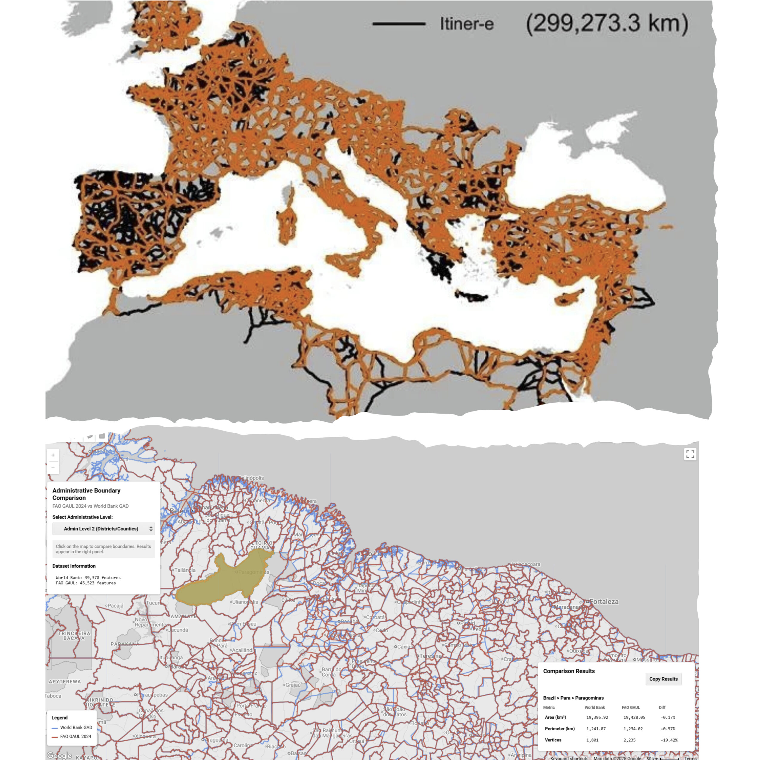
This spirit of discovery extends into our past with the release of Itiner-e, a high-resolution digital map of the Roman Empire around 150 CE. This dataset nearly doubles the previously known length of the Roman road network, documenting 299,171 kilometers of roads. Simultaneously, the World Bank has released new high-resolution global administrative boundaries as an open public good to improve the quality of subnational development research and support smarter decision-making.
In summary: Tech for Earth as a Living Digital Nervous System is becoming reality: data streams interact continuously, sensing subtle changes across the planet and enabling faster, coordinated, and informed responses.
Did you like this post? Follow us on our social media channels!
Read more and subscribe to our monthly newsletter!

