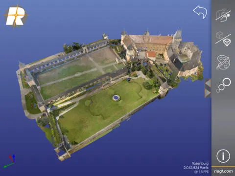
Last week the world’s first application for experiencing LiDAR data on an iPad was announced by Austrian company Riegl that since over 30 years is specialized in the research, development and production of laser rangefinders, distancemeters and scanners including appropriate software packages. The RiALITY iPad point cloud viewer is available in the iTunes App Store. It enables to visualise and navigate through point clouds captured by Riegl’s laser scanners. RiALITY features true color point clouds and 3D navigation. An Augmented Reality Mode allows point clouds to be virtually projected into the real world.
The scope of RiALITY is to ease the data flow and communication between the contractor (recording companies) and the purchaser (end user). Suchlike, the 3D point cloud data can be easily sent to the client, who is able to visualise the results without difficulty on an iPad for free. The software incorporates a demo dataset from the Rosenberg Castle in Austria. RIEGL scans can also be imported from RIEGL’s RiSCAN PRO software into the App, as well.
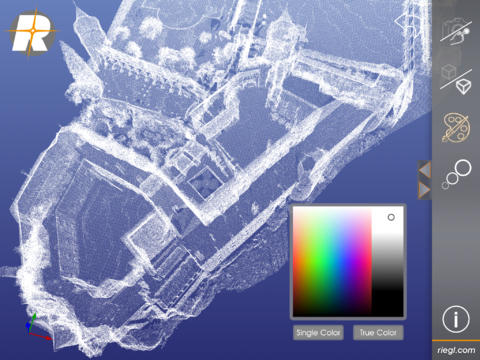
Take a look at the screen:
The features of RiALITY in detail are:
– Point Cloud Viewer: Easily visualize 3D Point Clouds on your mobile device.
– Touch Navigation: Use standard touch gestures to navigate through the point cloud.
– Augmented Reality: Print a reference image and experience point clouds in Augmented Reality.
– Single color and True color mode for point clouds.
– Adjustable point size.
– Orthographic and Perspective visualization mode.
– Import of your own point cloud from RIEGL RiSCAN Pro files (.rqx).
– Supports point clouds with up to 2.5 million points.
Go ahead and enjoy it!
Source: GISCafè


