#Business #GeoDev #Ideas

Fancy working on an Open-Source project for Self-Driving Cars?

Udacity, the online learning platform wants to build a Self-Driving Car. Nothing surprising, right? Almost everyone these days is involved in building autonomous cars but the biggest difference is Udacity is thinking Open Source!

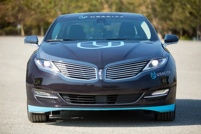
The Lincoln MKZ used by Udacity for the Self-Driving car project

The Lincoln MKZ used by Udacity for the Self-Driving car project

It doesn’t really come as a big surprise though. Udacity recently launched (the first?) online course on self-driving cars and over 10,000 people had applied for the $2400 Self-Driving Car Engineer Nanodegree program that will start later this month. The program is supposed to be totally hands-on and open-sourcing the Self-Driving car project is a huge step in democratizing the program.

It’s a very simple instance of a law that is fundamentally true: Technology is moving so fast, that by definition when something becomes hot, the skill set doesn’t exist – Sebastian Thrun

Udacity has taken a very structural approach to open-source project by breaking it down into challenges. Challenge #2 – “Using Deep Learning to Predict Steering Angles” is currently out. Open Source has proved itself as a force to reckon with, now it is to be seen if can solve the self-driving car challenge as well!

Say thanks for this article (0)
The community is supported by:
Become a sponsor
#Business
#Business #GeoDev
3 Pathways For Integrating Planet Data Into Your GIS Workflow
Avatar for Sponsored Article
Sponsored Article 08.12.2024
AWESOME 1
#Business #Featured #People
Explore the unexplored with Felt: Meet Sam Hashemi, CEO of the online platform making mapping effortless for everyone
Nikita Marwaha Kraetzig 12.7.2023
AWESOME 2
#Business #Featured #GeoDev
Geo Addressing Decoded, Part 4: Exploring the Applications of Geo Addressing Solutions
Aleks Buczkowski 06.25.2024
AWESOME 2
Next article
#Fun #Ideas

Top 10 most surprising maps that explain the world

The world is a very surprising place. Check out these 10 maps that will show you facts about our planet that you most likely didn’t know about.

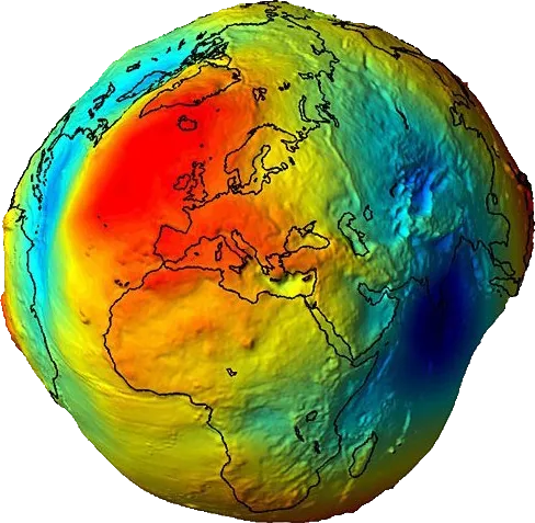
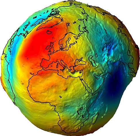
This is how the surface of the earth actually looks like

This is how the Earth would look like without oceans. It’s not round, it has a shape called the geoide.

geoide

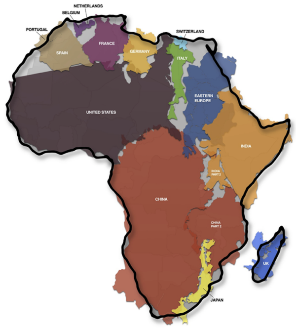
The True Size of Africa

Africa is much larger that you might think.

true-size-od-africa

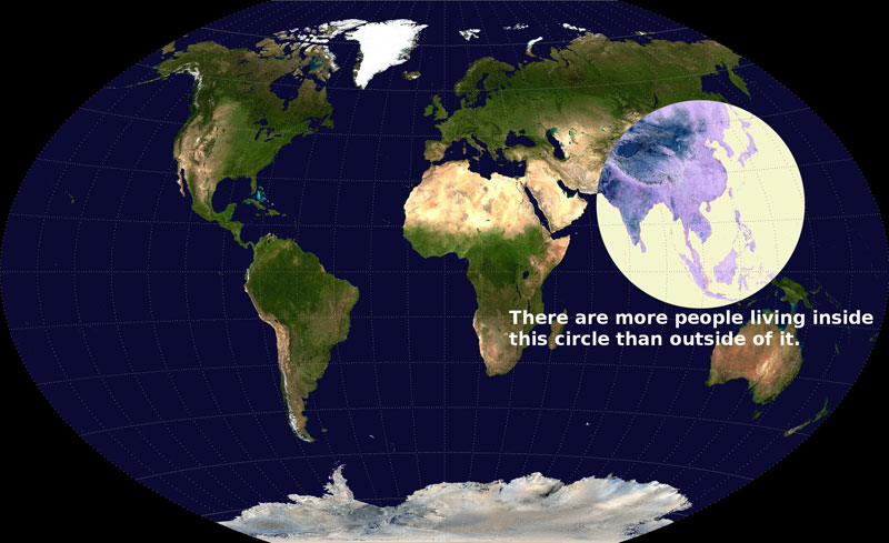
Over 1/2 of the world population lives in that circle

Oh boy, it’s 4 billion people living in such a small area.

map-of-0-5-population

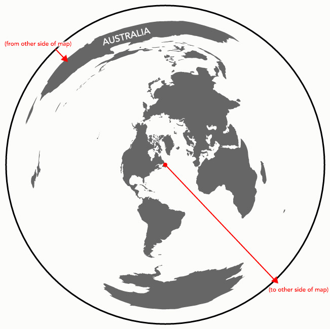
Direct line between Long Island and Australia

When standing perpendicular to the ocean at Long Island you might be actually looking at the south cost of Australia.

nl-to-aus

source: Andy Woodruff

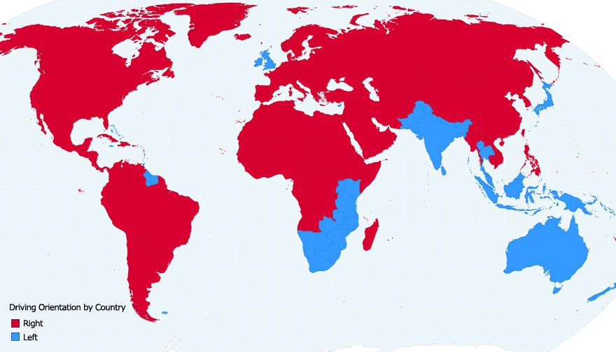
Driving orientation

About 90 per cent of the world’s total road distance carries traffic on the right and 10 per cent on the left.

fun-maps-28

source: Chartsbin

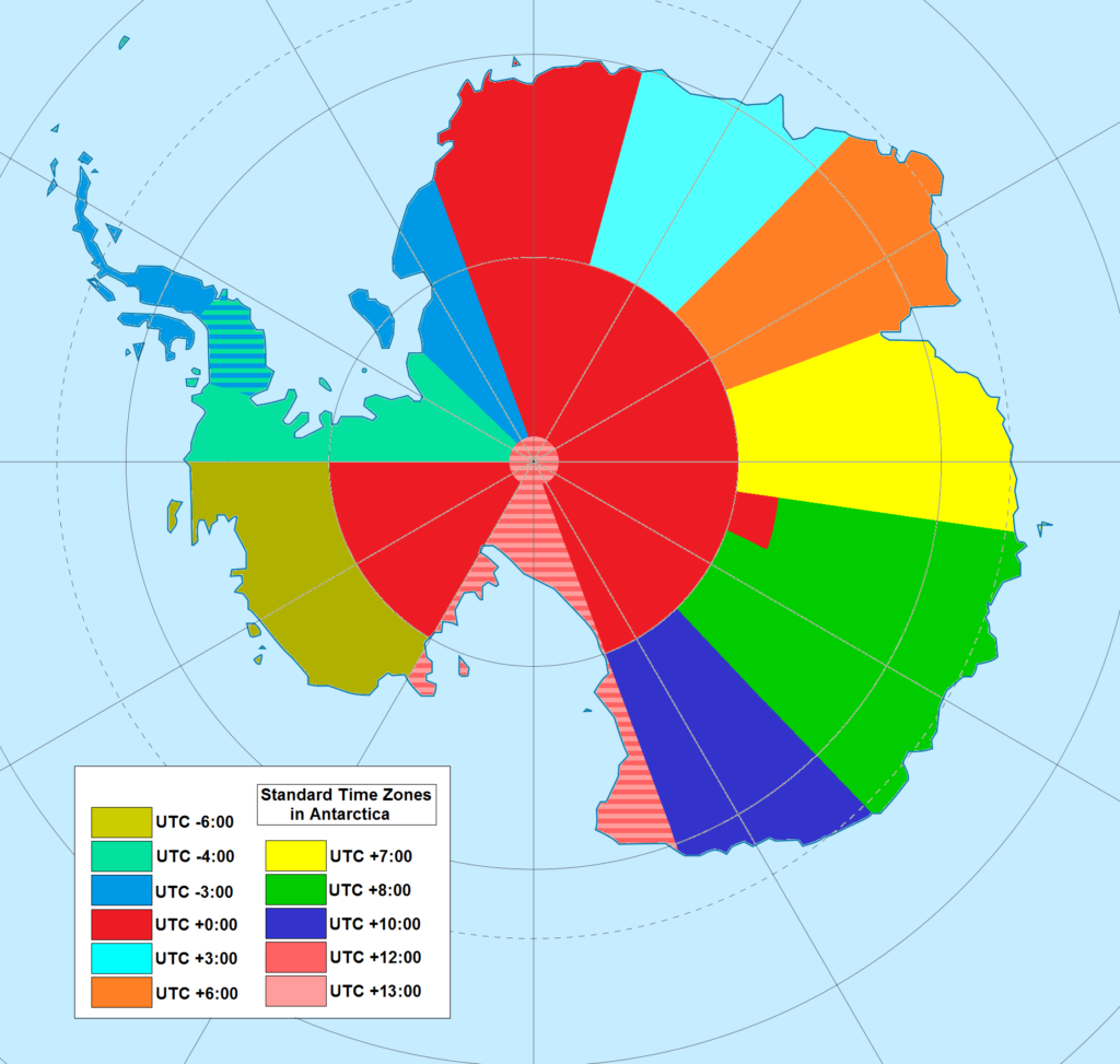
Time Zones in Antarctica

Technically, Antarctica, and the North Pole, fall under all time zones, as the longitude lines that are used to define time zones all meet at the two poles.

utc_hue4map_ata

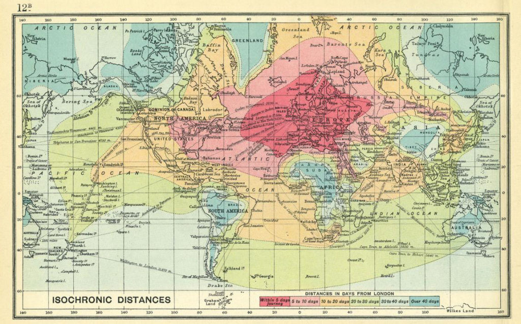
Travel time 100 years ago

The map shows isochrones of travel from London to locations around the world.

Travel-Isochrones-Geoawesomeness

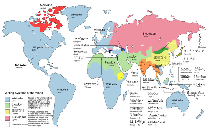
Writing systems of the world

Writing systems can be divided into two main types: those that represent consonants and vowels (alphabets), and those which represent syllables (syllabaries), though some do both.

writting-systems-of-the-world

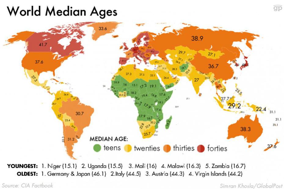
World Median Ages

The world’s 15 youngest countries are all in Africa, while Germany and Japan are the oldest.

world-median-ages


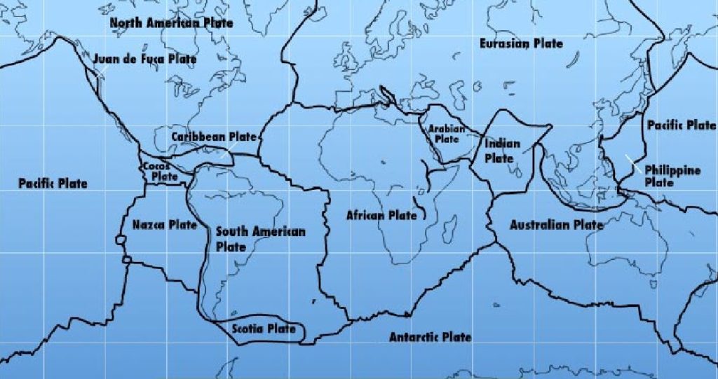
Map of tectonic plates around the world

This is why earthquakes happens in these places.

tectonic-plates

[td_smart_list_end]

Read on
Search