#Business #Ideas

The Essential Element for Location-based Games in 2017 according to Peter Wittig of Motive.io

Think about where you are right now. Are you at home, at work or out? What are you near? Have you been there before? What time is it? Is it sunny, snowing, raining? How much of that does your mobile device already know? All of it and more. If your device knows it, your game can know it too.

Context is the essential element for location-based games and experiences. Having on-demand access to contextual information like current location, location history, people or places closeby, weather, date and time makes the mobile device unique compared to other platforms. I would argue that it is context-aware games that will succeed in the future. While location is a big part of context, location alone is not enough. If you aren’t using location & context in your mobile game, it might be better on a platform with a larger screen.

Let’s consider movies vs theatre as an analogy. Movies, like PC or console games, have complete control over their environment. The perfect scene, sound and dialogue can be arranged because of that control. However, that means it is static and lacks the ability to be spontaneous based upon what is happening in that moment for a given viewer.

Now think about an improvised theatre performance in a public square. It needs to be ready to deal with ambiguity and change. Maybe it is a foggy day or maybe a construction project necessitated a change in location. The actors have the ability to personalize the experience for each new audience because they understand and share their context. Location-based games have this ability as well.

The future of location-based games will be dominated by those who take advantage of the on-demand contextual data available on each user’s device. The mixing of each individual user’s reality with the overall fantasy of the game will not only make for more engaging games but far more personal experiences.

Future location-based game developers: Don’t design a PC or console game and then decide it should be location-based. Build your experience around being away from a computer. Get outside and test early and often. Use the myriad of sensors on a mobile device to get contextual data when you need it. Personalize your game to each user based on their context. Embrace the ambiguity and change of the real world in your game and you will succeed.

Say thanks for this article (0)
The community is supported by:
Become a sponsor
#Business
#Business #Ideas
Urban Digital Twins in China: A Smart Gadget or a Decision Support Tool?
Nianhua Liu 03.28.2024
AWESOME 4
#Business #Events #Featured
Gain Insights from Spectral, SAR, and LiDAR Thoughts Leaders at Geo Sessions 2024
Avatar for NV5 Geospatial
NV5 Geospatial 09.30.2024
AWESOME 4
#Business #Featured #GeoDev #Ideas #News
Bee Maps: Creating a Buzz in the World of Fresh, Affordable, and Real-Time Mapping Solutions
Nikita Marwaha Kraetzig 11.5.2024
AWESOME 5
Next article
#Business #GeoDev

Uber launched a new service that could help cities master their traffic

Traffic and transportation planning is a tricky business. Local governments have been struggling for years to make good, data-driven decisions to transform cities into more livable places… And many times they failed primarily due to lack of data and means to use it.

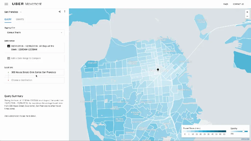
In the era of the Internet of Things the lack of data shouldn’t be a problem anymore. Companies like Google, Uber, TomTom, Here, Apple or Inrix have real-time data about traffic flows for hundreds of cities. The challenge is however how to transform this data into applicable knowledge that will improve urban mobility. This is were Uber decided to look deeply into its location-based Big Data and came up with a project called Movement, that is supposed to help cities better understand their traffic patterns.

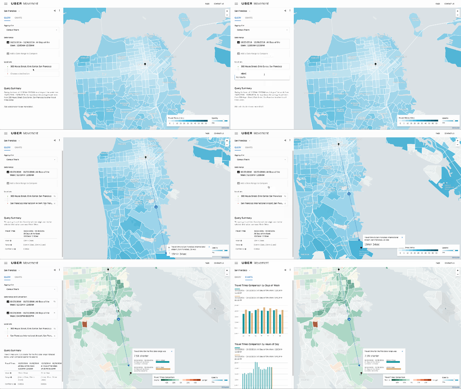
The Movement website gives you access to information based on analysis of billions of rides that Uber has completed in over 450 cities for 6 years so far. Uber says it was looking at all that data and began to realize that it could be used for public benefit. Built by a team of 10 engineers over the past 9 months, Movement now offers traffic patterns and travel time information for Manila, Sydney, and Washington, DC with dozens more cities to come before it launches to the public in mid-February.

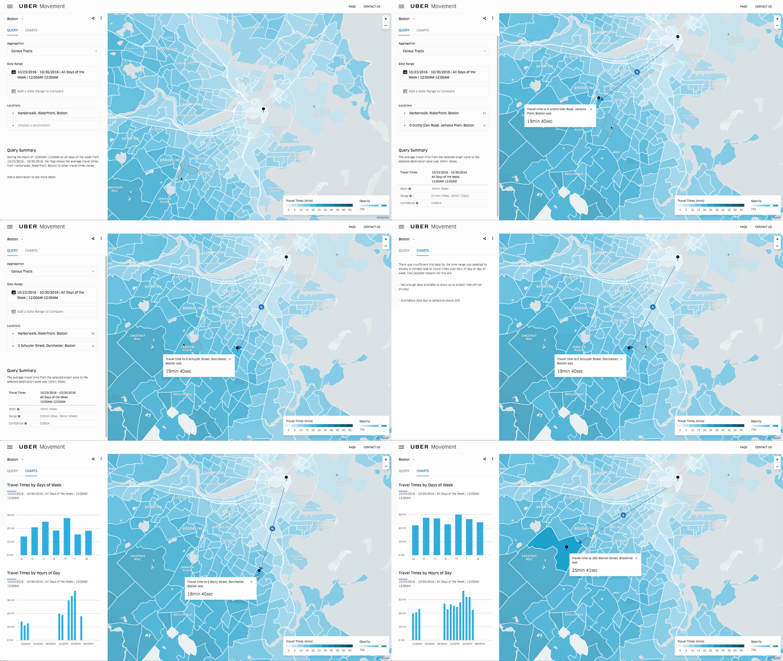
The data is anonymized by dividing cities into smaller segments by region and time. If there’s not enough data for a given set of parameters Movement will gray out the region rather than risk exposing individual data. Another benefit, is that the data allows to see, how big events, road closures have an impact on travel time. Awesome!

So why Uber is actually sharing this data? On one hand this will allow Uber to build a better relationship with municipal governments that might be helpful as its business matures and in the future it could potentially bring an additional revenue stream. On the other hand better managed traffic is beneficial for Uber users, drivers and for everyone else, so storing it internal would be a terrible wastage of a great resource. In that sense other companies should learn from the ride-hailing startup.

Great project Uber!

Read on
Search