Achieving Ambitious Climate Goals How Can Marine Geospatial Data Protect Our Oceans While Supporting the Shipping Industry
Editor’s note: This article was written as part of EO Hub – a journalistic collaboration between UP42 and Geoawesome. Created for policymakers, decision-makers, geospatial experts and enthusiasts alike, EO Hub is a key resource for anyone trying to understand how Earth observation is transforming our world. Read more about EO Hub here.
The ocean covers 70% of the planet’s surface. Sailing these high seas are vessels transporting over 11 billion tons of goods each year. With approximately 90% of global trade relying on maritime transport, finding ways to mitigate the shipping industry’s environmental impact is now imperative.
Sustainability has become a vital part of every industry across the world, and maritime is no different. A paradigm shift towards greener practices is already underway. So, how can we achieve ambitious and necessary climate goals while balancing the need for ocean protection and the importance of maritime trade? Marine geospatial data can help us to get there.
Is Shipping Sustainable?
The maritime industry, while crucial for global trade, currently faces significant sustainability challenges.
In an era where climate is at the forefront of global discussions, the industry is under increasing pressure to adopt sustainable practices.
If shipping were a “country,” it would be the sixth largest emitter. Global shipping is responsible for around 3% of the world’s greenhouse gas (GHG) emissions (more than Germany)–a figure that could rise to 17% by 2050 if left unchecked– so it is a crucial sector to decarbonize.
Within the EU, maritime transport produces 13.5% of all transport-related greenhouse gas emissions, second only to road transport. These statistics paint a worrying picture of the industry’s environmental impact.
In its current state, the shipping industry is far from sustainable. Despite some progress, such as a 40% reduction in carbon intensity from 2008 to 2018, the industry’s reliance on fossil fuels like heavy fuel oil remains a barrier to true sustainability.
Right now, the sector is at a crossroads, with the potential to transform itself into a more environmentally responsible force.

How To Make Shipping More Sustainable
We’re at a pivotal time for climate action across the world. So, what does this mean for shipping? To chart a course toward a greener future, the sector must embrace a multi-faceted approach that combines technological innovation, operational efficiency, and regulatory compliance.
Steps in the Right Direction
Some progress has already been made. In July 2023, Member States of the International Maritime Organization (IMO), the global regulatory body for shipping, adopted the Revised Greenhouse Gas (GHG) Strategy that sets a sectoral target of net-zero emissions by or around 2050. This led to the aforementioned 40% decrease in carbon intensity of international shipping between 2008 and 2018.
Despite these positive steps, the industry is still falling short of its sustainability goals. A recent report indicates that the shipping sector is off track to meet its target of having zero-emission fuels account for 5% of all fuels by 2030. This shortfall is a serious wake-up call, highlighting the urgent need for accelerated action across the entire maritime ecosystem.

Green Shipping: Radical Transformation
How can shipping become truly more sustainable? By embracing the concept of green shipping, which prioritizes environmental responsibility while maintaining global trade.
This includes:
- Accelerating the adoption of zero-emission fuels and technologies
- Leveraging data analytics for optimized route planning and vessel performance
- Fostering greater collaboration across the industry to drive collective action
The adoption of alternative fuels, such as LNG (Liquefied Natural Gas), biofuels, and eventually zero-emission options like hydrogen and ammonia, is paramount. Simultaneously, the industry must accelerate the implementation of energy-efficient vessel designs, leveraging advanced hull technologies and propulsion systems to significantly reduce fuel consumption. Digitalization and smart shipping solutions, powered by geospatial data, AI, and IoT, offer unprecedented opportunities to optimize routes, manage cargo, and minimize idle time, further driving down emissions and operational costs. We’ll be looking at marine geospatial data next.
This shift requires substantial investment and collaboration across the industry, from fuel producers to shipping companies.
The Green Shipping Challenge, launched at COP27, highlights the urgency for stakeholders to commit to concrete actions that will propel us toward these cleaner alternatives. It encourages countries, ports, companies, and other maritime stakeholders to make concrete commitments towards decarbonizing the shipping sector in line with the 1.5°C temperature goal.

Harnessing Marine Geospatial Data to Protect Our Oceans
Marine geospatial data is a game-changer for ocean protection, and we’re just scratching the surface of its potential.
What Is Marine Geospatial Data?
It encompasses a wide range of information crucial for the shipping industry and includes many technologies, such as:
- Satellite Imagery: With satellites like Sentinel-1, Sentinel-2, and Sentinel-3 at our disposal, we can monitor our oceans like never before. For instance, Sentinel-1 uses radar to pierce through clouds and ice, making it invaluable for tracking ship movements and monitoring sea ice. Meanwhile, Sentinel-2’s stunning 10-meter resolution imagery lets us spot changes in coastal habitats in real time.
- AIS (Automatic Identification System) Data: AIS is a key part of maritime safety and tracking. It provides real-time information on vessel positions, speed, and course. Satellite AIS (S-AIS) extends this capability globally, offering coverage in remote ocean areas.
- IoT (Internet of Things) Data: The maritime industry is increasingly adopting IoT devices for various applications:
- Smart containers that monitor temperature, humidity, and shock
- Engine performance sensors
- Fuel consumption trackers
- Weather stations on ships
- SAR (Synthetic Aperture Radar) Data: SAR satellites like TerraSAR-X can detect ships and oil spills through clouds and darkness, enhancing maritime surveillance capabilities.
- GNSS (Global Navigation Satellite System) Data: Precise positioning information from GPS, Galileo, and other satellite navigation systems is fundamental for accurate navigation and tracking.
- Vessel Monitoring System (VMS) Data: Used primarily in the fishing industry to track vessel locations and activities, VMS helps to combat illegal fishing.
- LiDAR Data: While primarily used for coastal mapping, LiDAR can provide detailed information on port infrastructure and nearshore environments.
- Meteorological and Oceanographic Data: Information on weather patterns, sea states, currents, and wave heights is critical for route optimization and safety. This data often comes from a combination of satellite observations, buoys, and numerical models.

What Can Marine Geospatial Data Be Used For?
The integration of these diverse data types, often through cloud-based EO platforms like UP42, is enabling the shipping industry to make more informed decisions, optimize routes, reduce environmental impact, and enhance safety.
1. Optimizing Routes for Efficiency and Emissions Reduction
Smart routing is the future of sustainable shipping. By leveraging high-resolution satellite data and advanced AI algorithms, we can optimize shipping routes to minimize fuel consumption and emissions.
AIS data is incredibly useful for enriching maritime analysis. UP42 offers easy access to AIS Historical Vessel Tracks via the Spire Historical Vessel Track API. You can use it to delve into the past and look at vessel movements on a global scale, dating back to 2011.
Knowing more about routes, both past and present thanks to geospatial data, facilitates efficient route planning and could potentially slash fuel consumption. Imagine ships navigating through optimal currents, avoiding ecologically sensitive areas, and arriving at ports just in time – all thanks to geospatial-informed route planning.
2. Monitoring and Protecting Marine Ecosystems
Coral reefs cover less than 1% of the ocean floor but support over 25% of marine life. It’s clear the welfare of marine life should be a priority in our efforts to protect our oceans.
However, they face countless threats, including entanglement in fishing gear, habitat destruction, and noise pollution from human activities.
Geospatial data though, can help ships avoid sensitive marine habitats while monitoring coral reefs, track harmful algal blooms, and assess the health of the oceans. SAR technology can detect oil spills through clouds and in darkness, Sentinel-1 and Sentinel-2 provide us with detailed imagery for tracking changes in coastal habitats, monitoring coral reef health, and detecting harmful algal blooms. This data helps shipping companies avoid areas of ecological sensitivity and adjust their routes accordingly.
3. Enhancing Maritime Safety and Security
Safety at sea is paramount. Geospatial data is informing maritime and port security strategies for the shipping industry while simultaneously helping us to meet critical climate goals.
Satellite-based Automatic Identification System (S-AIS) allows us to track ships in real-time, even in the most remote corners of our oceans. Unlike AIS, S-AIS is the term used to describe when satellites are used to detect AIS signatures.
This isn’t just about tracking ships though; it’s about predicting their behavior. We can now spot threats to marine ecosystems and ocean security—forecasting potential collisions, identifying suspicious activities, and predicting illegal fishing hotspots.
Combining different data types, such as AIS data with weather parameters and satellite imagery, means shipping companies can choose the most fuel-efficient, environmentally-conscious, as well as safest route possible.
How can you do all this, in practice though?
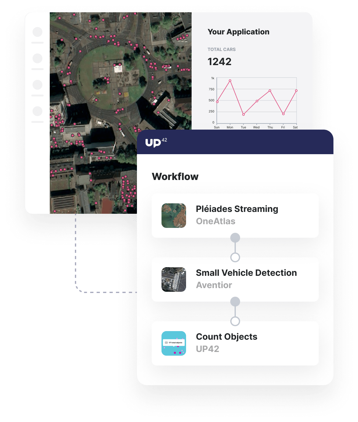
UP42 enables you to track, predict, and optimize maritime activity through a variety of data types and analytics tools. Below is an example workflow that brings AIS data from ExactEarth and SPOT 6/7 data from OneAtlas, together with raster tiling, ship detection, and ship identification tools.
Such specialist out-of-the-box maritime algorithms, such as ship detection, enable you to get from maritime data to actionable insights in seconds.
The Dual Challenge: Sustainability and Economic Growth
Now that we’ve seen where the issues lie and what solutions marine geospatial data holds, it’s clear that a balance needs to be found.
On the one hand, we’ve got an industry that’s the backbone of global trade, moving a mind-boggling 90% of the world’s goods. It’s the unsung hero of our global economy, keeping shelves stocked and businesses running.
But the shipping industry’s role in global commerce and its environmental footprint are at odds right now. Yes, the maritime sector is indispensable to our global economy. Yet, this same industry relies on fossil fuels, particularly heavy fuel oil.
The challenge lies in transforming the shipping industry into a champion of sustainability without sacrificing its economic importance. This requires a complete shift – embracing alternative fuels, optimizing routes through geospatial data, and investing in energy-efficient vessel designs.
The Path to Meeting Ambitious Climate Goals
Balancing the need for ocean protection with the importance of maritime trade is going to be a tricky, but necessary journey.
By committing to these transformative strategies, the maritime industry can lead the charge in combating climate change while ensuring a resilient future for global trade. The industry must view sustainability not as a regulatory burden, but as an opportunity for innovation and long-term resilience. Imagine a world where massive container ships glide across the oceans, powered by clean energy, navigating optimized routes that avoid sensitive marine habitats. That’s not just a pipe dream – it’s the future we need to be working towards.
As we sail towards ambitious targets like protecting 30% of our oceans by 2030 and achieving net-zero emissions by 2050, the shipping industry has the opportunity to lead by example, demonstrating that economic growth and environmental stewardship can go hand in hand. It’s time to chart a course for a sustainable future, full steam ahead!
Did you like the article? Read more and subscribe to our monthly newsletter!


