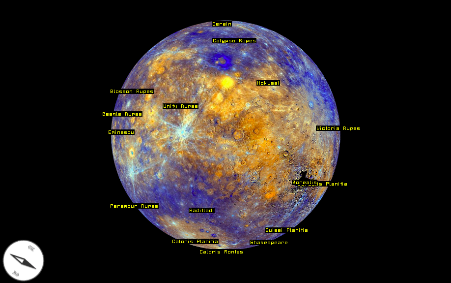
Check out this amazing 3D map of Mercury
Last month we wrote about the first topographic map of Mercury – the closest planet to our sun located 48 million miles (77 million km) away from Earth. The map was based on images taken by NASA’s MESSENGER – the spacecraft that launched toward Mercury in 2004 and began orbiting the planet in 2011. Last year it ended its four-year long mission after flying around Mercury 4100 times and capturing 300k images that were released for a free reuse to the public.
A Czech company called Melown decided use this opportunity and to test their 3D visualisation platform. They’ve taken 100k images of the planet to create their Google Earth-like model of Mercury. The effect is totally awesome and the engine works really well!
 “When NASA / JHUAPL released the first ever digital elevation data of Mercury based on the MESSENGER mission a couple of weeks ago, we saw it as an opportunity to do a lightweight case study with extra-terrestrial data. Unlike some other geospatial systems, Melown has been designed to model any planet (and any object for that matter) but we never put that ability to practical test”, Ondřej Procházka, Director and Chief Engineer of Melown commented for Geoawesomeness.
Melown provides the cloud services, network protocols and rendering technology which allows for interactive map applications, ranging from highly detailed true 3D scenes to entire worlds, such as Mercury.
Great job Melown team.


