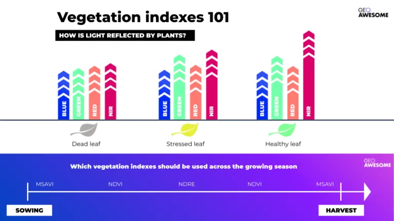
NDVI Is Not Enough: What Are Vegetation Indices and How Are They Used in Precision Farming?
Vegetation indices in precision agriculture go far beyond NDVI. Discover how MSAVI, NDRE, CCCI, drones, SAR, and high-resolution satellite data support smarter irrigation, fertilization, and yield decisions — and why combining multiple indices is key to truly data-driven farming.

Vegetation indices in precision agriculture go far beyond NDVI. Discover how MSAVI, NDRE, CCCI, drones, SAR, and high-resolution satellite data support smarter irrigation, fertilization, and yield decisions — and why combining multiple indices is key to truly data-driven farming.

Videos
Expert Reviews MOVIE MAPS

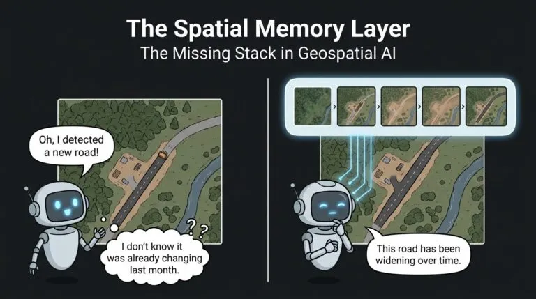
Scaling Change Detection: Why tasking is a thing of the past | Problem Solved | Geoawesome Podcast

GeoAI Hype Cycle 2026 What’s Real, What’s Next in AI Powered Earth Observation
TW Landsat 9 – More Than Just A Picture
Mapping human well-being and development at the local level

GeoAI: The new frontier of Financial intelligence | GIST Impact | AI & Geospatial Dialogue
The latest


Events

Next Event
08.30.2026
FOSS4G 2026
Podcasts
All PodcastsToday’s Featured


More Stories


Search