
In the world of Geographic Information Systems (GIS), everyday tools converge with the science of space. A new generation of apps blends geospatial mapping, augmented reality (AR), and astronomical ephemerides into powerful platforms. These tools allow professionals or everyday users to plan and analyze with celestial precision.
Geospatial Data and Mapping Foundations
GPS, Maps & Elevation Models
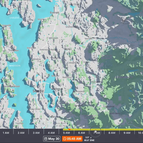
- Most sun/earth apps use GPS for precise time and space positioning.
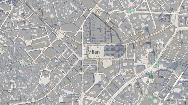
- Works seamlessly with base maps (satellite or terrain) from providers: Google, Mapbox, and OpenStreetMap (OSM).
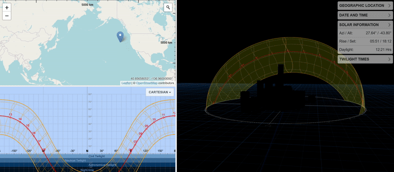
- Elevation data (e.g., Google Elevation API in Sun Surveyor (arxiv.org) helps calculate sun/moon angles, shadow lengths, and horizon visibility.
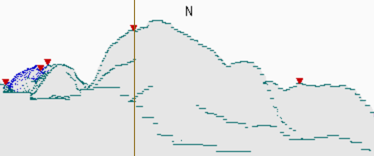
3D Horizon Extraction & Visualization
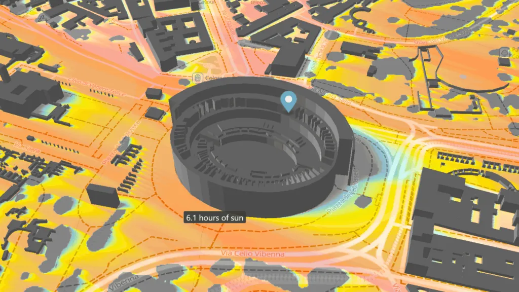
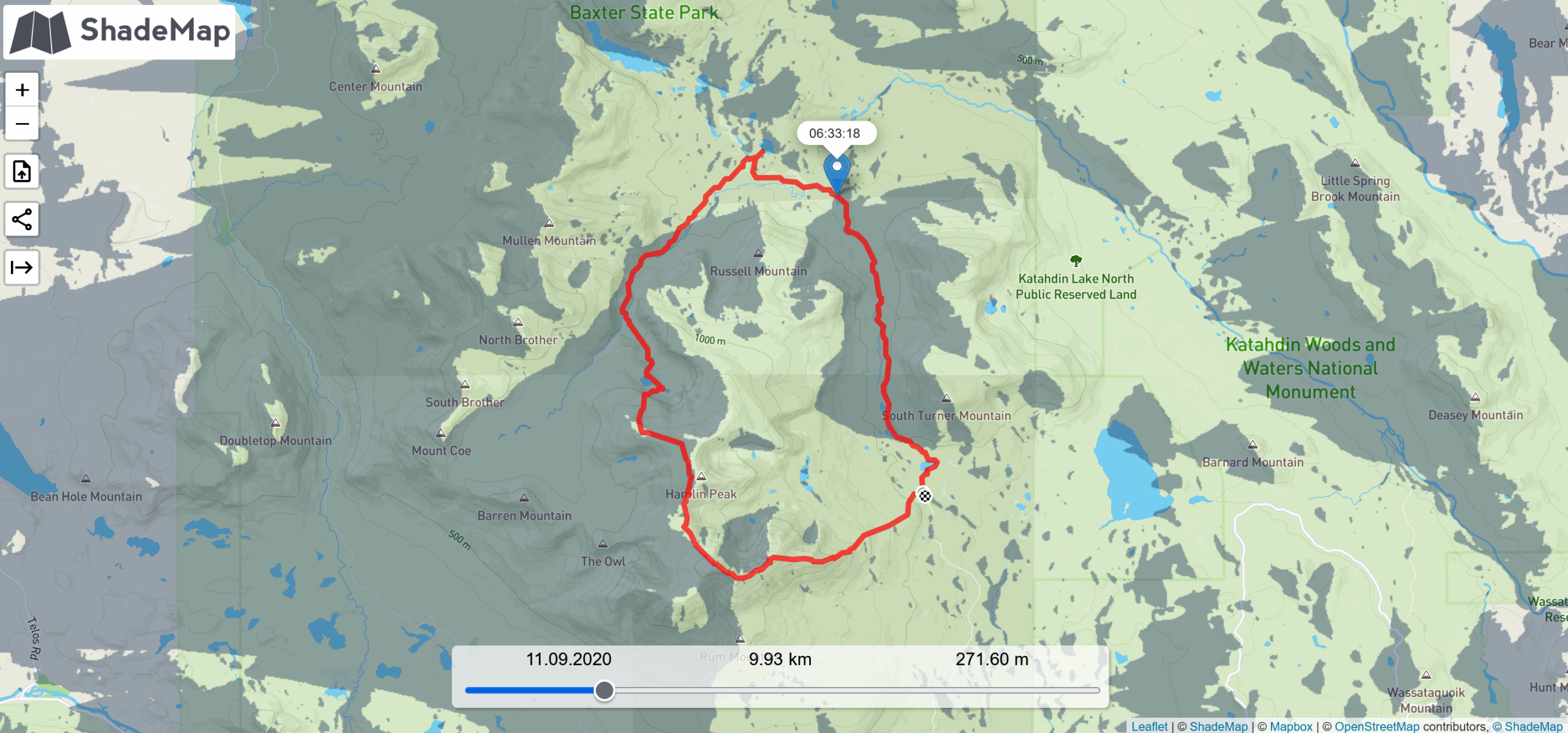
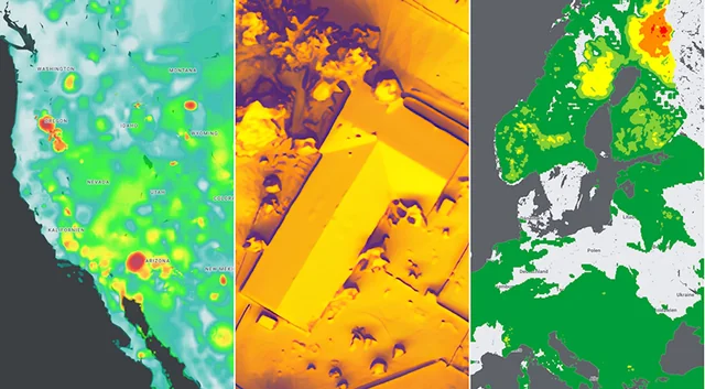
Some tools, like Shadowmap, let users simulate shade across time using GIS-derived 3D building and terrain data, often sourced from OSM building footprints and digital surface models.
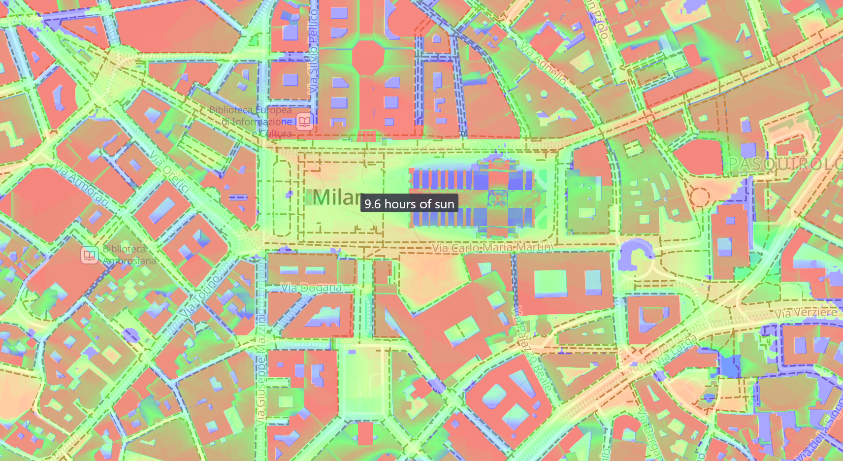
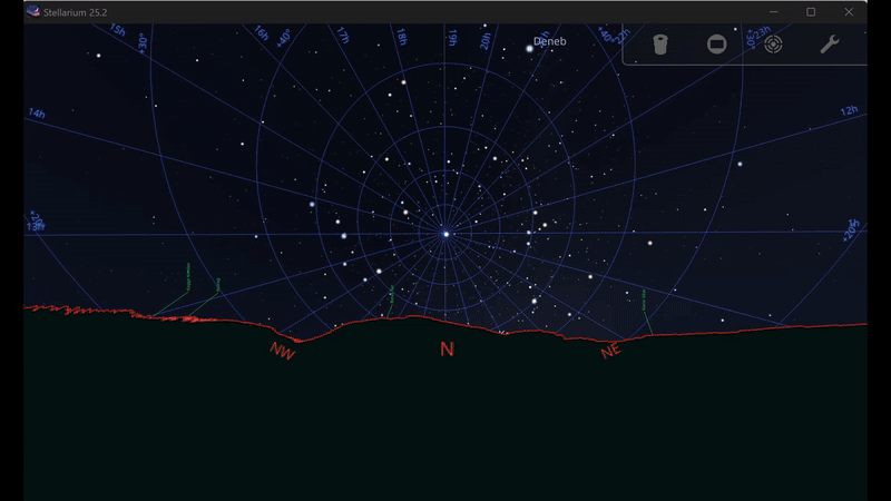
GIS techniques are used to create horizon polygons from SRTM elevation data (e.g., HeyWhatsThat), a method also used in Stellarium research for cultural astronomy contexts.
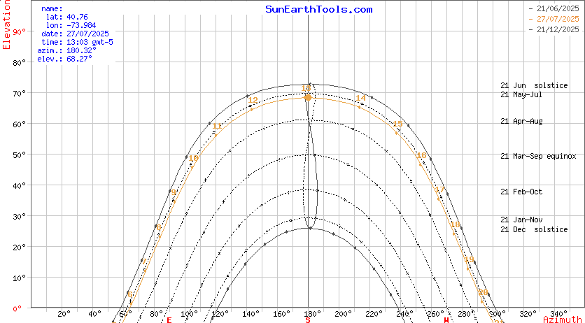
Ephemeris Tables & Sun Paths
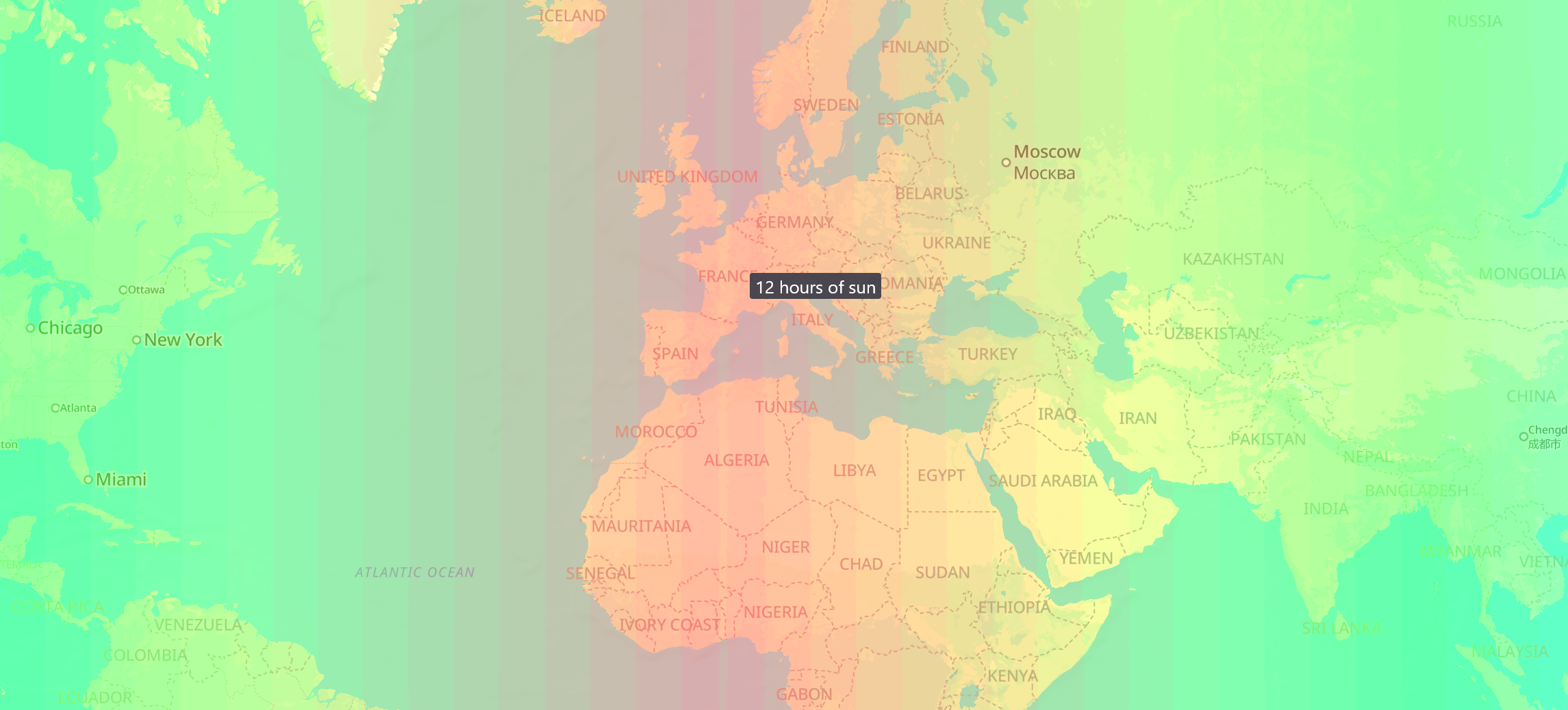
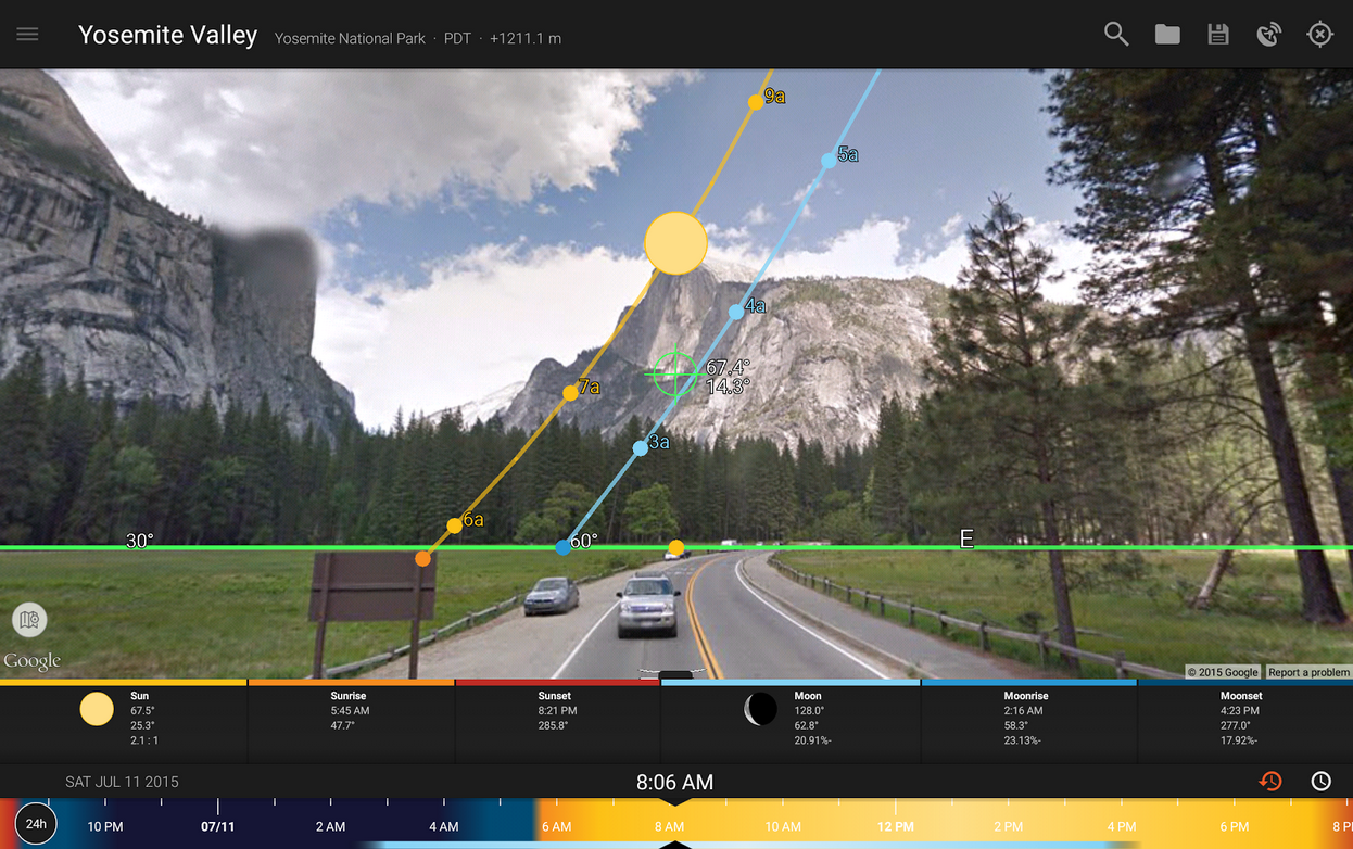
All apps feature sunrise/set, solar noon, twilight phases; many also plot declination, right ascension, azimuth‑altitude graphs (sunearthtools.com). Example: SunCalc shows the solar path, shadow lengths, and key times on a date-location graph.
Augmented Reality & Compass Views
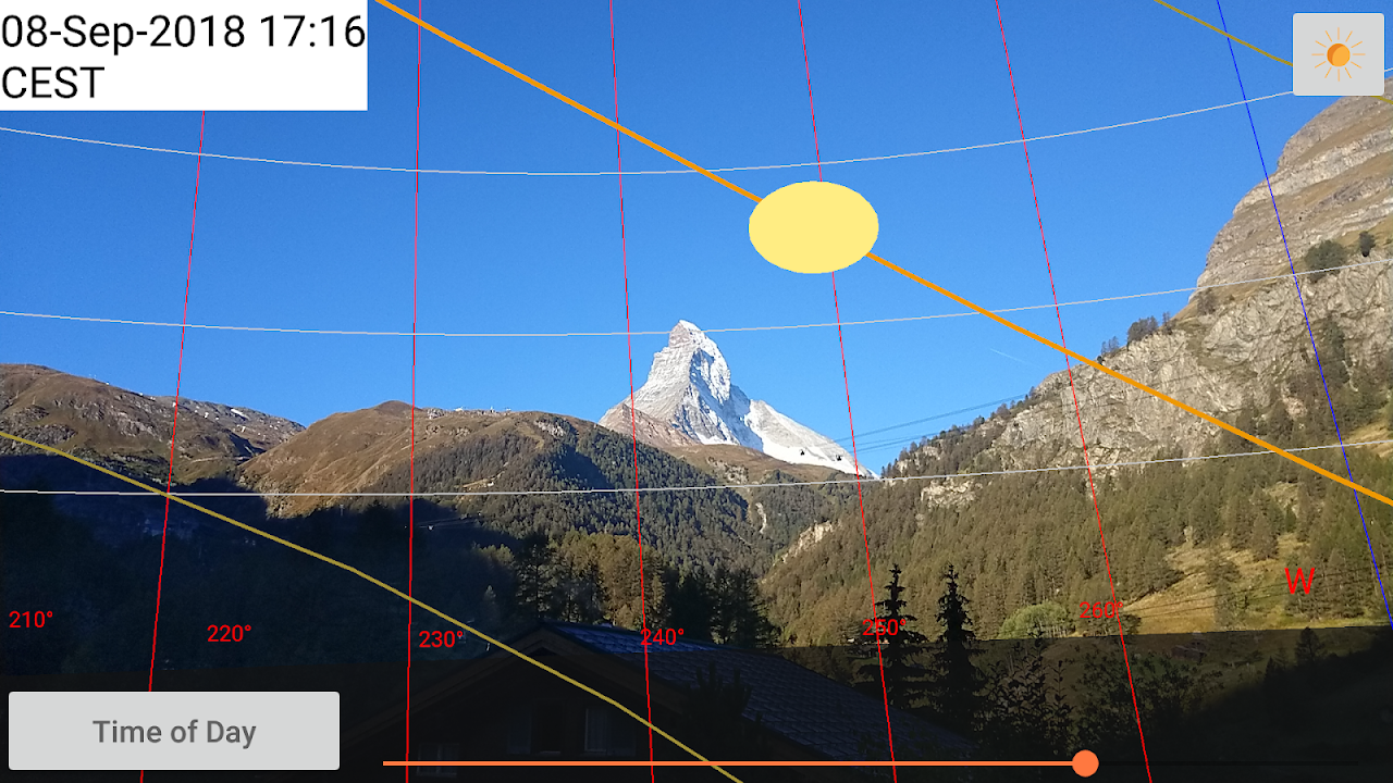
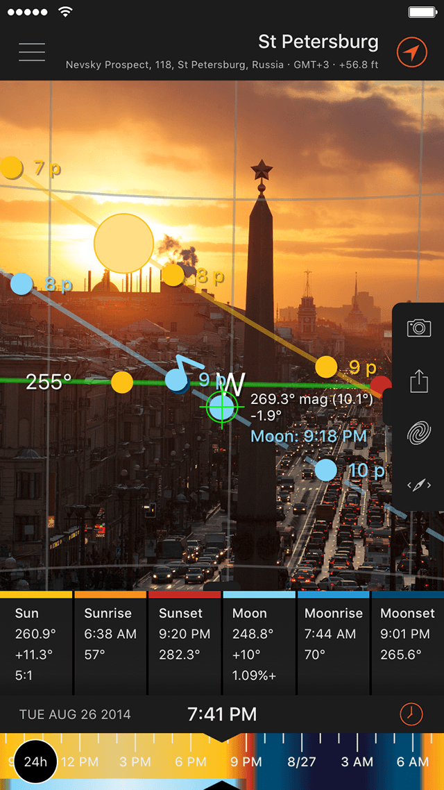
Apps like Sun Locator and Sun Surveyor use camera overlays and compass AR to show sun and moon directions in the real world. Use of the device magnetometer/gyroscope means users can physically align with projected celestial paths through 3D compass or street views.
How These Apps Visualize Data
- Polar sun-path plots: Show time along circles with azimuth angle, used by SunCalc.
- Cartesian ephemeris charts: Altitude vs. time graphs in Sun Surveyor.
- 3D AR overlays: Augmented layers of celestial paths in camera view.
- Street View & Map View: 360° panoramas occulted by urban structures with sun/moon tracked.
- Shadow & light simulation maps: 3D sun-exposure grids across terrain and buildings in apps like Shadowmap.
Integrating Geospatial and Astronomic Perspectives
| Use Case | GIS Component | Astronomy Component |
| Shadow planning | OSM building footprints + DSMs | Sun angles through ephemeris |
| Photo scouting | Elevation, terrain, panoramic views | Golden hour timing, path alignments |
| Star visibility estimates | Horizon silhouettes from local DEMs | Milky Way center visibility via Sun Surveyor |
| Solar installers | Building orientation + tilt | Sun path over solstice/equinox |
| Cultural research | Horizon polygons via GIS | Simulation sky epochs in Stellarium |
Why This Fusion Matters
For GIS Professionals
- Charts & maps enhance data interpretations: where sunlight falls and when terrain is illuminated or shaded.
- GIS developers can use API layers (Elevation, Maps SDKs, OSM, DSMs) to integrate astronomical calculators via AstroPy or astroplan packages.
Integrating solar irradiance and roof orientation data enables precise solar panel planning, allowing GIS workflows to estimate potential energy generation for any location. APIs like Google’s Solar API demonstrate how combining sunlight mapping with geospatial layers can help forecast energy output and optimize installations.
For Astronomers
- GIS adds real‑world horizon context, improving sky observability predictions and site analysis.
- Horizon profiles help in environmental light simulations, key in cultural astronomy.
For Educators and Outreach
- AR apps make behind-the-scenes science tangible and accessible.
- Visual tools deliver immediate engagement: understanding seasonal variation, twilight regimes, star rise/set.
The geospatial–astronomy apps showcase the synergy of GIS spatial models with celestial mechanics, bringing next-level insight to photography, architecture, renewable energy, and scientific exploration.
In a nutshell, these apps rely on:
- High-precision GPS/time data
- Elevation/environmental modeling
- Astronomical ephemerides
- AR/mobile visualization
Do you use any of these apps? Read more and subscribe to our monthly newsletter!


#Fun


Next article

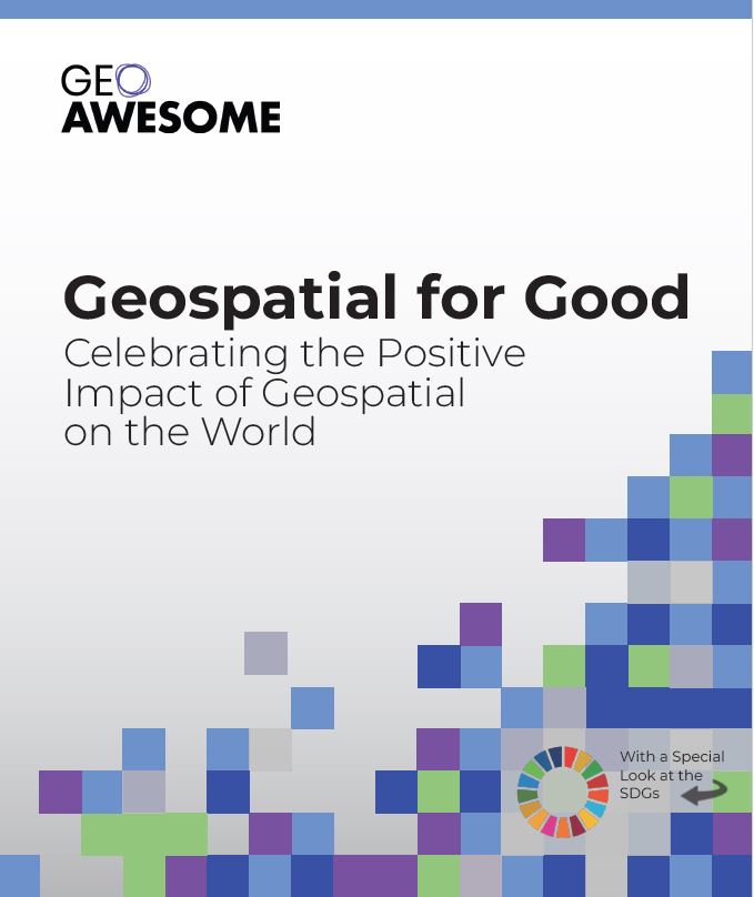
It’s Here! The 1st edition of the Geoawesome “Geospatial for Good” Report is Ready for Download.
Earlier this year, we asked for your help in showcasing the positive impact of geospatial technology on the world. Today, we are thrilled to announce that the “Geospatial for Good” report is now available for everyone to download!
This community-driven report highlights the incredible work being done across the globe, using geospatial data and tools to address the UN’s Sustainable Development Goals. Inside, you’ll find real-world case studies and project spotlights that demonstrate how our community is making a tangible difference in areas like climate action, public health, and sustainable development.
We are incredibly proud of what we have created together, but this is just the beginning. We invite you to download the report, share it with your networks, and let us know what you think. Your feedback is invaluable as we continue to tell the story of how geospatial technology is changing the world for the better.
Download the full report here and join the conversation. We look forward to hearing from you!
Acknowledgements
The report was authored with the active participation and support of several members of the community including Rhiannan Price, Bill Greer, Kiri Carini, Rohini Swaminathan, Sebastian Walczak, Isabella Merschdorf & Muthukumar Kumar. Geoawesome extends our sincere gratitude to Seamus Geraty for his invaluable assistance throughout the editing, design, and publication phases.
For questions, comments and suggestions, please contact muthu@geoawesome.com

