What we are reading this week (28th Aug 2016) – Social science using Location data and more
Social science using Location data
Predicting depression using GPS: Social media is a treasure trove of information for understanding people’s emotion and psychology. There are numerous articles including “How the CIA uses social media to track how people feel” but using it to predict an individuals’ current mindset maybe a more daunting task. Can location tracking be used to predict if a person is depressed (Read more)?
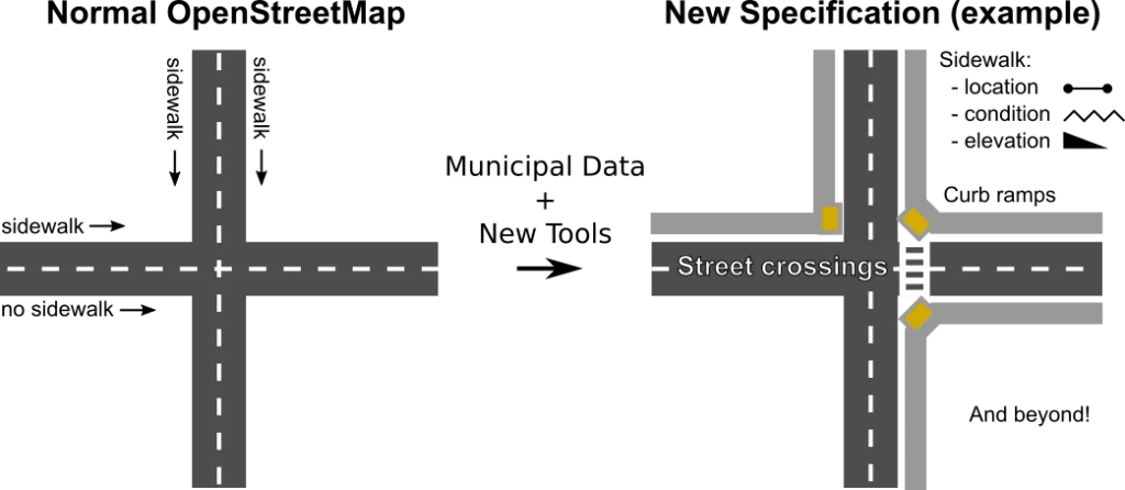
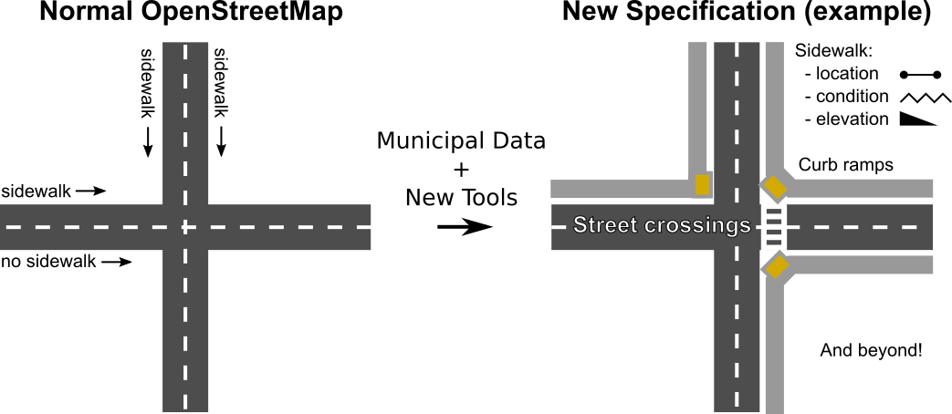
OpenSideWalks: Maps and navigation – I wouldn’t be able to get around any city without this tech. As much as its great, most of our maps including OpenStreetMaps have a major shortcoming – routing for people with disabilities. Unfortunately, there is limited information about sidewalks and ramps. Luckily OpenSideWalks, a Data Science for Social Good summer project at the University of Washington is trying to tackle that issue. (Read more)
Olympics 2016: Who really won the 2016 Olympics? United States of America? You are right, if you look at the medals tally but there are other ways of looking at it and the results are fascinating (Read more).
Maps
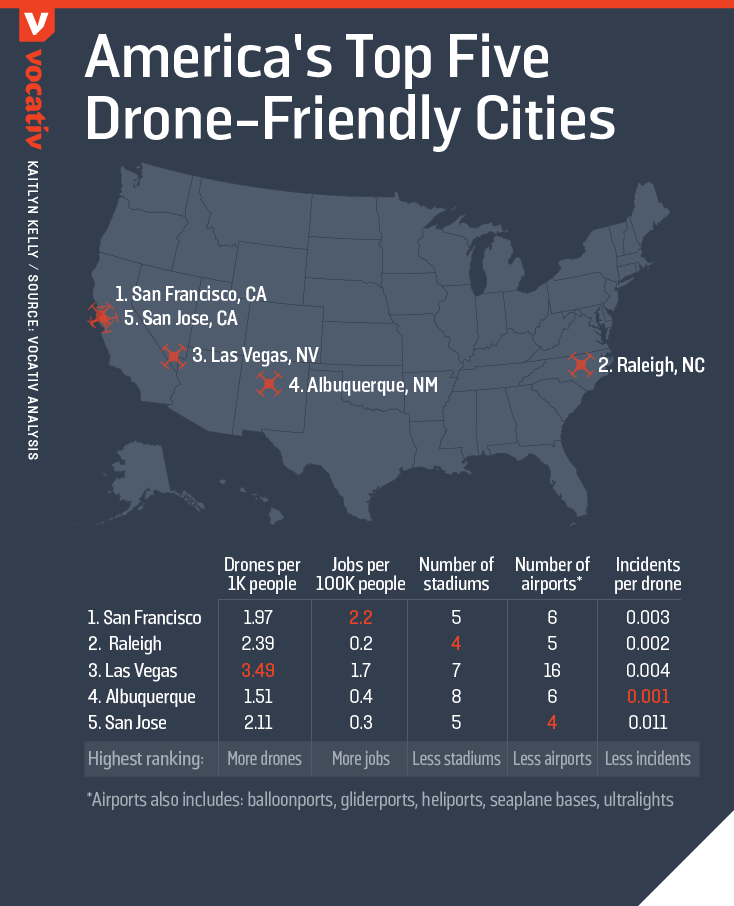
Drone friendly cities: What are top five “drone friendly cities in the United States Of America”? Vocativ “crunched the numbers” and here is what they found out (Read more).
Apple Transit Maps: Why exactly does it take so much time for Apple to roll out transit information for more cities? Apple Insider has an interesting explanation (Read more).
Augmented Reality
Pokemon GO: How Pokemon Go could influence augmented reality applications and the tech around it (Read more).
Holo Lens: The specifications of the secret Holo Lens that Microsoft has been working on (Read more).
Data
Indian weather data: Looking for Indian weather data from the INSAT satellites? The Indian Space Research Organisation has a new portal for disseminating such data for the general public via the Real Time Analysis of Products and Information Dissemination (RAPID) platform.


