
I’ve been writing a lot about beauty of spatial data visualization. Some people like Picasso… I like Geo, and I can’t do anything about it;). YouTube user STLTransit has a wonderful collection of videos that visualize the movements of the public transit systems of various locations — turning public transit data into a flowing display of a city’s daily life. Each video shows the transit system flow during a single day, with various transit systems like bus and rail shown in different colors. The results are short and exciting videos presenting a glimpse at our world.
Just look a it:
New york:
Manchester
San Francisco
source: The Verge


#Ideas


Next article
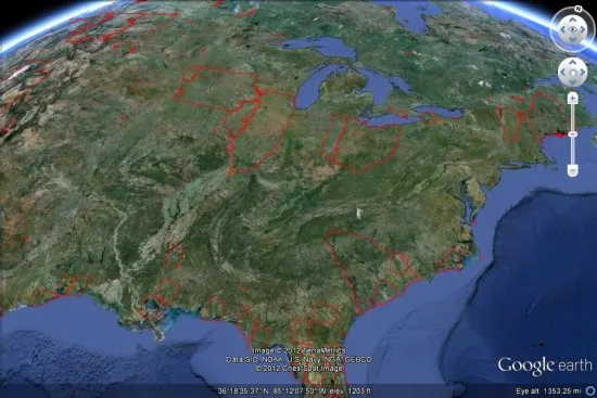

Folks! grab this KML file to your Google Earth platform and view the areas with fresh imagery. You could be lucky your area of interest is among the updates. A few days ago, Google added some refresh imagery to the Google Earth engine.
The areas outlined in red are the ones with refresh imagery updates. Take a quick hurl and good luck in finding your area of interest updated.

Source : gearthblog.com

