

1. Animated map shows the history of immigration to the US
source: Business Insider
2. Here is Everyone Who Has Emigrated to the United States Since 1820
source: Metroscom
3. A state-by-state look at the history of U.S. immigration by country
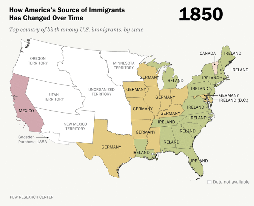 source: Pew Research Center
4. Size of the immigration to the US over 200 years
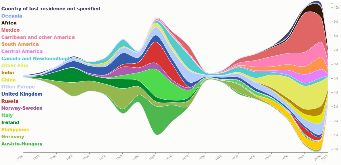
source: Insightful Interaction
5. Slavery Trade Map
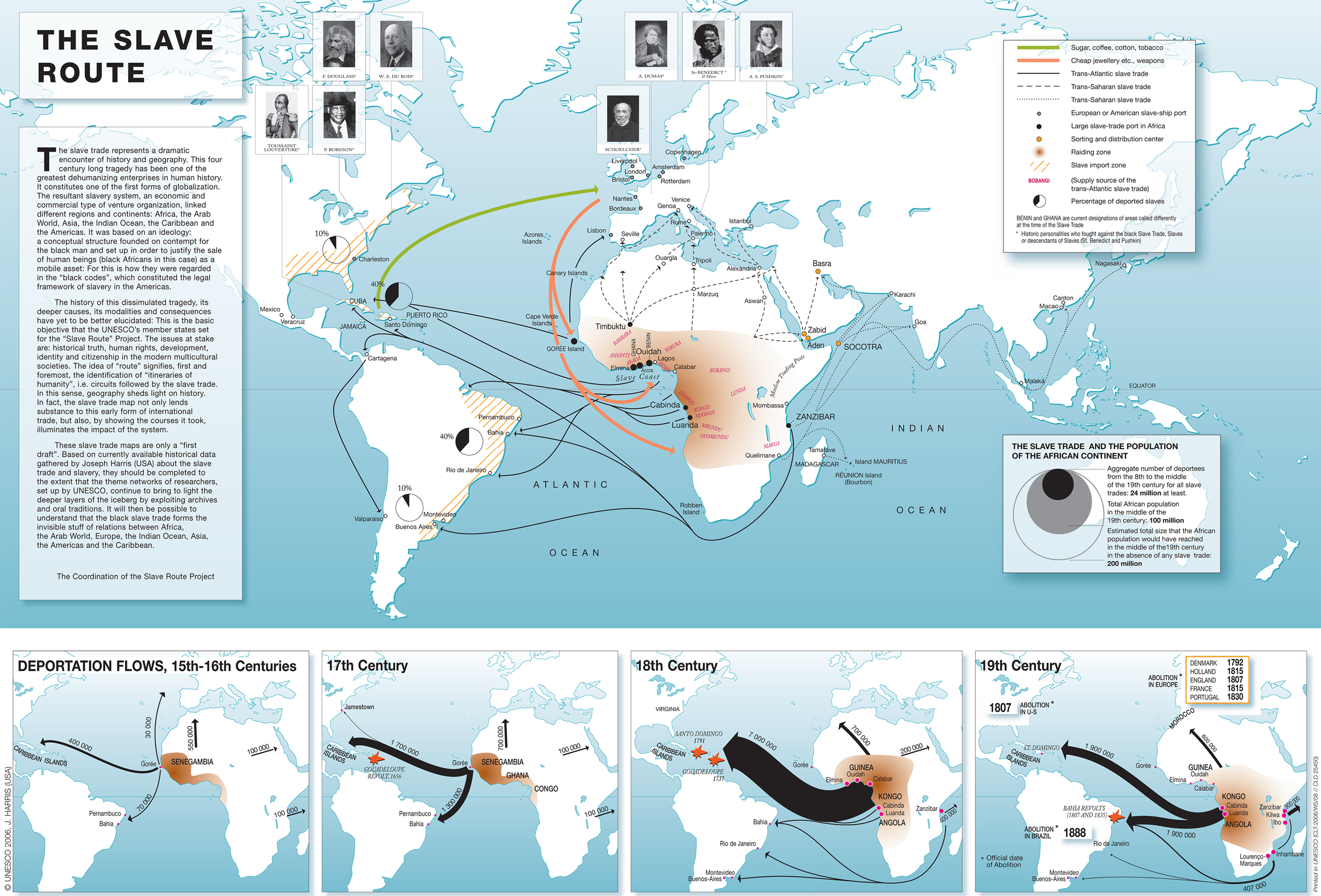
source: Emerson Kent
6. Seven Muslim-majority countries in the Middle East whose citizens were banned from entering the United States in January 2017
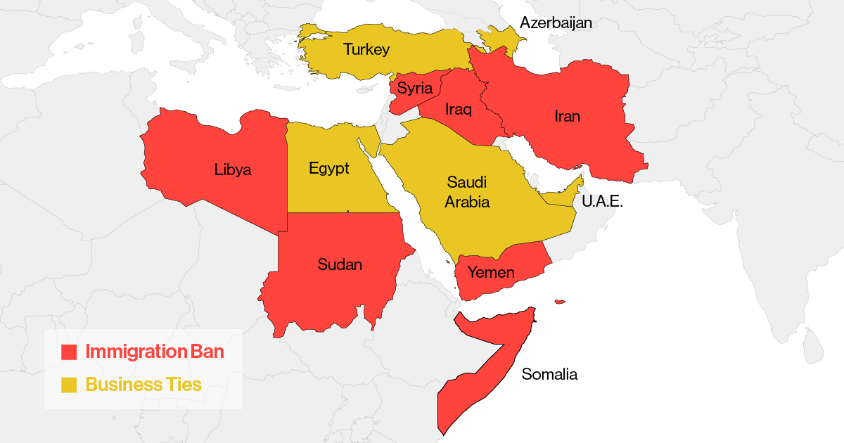 source: Bloomberg
7. Most common country of origin of legal immigrants (2012)
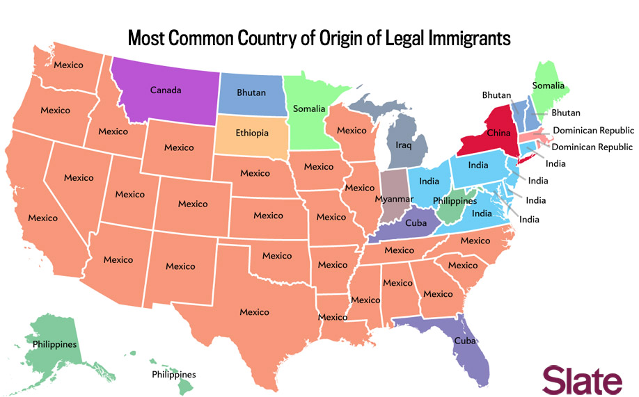
source: Slate
8. Most common country of origin of legal immigrants other than Mexico (2012)
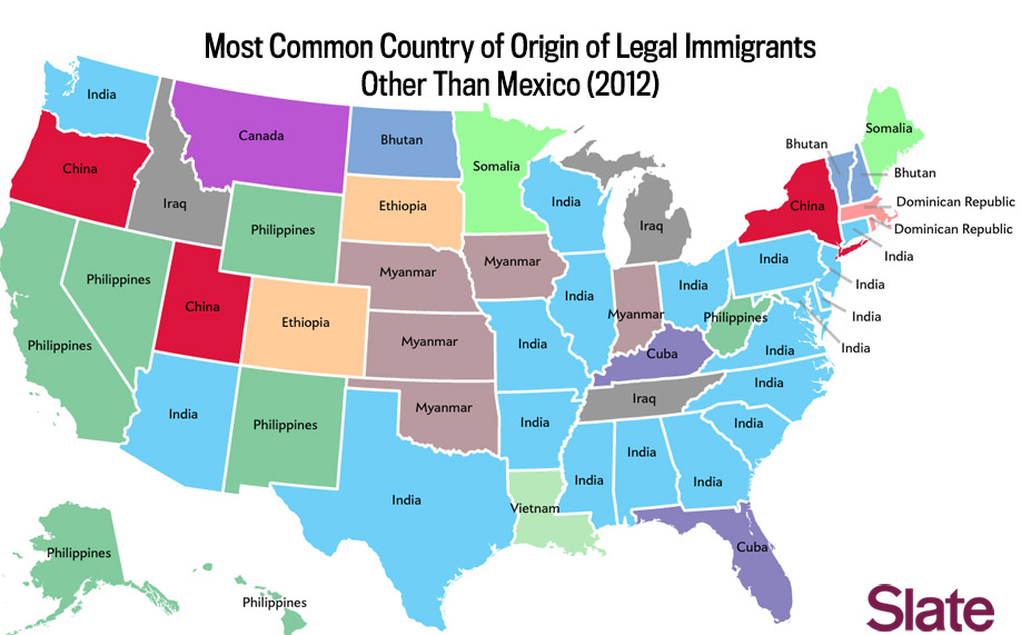 source: Slate
9. Unauthorized immigrants estimates
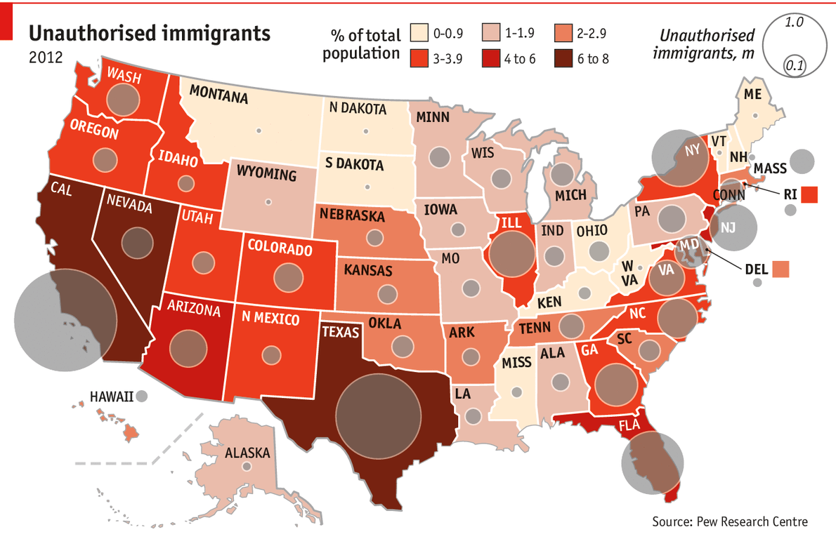
source: Economist
10. Foreign-born persons as a percentage of total US population (1850-2013)
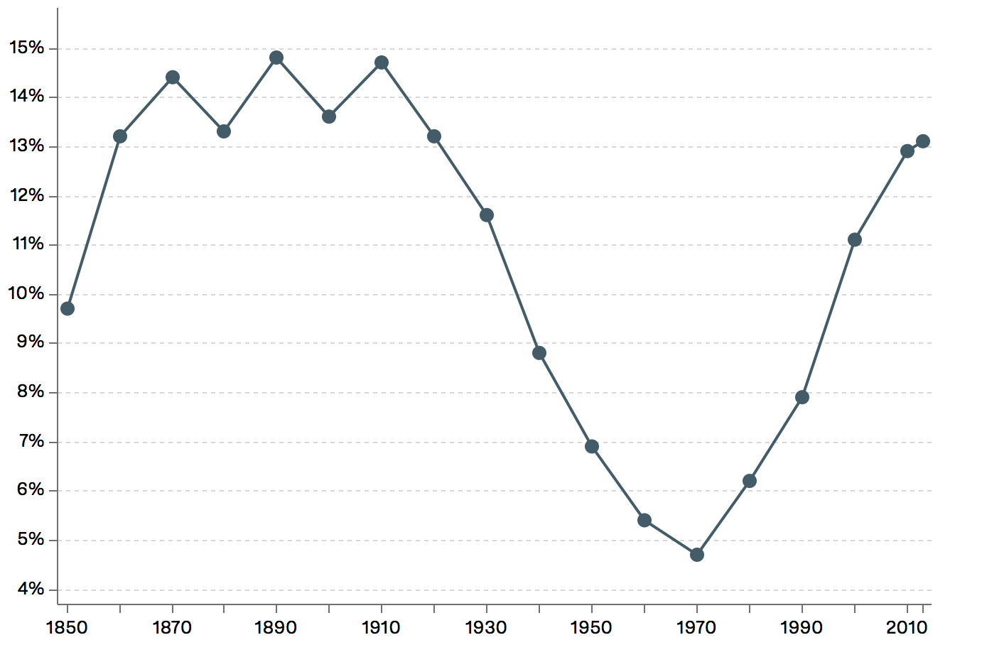 source: Vox
11. One reason some Americans fear immigrants? They overestimate how many there are
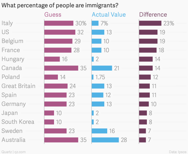
source: Quartz
12. Most common job held by immigrants by state
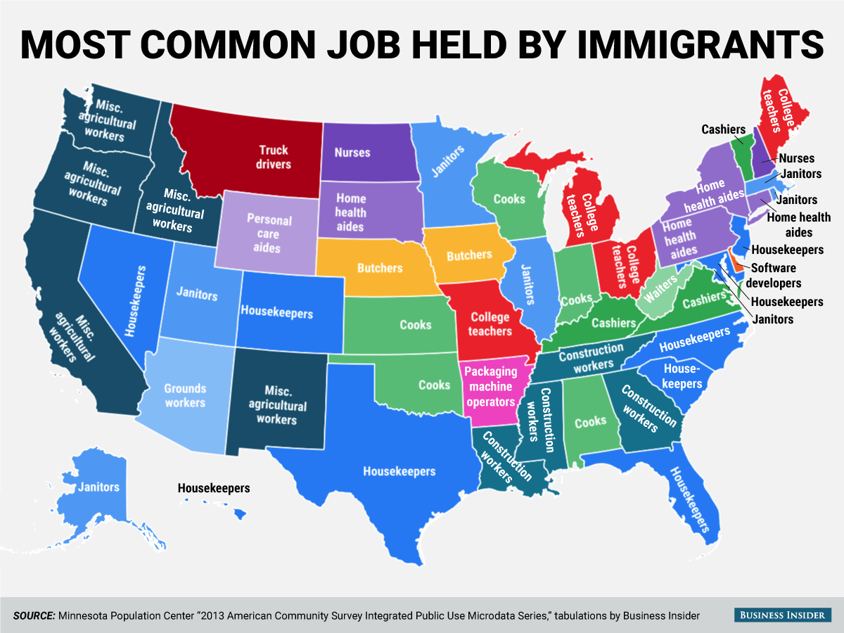
source: Business Insider
13. Impact of immigration on unemployment
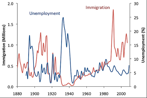
source: Cgdev

#Featured

Next article

 Drone mapping industry is growing incredibly fast, and it is here to stay. It’s not one of the tech bubbles. It solves many important problems related to the lack of accurate data and value of the market for drone-based services is estimated to be a multi-billion dollar business.
That sort of potential and growth dynamics require a great leadership and the industry is already attracting top talents and leaders. This week PrecisionHawk announced that Michael Chasen had been appointed as the company’s new CEO.
Chasen is an entrepreneur and technology veteran with more than 20 years of software experience. He is a co-founder of educational platform Blackboard, which he took public in 2004 and eventually sold for $1.7 billion. Within the next few weeks, he founded his another business called SocialRadar which was a geo-location startup that used satellite and street-level imagery to determine the exact location of points of interests. Last year he sold it to Verizon (the owner of MapQuest) and he immediately got a call from PrecisionHawk.
PrecisionHawk is one of the leading players in the drone mapping industry. The company offers its fixed wing UAV and a full software solution to collect automatically, process and analyze areal images. On the top of it, PrecisionHawk plays a significant role in shaping regulations and policies around drones, and it developed a custom drone safety platform LATAS. Today the company has about 165 employees, 50% up in the last year, so the new leadership comes just in time to structure this growth.
“Adoption of drone technology among major industries is growing at an incredible rate. By engineering an ecosystem that allows companies to gain valuable information, PrecisionHawk is at the forefront of one of the most important areas of technology innovation,” said Chasen. “The PrecisionHawk team has all of the building blocks that are required to become the world leader in commercial drone technology, and I am looking forward to the growth and immense opportunity ahead.”
Congrats and good luck!

