#Business #Ideas

New Taxi Ordering Service By TomTom

TomTom one of the major world navigation systems and map data provider doesn’t want to make life easier to startups focused on convenient ways to hail and pay for taxis. Last week they’ve launched a new service in Amsterdam.

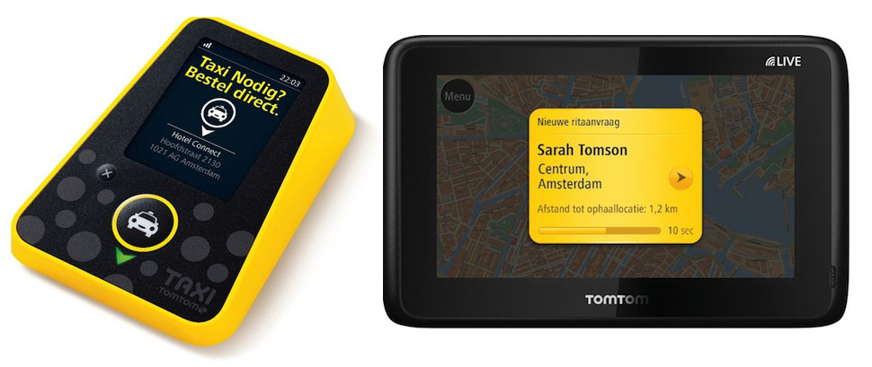
The system is an end-to-end solution based on dedicated hardware. It consists of two parts. First there is the Taxi Butler – simple device with a single button to call a taxi. On the other site Taxi Assistant device for cab drivers. So while being in a hotel, restaurant or a bar you simply press the button. TomTom server matches your request with the nearest free taxi.  Once a ride has been acccepted by the driver and the customer is onboard, the taxi pays back TomTom between €1-€1.5 per ride.Sometime ago TomTom acquired the taxi-fetching app maker TXXIso we can suspect that they’re planning to launch smartphone app as well.

The Taxi Butler costs €39 excl VAT and its use is free for the local business and the Taxi Assistant is 149 excl. VAT, including a two years subscription to TomTom’s connected services.

Hence sales of PNDs is dropping every month, sales of map data might not be that profitable when there are plenty of mapping APIs TomTom is searching for some new ways to diversify their revenue sources and this might a pretty good way.

source: GPS Business News

Say thanks for this article (0)
The community is supported by:
Become a sponsor
#Business
#Business #Contributing Writers #Fun #People
History of GIS | ESRI – A Pioneer in GIS Technology
Sebastian Walczak & Nikita Marwaha Kraetzig 07.26.2024
AWESOME 2
#Business #GeoDev
3 Pathways For Integrating Planet Data Into Your GIS Workflow
Avatar for Sponsored Article
Sponsored Article 08.12.2024
AWESOME 1
#Business
Geo Addressing Decoded Part 1: Why Does Geo Addressing Matter?
Aleks Buczkowski 04.16.2024
AWESOME 6
Next article
#Business

SPOT 6 Satellite successfully launched to the orbit, SPOT 7 on the way

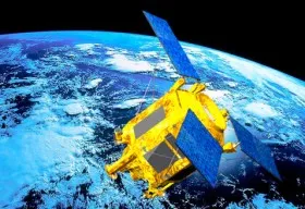
High resolution (1.5 meters)  SPOT 6 Earth observation satellite has been successfully launched to the orbit by a PSLV launcher from the Satish Dhawan Space Center in India., its twin SPOT 7 to join it within the first quarter of 2014.

SPOT 6 is an Earth observation satellite offering optical high-resolution capabilities, 1.5 m resolution having 60-km swath.

SPOT 6 and SPOT 7  are meant to  ensure service continuity of SPOT 4 and SPOT 5 satellites, which have been operating since 1998 and 2002 respectively.

It is being operated by Astruim Satellite and exploited by Astruim Services in coordination with the two Pléiades satellites along the same orbit.

Both the ground and space segments have been designed for improved performances compared to previous SPOT missions, especially in term of reactivity -from satellite tasking to product delivery and collection capacity. The constellation SPOT 6 and SPOT 7 will actually provide a daily revisit everywhere on Earth with a total coverage of 6 million sq km per day. The satellites are designed to have a life span of 10 years.

Quoting Eric Beranger, CEO Astrium Services, ” With four satellites phased 90 degrees apart in the same heliosynchronous quasi-polar orbit, we will be able to offer our customers geo-information products in record time, in as little as six hours. With four satellites, we obviously have more freedom in terms of the revisit interval, for better change detection or faster coverage. Users can choose between very-high-resolution data capture at a specific point and high-resolution data capture over a larger area. We can also combine the two, of course. For instance, in case of flooding, SPOT 6 can provide the big picture and Pléiades will bring the focus over the most populated or damaged areas.”

To view the first images acquired by the satellite, follow this link.

And For more information click on the image below and watch the promo video.

Source: Spatial Source.com

Read on
Search