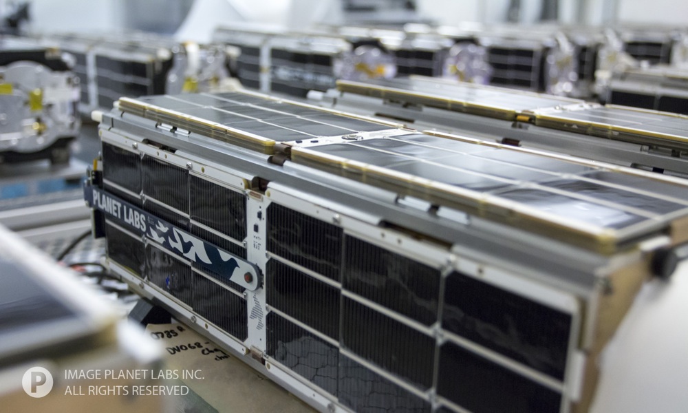
The entire Earth photographed from space each day
With the increasing number and enhanced resolution of Earth-observing satellites tracking occurrences on our planet from above is becoming feasible. The launch of World-View-3 in August 2014 has advanced the resolution of sensors in space once more and now stands at incredible 31cm pixel size allowing to capture small cars and even mailboxes.
But is it indeed possible to scan the entire earth each day? – This is exactly the mission of the San Fransisco based Company Planet Labs. In January this year Planet Labs launched the first swarm of 28 mini satellites and complemented the mission with subsequent 43 units in order to reach a total number of 71 “Doves”, as the company calls their mini satellites. The “Doves” are designed as nimble imagers, which is a major design difference to the prevailing philosophy of building powerful, rigorously tested and thus expensive earth observation satellites. The advantage of the mini satellites over other missions is therefore not their resolution of 5m (there are EO satellites with a much greater resolution) but first their number, making daily vast scans of the Earth’s surface possible, and secondly their simplicity ending up in cheap design and operating costs. The latter reason explains also why an only two year old company was able to gain ground in a rather cost expensive and knowledge driven sector: The company does not have the high risk of losing a satellite, in opposite, they can be sent into space without begin perfected, as continuously updated satellites with improved units can be re-launched in order to replace failed ones. – The need for long lasting testing is therefore spared.
One of the problems that the company faces in terms of everyday global data coverage is the removal of cloudy pixels in their stitched images. Planet Labs is developing algorithms to choose the best and clearest pixels for a world wide mosaick, but solely detecting clouds will not solve the problem as cloud shadows, for example, are as severe as clouds themselves.
“Fresh data from any place on Earth is foundational to solving commercial, environmental, and humanitarian challenges”. With this scope, the company addresses applications as change detection, customer maps and basemaps, persistant monitoring, planning and logistics for clients in diverse industrial sectors ranging from agriculture, energy, infrastructure and mapping to natural resources.
Dove satellite from the first mission in January 2014 (Flock 1); Planet Labs designs, builds, and operates advanced spacecraft. Source: Planet Labs
The 28 mini satellites of the „Flock 1“ ready for shipping. Once the satellites are assembled, Planet Labs conducts a variety of tests to provide confidence in the satellites’ performance in space. Source: Planet Labs
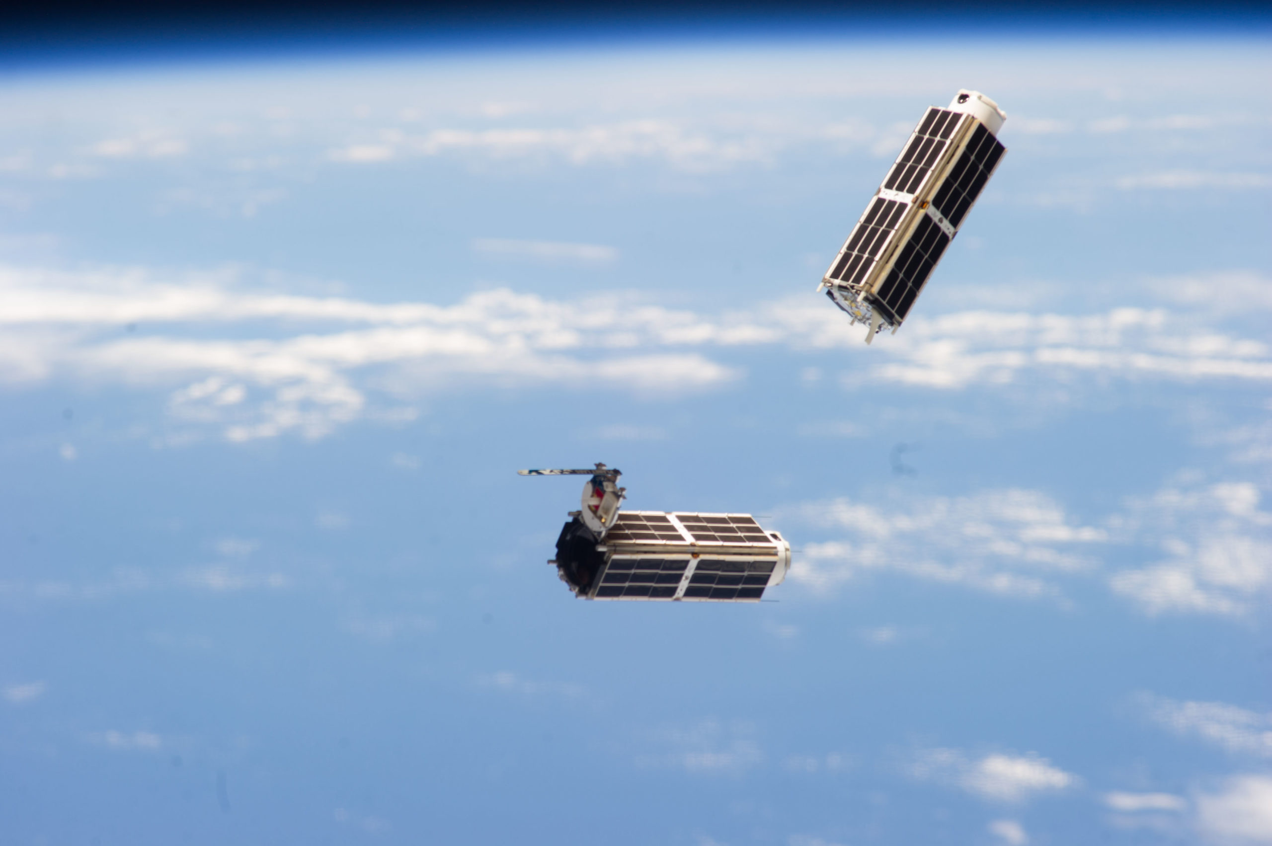
“Shortly after release, two doves float against the Earth’s horizon, still in view of the International Space Station. After deployment, the satellites go through what is called a commissioning period. Each Dove is powered on, and tests are run to confirm that all systems are functional.” Source: Planet Labs
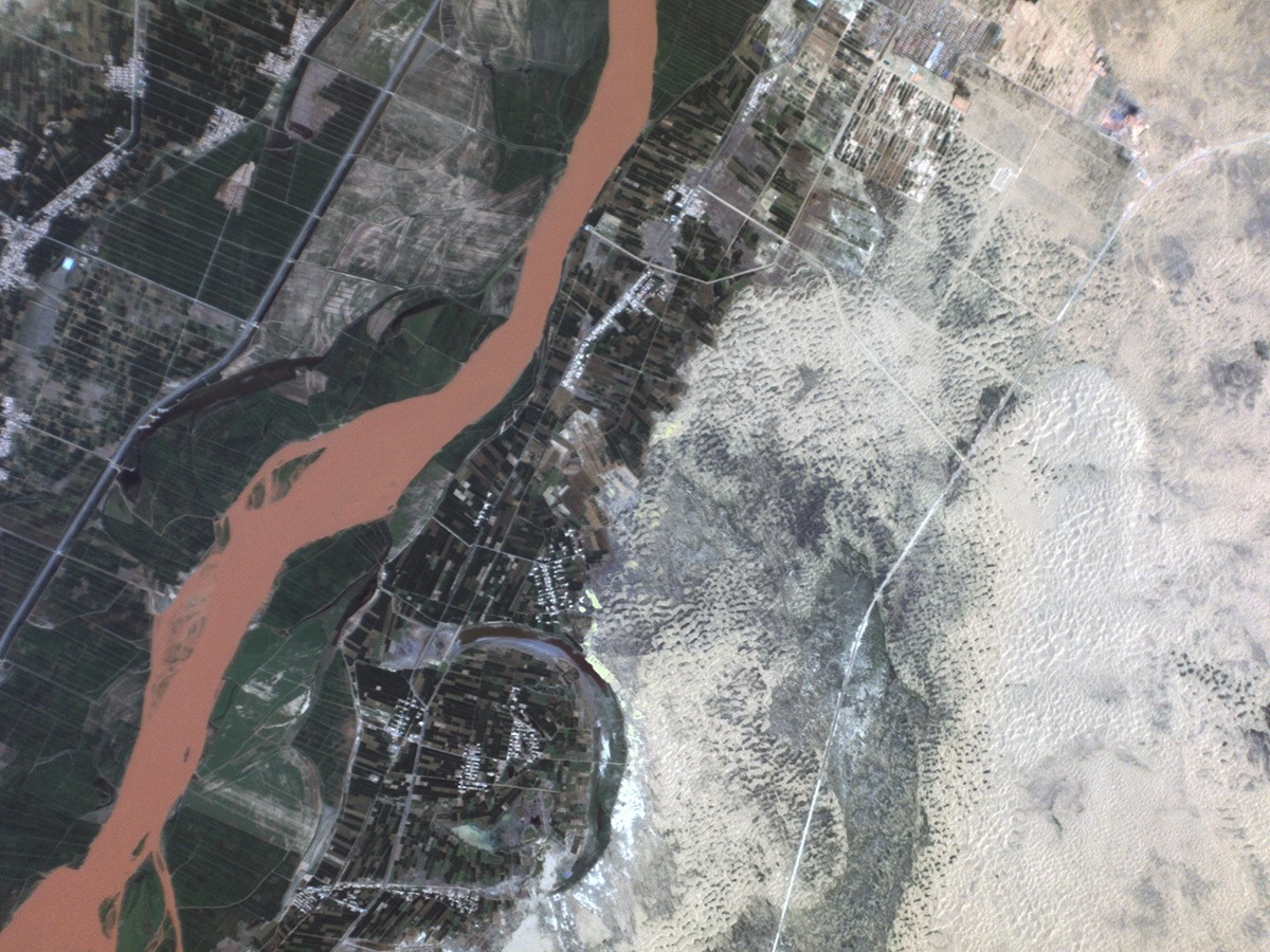
Desertification Control Project, Ningxia, China. July 14, 2014. “Agricultural lands abut the Yellow River, just outside of Touzha in Pingluo County, China. This is part of the Ningxia Hui Autonomous Region in Northwestern China, where a desertification control project is under way to preserve agricultural lands.” Source: Wired
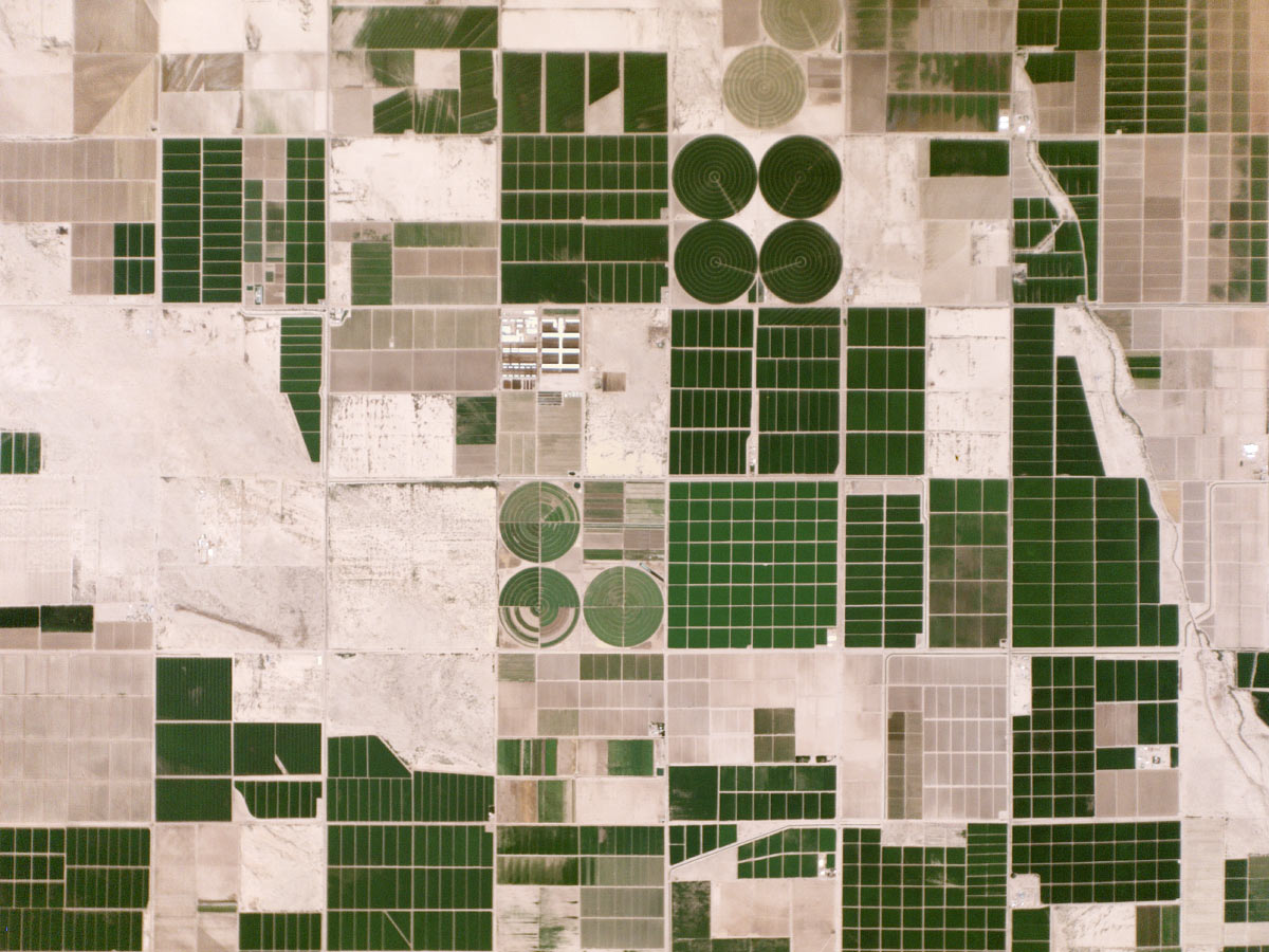
Irrigated Fields, Arizona, USA. August 16, 2014. “Dark green fields stand out against the pale desert floor in Pinal County, Arizona. The region’s farms rely on irrigation, since they receive less than 10 inches of rain a year. Irrigation water comes from two main sources: the Colorado River and aquifers.” Source: Wired
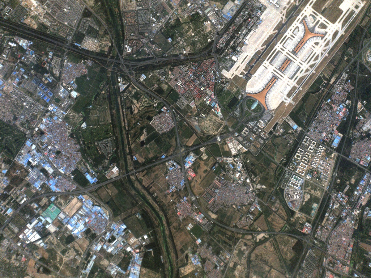
Airport, Beijing, China. July 25, 2014. “Beijing Capital International Airport Terminal 3 was built for the 2008 Olympic Games, and is now the second largest airport terminal in the world. The airport itself is an exclave of the Chaoyang District, but the area surrounding it is the suburban Shunyi district.” Source: Wired
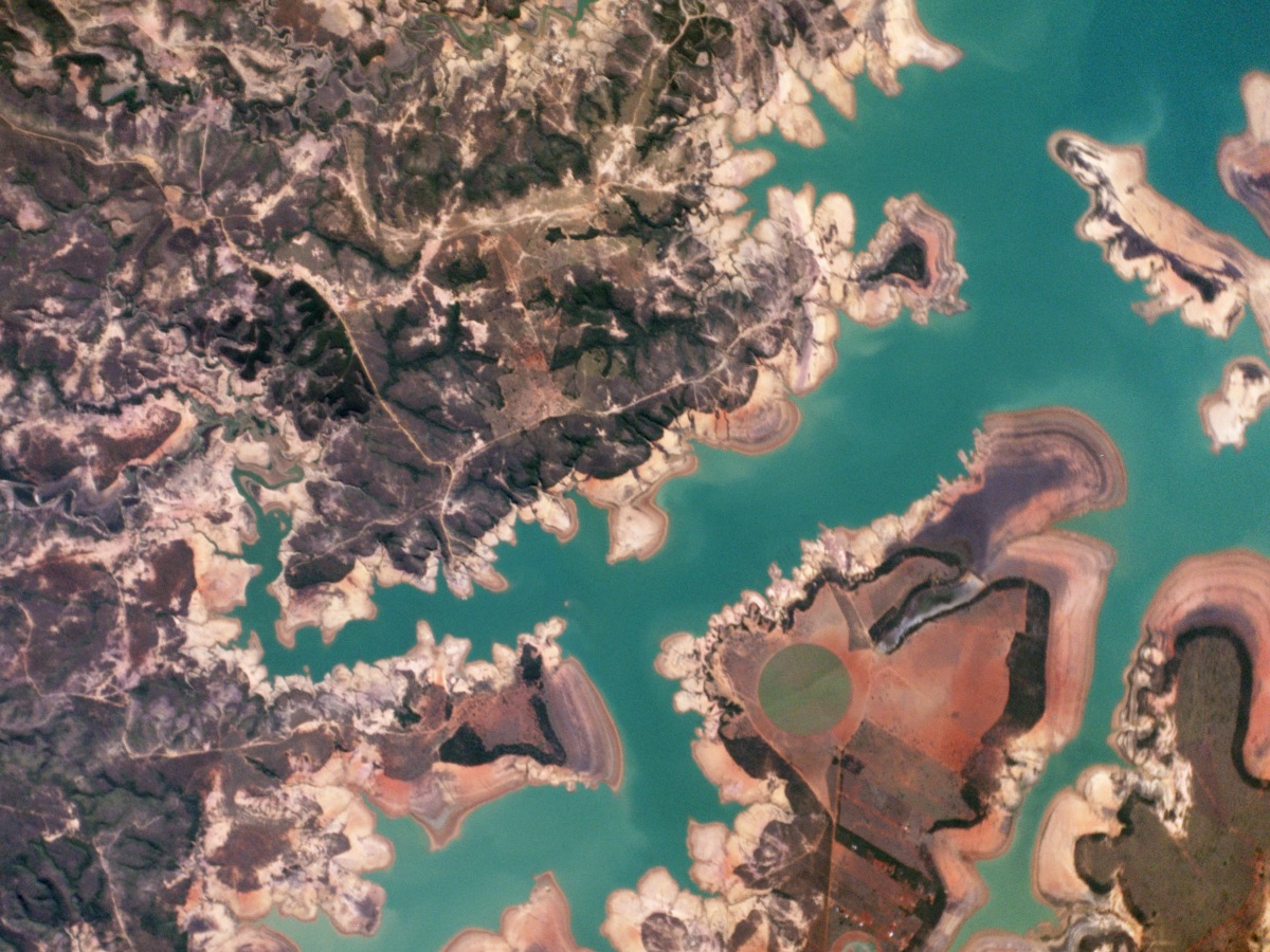
Três Marias Reservoir, Minas Gerais, Brazil. July 31, 2014. “The Represa Três Marias, the result of damming the São Francisco river, is one of the largest reservoirs in Brazil. In 2014, Minas Gerais experienced one of the worst droughts of the last 50 years. “Source: Wired
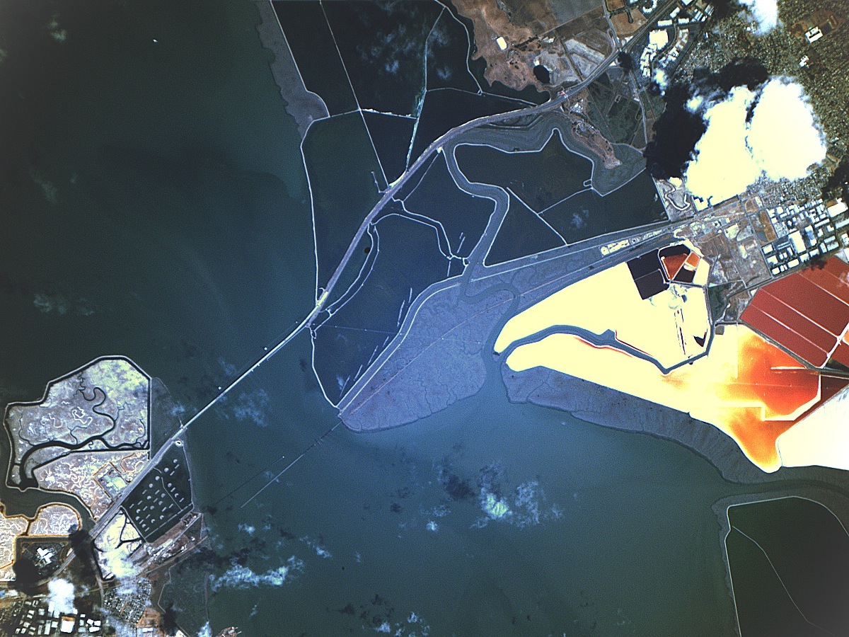
San Francisco Bay Area, California, USA. July 23, 2014. Source: Wired
Did you like this post? Read more and subscribe to our monthly newsletter!


