Sisters of SAR: mission, vision and all the fun things they do
Building a more diverse, inclusive, open and welcoming geospatial industry is all about giving a voice to a more diverse group of geospatial experts and it’s a pleasure to showcase SistersofSAR and the all the awesome work they do!
Sisters of SAR
SistersofSAR is a voluntary initiative that officially launched on Twitter on April 27, 2020. Created and organised by women in SAR, they promote the exceptional advancements in SAR research and engineering around the world while showcasing the accomplishments of other women in our field. In a field historically dominated by men, they help make sure that the voices and work of women no longer go unnoticed.
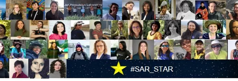
#SAR_Star
@SistersofSAR is lead by Dr. Laura Dingle Robertson, Physical Scientist, Agriculture and Agri-Food Canada; Dr. Gopika Suresh, Research Scientist, Federal Agency for Cartography & Geodesy Germany; & Sarah N. Banks, Physical Scientist, Environment and Climate Change Canada. Currently they have over 7300 followers. If you aren’t one of them then you gotta follow them ASAP 🙂
?It's our 2nd #Twitterversary today! ?Thank you to everyone who's been on the ride since 2020 & those who have joined us along the way! ?Many thanks to our collaborators & all of our ⭐️#SAR_STARS! We can't wait for Year 3! ?Cheers from @LDR1, @Go__pika & @SAR_ahBanks pic.twitter.com/zCA7BXfpz4
— Sisters of SAR (@SistersofSAR) April 27, 2022
What do Sisters of SAR tweet about?
Sisters of SAR follow a weekly tweeting schedule that aims at promoting women in SAR, capacity building, spreading SAR awareness and providing up-to-date information regarding SAR missions, job opportunities, upcoming conferences and trainings. They also give shout-outs to other Diversity, Equity and Inclusivity initiatives.
They do have an amazing schedule each Monday to Friday!
- #SAR_FACT Monday;
- #TrainingTuesday,
- #DiversityDay Wednesday,
- #PictureDay Thursday, and
- #SAR_STAR Friday!
For the month of May; #SAR_FACTs were:
May 2: How backscattering varies with incidence angle ? also depends on the target? A flat dry soil surface has a stronger drop off with incidence angle than, for instance, a forest! ?
May 9: We’re talking about small #SAR #satellites today⁉️ DYK there several small #SAR ?️ companies contributing to the #GoldenAgeofSAR! Role call: @iceyefi, @capellaspace, @umbraspace, @synspective, @QPS_Inc, #EOSSAR!
May 16: For #Sentinel1, the ‘image concept’ is introduced after Level 1 processing, which re-arranges Level 0 samples in azimuth & range bins to locations on earth. ESA applies processing to generate Level-1 in 2 formats: SLC & GRD.
May 30: The first backscattered signal of a #SAR is registered for the swath edge that is closest to the sensor orbit, which is called the near range. The last backscattered signal sample is registered at the far range edge of the swath?
#TrainingTuesdays were:
May 3: Last of the four part series from @NASAARSET starts today at 10:00am ET “Part 4: Crop-Specific Time Series Analysis for Growth Monitoring”! All of the series are available on @YouTube in case you missed them! https://appliedsciences.nasa.gov/join-mission/training/english/arset-mapping-crops-and-their-biophysical-characteristics?utm_source=social&utm_medium=twitter-i&utm_campaign=CropMapping-II-22
May 10: Ever checked out @NRCan #Polarimetric Workstation? From 2010, this #PolSAR tool works with #RADARSAT2, #ALOS & #Convair580 data! https://web.archive.org/web/20221206153010/https://www.nrcan.gc.ca/earth-sciences/geomatics/satellite-imagery-air-photos/applications-development/water-wetlands/polarimetric-workstation/9747
May 17: Have you checked out #GEE’s #SAR basics on using #Sentinel1 algorithms in #GEE? https://developers.google.com/earth-engine/tutorials/community/sar-basics?hl=it! Good place to start with #SAR processing! https://developers.google.com/earth-engine/guides/sentinel1?hl=it
May 24: In person #training opp. this week is #LPS2022 in Bonn, ??! For those lucky enough to attend lots of interesting #SAR research to learn about. If you aren’t there lots of tweets of research & posters! #EOChat (Keep an eye out for @SistersofSAR’s @Go__pika)
#DiversityDay Wednesday’s were:
May 4: Highlighting today @WOMENinSTEM_IC who are “supporting & promoting women working in Science, Technology, Engineering and Mathematics at @ImperialCollege London”! Check if your college or Uni has a group supporting #WomeninSTEM today! #InclusionMatters #EOchat
May 11: Today we feature @TheGISGirl who provide “training/resources for women to increase awareness in geo”! ?Give them a follow & ⬇️check them out https://linktr.ee/thegisgirl! #WomenUpliftingWomen #WomeninGeospatial #EOChat
May 18: Today we are talking about @WomenSciAUST who are “volunteer-run, connecting all women in science, technology, engineering, math & medicine (STEMM)”! ?Check them out at https://womeninscienceaust.org #WomenUpliftingWomen #inclusion #EOChat
May 25: Highlighting @womenintechdach who are “cross-industry, non-profit association with the aim of attracting & promoting women in technical professions & making them more visible” ?Give them a follow & learn more https://womenintechev.de #WomenUpliftingWomen #EOChat
They didn’t manage to tweet on #PictureDay this May! But they do have an amazing archive of tweets for you to explore!
#SAR_STARs in May were:
May 6: @DabiriZ (Zahra Dabiri), is a researcher at the Dep. of Geoinformatics @Z_GIS1, University of Salzburg (@PLUS_1622), Austria who is focused on methodological developments using digital image processing techniques!
May 13: @cherylldoughty (Cheryl Doughty) is a #postdoc @NASAGoddard under fellow ⭐️#SAR_STAR @EarthToLola studying climate change impacts in coastal ecosystems; pairing data from the ground with remote sensing to answer ecological questions!
May 20: @bindi_dave (Bindi Satyam Dave) is a #Postdoctoral #Researcher at @mcgillu for the @McGillMSSI in the area of #Applied #Geospatial & #RemoteSensing techniques for Sustainable Engineering studies.
May 27: @HeatherSelley (Heather Selley) is a #PhD student @SEELeeds in the Institute for Climate & Atmospheric Science (@ICASLeeds) whose research focuses on changes of ice speed in West Antarctica ?? & investigating the processes driving these changes.
Additionally:
May 17th: ‘Scene from above’ podcast was released featuring our thoughts and visions of an inclusive future in remote sensing based on a scenario development workshop that Ladies of Landsat and Sisters of SAR organised and participated in. https://www.podbean.com/ew/pb-c4buz-1221aeb
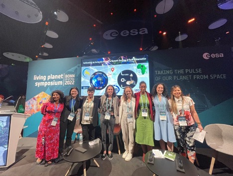
May 24th: We were present at the Living Planet Symposium 2022 #LPS22 in Bonn where we, together with @LadiesofLandsat, organised an Agora session titled ‘’Cultivating an inclusive future in Remote sensing and Earth Observation’. This session was moderated by our own Dr. Gopika Suresh (@Go__Pika) and Dr. Flavia de Souza Mendes (@Flasmendes) from Ladies of Landsat and featured women scientists from all over the world as well as videos of supporting organisations from our community.
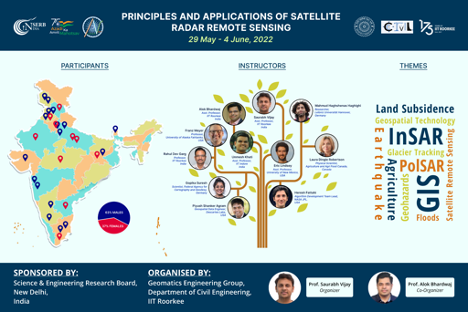
May 31st: Sisters of SAR also participated in capacity building in the InSAR Karyashala 2022 workshop organised by IIT Roorkee, India where Dr. Laura Dingle Robertson gave a lecture on ‘’ Polarimetric SAR and its applications in agriculture studies’ and Dr. Gopika Suresh gave a lecture on ‘Applications of SAR for coastal hazards’.
