Over the past few decades, the field of satellite imagery has evolved from a means of capturing a coarse, low-resolution, broad overview of the Earth’s surface, to a cutting-edge technology offering images of incredible detail. These extraordinary leaps in clarity and precision have been hugely significant for industries that rely on such data—from urban planning to infrastructure development, navigation, and an ever-expanding variety of other use cases.
One of the most significant developments in recent years is the arrival of super-resolution models, a machine learning technology which enables the generation of clearer, sharper images from satellite data. While not technically enhancing the actual resolution of captured data, these models work by leveraging sophisticated algorithms to accurately predict and generate additional pixels, thereby enhancing the visual quality of images. One of its most important achievements is in enabling the production of 15 cm satellite imagery from 30 cm native data.
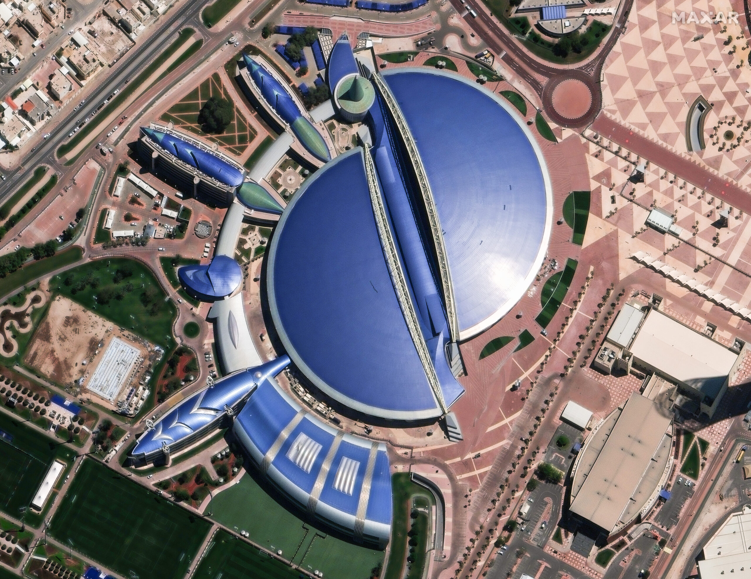
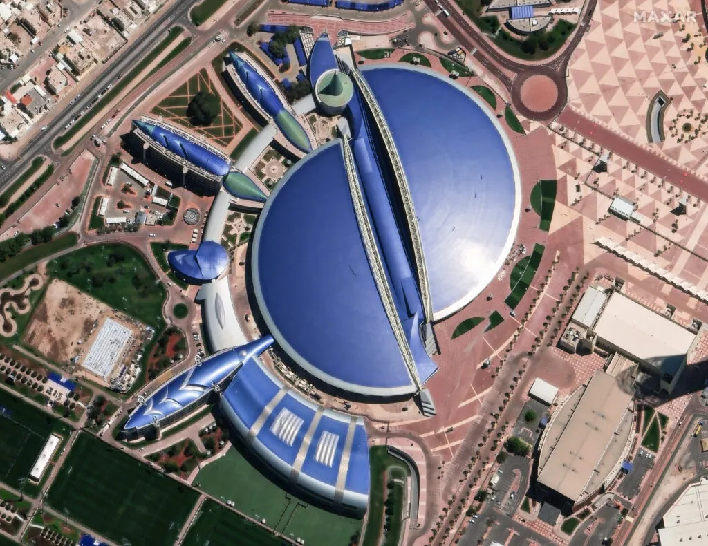
Satellite image ©2024 Maxar Technologies.
Why 15 cm Data Matters
15 cm resolution provides an unprecedented level of detail, nearly equivalent to aerial imagery—a true breakthrough for satellite imaging. The level of granularity allows for more precise mapmaking and improved ‘feature extraction,’ enabling users, both human and artificial intelligence (AI), to identify objects and features that would otherwise be too vague to discern—including road lane markings, detailed building features, utility infrastructure and much more. This is redefining what is possible for end users of the technology.
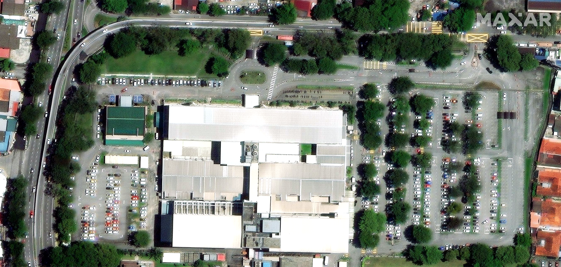
Satellite image ©2024 Maxar Technologies.
One of the providers setting the pace with this new technology is Maxar Intelligence. Maxar’s Vivid Advanced product represents a new industry standard, providing a foundational basemap that is transforming how stakeholders across a number of industries engage with near real-time spatial data, significantly improving decision-making and reducing operational costs. “15 cm HD really unlocks that detailed view of the current conditions on the ground, which is essential for navigation, route planning, and urban mapping,” says Janey Bessler, Maxar’s Manager of Sales Engineering. There are also many other use cases, including applications for sustainability and Environmental and Social Governance (ESG).
Applications for 15 cm resolution:
Impact on Mapping, Digitization, and AI
15 cm resolution is having a significant impact on the mapping industry as an important component of data fusion. When combined with other data sources, it enables mapmakers to update their maps in a much faster and more reliable way, and to digitize finer map details which have previously been challenging to capture at a global scale. This includes road markings, lane changes, minor infrastructure adjustments, and subtle landscape variations. Adding this level of detail makes digital mapping solutions more accurate and reliable, increasing efficiency and reducing costs and margin of error for any number of use cases, from logistics to emergency response.
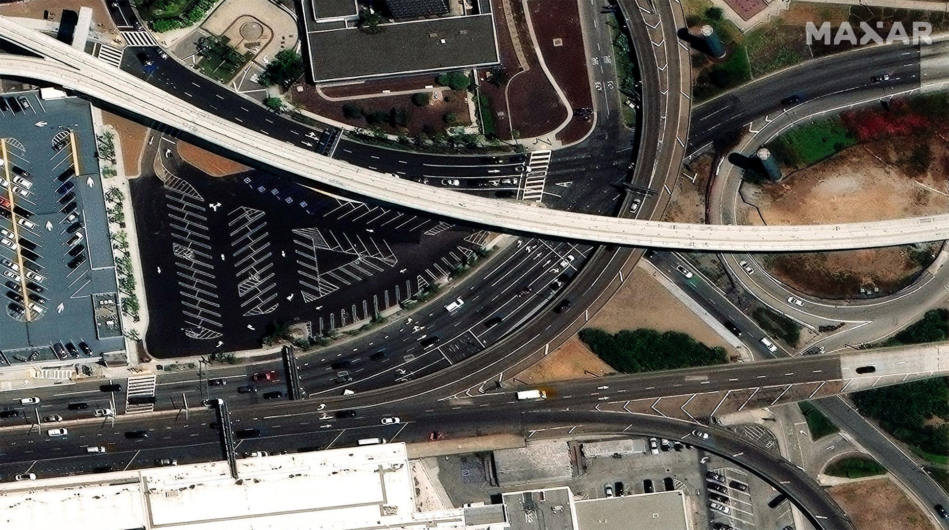
Satellite image ©2024 Maxar Technologies.
15 cm satellite imagery is also dramatically enhancing the performance of AI models, which rely on the resolution of the input data to extract features, detect changes, and generate insights.
“Machine learning and AI in general perform more efficiently when there’s an increased level of detail in the pixels, which is exactly what 15 cm data provides,” explains Maxar’s Luca Perletta, Sales Manager for Europe. “It’s about providing a consistent and reliable base for these advanced applications, making it possible to analyze and extract features with a level of precision that was previously unimaginable.”
With Maxar’s Vivid Advanced basemap, AI models can be used to automate processes such as identifying new construction and road layouts or monitoring urban sprawl and population movements.
Keeping Up with Change
Up-to-date imagery is essential for keeping up with rapid, continuous change. This can be of relevance in areas subject to environmental pressures like erosion or desertification, where 15 cm imagery can enable governments and NGOs to monitor natural events on a far more granular level. This has the potential to replace in-person site visits, which are currently required to supplement lower-resolution data. This data will start becoming available at a faster pace as more of Maxar’s new WorldView Legion satellites, which will triple the company’s 30 cm native imagery collection capacity.
It’s also essential in urban environments: Cities are evolving at an unprecedented pace, and traditional mapping methods often lag behind, making it difficult to maintain an accurate view of infrastructure and development. By combining 15 cm imagery with AI-powered models, urban planners and governments can automatically monitor these changes, ensuring real-time situational awareness. Perletta emphasizes the impact of this shift: “End users are moving from reactive to proactive mapmaking. By providing the most up-to-date imagery, we enable them to anticipate changes and update their maps even before new developments are fully completed.”
Maxar utilizes in-house change detection methods to understand where and when to update its Vivid Advanced basemaps, so its customers are always provided with the most current imagery. The company has also been strategic in ensuring that its 15 cm resolution data is available for major urban areas and regions experiencing rapid development, where it can inform everything from construction projects to environmental monitoring:
“We’re focusing on areas of change and population, expanding beyond city centers to the places where we detect the most development happening,” says Bessler. “By identifying areas of change and updating them more frequently, we can ensure that our imagery remains relevant and valuable.”
“Our customers are increasingly looking for programmatic access to our imagery,” adds Bessler, “so they can run AI and machine learning models directly on our 15 cm data to extract features and detect changes at scale.”
This programmatic access allows for continuous and dynamic updates in real-time, with minimal human intervention.
Challenges and Opportunities
Challenges
While the benefits of 15 cm imagery are clear, processing high-resolution data comes with its own set of challenges. For a start, industries working with it need to have the right tools and on-staff expertise to process and extract meaningful information from the data. Furthermore, high-resolution imagery requires robust infrastructure and storage solutions to manage the vast quantities of data. Another issue is the accessibility of this data—as resolution increases, so do the demands on the infrastructure supporting its flow. All these challenges can place additional pressure on any organization that uses Earth observation (EO) data in its operations or processes. Many of these challenges can be ameliorated through geospatial subscription services like Maxar Geospatial Platform (MGP) Pro, which allows the data to be streamed online or accessed via an Application Programming Interface (API). Services like these make it much more convenient to work with EO data, as opposed to the traditional process of downloading the raw data and working with it locally—still a common practice for smaller projects in particular.
For end users relying on raw satellite imagery, the process of stitching images together or mitigating the effects of cloud cover can also be a daunting task, but essential if they need to apply AI or ML. Maxar’s Vivid Advanced basemap addresses this issue:
“Vivid Advanced offers a seamless, cloudless basemap at 15 cm resolution, ensuring that users can rely on consistently high-quality imagery, no matter where they are in the world,” explains Perletta. “Customers appreciate how this simplifies their workflow by eliminating the need for image stitching and dealing with cloud cover, allowing them to focus on analysis and decision-making.”
Opportunities
If the challenges can be overcome, the opportunities that 15 cm imagery presents will be transformative.
“Precise mapmaking and better feature extraction are critical for applications like autonomous driving,” says Perletta, “and this is one area where 15 cm resolution is a game-changer.”
By dramatically improve the accuracy of AI models, the technology can also enable more dynamic, real-time applications, including infrastructure monitoring, disaster response, and environmental conservation.
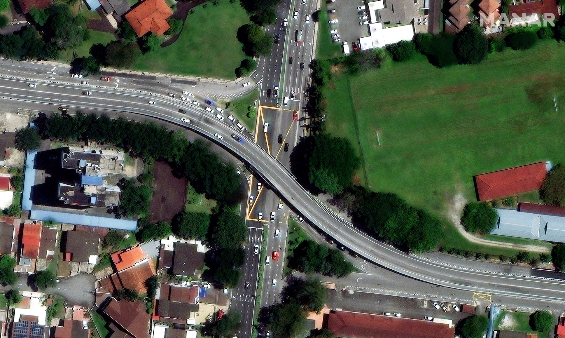
Satellite image ©2024 Maxar Technologies.
One of the most exciting opportunities lies in democratizing access to high-quality satellite imagery. As technology advances and costs decrease, detailed imagery is no longer reserved for large corporations or government entities, and organizations of all sizes can benefit from it. This has the potential to drive innovations, as smaller companies, NGOs, and even individual developers learn to leverage this data for projects ranging from sustainable development to urban innovation. The democratization of satellite data is paving the way for a new generation of creative, agile solutions to some of the world’s most pressing challenges.
The Future of Mapping: 15 cm and Even More Detailed Satellite Imagery Will Continue to Shape the Future
15 cm satellite imagery has set a new benchmark for the mapping industry, and satellite data will truly rival aerial imaging as providers like Maxar achieve ever-greater resolution. As the technology advances, it will continue to shape the future of mapping, urban planning, and monitoring.
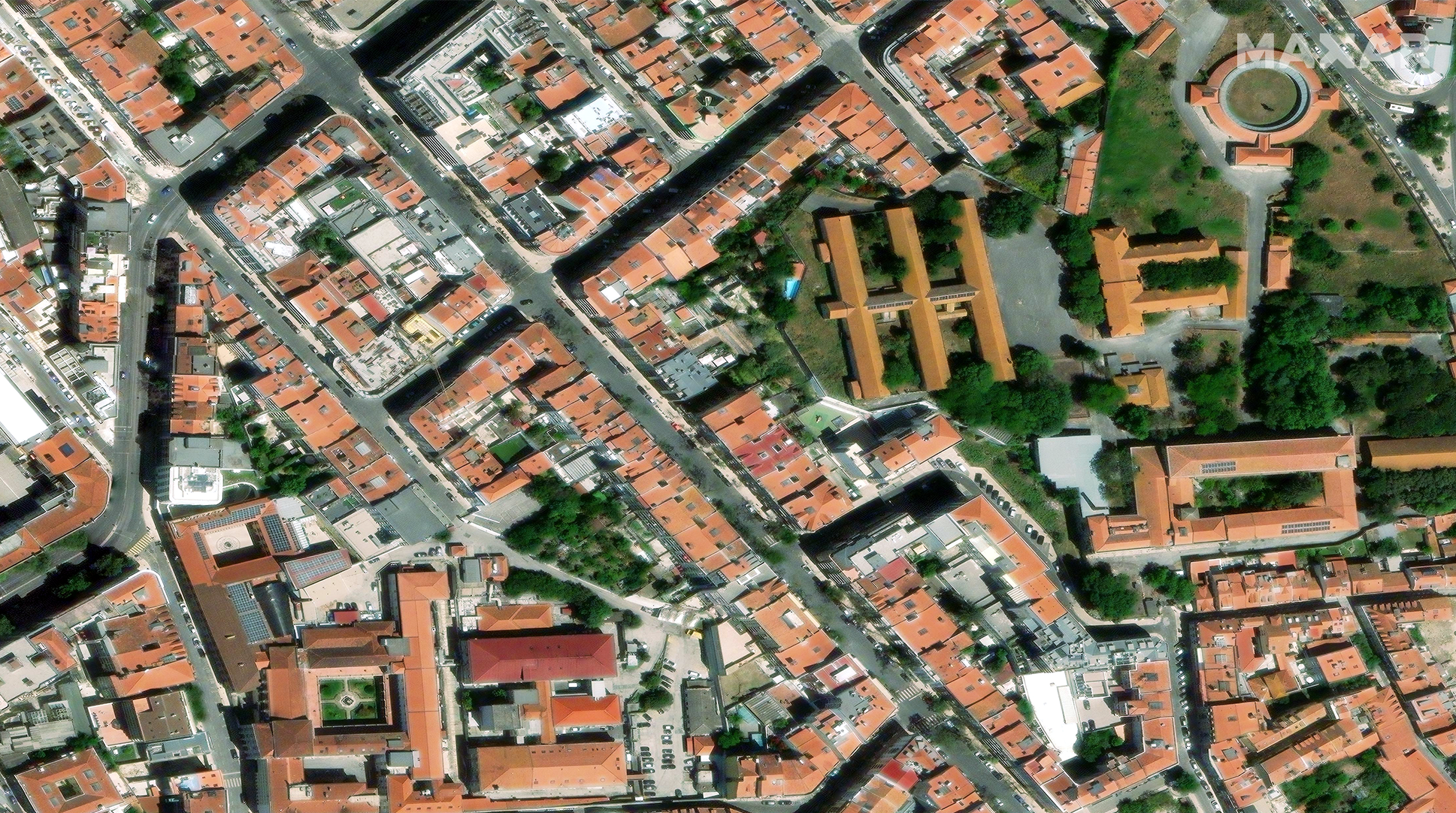
Satellite image ©2024 Maxar Technologies.
There are broader societal benefits to increasingly high-resolution satellite imagery. Accurate, up-to-date maps are essential tools for disaster response teams who need to assess damage and coordinate rescue efforts and allocate resources in real-time; they enable first responders to work more efficiently, potentially saving lives; they can provide a clear view of land use changes, deforestation, and coastal erosion, helping organizations to keep tabs on environmental degradation and mitigate its effects.
It’s likely that high-resolution satellite data will be integrated with other emerging trends, not just AI, but digital twins and immersive augmented and virtual reality technologies, allowing city planners, architects, and engineers to visualize and interact with urban landscapes in virtual environments like never before. This has the potential to advance the way urban centers are developed, monitored, and maintained, allowing for smarter and more sustainable cities.
15 cm resolution satellite data represents far more than just a technical achievement—it marks a shift toward a more connected and well-mapped world. From urban planning to autonomous driving, disaster response to environmental monitoring, the potential applications are vast, and the implications are far-reaching. Industries now need to embrace the potential of 15 cm satellite imagery, integrate it into existing workflows, and leverage its capabilities to create smarter, more connected futures. The new era of Earth observation will not only transform how we map the world but also how we interact with it.
Learn more about how satellite imagery provides the resolution, accuracy and frequency required for reliable maps, at global scale at https://explore.maxar.com/precision-maps.html
