Standardization can have a profound effect on industries and the people they interact with. Done right, standardization can shift innovation of entire industries. Whether we talk about a USB-C as a port standard for devices or containerization in the shipping industry, standards have allowed companies to focus on what they’re good at rather than how they play with others. A similar shift is taking place right now in how we create and consume digital maps.
Standardization in mapping shouldn’t come as a surprise. The demand for location-based services has shot through the roof in recent years. Designers and developers now consider location as a given in many of the services they’re building. This goes for more obvious cases, like Uber and Lyft, but also for platforms like Facebook and fitness apps like Strava. More than ever before, maps are in demand—both the raw data behind them and the visualizations they enable.
There’s also greater pressure in terms of what’s expected from a map. Until recently, all a new business cared about was to be listed in the Yellow Pages. Now the concern is whether or not they exist on major mapping platforms. The location, opening hours, contact information, and description of services are most easily retrieved via a map-based application. Navigation data like the direction of travel, speed-limit, surface-type, and transport networks are equally important elements of a modern map. The cost of acquiring and maintaining this data is huge, but the industry is pragmatic and channeling efforts towards a neutral platform and database which also serves as the foundation for the standardization we’re now seeing: OpenStreetMap.
What began as a crowdsourced map curated by volunteers has evolved into a diverse ecosystem of players with a shared interest in collecting and consuming map data. In fact, it seems that everyone uses OpenStreetMap. Corporate giants like Apple, Facebook, and Uber all use OpenStreetMap. Individual volunteers used the service to map villages in the Philippines before the typhoon season, while a Microsoft team used it to mapping bodies of water in Australia. In the past, such mapping took place independently on offline paper maps and closed databases. Not only has the cost of these approaches excluded many, but the advantages of using OpenStreetMap as a base map have also become more significant. A ride-sharing company launching in Tanzania tomorrow could take advantage of the incredible flood resilience mapping by the Ramani Huria project throughout Dar Es Salaam. The flood mapping included locations of businesses and health clinics, as well as tedious details of the road network. This data is just as relevant for a ride-sharing company as it is for flood resilience work, even without direct collaboration. When OpenStreetMap is lacking features, a key advantage is that the map is readily compatible with other services such as OpenTraffic, Mapillary, or TripAdvisor. At the end of the day, all of these players benefit from an improved OpenStreetMap.
On the engineering side of things, OpenStreetMap is becoming an obvious standard foundation when people and organizations want their location data to be displayed on top of a map. Because of OpenStreetMap’s open structure to storing data, companies and organizations are able to build other applications on top of it quite easily—keeping the bits they like, and simply removing the bits they don’t, while combining it with data they’ve gathered elsewhere. This approach is taken by giants like Microsoft, but also by much smaller organizations like the offline map platform maps.me.
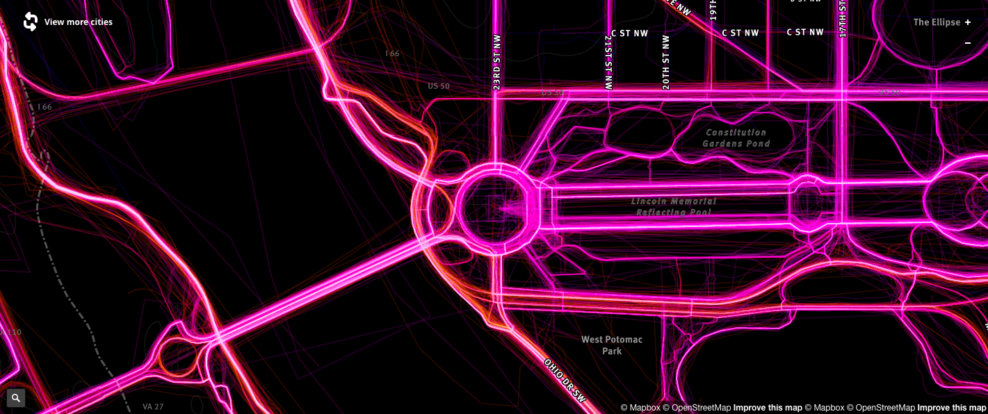
Driving patterns data as collected by Mapbox
It isn’t just humans that are impacting the way the map changes. Companies like Mapbox are collecting over 400 million kilometers of data on driving patterns which are being analyzed with machine learning to estimate the speed limit of a road, direction of travel and where construction might be taking place. Existing OpenStreetMap data can then be validated and updated at a greater frequency than human volunteers can achieve alone. Similarly, Mapillary applies computer vision and machine learning to the 385 million images on our platform. This helps to identify over 33 billion map features—all of which we’ve committed to making freely available to the OpenStreetMap community. These automated methods are producing a flood of data that human mappers can use as sources, guides, and evidence, noting the fact that all OpenStreetMap data must be added and verified with a human touch as a final step.
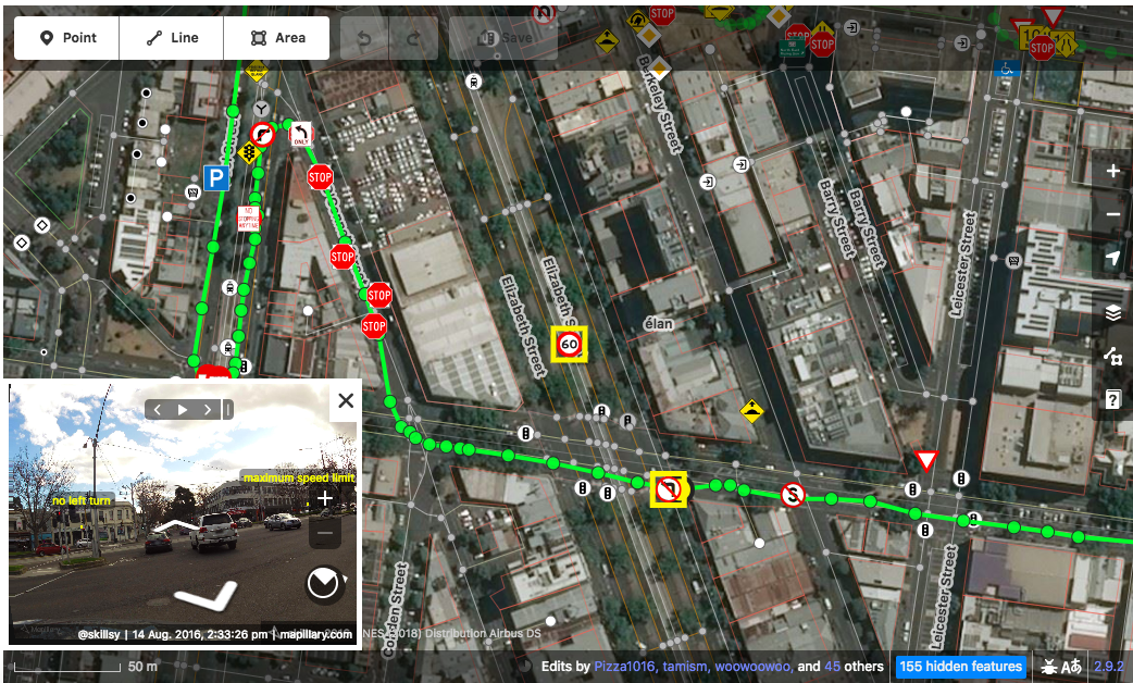
Mapillary detected traffic signs in OpenStreetMap’s iD Editor
This is where the community continues to play a defining role. OpenStreetMap volunteers make extraordinary additions to maps from perspectives that don’t always matter to commercial players. The fact that these divergent groups of individuals, companies, governments, and organizations can each contribute to the one platform is a powerful thing. It means that the value shifts towards the applications that can be built with the map data rather than who controls it. The result is better maps everywhere.
OpenStreetMap is more than a crowdsourced map—it’s turning into a mapping standard, and we’re all better off because of it.


 How can an empty address help fight homelessness? By definition, a homeless person is someone without a permanent residence, unable to acquire and maintain regular, safe, secure and adequate housing. Unfortunately, being homeless doesn’t just mean that they are without a house, an address, but also end up losing their de facto means of identification. Without identification, it becomes difficult for them to access the basic services that they need to recover – social benefits, a bank account, employment all get either taken away or gets too complicated. Those who might have otherwise gotten back on their feet with a little early support are instead left to become entrenched in the situation and, ultimately, develop more complex and care-intensive needs over time. If only they had an address in the first place, we could have helped them get access to the social benefits that they deserve!