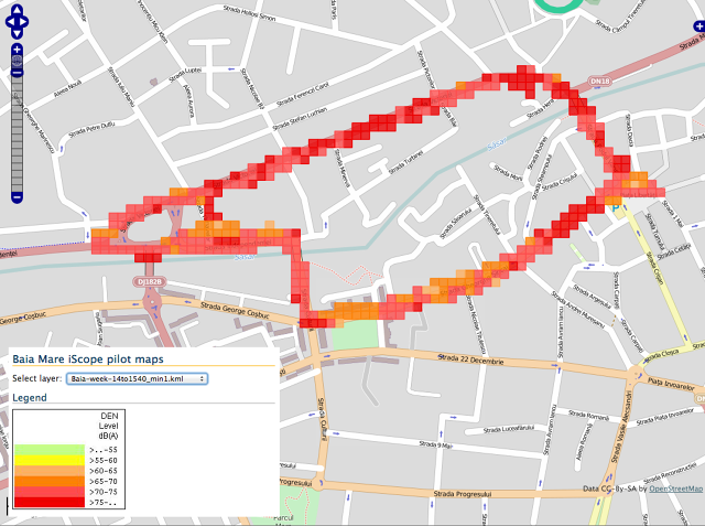
 Let’s be honest, we live in a very loud world. Road traffic, construction sites, ambulances and other sounds create urban cacophony, which is not only a form of pollution but most importantly it’s unhealthy and it significantly decreases the quality of life. On the other hand street noise isn’t generally a category-one issue for city governments, and they don’t put a lot of resources into measuring it.
Now there is solution. NoiseTube is a research project, started in 2008 at the Sony Computer Science Lab in Paris and currently hosted by the BrusSense Team at the Vrije Universiteit Brussel. NoiseTube is an open-source platform which consists of web map service and apps for iOS and Android that let you transform your smartphone into an acoustic detector to measure noise pollution.
The app uses your smartphone’s microphone and GPS to gather the noise, position and time. Each smartphone model has to be calibrated by the NoiseTube team to decrease the microphone’s error in order to produce a relatively accurate data set. The accuracy is estimated for around 5dB. I don’t know however if the app is able to make up for keeping your phone inside you pocket.
So far around 3000 users have registered to participate in the project, with over 10,000 people downloaded the app (both Android and iOS). The app offers online and offline modes. In online, you just open the app and forget about it. It automatically uploads sound level data as you wander about. In offline mode, it stores the data on the phone, and you have to upload it later.
What I like about the project is that NoiseTube shows the potential for cheap sensors and apps to broaden environmental sensing in cities, especially around under-acknowledged problems like noise pollution, which don’t generally get a lot of resources.
source: Mashable


