#Business #Ideas

New emergency locator beacon takes ‘search’ out of ‘search and rescue’

For more than four decades now, airlines, ships and hikers have been using emergency locator beacons that were developed in the 1970s to transmit distress signals to the nearest satellites. These beacons have saved 40,000 lives till date, but the technology comes with a striking limitation: It is accurate only up to 2km radius.

In case of an airplane crash or a lost hiker, there is still a lot of searching that needs to be done within that 2km perimeter. This limitation became all the more apparent following the disappearance of Malaysian Airlines MH-370 in 2014. That’s when NASA’s Search and Rescue (SAR) office started developing a far more effective beacon — one that would be accurate to about 100 meters.

Such accurate locator technology will go a long way in reducing the risk faced by both the person who is in distress and the emergency responders. A game-changer of sorts, the technology will also cut down the time needed for search operations. In SAR Mission Manager Lisa Mazzuca’s words, these second-generation beacons will “take the ‘search’ out of ‘search and rescue’.”

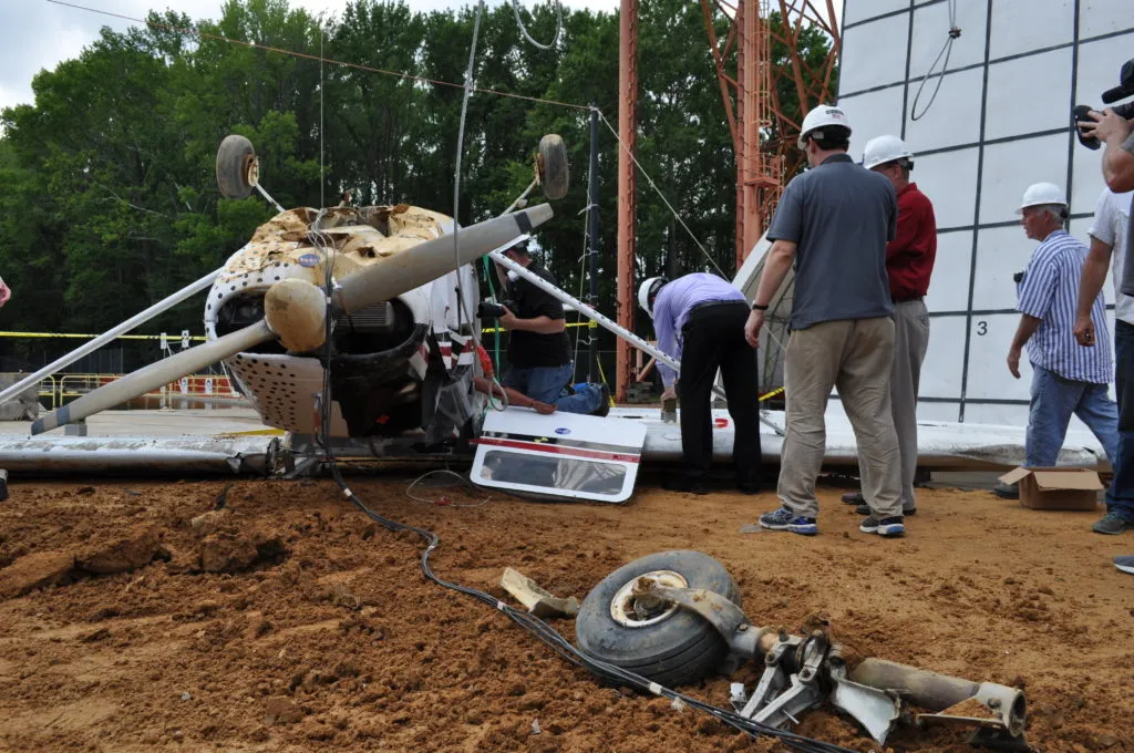
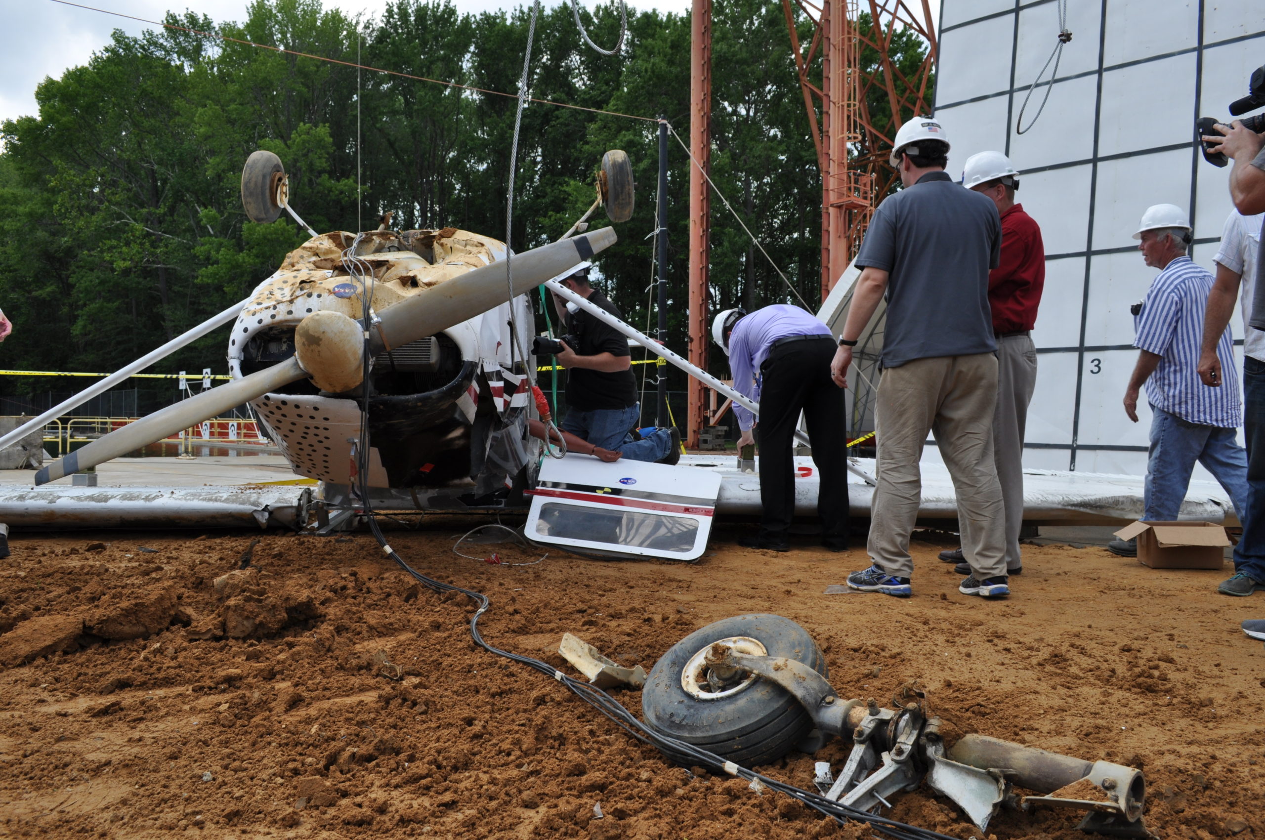
The SAR office, which serves as the chief R&D body for both the US Search and Rescue Satellite Aided Tracking (SARSAT) program and the International Satellite System for Search and Rescue (Cospas-Sarsat), has been performing crash tests with real airplanes in a controlled environment to assess the effectiveness of the new beacons. The team has achieved a location accuracy of about 140 meters in these tests.

Mazzuca says that her team is working on incorporating the new beacons into emergency locator transmitters (ELTs) for aviation, as well as in UAVs that can be used to assist the rescuers. The team is also working to develop a new SAR platform based entirely on these second-generation beacons. Apart from aircraft, these second-generation beacons would also prove useful for amateur hikers and boaters, and would be available at outdoors stores at reasonable prices soon.

Say thanks for this article (0)
The community is supported by:
Become a sponsor
#Business
#Business #GeoDev
3 Pathways For Integrating Planet Data Into Your GIS Workflow
Avatar for Sponsored Article
Sponsored Article 08.12.2024
AWESOME 1
#Business #Events #Featured
The Future of Navigation: How Satellite Data Shapes Map Innovation
Avatar for Muthukumar Kumar
Muthukumar Kumar 10.29.2024
AWESOME 1
#Business #Featured
Global Top 100 Geospatial Companies – 2024 Edition
Avatar for Muthukumar Kumar
Muthukumar Kumar 01.31.2024
AWESOME 10
Next article
#Ideas

Stunning 1.4 billion pixel map reveals Gulf of Mexico’s speckled seafloor

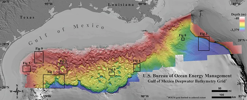
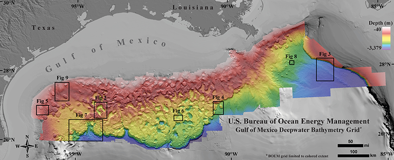
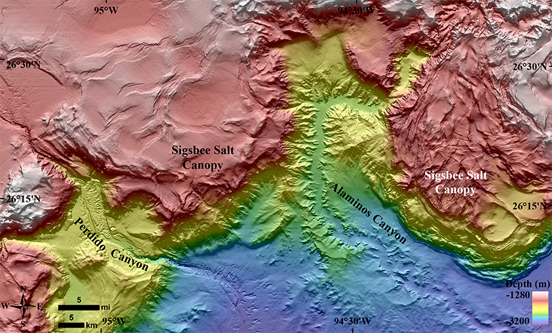
The Gulf of Mexico is a geology enthusiast’s dream. Its dynamic seafloor is speckled with domes, canyons, channels, pockmarks, mud volcanoes and sediment waves. The movement of salt deposits from almost 200 million years ago makes sure that even today the terrain is always in a state of flux. A just-released 1.4 billion pixel, Gulf of Mexico bathymetric map displays all the magnificent features of the seafloor and geomorphological processes with an astounding clarity.

The map has been created by the Bureau of Ocean Energy Management (BOEM), a federal agency that manages the United State’s natural gas, oil, and other offshore mineral resources. So, if any oil and gas company wants to explore the Gulf of Mexico for hydrocarbons, it needs to hand over the findings from its seismic surveys to the BOEM.

A seismic survey basically uses an energy source to create a shockwave on the ground surface along a predetermined path. These waves are then reflected by subsurface formations and return to the surface. A geophysicist or software can analyze this data to create 2D or 3D images of the surface.

Right now, the agency is in possession of 1,700 time and depth 2D/3D seismic surveys for the Gulf of Mexico. And to create this amazing deepwater map, all BOEM had to do was to convince a handful of companies to release their findings publically.

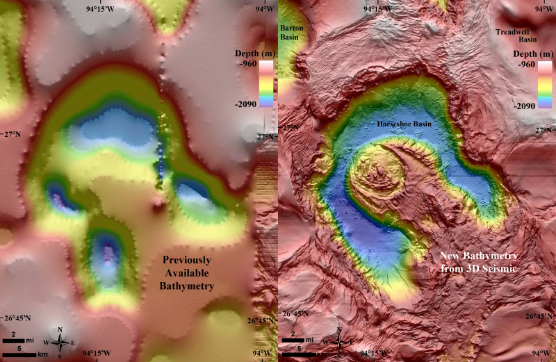
The bathymetric map exclusively utilizes only 3D seismic data, covering more than 90,000 square miles in the northern part of the Gulf of Mexico. It is available at a resolution of 49 square meters per pixel. Now, since this map doesn’t cover as large areas as have been covered by the NOAA/NGDC/GCOOS map, the historic map will continue to be relevant. But in comparison, the new map increases the horizontal resolution of the salt mini-basin province, abyssal plain, Mississippi Fan, and the Florida Shelf and Escarpment by a whopping 10 to 50 times!

You can read all about the making of this map here.

Read on
Search