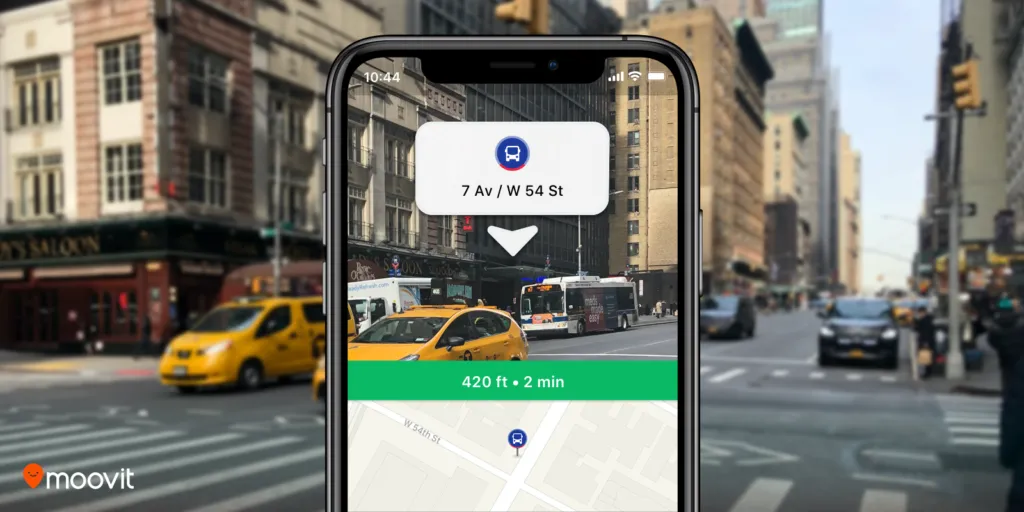
After Google Maps released augmented reality-powered walking directions to rave reviews last year, another navigation player is ready to display digital directions on top of real-world images and help users to get to their destination easily. Mobility as a Service (MaaS) solutions company Moovit has launched a beta feature called Way Finder to leverage AR for better navigation in its popular urban mobility app.
Moovit is an Israeli startup that specializes in public transportation planning. Over 700 million users in 3,000 cities across 98 countries use the Moovit app to get real-time transit data. It was a humorous comment left by one of these users on Facebook that got the geospatial company to think about using AR for locating bus stops and train stations: “A feature that I need for Moovit: Cross the street, stupid. This isn’t the right side.” The company took the request by the Facebook user seriously and paved the way for the feature during a hackathon session. At present, Way Finder has been rolled out to iOS users only.
“Getting around in an unfamiliar place can be quite frustrating and inconvenient. We are so proud that our team took what began as a very creative hackathon project to solve a users’ needs, to new heights and really drove Moovit’s evolution to the next level. Way Finder makes getting to any destination a better experience, and further helps us in our mission to simplify urban mobility,” says Yovav Meydad, Moovit’s Chief of Growth and Marketing Officer.
How to activate AR navigation on Moovit app
If you have the latest iOS version of Moovit on your phone, you can enable Way Finder in the app Settings screen under ‘Labs’. Once you have the feature activated, simply input your destination and select a ‘Suggested Route’. A blue Way Finder button will pop up after you tap on ‘Navigate’ to start Live Directions. Tap on that button and hold the phone up to the surrounding environment for Way Finder to begin.
Now you should see the top half of your phone screen displaying icons, and signs overlaid on a live camera view, with left and right turn arrows indicating direction. The bottom half of the screen, meanwhile, will show your location on the map from a bird’s eye view. Lower down your phone and the screen will switch to map view only.


