Do you know how maps of Game of Thrones were created?
[House of the Dragon update]
In the series “House of the Dragon,” the addition of Team Green’s and Team Black’s maps provides a strategic visualization of their respective territories and influence, enhancing viewer understanding of the geographical and political dynamics. Surface visualization techniques further enrich this depiction by offering a detailed, three-dimensional perspective of the landscapes and key locations to the storyline.
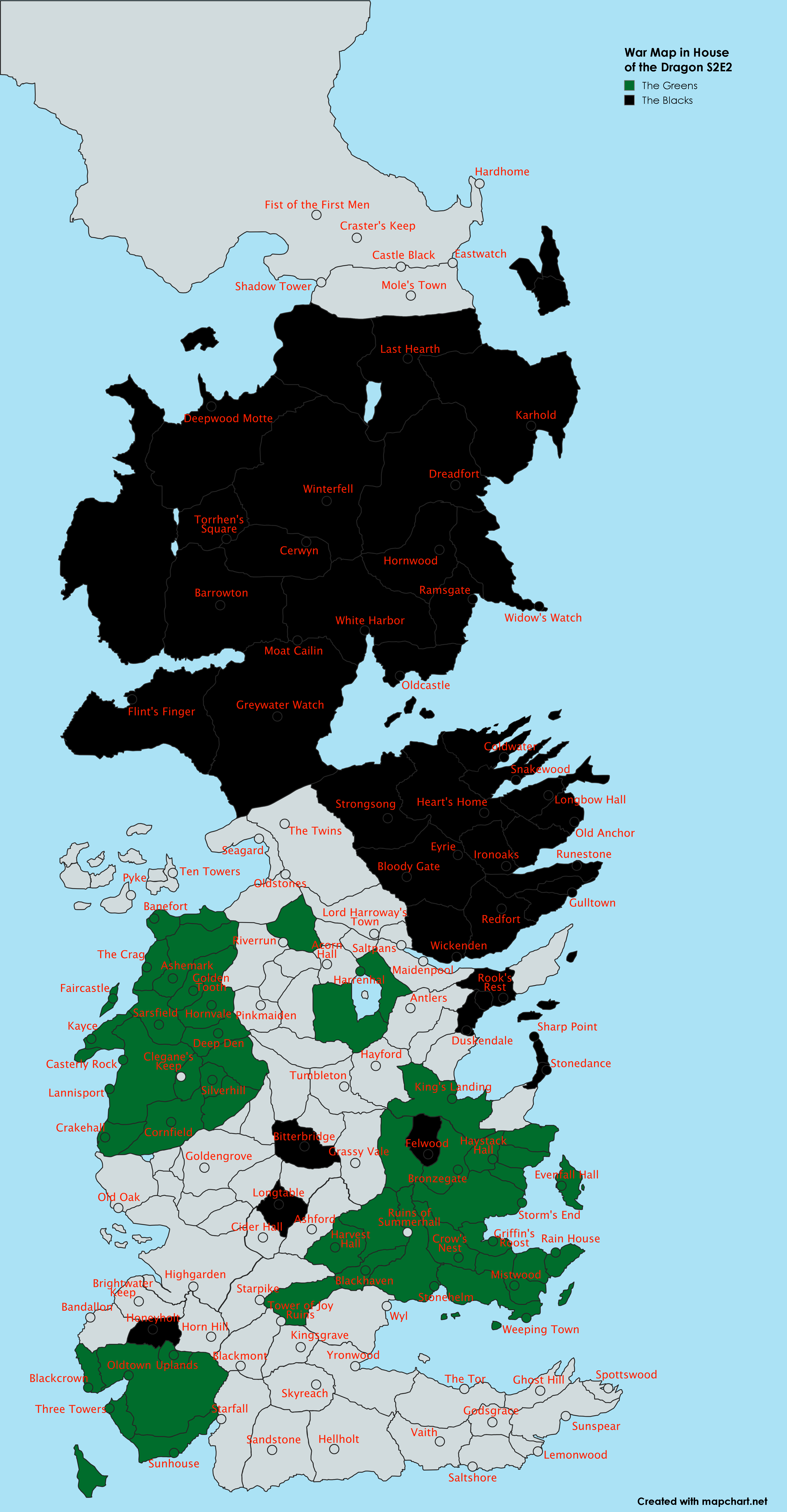
House of The Dragon map. Source: Reddit
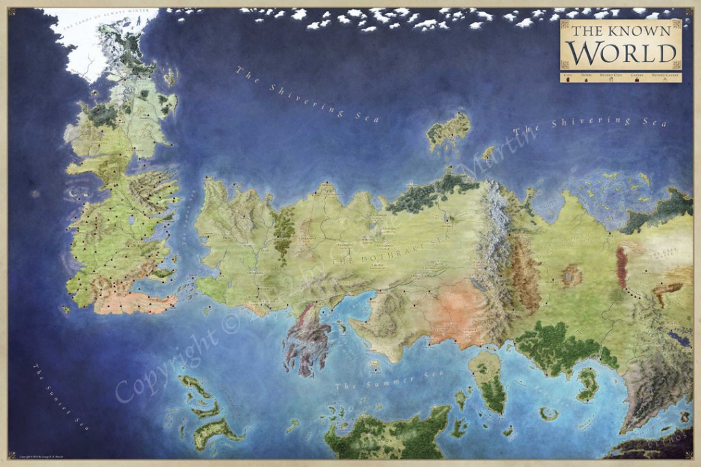
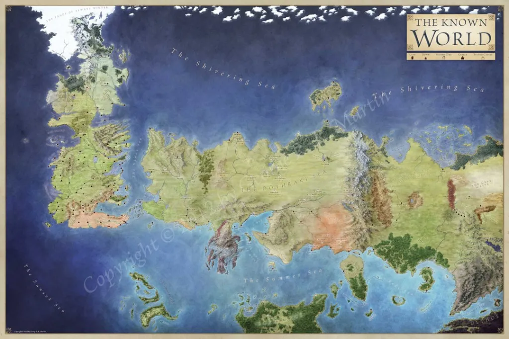
The Known World by the Song of Ice and Fire
Interactive map
Jonathan Roberts was only 31 when he received the fateful email in early 2012. It came from Random House, the publisher of the Song of Ice and Fire epic fantasy saga that the blockbuster TV series Games of Thrones is based on. They wanted to know if he would be interested in doing the artwork for the official Game of Thrones map collection that author George R. R. Martin wanted in his book The Lands of Ice and Fire.
Jonathan, who was a theoretical physicist at the time, said yes and went out to buy the books – it had been more than a decade since he last read them. The publishers wanted 12 maps, each 2 feet by 3 feet in size and detailed to perfection. And they wanted all 72 feet of Westeros in 3 months – a deadline which would require Jonathan to complete one map per week.
Getting started was not an issue. At Jonathan’s disposal were 5,700 pages of text and the map sketches created by Martin to pinpoint accuracy. The sketches were beautifully rendered on A4-size paper sheets with HB pencil. Martin had even highlighted the different map components in different colors – forests were drawn in green, major locations were denoted by a symbol to tell if they were big keeps or small towns, etc.
What’s more, voluminous paragraphs of notes had been written about each of these areas. One of Martin’s final notes read: “I need to stop mapping for a while. If I had to come up with one more name, I think my head would explode. Then the Dothraki would name my neck, ‘the place of the bloody stump.’”
So, Jonathan created a rough composite sketch of the known world, fusing the lands of the Seven Kingdoms and the lands across the Narrow Sea, had Random House clear it, and painstakingly started working on the style and the visual details. First came the coastlines, then the mountains and the rivers, followed by the forests, roads and all the other things.
The city of Braavos had never been mapped before, even by Martin; all he had done was prepare a rough sketch. And in 2012, there were only a few references of the city that were known to the public, like the Iron Bank. The rest of the locations were only mentioned in the books. Which meant Jonathan spent a lot of time leafing through the text, page by page, figuring out where everything should land up on a map.
The sheer volume of names and labels on these maps was so enormous that it became impossible for Jonathan to keep track of accuracy. So, Elio and Linda from Westeros.org – the largest Internet repository for Game of Thrones information – were roped in to fact-check every single name on the maps.
With the labels and lines OK-ed by Martin, Jonathan finally began transforming the raw maps into multihued visual treats. The author’s super specific vision for his fantasy world meant that Jonathan would need to navigate through a blizzard of post-it note edits and three color revisions before the maps could be sent to the printers.
When The Lands of Ice and Fire was finally published, it showed Martin’s universe at a scale so exhaustive, it had never been depicted before. The collection features the complete map of the known world; a map that tracks the movements of the protagonists; a full map of Westeros; a map of the Dothraki Sea and the Red Wastes; the Braavos city map; maps of King’s Landing; The Wall and Beyond the Wall; the Free Cities; and Slaver’s Bay, Valyria, and Sothyros.
Check out these 13 incredible facts about the Game of Thrones maps:
- The Game of Thrones maps do not follow any specific mathematical projection
- All the maps (except one) have been drawn by author George R. R. Martin from the point of view of one of the Citadel masters
- The first ever map of the city Braavos was created by Jonathan Roberts for The Lands of Ice and Fire
- There are five different distinct color and styles for the arable lands across the Westeros world map
- The mountains in have been inspired by the Argentinean Andes because they were drawn in the back of a conference hall in Pampas whilst listening to talks on ultra-high energy cosmic ray astrophysics
- King’s Landing is almost as rectangular as Manhattan, New York
- In Braavos, each of the blocks is a block; like a single building. In contrast, King’s Landing is made up of thousands upon thousands of tiny little buildings
- King’s Landing has three big hills: One with the dragon pit on the top right, the Great Sept of Baelor on the bottom left, and the hill that the Red Keep sits on
- The Summer Sea, where Daenerys Targaryen had been sailing right before she got to the Slaver’s Bay, is supposed to have a Mediterranean feel
- Jonathan got an earful for making the old roads of Old Valyria ‘wandery’. They are supposed to be ultra straight because they were created by dragons
- Jonathan got really specific instructions for the coastlines: This should be like small islets and islands coming off at this place. This should be much more jagged. This is a coastline you can’t land in. This is smoother. This has a beach. That beach should be this color
- The Journeys map shows the path of every character through every book to the end of the published books
- The final version of Westeros maps was made more inviting by using warmer shades of the colors used
Think we missed out on something? Let us know in the comments below!
Did you like this post? Read more and subscribe to our monthly newsletter!


