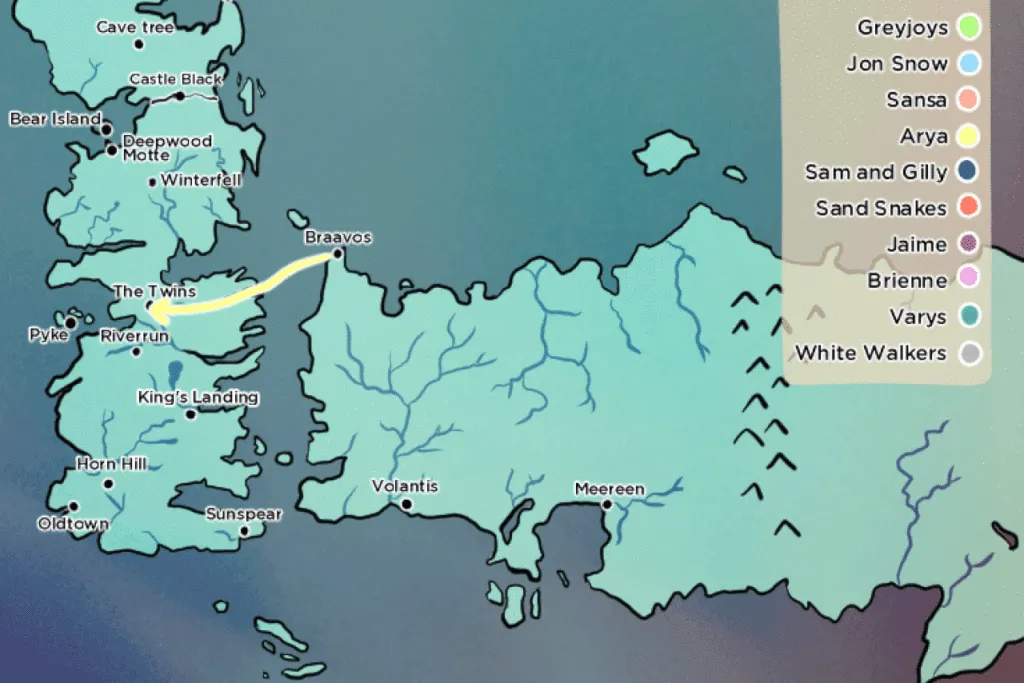

If you are a Game Of Thrones fan, the last thing you want is to be reminded (for the 100th time) that season six is over. But then, it’s time to begin the reruns and to chat endlessly about it. For starters, all those insanely fast journeys that everyone made in the GoT universe! What’s up with that GoT? Verge decided to write a TL;DR and mapped all these impossible journeys in a really interesting post (link). Check it out!
Game Of Thrones Season Six #Mapped – copyright TheVerge
From a fan perspective the map couldn’t be more amazing but it seems like the cartography could be so much more imaginative when it comes to visualising fantasy worlds. Do we really need to use the same cartographic expressions to map the real and fantasy worlds? But Winter is here and the map couldn’t have come at a better time.


#Ideas


Next article
With ArcGIS Maps for Adobe you can finally style your maps in Photoshop and Illustrator without any hassle

Making beautiful maps is a difficult task. Online geoviz platforms like Mapbox, CartoDB or ArcGIS Online are cool for interactive visualisations but sometimes you just need to quickly make a great looking static map. Normally you prepare the data in any GIS software that most likely has advanced spatial analysis tools but very poor visualisation capabilities. So in order to style it you need export you map to Adobe Photoshop or Illustrator. The problem is that the process is a real hassle. Typically you would get your data cut into strips with messed labels and layers. There are some tricks to make it work but it’s a frustrating and time-consuming.
Today Esri announced something that will make all cartographers and map designers happy – ArcGIS Maps for Adobe Creative Cloud Beta. It is an extension for Adobe design environment where users can download their ArcGIS Online maps directly to Photoshop and Illustrator. You just sign in to your Esri account and download any map or data layer as a vector or high-resolution image. It’s still in beta so a lot of things might change and Esri is counting on your feedback. You can sign in for the trial program here.
Frankly speaking it’s a great news and I’ve been waiting for it for years!
![]()
![]()

