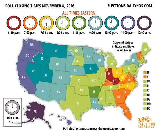

Today is a big day in the US. Millions of US citizens across the country will take part in 2016 presidential elections. This map might be helpful in order to get in time before the polls close.
Polls begin closing across the country starting at 6 p.m. Eastern time in Indiana and Kentucky and will finish at 1 a.m. Eastern time Wednesday on the western islands of Alaska. Make sure to get there in time.
This map is just one of examples that elections and maps goes together well. Check out this post to learn more about election maps.

#Ideas


Next article
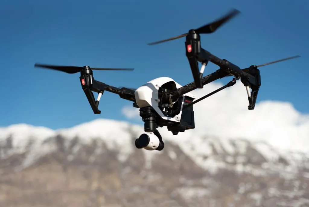

2016 is definitely the year of drones. We hear about them all the time. But don’t be fooled by all the drone-powered package delivery, drone racing or even drone filming… The biggest and the most profitable value of drones is related to their ability to collect data.
According to the report by PwC drones could replace $127 billion worth of existing business services and labor by 2020. When you dig a bit deeper you will realize that infrastructure, agriculture, insurance and mining are drone based services directly related to inspection and monitoring of physical assets which in order words means drone mapping.
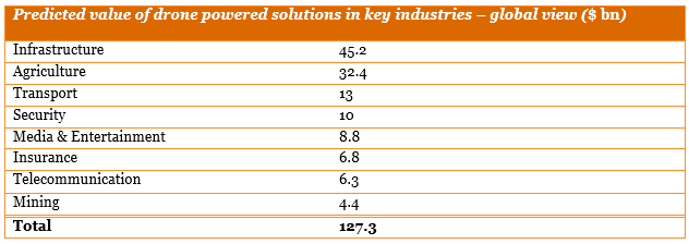
These four industries stand for $89 billion of predicted value of drone mapping services in the next 4 years. The buzz around UAVs helps to convince businesses to start testing and using drone powered solutions. In most of the cases companies are not willing to purchase the equipment and acquire the know-how (at least not right away) and they are cooperating with drone mapping consultants and service providers. With this in mind the new emerging business model seems to be the most suitable for the role of UAVs across the world – drones as a data service.
Drones are essentially mobile sensor and data collection vehicles and this is how they should be considered. Fortunately for individuals and companies who would like to enter this business, UAV mapping technologies are more accessible, cheaper and easy to use than ever before.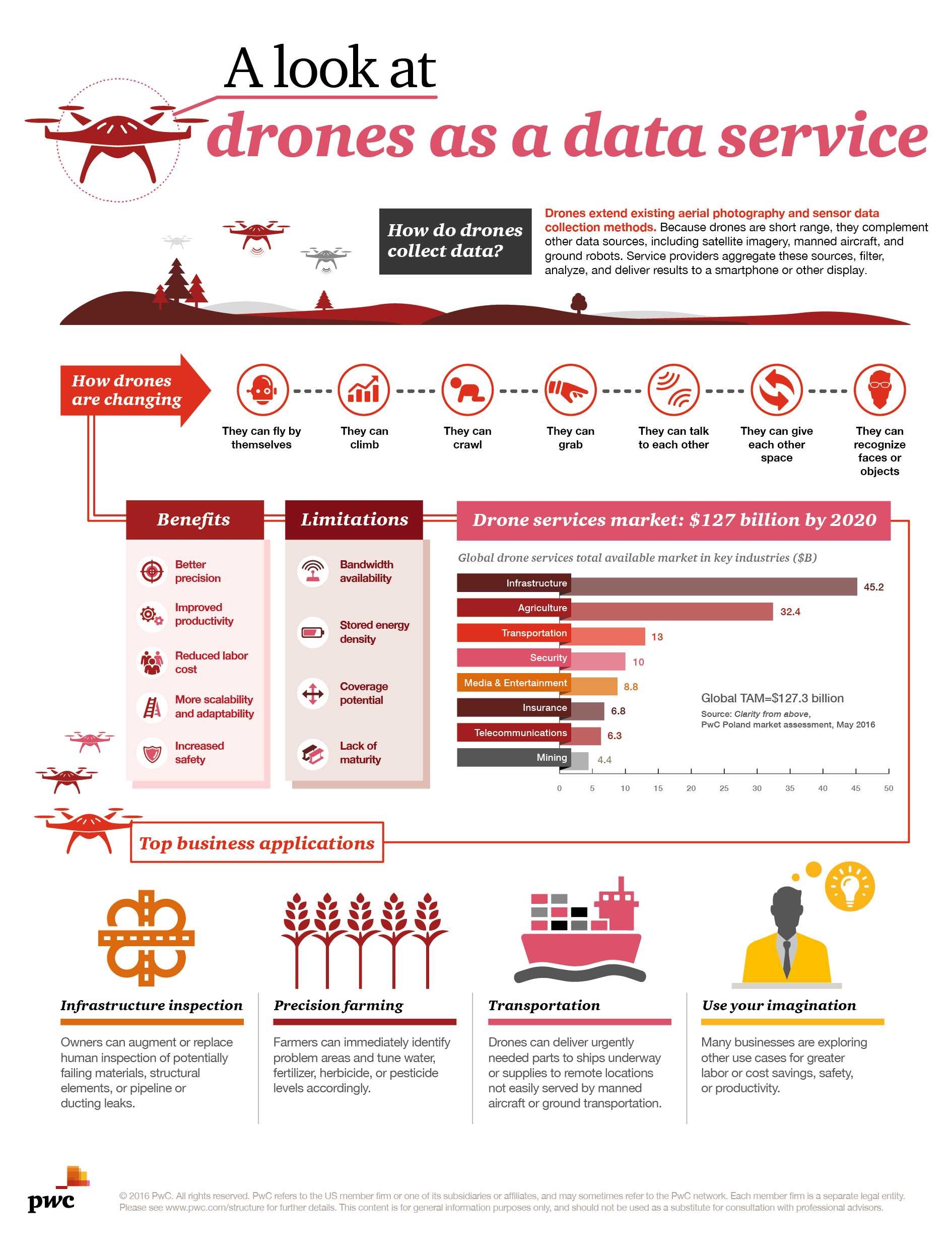 Offering drone services require having a suitable hardware (quadcopter or fixed wings drone) with a regular camera and potentially other sensors (you can find one more information on the drones remote sensing sensors here). Professional, easy to use cloud-based software e.g. DataMapper will help you plan the flight, process and analyze the data, and at the end present the results. Some professional surveying equipment might still be needed to set up ground control points that will allow you to relate your drone survey to the geographic reference system used by your customers.
The solutions are there. The business potential and value for the customer is there. The regulations are there in most of the western countries including the US. Drone mapping services will soon be ubiquitous.

