

In Geoawesomeness’s 10 Year Anniversary, we are celebrating by featuring stories about Humanitarian OpenStreeetMap and MapAction. It’s awesome to know that there are other groups of people working on the same goal.
Under the motto “Digital Earth for Sustainable Societies”, the Department of Geoinformatics – Z_GIS, University of Salzburg is hosting “ISDE12 – International Symposium for Digital Earth 2021” in Salzburg from July 6th to 8th 2021.
The conference addresses the 17 UN Sustainable Development Goals (SDGs) and showcases ways how the concept of “Digital Earth” can help to achieve them. In particular, the European Commission, in cooperation with ESA, is presenting the “Destination Earth” initiative that aims for solutions for climate change and for a climate-neutral Europe. Besides, GeoHumanitarian, Digital Twins, and Youth Forum are held in ISDE12 to discuss the solutions for improving livelihoods around the planet.
ISDE12 is organized as a hybrid event. The registration to ISDE12 is now closed.

About ISDE
The International Society for Digital Earth (ISDE) aimed at harnessing the world’s data and information resources to describe and digitally represent our planet, and to monitor, measure, and forecast natural and human activities on earth.
Digital Earth is the name given to a concept by former US vice president Al Gore, describing a virtual representation of the Earth connected to the world’s digital knowledge. In his remarkable 1998 speech, Gore described a digital future where children – indeed all the world’s citizens – could interact with a computer-generated three-dimensional spinning virtual globe and access vast amounts of scientific and cultural information to help them understand the Earth and human activities.
The 2009 Beijing Declaration of Digital Earth stated “Digital Earth is an integral part of other advanced technologies including: earth observation, geoinformation systems, global positioning systems, communication networks, sensor webs, electromagnetic identifiers, virtual reality, grid computation, etc. It is seen as a global strategic contributor to scientific and technological developments, and will be a catalyst in finding solutions to international scientific and societal issues.”
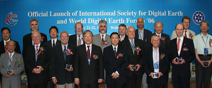
Since 1999, 11 International Symposia and 7 summits on Digital Earth, organized by ISDE have been held in 12 countries around the world. ISDE also publishes the International Journal of Digital Earth and Big Earth Data journal, and Manual of Digital Earth. In addition, ISDE is a member of the Group on Earth Observations, International Science Council, and Geospatial Societies of the United Nations Committee of Experts on Global Geospatial Information Management.
The Vision
“Digital Earth” was introduced as a vision in 1998 by the then US Vice President Al Gore. He described a digital future where everybody will be able to interact with a computer-generated three-dimensional spinning virtual globe and access vast amounts of scientific and cultural information to help them understand the Earth and human activities – with technology so easy that even a child can operate it. Digital Earth may destine to become the defining scientific and technological achievement of the 21st Century. This grand challenge will demand extreme computing for the most demanding Big Data challenges, the smartest applications of artificial intelligence, webs of sensors and actuators, and compelling gamification and visualisation methods. Most importantly, it will require agile minds collaborating in cross-discipline innovation and scientific pursuit. Young people in particular, as ‘digital natives’, are adept to connecting local action and global changes through mixed-reality media to open online services.
![]()
The mission
The International Society for Digital Earth (ISDE) has been dedicated to implementing this vision since 2006. This is made possible by advances in ongoing Earth observation using sensors in space and on the surface, the establishment of extensive geodata infrastructures and the development of dynamic geomedia. The Department of Geoinformatics at the University of Salzburg has contributed to these developments in a leading position for decades. This was recognized by the invitation to host the Digital Earth Symposium in Salzburg in July 2021.
Host organization – University of Salzburg
The Department of Geoinformatics – Z_GIS at the University of Salzburg is an interdisciplinary Centre of Competence for Geoinformatics and geospatial data management, integrating basic and applied research with graduate education and outreach activities.
By applying innovative spatial concepts and methodologies, Z_GIS are contributing to the management of our societies, businesses and environments. As an Interfaculty Department, Z_GIS develop geospatial competences across disciplines, offering graduate study programme in residential as well as distance learning modes. Our global network of partners from academia and industry serves as a strong platform for joint research and exchange of students and faculty – supporting the worldwide geospatial community and fostering awareness of the spatial dimension of social and natural phenomena.
www.zgis.at | zgis@sbg.ac.at | twitter: @Z_GIS1
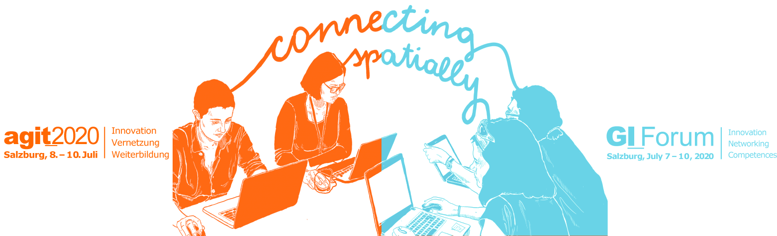
AGIT & GI_week: joint exhibition
Z_GIS organizes conferences since 1989. Over 1000 people attend the biggest scientific conference – the AGIT Symposium & GI_Forum – at the University of Salzburg in the field of Geoinformatics each year. In 2021, these two symposia together with the ISDE12 will share the innovative international EXPO in 2021 and attract an even broader audience to the University of Salzburg.
Z_GIS has strong experience in organising conferences for many years. Over 1000 people attend the biggest scientific conference – the AGIT Symposium & GI_Forum – at the University of Salzburg in the field of Geoinformatics. The goal of the conferences is to promote translating theory, methods and techniques into a broad range of Geoinformatics application domains. Young researches are especially welcome to contribute and discuss their findings. The international GI_Forum runs concurrently with the highly regarded German language conference on Applied Geoinformatics – AGIT hosted by our local conference team for more than 30 years. The two symposia share the innovative AGIT EXPO exhibit and stimulating social events.
For further information about the GI_Week and its two concurrently running conferences please visit:
– www.agit.at (for the conference on Applied Geoinformatics in German language)
– www.gi-forum.org (for the International conference in English language)
Keynotes:
- Heinz Fassmann, Austrian Minister for Science and Education and Geographer
- Carl Steinitz, Haward University
- Lawrie Jordan, ESRI
- Huodong Guo, Chinese Academy of Sciences
- Martin Visbeck, Geomar Kiel
- Martin Raubal, ETH Zürich
- Yana Gevorgyan, GEO director (from July, 01)
Data Driven Intelligence Forum
How can we combine data economy and sustainability?
As part of ISDE12, the Data Intelligence Offensive is hosting a forum for exchange and debate on the issues of the emerging data economy. There are already many technically feasible solutions, but the challenge for politics and business will be to implement them for the benefit of society, the environment, and nature – as formulated in the UN’s 17 Sustainable Development Goals – and in accordance with the strictest ethical and legal standards.
The topics of the forum include presentations of the Austrian data strategy, current projects on the intelligent use of data in geoinformatics, lightning presentations of solutions offered by start-ups, discussions on the development of GIS data spaces, and various exchange formats with international experts and researchers. The RSA FG is also represented and will give some presentations. The Research Studio iSPACE is a key partner.
In keeping with the spirit of ISDE12, the DIO Forum is designed to build bridges between politics, science and society.
Speakers
- Michael Wiesmüller – BMK
- Günther Tschabuschnig – President of the DIO
- Thomas Prinz – RSA FG iSPACE
- Markus Biberacher – RSA FG iSpace
- Martin Loidl – Z_GIS, Department of Geoinformatics, University of Salzburg
- Gerald Spreitzhofer – CEO of MetGIS
- E. Geyer Scholz – Founder of Smart City Consulting
- Fred Seyr – Spot on Statistics
- Jan Kinne – Istari
- Peter Penzenstadler & Felix Haberl – Vloor
- Lucas Kruitwagen – OXEO
Youth Forum
A special track of the ISDE12 is going to be the Youth Forum, which aims to serves as a platform bringing together initiatives and efforts from around the world and unconstrained by disciplinary or other boundaries. We want to involve young people and their ideas to the conference – not only at the conference but they will also connect throughout spring 2021. They will create added value and synergies by learning from and with each other. Watch out for online round tables scheduled on a range of topics.
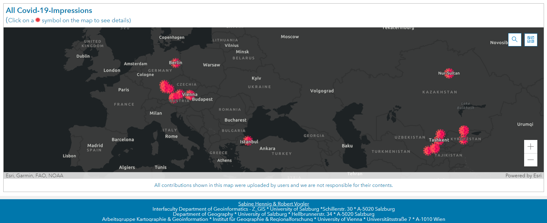
One particular idea for Youth Forum is Covid-19-Impressions:
The coronavirus SARS-CoV-2 has a fundamental impact on our lives – and this worldwide! All areas of life – be it contact with friends and family, school, vocational training, study and work, leisure time, sport, travel, etc. – have changed massively as a result of the pandemic and thus also led to new good and bad experiences. Many of these are obvious, but many more remain hidden. We want collect all these hidden, unknown experiences from all over the world and make them visible with our Covid-19-Impressions project (https://t1p.de/Covid19Impressions)
Digital Twins – Forum for a Sustainable Planet
The United Nations 2030 Agenda for Sustainable Development is designed as a universal development agenda for all countries. SD Goals address economic, social, and environmental aspects of balancing the use of natural resources for socio-economic development with conserving ecosystem services critical to the wellbeing and livelihoods of everyone. Digital Earth plays a key role in providing insights into scientific foundations of informed decisions and evidence-based policy advice.
The Digital Twins Forum for a Sustainable Planet creates a space to understand the contributions of Digital Earth to SDGs, connecting scientists with policymakers. Keynote speakers from government and academia present the role of Digital Earth developments informing SDG policies. Brief flash talks from researchers sharing their Digital Earth insights and technologies will broaden the scope of different perspectives. Based on these stimuli, a round table facilitates a dialogue with the audience.
The program of the forum includes keynotes and talks by:
- Prof. Graciela Metternicht
- Dr. Zhongchang Sun
- Marc Paganini
- Dr. Argie Kavvada & Dr. Adytia Agraval
- Prof. Maria Brovelli
YOU as a student, researcher, project manager, consultant, or government official are working towards SDGs – this is the right forum for you! Do not miss the opportunities to connect with our keynote speakers to exchange knowledge, collect ideas, identify challenges, explore opportunities and initiate collaborations towards Digital Earth contributions to SDGs. Join this forum!
We are open to accepting additional suggestions of flash talks: 5-minute oral challenges as well as your research outcomes in support of SDGs. Please send your proposal and slides to emails: lixiachu613@gmail.com; gregory.giuliani@unepgrid.ch; fukui@isc.chubu.ac.jp.
Destination Earth Forum
On Thursday, July 08 we want to highlight recent efforts and achievements on the way from “Digital Earth vision to Digital Twins of the Earth”. Our special track – the Destination Earth Forum – is co-organized with ESA and will promote the European approach of instantiating the Digital Earth concept.
The forum starts providing a high-level vision from invited speakers from all over the world and will then focus on Destination Earth and the European perspective.
![]()
Special forum in ISDE12 – GeoHumanitarian Action
This special forum is co-organized by the Christian-Doppler laboratory GEOHUM. GeoHum-Christian Doppler Laboratory of the University of Salzburg is in cooperation with Doctors without Borders and other humanitarian organizations.
The GeoHumanitarian Action Forum is a special forum in this year’s ISDE and will be held on Thursday, July 8th, 2021. The day’s programme brings together experts from research institutions, service providers, and humanitarian actors, to exchange about the role of geospatial technologies and Earth observation in humanitarian operations. With a mix of presentations, panel discussions, and keynotes, the forum’s interactive format will give both newcomers and experts plenty of opportunity for networking and sharing ideas.
Geospatial technologies at the interface of satellite Earth observation ( EO ) and geoinformatics ( GI ) are now widely used to support humanitarian operations. The uptake and further development of dedicated information services happen at unprecedented speed, with applications ranging from mission planning and operations in crisis intervention to population estimation for food distribution or vaccination campaigns. The global pandemic experience has even further pushed the need for objective and up-to-date information on impact on mortality rates and mitigation measures.
If you are interested in this event, please find all information here: https://geohum.zgis.at/events/ and the full program of the GeoHum-Forum here.
![]()
Call for Sponsors
Z_GIS see sponsors of the ISDE and the joint exhibition as our partners! We offer a variety of different, pre-defined sponsorship packages, from Bronze to Platinum level, which includes many benefits, as well as special sponsorships. Should you look for a more individualized sponsorship option, we’ll be happy to answer your questions via mail: info_isde12@sbg.ac.at or nianhua.liu@stud.sbg.ac.at
This event is designed to bridge politics, science, and society. You will meet representatives from federal and state governments, the EU Commission, UN organizations, and international space agencies.
We invite you to present your company at ISDE12 and to actively shape the program in the form of:
- pitch at the Youth Forum (“empower young talents”)
- give an “innovation keynote”
- become a sponsor (bronze to platinum packages available)
Based on an elaborated Covid-19 hygiene concept, we are planning a hybrid event that can be attended on-site and online. More than 1,350 people have already expressed their interest in participating. In case it is not possible to allow on-site planning due to the COVID-19 pandemic, there is a plan B for a purely online event.
If you are interested in positioning your company and/or your solutions to the SDGs and the topic of Digital Earth / Digital Twins, we look forward to your feedback!

#Featured

Next article

Unmanned drones on the market today are no longer only an entertaining gadget for hobbyists, nor are they only equipped with low-resolution, standard optical cameras. Many of today’s drones can be equipped with high-precision, high-quality thermal cameras that have a wide array of uses in government applications and private industry.
However, before we get into the several applications of drone thermal cameras, let’s discuss what thermal cameras are and what makes them useful today.
What are thermal cameras?
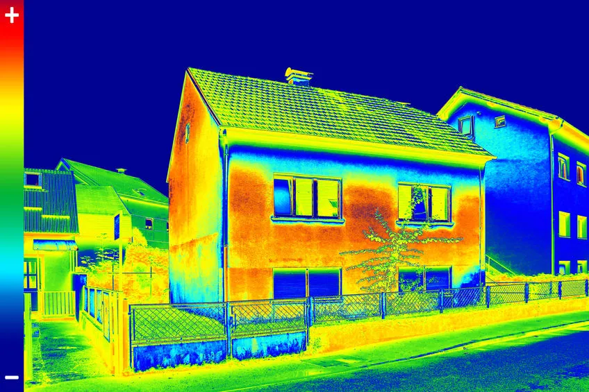
Thermal camera sensors, like standard electro-optical cameras, generate an image or digital reproduction of what they see, but instead of capturing the wavelengths of light to which our eyes are sensitive, they capture heat, emitted as infrared radiation, to produce an image.
Since thermal cameras are built to sense and view heat zones that are completely undetectable to the human eyes, the resulting images look remarkably unlike how we see things through our eyes.
Standard thermal cameras show blue to red smears, with each color reflecting different temperatures produced by people, structures, and objects. Areas with lower temperatures are represented by blue, while those with higher temperatures are represented by red. Some thermal cameras, on the other hand, use different color schemes.

The thermal scale of the sensors can be modified based on the user’s preference or on the particular application for which it is being used. The scale can be adjusted to reduce color contrast to get more general data or to reduce complexity, or it can be adjusted to increase the color contrast for more accurate and granular temperature assessments.
Thermal cameras have been used in military applications for years to identify threats at night or through terrain with low visibility. These days, they are available as portable or mountable accessories as a solution for thermographic services for industries such as manufacturing, business, and defense.
Thermal Cameras on Drones
Typical thermal cameras that are mobile and portable, and those installed on stationary structures for continuous coverage and surveillance, were great first steps in the use of thermal imaging devices. With the advancement in drone technology and the production of smaller, less costly, commercial drones, attaching thermal cameras to drones seemed to be a logical next step.
DJI and FLIR Systems collaborated in 2015 to create the DJI Zenmuse XT, one of the first drone thermal imaging cameras, by combining their industry-leading aviation systems and first-class infrared imaging innovations. The introduction of thermal cameras as a feature of high-end drones has drastically increased the prevalence of drone technology in many industries.
Since then, FLIR has developed new thermal camera models to satisfy various industries’ needs. Local government agencies, large and small private businesses, and even ordinary households can now use thermal imaging to enhance their physical security, to identify areas in need of immediate repair or likely to need repair in the future in their buildings and infrastructure, and to provide additional services in a variety of industries and applications, thanks to drone companies like Yuneec, Autel Robotics, and Parrot.
Common Uses for Drones with Thermal Cameras
Solar Panel Field Inspections
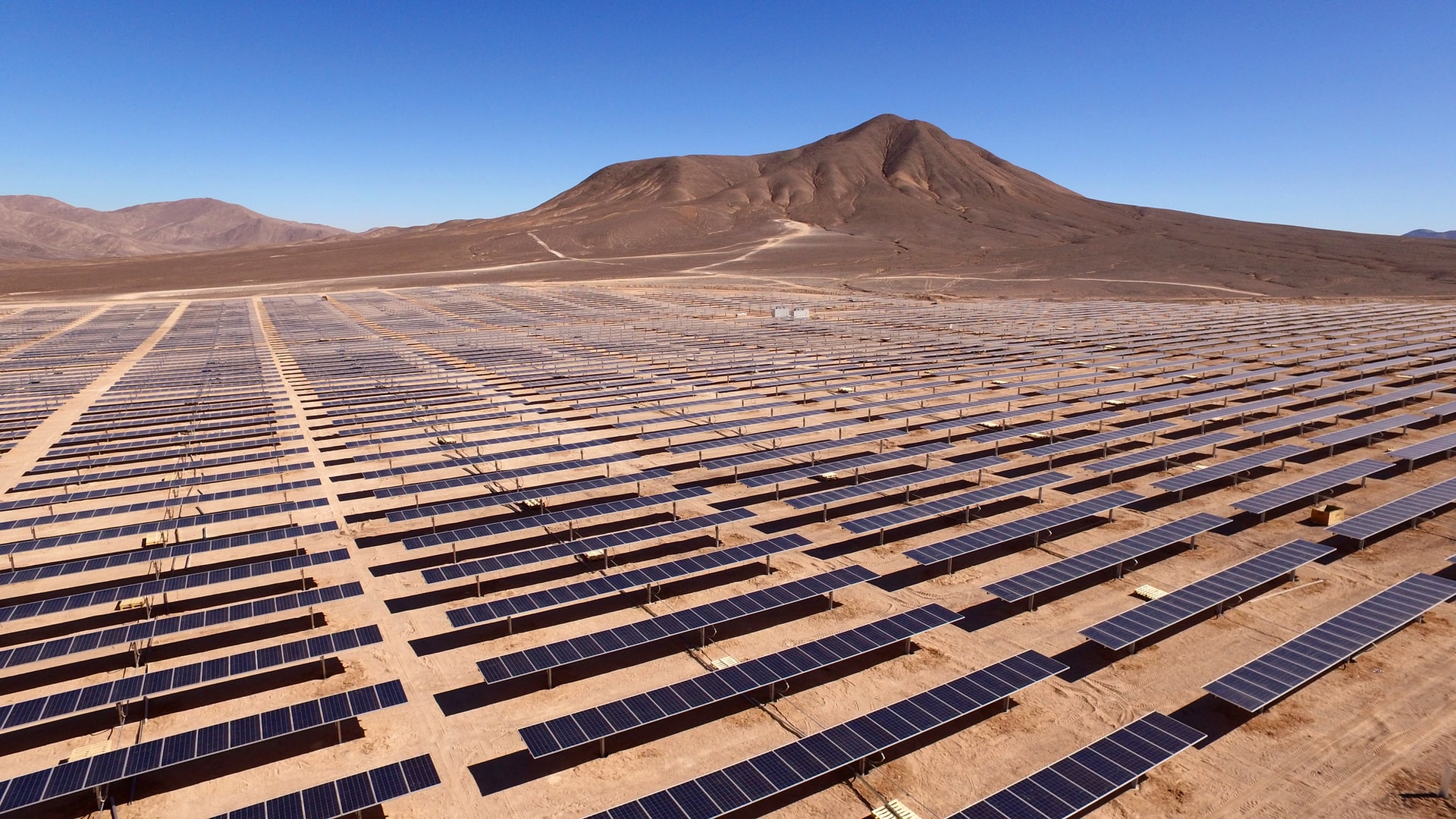 Conducting inspections of solar panel fields, especially larger installations, can take a long time. A drone, by contrast, can inspect a large solar field in a much shorter amount of time and at a lower cost than hiring a manned aircraft with thermal sensors. A drone can use its higher precision capabilities to monitor defects in solar cells and get exact measurements of other particularly critical issues at relatively frequent intervals.
Electrical Inspections
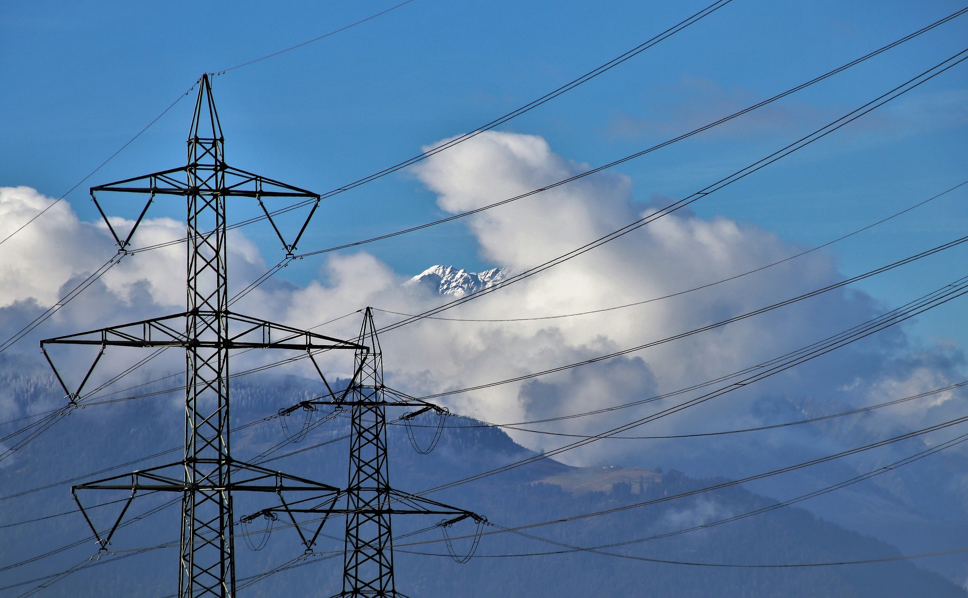
Electrical installations, such as power stations, powerlines, and voltage regulation devices, may more be easily inspected and checked for excessive heat spots, defective parts, and weak connections from a safe distance using thermal cameras and trained drone operators, eliminating any requirement for bulky devices or placing lives in danger.
Drones minimize costs and resources by reducing the number of engineers needed to carry out the task to only some drone operators and pilots with built-in or remote screens, even in difficult-to-reach locations.
Roof and Building Inspections

As one would expect, drone thermal imaging is beneficial for examining the exteriors of homes and businesses. It’s ideal for detecting leakages and identifying causes of power inefficiency and external problems. In the case of houses, this can save homeowners a lot of money on energy and maintenance costs when these issues are detected early.
Drones can also significantly reduce the time it takes to examine large structures and areas, so long as the particular drone can reach a high enough altitude, subject to technical and legal restrictions, to get a bird’s-eye view of the entire structure or area. When the drone operator identifies a problem area, he or she can then guide the drone closer for more precise imaging.
Road and Bridge Inspections

Thermal cameras are particularly suitable for assessing the extent of erosion on bridges and roads, as well as analyzing their general stability, so having them mounted on drones makes the inspection process much simpler, quicker, and far less expensive. Inspectors of large land or water bridges often have to climb hundreds of feet into the air, suspended over land or water, which puts their lives at risk. Drones can severely reduce or in many cases eliminate this requirement, which helps not only to keep insurance premiums and medical bills low, but can also prevent the loss of life.
Agriculture
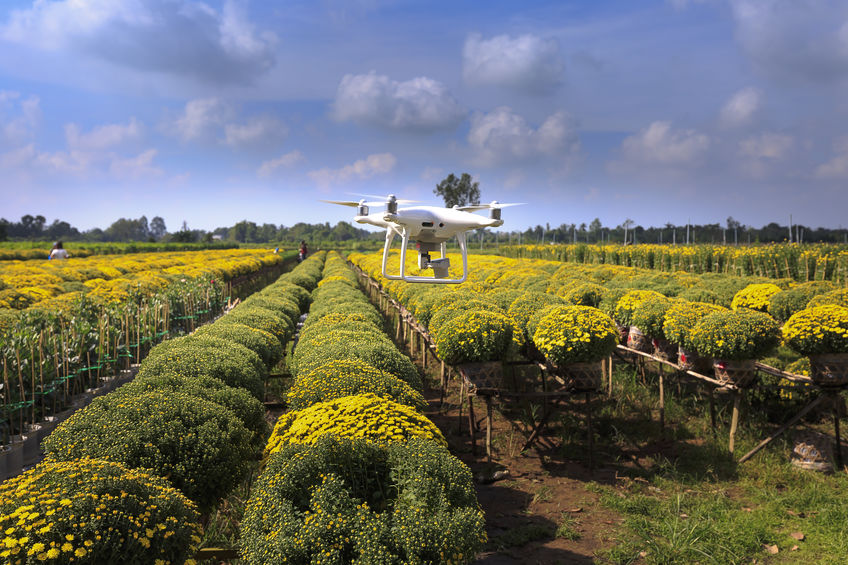
Drones are increasingly being used in agriculture because the thermal cameras available for drones can efficiently deliver accurate temperature readings, which can be used to identify the presence of crop pests and diseases, can measure acidity, and can determine other environmental factors that can negatively affect production. Cattle ranchers also use thermal drones to keep a record of their livestock and locate any cows that have run off away from the herd.
Oil and Gas
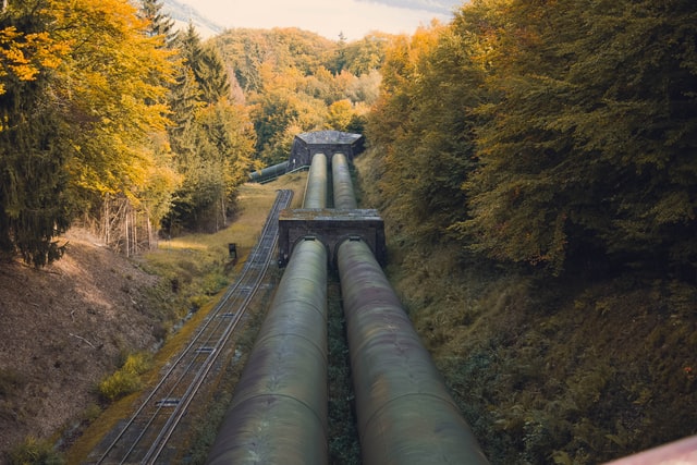
Refinery and pipeline monitoring are two particular fields of application for drone thermal imaging that fall into the oil and gas category. Thermographic drones fitted with optical gas imaging (OGI) sensors can easily detect leakage from a safe distance during refinery examinations. Pipeline checks are often carried out by fixed-wing drones rather than the more prevalent quadcopter drones because they can cover more ground as pipelines can run for miles.
When compared to the conventional use of manned aircraft, both systems are considerably less expensive. Often, thermal imaging drones will stitch several images into an actual 3D map to offer both a general summary and more precise details that reveal trouble spots as well as the lifespan of individual elements for later study, in addition to collecting high-resolution photos.
Public Safety and Security
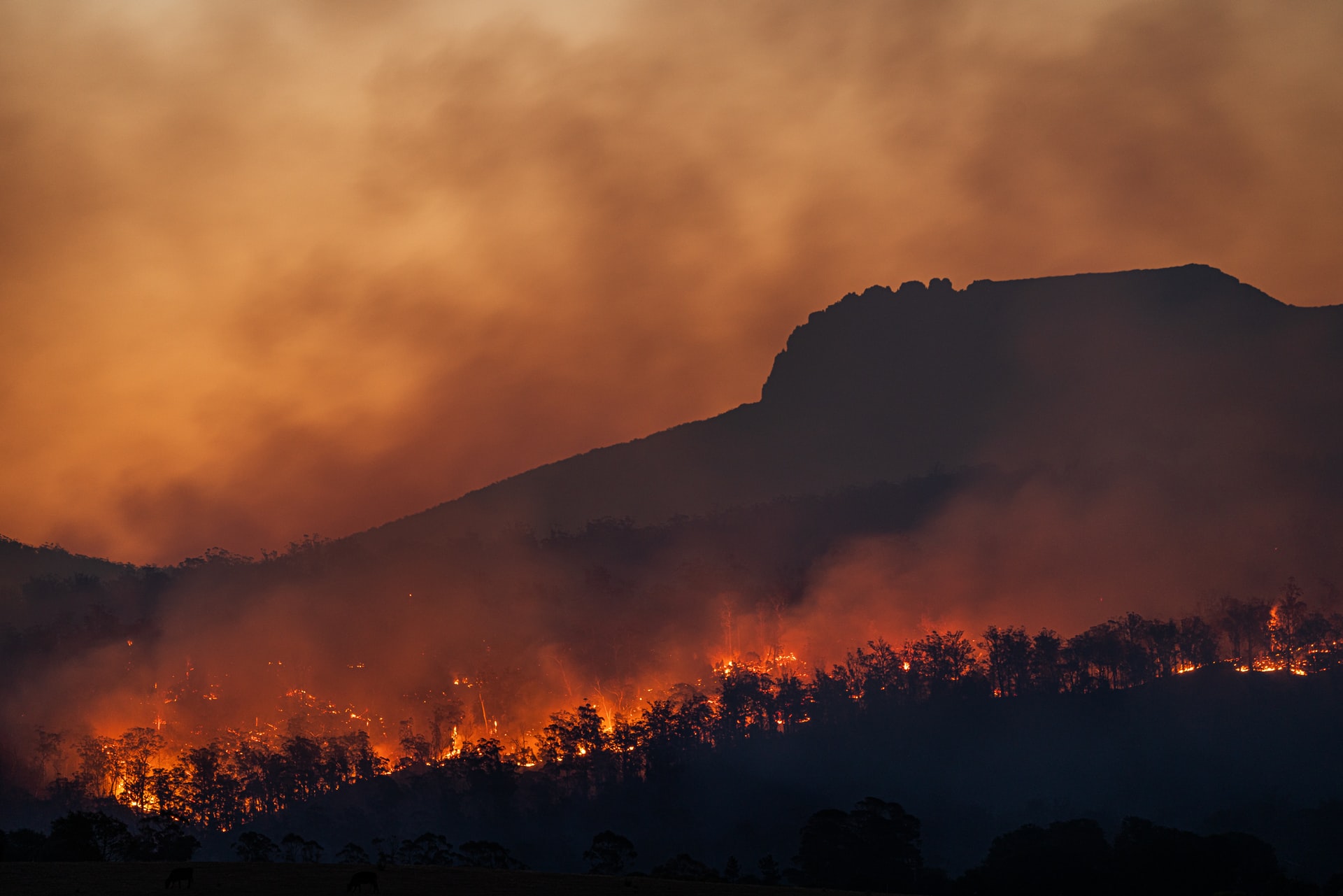
The most significant advantage that thermal drones have is for public safety and security. Relief and recovery operations, fire protection, and mobile monitoring are just a few of the applications that rescuers and security personnel have found drones with thermal cameras to be useful in.
Thermal camera-equipped drones are one of the most effective ways of locating missing individuals because they can detect people even in dark or partially occluded environments. When looking through the haze and visualizing the trouble spots from above, thermal drones can aid in the quick detection of forest fires and volcanic activity.
Since they are remotely operated, unmanned drones also protect personnel from unnecessarily risking their lives. Drone footage can be streamed and viewed in real-time for tracking, intelligence gathering, and to assist ground teams to avoid hazards while locating victims or dealing with environmental threats.
Potential Areas Of Concern With Thermal Camera-Equipped Drones
Privacy
Although drones have many advantages, they also have the potential to be misused by bad actors. Drones are widely available and the cost, even with advanced features like thermal cameras, is only coming down. This means that criminals or even just nosy neighbors can also acquire a relatively advanced drone and invade the privacy of other members of their community. Since loud propellor sounds are no longer the issue that they once were, a malicious drone operator can pilot a drone unnoticed and obtain valuable data on a target’s movements and habits. Being equipped with a thermal camera means that this surveillance can be conducted day or night.
Government officials can also employ this technology to infringe on the individual rights of citizens if there are not strong legal protections in place to prevent police and other law enforcement agencies from deploying drones against the citizenry.
Safety
When using drone technology, safety is the most crucial factor to consider. Drones with high-quality cameras can detect potential accidents and efficiently navigate their way through them, which is a useful feature. Drone navigation capabilities must be comparable to those of manned aircraft navigators.
Hiring experienced drone service operators that can fly an airborne drone without damaging it is essential. Drones flying over densely populated areas face a higher risk of ground impact or of causing injury or damage owing to machine failure or hacking.
Weather Dependent
As compared to conventional aircraft, drones are more susceptible to nature and climate conditions. In moderate to heavy rainfall or high winds, a drone cannot navigate properly or collect accurate data or imagery. That being said, there are drones on the market that are more durable and can effectively survive strong gusts of wind.
Conclusion
Drone pilots are discovering more opportunities to use thermal imaging sensors as the technology in this fascinating area advances. Drones equipped with thermal cameras are now being routinely used to increase solar plant performance, to monitor and check livestock, to quickly detect thermal runaway switches on electrical supply lines, to inspect infrastructure at mines, to maintain agricultural systems, and to assist in search and rescue missions. As drone technology improves and as new industries find uses for remotely-operated drones, the use cases for drones equipped with thermal cameras will only continue to grow.
Did you like this post? Read more and subscribe to our monthly newsletter!

