Interactive map reveals where drones are being flown inside the US
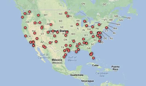
Did you think that unmanned aerial drones are used by army only somewhere far away… With the latest map made by Electronic Frontier Foundation, we’re starting to see a clearer picture of the rapid deployment of drones by military, state and local law enforcement inside the domestic United States.
Using data obtained through their Freedom of Information Act lawsuit against the FAA, the EFF have constructed an interactive map showing the locations where police, military, and others are currently authorized to fly drones in national airspace, as well as some details on the drones themselves and how they’re being used.

Drones are being used for variety of purposes. The California Department of Forestry has plans to use drones to fight forest fires. The Queen Anne County, Maryland Sheriff’s Department, will be using drones equipped with special imaging technology to surveil large patches of farmland for marijuana growth. And other drones are used for an entire city surveillance with special “Gorgon Stare” technology.
I’m just wondering how much we still don’t know…


