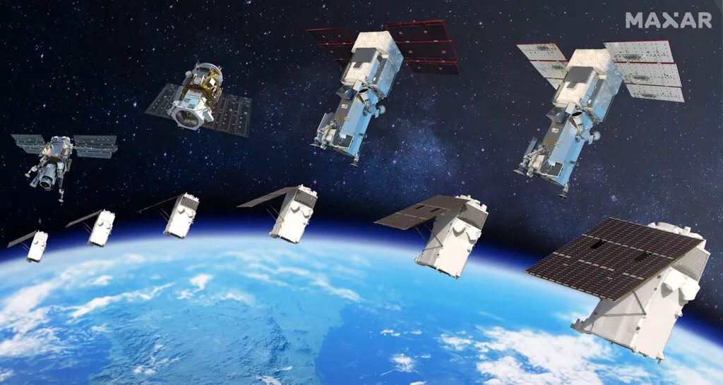
How Maxar’s constellation is setting new standards in precision, change detection, and revisit capabilities

With all six WorldView Legion satellites now fully operational, Maxar‘s next-generation constellation has ushered a new era of precision in the geospatial industry. The increased data capture capability delivers transformative impacts across various sectors, by providing clearer and more frequent images of the Earth’s surface.

Satellite imagery expert Chris Orndorff explains the groundbreaking technologies behind the expanded constellation, and how Maxar is helping users to harness the data captured by WorldView Legion.
The Technology Behind WorldView Legion
Fixed, mid-inclination orbits
Maxar’s WorldView-1, 2, and 3 satellites are sun-synchronous, fixed-orbit satellites, focused on capturing large swathes of data. Like most satellites, which are sun-synchronous, they always pass over a given area at the same time. 4 of the 6 WorldView Legion satellites go in a different direction: “With WorldView Legion, we are focused on taking our highest resolution imagery at 30 centimeters and making it more widely available by utilizing multiple different orbits.” WorldView Legion satellites are able to capture high-resolution data across vast areas more efficiently than ever before, due to their orbits and revisit capabilities.
Mid-inclination orbits (MIO) allow WorldView Legion’s satellites to cover a broad swath of the Earth’s surface, focusing on mid-latitude regions (between approximately 45N and 45S) where approximately 90% of the world’s population lives. They are crucial for capturing data across those highly populated areas of the Earth. And vitally, unlike satellites with a traditional Sun-synchronous orbit, the mid-inclination orbits also allow them to capture data at different times of a day. “The MIO satellites won’t see Northern Europe or the northernmost parts of Canada,” explains Chris, “but the areas they do see, they’ll see more frequently—in some cases you might even have multiple passes by a single satellite over a location within the day.”
Multiple revisits in a single day have specific benefits for diverse monitoring applications. The entire constellation can achieve upwards of 15 crossings per day in certain areas of the world. This capability enables Maxar to effectively balance coverage and revisit capabilities. For instance, it accommodates differing weather and light conditions. Coastal regions in particular can build up cloud cover at different times of day depending on land mass and wind patterns, and frequent revisits can overcome this issue. “The MIO orbit gives us a lot more opportunity to collect in some of these notoriously cloudy regions,” says Chris.
Impact on Urban Mapping: The mid-inclination orbits enhance the constellation’s ability to monitor changes and maintain up-to-date imaging over key geographic regions. These mid-latitude regions include some of the world’s most rapidly changing environments—and significantly, most of its urban centres. As such, capturing detailed satellite imagery with increased regularity is of utmost strategic importance.
![]()
Detailed Change Detection and Timely Updates
Urban areas are dynamic, continually evolving landscapes where new developments and changes occur frequently. The expansion of these regions through urban sprawl often leads to increased pressure on infrastructure, services, and the natural environment, so efficient monitoring is crucial for city planning and sustainable development.
The ability to quickly digitize new features as they are built is also vital for keeping urban maps relevant. Ensuring that new residences, roads and structures appear on maps in a timely manner is essential for emergency services, delivery services, and public information. Changes around important cultural landmarks or critical infrastructure can have particularly significant implications for urban mobility.
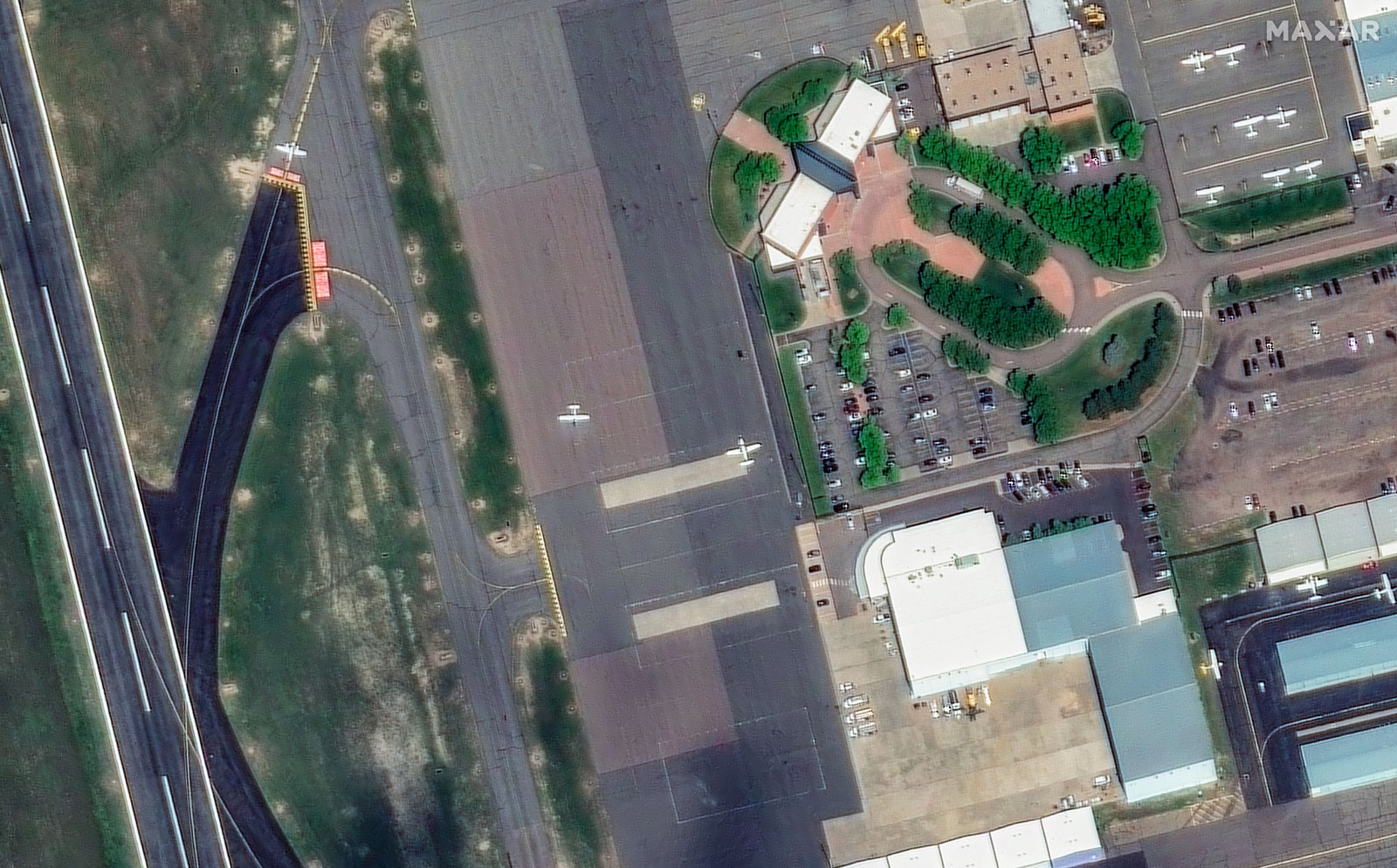
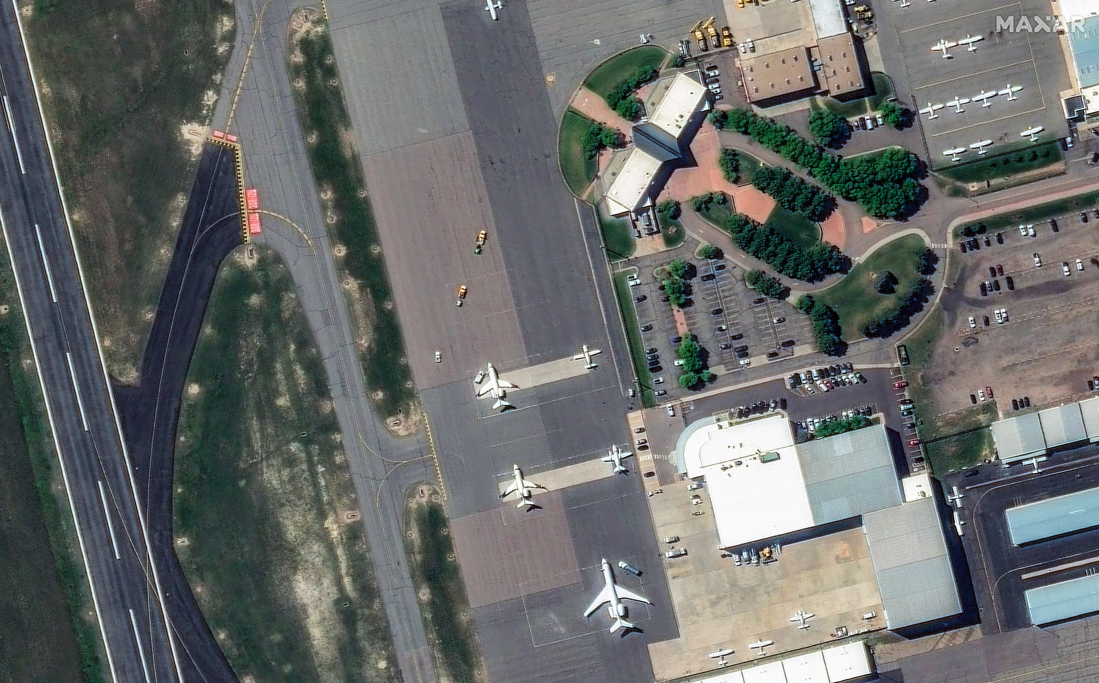
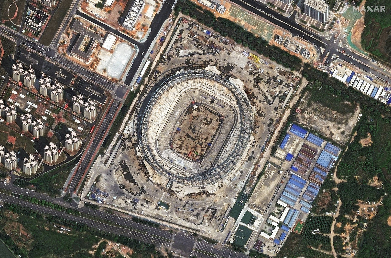
Chris explains why timeliness is such a big differentiator between satellite and aerial imagery: “ For the construction of major landmarks like cultural centers or stadiums, it’s vital to know exactly when they are completed so maps can be updated for navigation. Aerial observation, even for a large city, might only happen once a year, meaning a completed construction project could take up to a year to be reflected on a map. This is a very slow way to keep maps current.”
Maxar’s WorldView Legion satellites are now helping to detect these urban changes with unprecedented detail and timeliness. To do this efficiently, Maxar takes low-resolution data from broader civil government sensors and validates it against its own AI-powered analytics to pinpoint changes. The company employs a number of cutting-edge technologies to increase speed and efficiency:
Advanced Techniques in Change Detection: Ignoring Noise and Prioritizing Collections
One of the significant challenges in satellite image analysis is differentiating meaningful changes (like new constructions) from changes that are not relevant (like seasonal vegetation changes). Maxar’s advanced imaging technology and analysis tools allow for the precise identification of relevant urban features, such as roads and buildings, filtering out irrelevant ‘noise’. “A lot of change detection just shows you the difference between A and B,” says Chris, “and with EO- or SAR-based imagery, you pick up a lot of noise when doing comparisons, whether they be seasonal patterns in grass or lighting conditions. We want to make sure that that noise is not interfering with what we’re trying to do.”
Another big issue that Maxar is tackling concerns change detection within an established urban landscape. These areas are typically more difficult to monitor because of their complexity. Maxar employs an AI-driven mapping technique to highlight areas that show relevant changes. This approach allows for more focused imagery capture and analysis in regions with high development activity, ensuring resources are allocated where they are most needed. “Our building and road change vectors show us where we need to focus new collections: If our algorithms identify enough change, we prioritize those areas.”
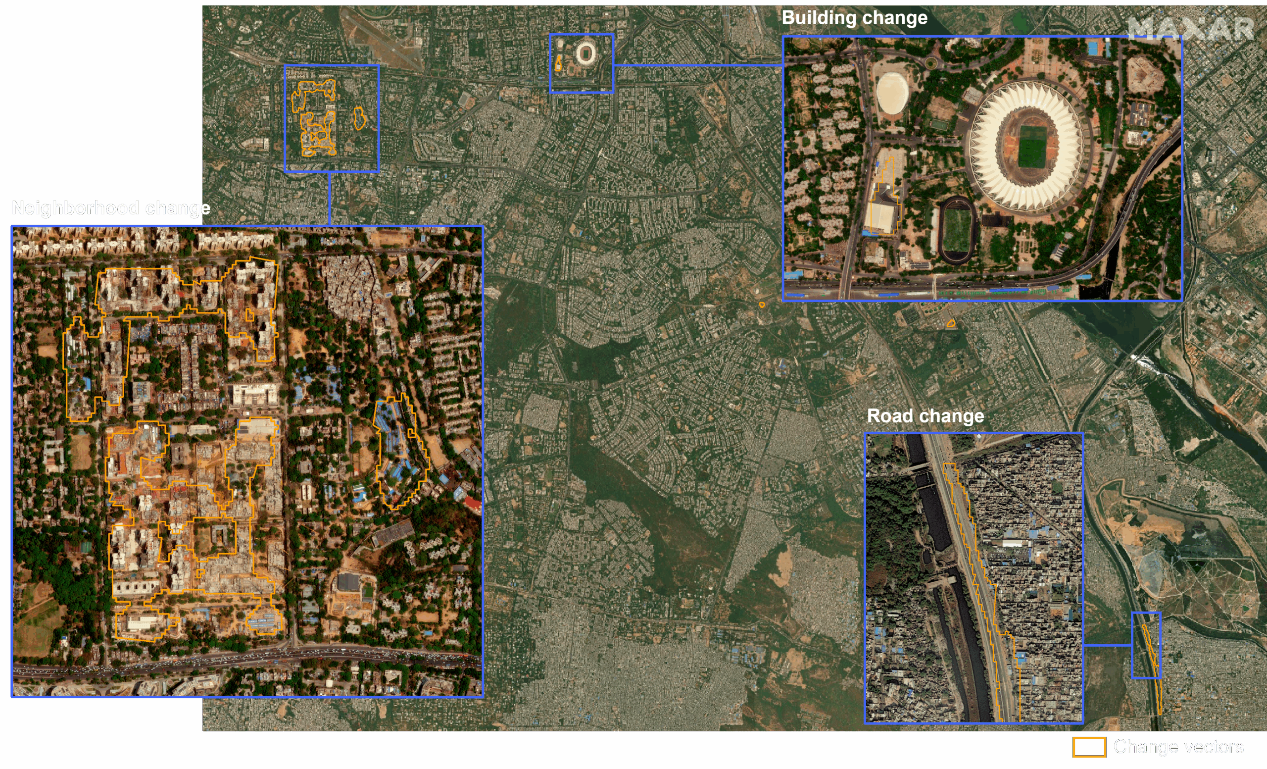
Maxar Building & Road Change Vectors in New Delhi, India, help mapmakers identify relevant construction and developments reshaping the environment.
Further applications
Improving urban monitoring and mapping may be one of WorldView Legion’s most valuable applications, but its ability to provide very frequent revisits and high-resolution data has further uses across a wide range of industries:
Environmental monitoring: Specific spectral bands can be of enormous value when it comes to monitoring environmental changes. Specifically, says Chris, they are excellent for monitoring vegetation health: “We have found that you can get increased precision around agricultural indicators, like soil moisture, from some of those near-red edge indices.”
Defense and Security: WorldView Legion offers clear benefits for defense and national security, where high-resolution, frequently updated imagery can aid in detailed surveillance and tactical planning. Meanwhile, capturing images before and during large cultural events like the Olympics or political rallies can make it easier for authorities to keep people safe.
Disaster response: In the wake of natural disasters or other crises, detailed, near-real-time imagery can help to assess damage, as well as aiding with the allocation of resources or keeping first responders safe.
Financial: Frequent revisits can make a huge difference to financial organisations, who may be monitoring ports to assess the movement of specific cargo, or assessing stockpiles of commodities at mining sites etc.
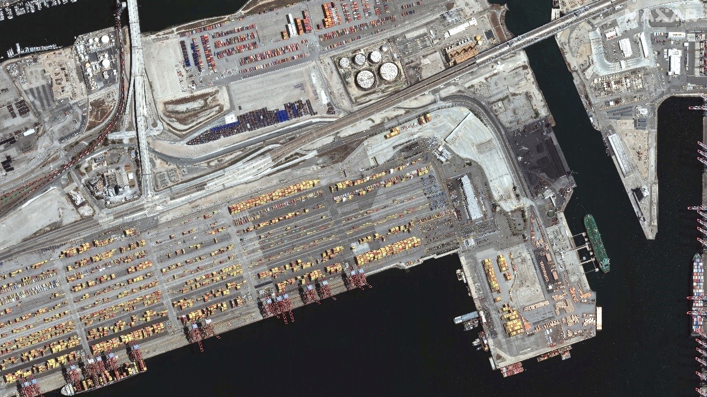
This high-definition WorldView Legion image shows shipping containers at the Port of Long Beach in California.
Enhancing Global Mapping Standards
WorldView Legion’s advanced imaging and revisit capabilities are poised to have a transformative effect on the mapping industry, enhancing global data coverage. “What’s really exciting,” says Chris, “is the speed at which we can detect changes and update the maps you use on your phone or in your car. You can see changes almost in real time. For example, if a stadium opens tomorrow, it will appear on your map, and you’ll know how to get there, where to park, or which public transit to take.”
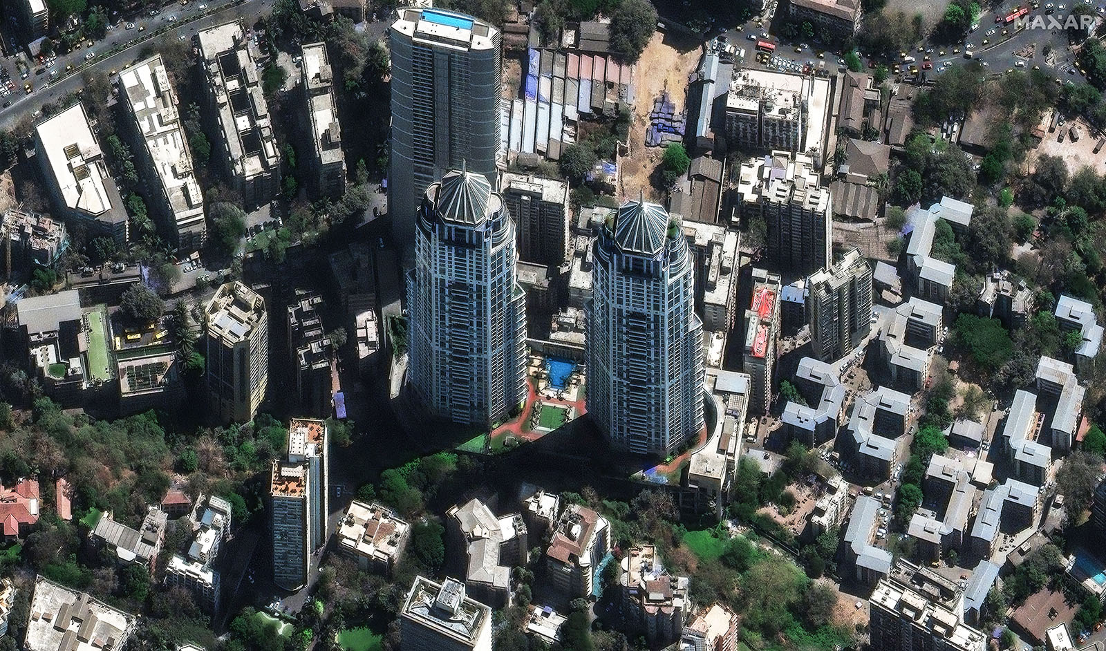
There is also the potential for these technological advancements to standardize high-resolution mapping globally, providing detailed satellite imagery to previously under-mapped regions, something Chris is passionate about: “This is about providing the same experience around the world that people in the US or Europe or Australia or Japan have come to expect. We expect the features on our vector maps to be really crisp and of high detail, and for the basemap to have very high resolution. I want somebody in Mumbai to have the same experience as somebody in Miami. I would love to see a world where the entire basemap is 15 centimeters, as standard.”
As we look to the future, ongoing innovation in satellite technology is going to be of huge strategic importance, and will continue to play a driving role in the way we map and monitor our rapidly changing world.


#Ideas

Next article
Open GeoAI Innovation – How Projects like MMEarth Are Accelerating Geospatial AI
GeoAI is not only the domain of tech giants; a vibrant community of researchers and open-source contributors is also driving the field forward. One notable example is MMEarth (Multi-Modal Earth), an academic project that has created a massive geospatial AI dataset and model. While Google’s AlphaEarth and Google Earth AI is proprietary, MMEarth represents a collaborative, open approach – and its advances are poised to benefit the entire geospatial industry. In this article, we examine how MMEarth and similar initiatives are laying the groundwork for more accessible and powerful GeoAI, and why that matters for enterprises and investors.
MMEarth – A Multi-Modal Foundation for Geospatial Learning
The MMEarth project (spearheaded by researchers from University of Copenhagen and others) set out to address a fundamental challenge: the huge volume of unlabelled Earth observation data and the relative scarcity of labeled datasets for training AI. Their insight was that satellite imagery can be self-supervised by pairing it with other co-located data layers automatically – for example, combining an optical satellite photo with radar data, elevation maps, land cover type, climate readings, etc., all tied to the same location and time. By doing this at scale, an AI model can learn useful representations of Earth without needing humans to label every feature.
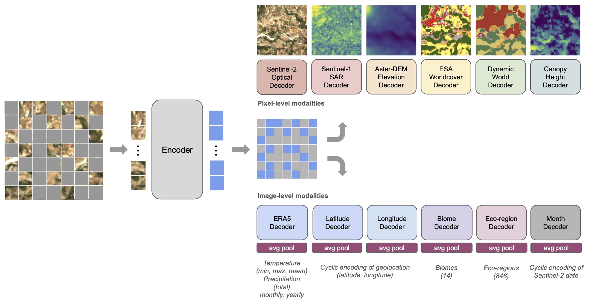
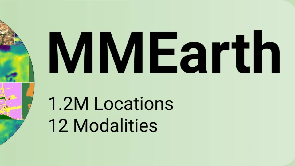
The result is MMEarth, a diverse multi-modal pretraining dataset at global scale. It covers 1.2 million locations worldwide, each with data from 12 different modalities aligned (from multispectral images to climate stats). This makes MMEarth’s image collection comparable in size to the famous ImageNet dataset (which has ~1 million images) – a noteworthy milestone for the geospatial field. Importantly, the locations were sampled across 14 different biomes (tundra, forests, deserts, mangroves, etc.) to ensure a rich variety of environments, and across multiple years to incorporate temporal variation. In other words, MMEarth was designed to avoid bias toward any one region or landscape, aiming for a truly global representation. For businesses, this broad coverage means AI models trained on MMEarth are more likely to generalize well – whether you’re analyzing farms in Brazil, forests in Indonesia, or cities in Africa, the model has “seen” something similar during training.
Using this corpus, the researchers trained a Multi-Pretext Masked Autoencoder (MP-MAE) – essentially an AI model that learns to predict missing bits of data across different modalities (a form of self-supervised learning). The outcome was impressive: the MMEarth-derived model outperformed models pretrained on generic images (ImageNet) as well as those trained on single-source satellite imagery on a suite of downstream tasks like land cover classification and segmentation. In particular, using multi-modal data gave the model a big boost in situations with very few labeled examples, achieving higher accuracy with limited training data. This implies that an AI built on MMEarth can be fine-tuned for a specific task with far less manual labeling – a significant cost and time saver. As the authors noted, pretraining on multi-modal Earth data led to “better label efficiency and parameter efficiency, crucial aspects in global-scale applications.”
All of MMEarth’s dataset and code are open source. This means any organization can leverage the work: if a startup wants to build a new crop disease detection AI, they could start with MMEarth’s pretrained model as a base, rather than starting from scratch. Large tech companies have the resources to train models like AlphaEarth, but MMEarth democratizes some of that capability to the wider community. We are already seeing its impact: open-source geospatial libraries (e.g., Facebook’s TorchGeo) have integrated MMEarth data to allow developers to experiment with these multi-modal models. The GeoAI research community is also building on MMEarth to study fairness and biases (ensuring an AI doesn’t perform poorly in underrepresented regions).
The Power of Open Collaboration in GeoAI
Open initiatives like MMEarth illustrate how collaboration can accelerate GeoAI innovation. By pooling data from sources like ESA’s Sentinel satellites, NASA’s climate datasets, etc., and sharing the results, researchers created a resource that many others can use. This collective approach is particularly valuable in geospatial domains: data is diverse and no single entity has it all. When academic, public, and private sectors contribute, the resulting models are more robust and widely applicable.
For enterprises and decision-makers, the influence of projects like MMEarth may be indirect but important. They expand the frontier of what AI can do with geospatial data, often publishing findings openly. For example, if MMEarth reveals that incorporating radar and elevation data improves building detection in dense urban areas, a company developing its own AI for smart city planning can take that insight and run with it. Essentially, open research acts as R&D for the entire industry.
Another advantage is talent development. As geospatial professionals experiment with open data and models like MMEarth, they build skills that will flow into industry. The next generation of GeoAI practitioners may very well cut their teeth on open projects and then bring that expertise to enterprises or startups. This enlarges the talent pool for geo-focused AI, addressing a common pain point for companies trying to hire in this niche.
Investors, too, are paying attention. In recent space-tech and AI forums, experts have highlighted how combining multiple modalities of data (imagery, sensor, IoT) is key to unlocking new Earth observation analytics. An investment director might look at a company leveraging MMEarth and see a lower technical risk – because the core tech has been peer-reviewed and the training data is available, the company can focus on the value-added application (whether it’s precision agriculture, mineral exploration, or climate risk assessment). The presence of a strong open ecosystem around GeoAI can de-risk innovation and invite more funding into the space.
Did you like the article? Subscribe to our monthly newsletter!

