#Business #Environment #Featured #Satellites

How Earth Observation is Transforming Wildfire Monitoring and Management

Editor’s Note: This article is part of Geoawesome’s ongoing effort to raise awareness and foster dialogue within the geospatial sector. As an independent voice in the community and as a source of market intelligence, we see it as our mission to share insights that inform, inspire, and spark collaboration. We’d love to hear your thoughts—reach us anytime at info@geoawesome.com.


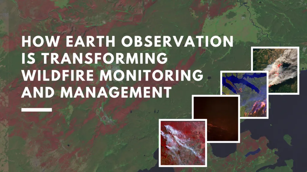
Wildfires are among the most devastating natural disasters, threatening ecosystems, human lives, and property. With climate change accelerating the frequency and severity of these events, timely and accurate monitoring has become critical. Earth observation technologies are at the forefront of this effort. These technologies provide invaluable data for early detection, real-time tracking, and post-fire assessment. This in-depth paper will present the impact of satellite-based EO on wildfire management, highlighting stakeholders, significant advancements, and the expanding role of AI in forest fire mitigation.

Key Players, Data Providers and End-Users in Wildfire Monitoring

Notable Developments and News

Advancements in AI Integration

Artificial Intelligence is revolutionizing wildfire management by processing vast datasets to forecast risks and fire behavior. In California, AI algorithms now analyze meteorological data, vegetation moisture levels, and historical fire patterns to predict fire paths in seconds. These forecasts are becoming critical tools for firefighters and emergency managers.

Read more: The Guardian – How AI is Revolutionising Firefighting

Global Efforts in Satellite Deployment

In September 2024, Sentinel-2C was launched by Arianespace as part of the Copernicus program. The new satellite enhances monitoring of forests, urban expansion, and environmental emergencies, including wildfires. It adds to the world’s largest environmental monitoring program, reinforcing Europe’s EO capabilities.

Challenges in Early Detection

Despite the progress in EO and AI, early detection alone cannot prevent fires from becoming uncontrollable. Rapid fire spread due to wind and extreme heat remains a significant challenge. As Wired reported, even with faster detection, the combination of climate extremes and fuel buildup can overwhelm response efforts, underlining the need for integrated fire strategies.

CO2 Emissions from Wildfires

Wildfires are now a major source of greenhouse gases. In 2024, fires contributed to a record increase in global CO2 levels. The Guardian highlighted the role of fires in driving climate change, creating a feedback loop that could lead to more frequent fires in the future.

Regional Highlights: The Americas

The Copernicus Atmosphere Monitoring Service noted that the Americas experienced exceptional wildfire activity in 2024. Drought conditions and extreme weather were key contributors. EO data has been essential in understanding these patterns and coordinating international response efforts.
Wildfires in the United States

According to the latest NOAA report, wildfire activity in the U.S. continues to trend upwards, with longer fire seasons and increased burn areas. Real-time satellite mapping and weather forecasting are now critical components of federal and state fire response strategies.

Maps and Products for Wildfire Monitoring

Looking Ahead

The future of wildfire monitoring depends on better satellite coverage, smarter AI tools, and easier access to fire data. New technologies and community efforts like Earth Fire Alliance are helping people around the world detect and respond to fires more effectively.

However, challenges remain. Investment in resilient infrastructure, interdisciplinary cooperation, and public engagement are essential to translate EO data into effective action.

How do you see the role of EO evolving in wildfire response? Are there local efforts or technologies that deserve more attention? Send me an email at sebastian@geoawesome.com and join the conversation.


Do you like this article? Read more and subscribe to our monthly newsletter!

Say thanks for this article (0)
The community is supported by:
Become a sponsor
#Business
#Environment #Fun #Satellites #Science
Exploring the World of Google Earth Engine Through Time-Series Visualizations
Sebastian Walczak 06.5.2024
AWESOME 2
#Contributing Writers #Environment #Fun
Flow in Motion: A Step-by-Step Guide to Animated Flow Maps
Sebastian Walczak & Nikita Marwaha Kraetzig 02.27.2025
AWESOME 1
#Contributing Writers #Environment #Fun #Satellites #Science
Super-Resolution for Satellite Imagery Explained
Sebastian Walczak & Nikita Marwaha Kraetzig 07.18.2024
AWESOME 2
Next article
#Business #Environment #People

The Role of Geospatial Technologies in Decarbonization and ESG

As the urgency to combat climate change intensifies, businesses and governments are increasingly turning to geospatial technologies to inform data-driven decisions related to sustainability, urban planning, and compliance. In the first episode of Geoawesome’s Problem Solved podcast, hosts Muthu and Aleks explore how geospatial solutions are redefining the landscape of environmental, social, and governance (ESG) reporting and decarbonization strategies. Their guest, Bobbie Kalra, founder of Magnasoft, shares insights on how geospatial technology is revolutionizing sustainability strategies, particularly in the built environment.

Buildings: A Major Contributor to Global Emissions

It is estimated that buildings account for a staggering 39% of global CO₂ emissions. Managing and reducing this footprint is a complex challenge that requires accurate, scalable data collection. Historically, emissions analysis and sustainability reporting have relied on costly, time-consuming surveys and high-end laser scanners. However, recent advancements in geospatial methods have streamlined this process, reducing costs by up to 60%.

Scalable Data Collection with DIY Geospatial Models

Magnasoft has developed a cost-effective method for assessing building emissions using iPads and mobile LiDAR. Instead of deploying costly hardware, property owners and facility managers can use readily available devices to collect detailed spatial data, which is then analyzed remotely. This “Do-It-Yourself (DIY) model” enables organizations to:

  • Capture real-time building data without technical expertise
  • Reduce the need for on-site survey teams
  • Streamline compliance reporting while maintaining high data accuracy

This approach aligns with the growing demand for scalable and automated ESG reporting. Such reporting is critical for organizations aiming to comply with standards such as BREEAM, LEED, and NEN 2767.

Remote Sensing and Multi-Sensor Integration

Geospatial technologies are evolving to integrate multiple data sources, including aerial imagery, mobile LiDAR, and remote sensing, to assess urban and environmental landscapes at scale. For instance, Magnasoft has successfully implemented solutions to map entire cities’ building inventories, helping governments and corporations make informed sustainability decisions.

This integration enables:

  • Automated identification of inefficient buildings
  • Simulated models to estimate decarbonization potential
  • Predictive analysis to guide renovation and decommissioning efforts

Compliance and Business Needs Driving Geospatial Adoption

The geospatial industry has always been technology-driven, but widespread adoption in ESG is a recent development. Governments are introducing stricter carbon reporting mandates, such as the EU Corporate Sustainability Reporting Directive (CSRD) and the Task Force on Climate-Related Financial Disclosures (TCFD). These frameworks require businesses to quantify and disclose their environmental impact, and geospatial data plays a pivotal role in ensuring transparency.

For companies grappling with ESG compliance, integrating geospatial solutions can yield a competitive advantage by offering:

  • Accurate lifecycle assessments (LCA) of assets
  • Standardized carbon footprint calculations
  • Continuous monitoring of decarbonization efforts

From Overengineering to Practical Solutions

A key point that emerged from this discussion is the importance of geospatial companies aligning their efforts with real-world business challenges, rather than solely concentrating on technological development. While the geospatial industry has historically been deeply rooted in academic research and remote sensing advancements, its commercial application remains underutilized. To address this discrepancy, industry leaders must:

  • Engage more closely with end-users to understand operational pain points
  • Develop lightweight, cost-effective solutions tailored to specific ESG challenges
  • Simplify technology adoption for non-technical stakeholders

What Is The Future of Geospatial for Sustainability?

The global race to achieve Net Zero by 2050 (Paris Agreement) has placed decarbonization at the forefront of corporate agendas. However, despite significant advancements in geospatial technology, adoption remains slow. The next decade will be critical in determining whether geospatial becomes a mainstream or remains a niche solution known only to a few experts.

Bobbie predicts that in the near future, geospatial solutions will be seamlessly integrated into ESG reporting, much like how navigation technologies are now an invisible yet essential part of daily life. In this scenario, companies will no longer need to “learn” geospatial tools, as they will be embedded into standard decision-making workflows.

Resources for Further Exploration

For those looking to explore decarbonization solutions further, here are some key resources:

Final Thoughts

Geospatial technology is emerging as a powerful enabler of ESG and decarbonization efforts, offering businesses the tools to assess, monitor, and reduce emissions efficiently. As regulatory compliance requirements intensify and the urgency for climate action increases, the adoption of geospatial solutions will transition from being an option to a necessity.

Innovative approaches, such as DIY LiDAR data collection and multi-sensor integration, are being demonstrated by companies like Magnasoft. These approaches show how the geospatial industry can move beyond academic applications and deliver tangible value to businesses. As the Problem Solved podcast series progresses, it will be intriguing to observe how other industries leverage geospatial intelligence to tackle the world’s most pressing challenges.

Read on
Search