#Business #Featured #GeoDev

Google Maps API pricing got you down? See these awesome alternatives

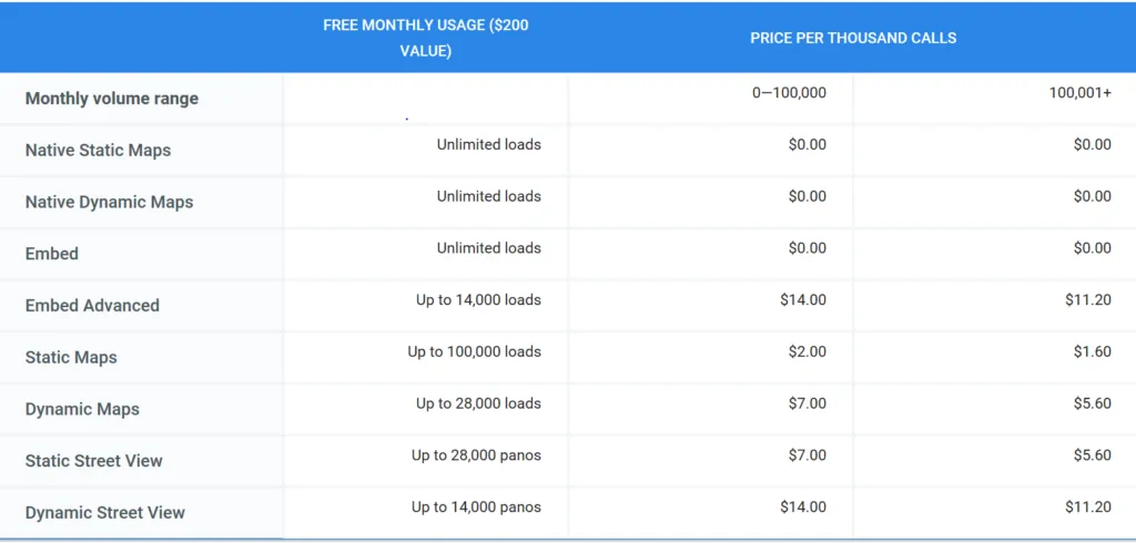
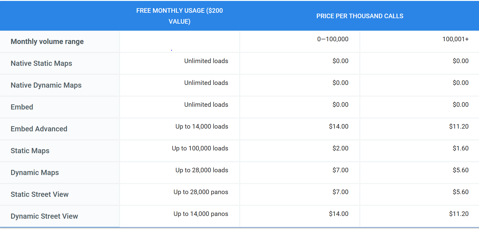
Come June 11 and using Google Maps API is going to get a whole lot expensive for those of you looking at more than 25,000 transactions per month. See the Google Maps API pricing structure that goes into effect that day:
Read: Insane, shocking, outrageous: Developers react to changes in Google Maps API

If you’re as bummed out about the recent changes announced by Google for its Maps platform as we are, you have come to the right place. With less than 6 weeks to go before the amendments take effect, developers have their work cut out for them: Audit, change, test, and deploy an alternative. So, here’s something that may make the job just a teensy bit easier: A list of Google Maps API alternatives you can give a try.

[Update, Dec 16, 2020: Amazon Web Services teams with Esri, HERE to offer developers affordable, pay-as-you-go location-based data, mapping services]

1) TomTom
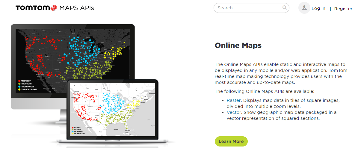
One of the first platforms that come to mind when you think of a reliable Google Maps API alternative, TomTom offers developers 2,500 free daily transactions, global customer support, and a really lucrative pay-as-you-grow credit package. Depending on your volume and usage, you can expect additional transactions to be charged at $0.5/1000 call or even less.

Explore TomTom Maps APIs here.

[Update 25th September 2018: We interviewed TomTom’s head of developer relations, Gregory De Jans to learn more about their mapping APIs. Here’s all you need to know about TomTom’s Mapping APIs]

2) Mapbox
If someone recognizes an opportunity when they see it, it’s the team at Mapbox. As soon as the Google Maps API news broke, Mapbox CEO Eric Gunderson made a clarion call to developers to join his bandwagon. Between now and June 11, any developer who is new to Mapbox can sign up and use all the pay-as-you-go APIs for free. You don’t even need to add a credit card to get started. Just tweet #WeAreBuilders to Mapbox along with a link to your map.

Explore more here.

3) HERE
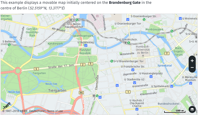
The force behind Bing Maps (which are inexplicably expensive, IMO), HERE offers a powerful set of developer tools with great features. Though its free tier has less free calls per day, at $49 for 100,000 monthly transactions, HERE’s API gives you better ROI than Google Maps’. And did we mention you can use their 90-day free trial key without sharing any payment information?

Find out more about their public and business plans here.

4) Leaflet

This modern, open-source JavaScript library has quickly become very popular among developers because of its flexibility and the fact that. If you are looking for complete freedom from ambiguity, one good option would be to run your own tile server based on OpenStreetMap and then connect to it using Leaflet. Another try-worthy combination for some projects could be the Esri-Leaflet one.

You can find out more about Leaflet API reference here and OSM’s Tile Usage policy here.

5) OpenLayers
Capable of pulling tiles from several different mapping sources (Bing or OSM background, vector data from KML or GML files, WMS overlays, etc.), OpenLayers is another open-source JavaScript library that you can use to display pretty much any free map service. And with its large fan base and active community members, you can expect to find well-document information and plenty of live demos to get you started.

Find more information here.

6) LocationIQ
If your project requires geocoding or reverse geocoding, LocationIQ could be a good alternative. Its super-affordable pricing model gives you 10,000 free transactions per day for non-commercial use, while for commercial users, the bestselling plan is that of 50,000 calls per day for $100. LocationIQ’s data is powered by OpenStreetMap.

Get to know them here.

7) MapTiler
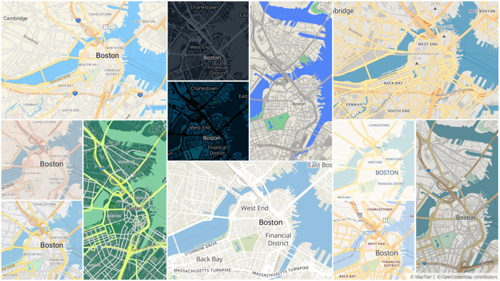
Google Maps API alternative MapTiler | By Ishveena Singh
Powered by open-data and open-source software, MapTiler provides global Street and Satellite Map APIs. MapTiler is compatible with Leaflet, OpenLayers as well as open-source Mapbox SDKs (including Android, iOS and Unity games) thanks to vector tiles, giving developers the much-needed freedom of choice of the tools. Their maps can be easily customized with brand colors, tightly integrated or even redistributed — all at 80% less cost than Google Maps.

8) AND

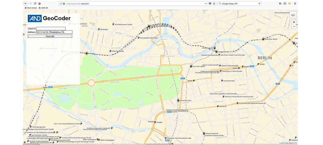
Headquartered in the Netherlands, AND comes with three decades of experience in providing APIs for location-based services. Their Map API is powered by the proprietary worldwide AND Maps and they offer the full spatial functionality based on data from OpenStreetMap. Standard features include Map Viewing, Geocoding and Reverse Geocoding.

Find out more here.

9) Sygic Maps
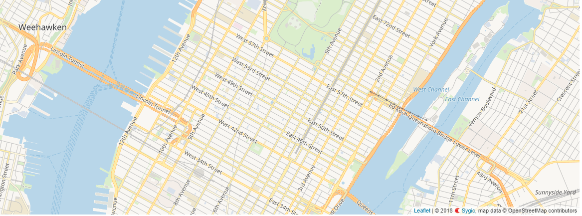
Sygic is an enterprise-grade map-agnostic platform that features Cloud-based maps from HERE, TomTom, OSM and others. Though their pricing is not available online, they assure us that it is quite affordable and extremely transparent, and has helped them garner 200 million users in the last 15 years. A trial API key is available on a simple request here.

10) Jawgmaps

Paris-based Jawg’s API has a free tier which would give you 50,000 map views for non-commercial usage. The super-useful video above shows how you can switch from Google Maps to Jawgmaps in just 1 minute! And the good part is you would understand it even if you don’t know French. To see their complete pricing structure, click here.

Of course, this is not an exhaustive list and there are plenty more Maps API alternatives out there. Foursquare has great geocoding features, while those who host their data on CartoDB can easily utilize Carto’s API services. Esri’s powerful ArcGIS platform can prove to be the best bet for some projects, and OSM’s database is utilized by several other API providers.

In fact, if you want to switch to OpenStreetMap, this website has a full list of companies that offer consulting, tile-hosting or other services for sites wishing to switch to OSM. You can even see which company is based where, check out the basics of making the switch, see case studies, and basically find out all the information you need.

If you have a recommendation that you think could help others out, feel free to leave a comment below. Also, let us know your thoughts on this subject by voting on this tweet:

For your geocoding needs: OpenCage

OpenCage focuses just on the geocoding piece. The offer an API for forward and reverse geocoding based on open data sources like OpenStreetMap. There is a free-trial tier and then different pricing plans depending on volume. One unique point is there is no “surge” pricing, so if you have a spike in usage or just need to geocode a bit more you do not get hit by a surprising bill.

All the details are on the OpenCage site, where they have a detailed guide to switching from the Google Maps API.

Say thanks for this article (0)
The community is supported by:
Become a sponsor
#Business
#Business #Events
SatSummit 2024 Reflections: The evolving landscape of Earth Observation
Avatar for Florian Fichtner
Florian Fichtner 05.22.2024
AWESOME 9
#Business #Fun #Ideas #People
History of GIS | Top 6 Figures in GIS and Geospatial
Nikita Marwaha Kraetzig 08.12.2024
AWESOME 2
#Business #Environment
Major milestone achieved towards building a green supply chain with the Supply Chain Data Partnership’s new global location register
Nikita Marwaha Kraetzig 12.8.2023
AWESOME 1
Next article
#Business #Ideas

Meet Spatial ai – the startup that is building a dashboard for the living city! #TheNextGeo

The world’s population is increasingly urban. By 2045, close to 6 billion people are expected to be living in cities (UN report). An increasing urban population and ever-changing dynamics in a cities mean that we need a (way) better method to understand our cities and how we as humans interact with the physical environment around us. We need to be able to have the same amount of knowledge a local would have in a small town and be able to understand our cities in the same way. Can social media (and spatial AI) help? Spatial, the startup from Cincinnati certainly thinks so!

I am really excited to talk to Lyden Foust, CEO of Spatial about his vision for building “a dashboard for the living city” using conversations from social media. Lyden and Spatial ai literally “blew my mind” when I first spoke to them last year and its a pleasure to interview them as part of the #TheNextGeo series. Here’s what Lyden had to say about Spatial and his vision. Read on! 

Spatial ai Team

The team behind Spatial ai. From Left (Jimmy Chase, Jack Schroder, Griffin Morris, Nathan Rooy, Phillip Martin, Will Kiessling, Lyden Foust, Chad Gardener).

Spatial is a location data company that uses conversations from social networks to understand how humans move and experience the world around them.

Q: You used to work as an ethnographer before you started spatial.ai, what motivated you to dive into the world of maps and data science? When did you decide that you wanted to start your own company?

A: First of all, since playing Sim City 2000 I have been hooked on how cities move and change. Then while reading Lord of the Rings I became fascinated with Tolkien’s maps. I thought this had little to do with my day job as an ethnographic researcher, where I studied communities for companies like Procter & Gamble or Johnson & Johnson.

As a researcher, I found it difficult to get a “human” understanding of a community before I was sent to research. This, of course, was a big issue, because if we picked a bad place, it could result in months worth of wasted research at a minimum. One research trip, in particular, I found myself at the wrong place/wrong time and ended up getting held at gunpoint. Talk about bad location choice.

Even if we picked the right place to research, it was still very hard to develop the type of relationship with the people there where they would behave naturally, and not like there was a researcher around. At some point in late 2015, I stumbled across an epiphany. While researching, I noticed people would tell their social media more than they would ever tell me. Geolocation with phones allowed folks to share location publicly – thus creating essentially a huge map of conversations. I realized at that point that there was a layer of data above every city, that was constantly moving and changing – a map that could give you the emotional heartbeat of a community – the thing I had been searching for since popping in that floppy disk to play Sim City. (Side note: Yes, floppy disks did exist even in 2000 and you could play games with it..)

Q: To say that Spatial is working on building an API that answers “Location questions” is to do injustice to the awesomeness of what spatial ai is all about. Could you tell us a bit more about what you are working on? What problem are you trying to solve? How does location data play a role in it?

A: At the most basic level, the problem we solve is: “How do I make the right location decision without knowing social context of the community?”. As you can tell, this is particularly important for the brick and mortar stores that define our communities and the roads that connect them.

Retail brick and mortar companies use our 500 categorized social segments to pick the right spot in cities. We have improved retailers site forecasts by 15 – 30%, such as when we showed pay less that tracking bikinis, babies, and versace impacts bottom line revenue.

Companies like Ford, and cities like Pittsburgh, Miami, and Grand Rapids are using our data to design transportation. Tracking a community’s access to the intellectual, financial, relational, health, and spiritual resources they need to thrive. For example, we can understand intellectual access by tracking to what extent a community talks about like philosophy, STEM, history, science, sculpture etc. The traditional way of doing this by measuring the distance from POI’s like schools or museums ignores the fact that you don’t have to be in a school or museum to have access to this type of thinking. It could very well happen in a pop-up event, or with street art – or within homes. Again making what was once immeasurable, measurable.

It is obvious that the personalities of communities are extremely important in how we design cities, but until now we have never been able to quantify them. Now we can.

Q: Most of the data and the analysis that powers spatial ai is from social media. How do you ensure that all these insights are not just being driven by tourists visiting places that they read about on the internet in the first place?

A: Most of the data we collect is from locals. Think of it, you are probably only vacationing a short percentage of the year. That being said, we have a few very clear tourist related segments in our dataset, delineating that from the way locals talk – these segments are important to cities for tracking how “inviting” + “accessible” certain areas are for people not acquainted with the city.

Q: As an ethnographer, it must be hard for you to have a tool like Spatial ai at your disposal and not try to explore the human geography of different cities. 

Oh man, I do explore the human geography of cities A LOT! More digitally now with Spatial than I used to do with boots on the ground research. More interesting than what a community is like today, is how it has changed in the past few years. Then you get a sense of the trajectory of a community and begin seeing patterns.

Q: Is a Tesla better than a smart ranger? What do you think, Lyden? Side note: You guys need to watch the YouTube video, to get why this question makes sense 🙂

A: That is the good thing about API’s, it is up to the world’s creativity on how to use our data. The Spatial API can also work the other way around! Instead of restaurant or attraction companies picking the right communities of people, people can use our data to pick the right restaurants or attractions.

The navigate like a local API appends attributes people talk about on social media to points of interest: such as “Find me a seafood restaurant that also serves vegan food”, or “Where can I listen to live music and watch the sunset” – all questions location assistants fail to answer.

This is particularly useful in vehicles as the video shows, where you can’t be hands-free enough to do research (yet). We are working with companies like Ford to make this type of search the standard for location data.

Q: As a startup founder, I am sure that there are many things that you must have learnt along the way. What was the most interesting feedback that you received so far?

A: Deep. My fiance told me about two months ago that I was not getting enough sleep, on average doing about 5 hours a night. We realized I was taking 100% of my identity from being a startup founder, so of course, I was spending every last second at work. This attitude literally decreased my social intelligence and mental capacity.

I had a worldview shift recently as I consider what it means to be a husband, friend, colleague, a father and eventually a grandfather. I am getting 8 hours of sleep, doing fewer things but getting more done, and focusing solely on what builds my team up so they can help companies build cities.

Q: You guys are working with Ford, Waze, Uber, Mapbox and a couple of more noticeable names in the tech industry. It certainly looks like you have already cracked the code on “a startup’s guide on how to make money”

A: Nope, we are about 4 months away from really nailing that one in the fashion I envision. It is important that we do because thousands of location decisions are made every day – and every one that is made without taking community context into account is leaving both money on the table for the company, and thriving commerce for the community.

Q: How does your business model look 4 months from now? Are there any changes to your current model that you’d like to make or is it just a process of selling it right?

A: As we have grown we have moved closer and closer to a pure data play, which was always the vision. To show people how to use the data, we had to build quite a few custom things for our customers. Now companies see how they can use it and just want the feed.

Q: Where do you see Spatial ai, 3 years from now?

A: Three years from now there will be a new row on every location data sheet that says CSI (Composite Social Indicator). This is simply the next natural step in understanding cities: Census > Psychographics > Movement data > Social data. We want to bring a quantified social voice to the critical decisions that shape cities.

Q: You are based in Cincinnati, Ohio, USA. How’s the startup scene there? Is it easy to hire people and get investments?

A: I have some thoughts on this one. This question is very important because it points to how smaller cities can thrive. Outside of the coasts, no one community alone is good for startups and investments. There is a systemic issue that tends to pit one city vs. the other (ie. Detroit is better than Columbus, or Cincinnati is better than Pittsburgh) – you see this come out in articles all the time (top 10 cities to run a startup in the midwest etc.).

What we in the midwest should be thinking about is how all of these communities work together. There is a Diamond in the Midwest as Ted Serbinksi puts it. Chicago, to Detroit, to Pittsburgh, Cincinnati, Indianapolis and back up. If we all operate as one, the combined strength can result in better cities and more opportunity. I think we are an early example of that, our first small seed check came from Cincinnati, Detroit chipped in with the next quarter of the round, and then Chicago followed on with the biggest sum. This could not have happened if we pitted city vs. city.

Cincinnati is a great place to start a company, but to get from great to excellent will rely entirely on our ability to lean on other cities vs. compete with them.

Q: Okay, this is a tricky one – on a scale of 1 to 10 (10 being the highest), how geoawesome do you feel today?

A: It is earth day, and I am tracking which communities most love the earth – so I’d give it a 10 – this is pretty geoawesome.

EDIT: Spatial recently mapped the greenest communities in Cincinnati, check it out “The Top 5 Greenest Communities In Cincinnati“.

(Lyden and I spoke on Earth day…)

Q: Any closing remarks for anyone looking to start their own geo startup?  

A: Three pieces of advice if you choose to go the route of the startup:

  1. Keep people updated weekly, especially at the beginning: I have been keeping a weekly update for 2.5 years now. It helps our team stay on track and has shown traction with investors.
  2. Beware the fountain of Galadriel: In LoTR, those who looked into this fountain would see their own unique truth, it was a reflection on them. Especially with geo-related companies, everyone will look into your startup and see something different they’d like to use it for. Be clear about exactly what you do and honour what they are seeing.
  3. Create a culture of invitation and challenge: Encouraging and never challenging others is ruinous to both you and your team. Direct challenge without showing care burns people out. Care personally and challenge directly. In the end, the product you make is a direct reflection of who you are as a team, this is a truth no one can hide from.

If you would like to reach out to Spatial ai or Lyden, here is his twitter handle @lydenfoust


The Next Geo is supported by Geovation:

Location is everywhere, and our mission is to expand its use in the UK’s innovation community. So we’re here to help you along your journey to success. Get on board and let’s start with your idea…

Learn more about Geovation and how they can help turn your idea into reality at geovation.uk


About The Next Geo

The Next Geo is all about discovering the people and companies that are changing the geospatial industry – unearthing their stories, discovering their products, understanding their business models and celebrating their success! You can read more about the series and the vision behind it here.

We know it takes a village, and so we are thrilled to have your feedback, suggestions, and any leads you think should be featured on The Next Geo! Share with us, and we’ll share it with the world! You can reach us at info@geoawesomeness.com or via social media 🙂

Read on
Search