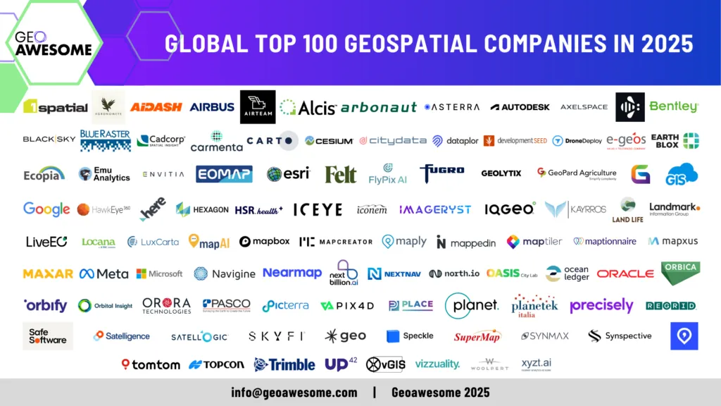

The wait is over! We are excited to officially unveil the Global Top 100 Geospatial Companies 2025 list—our annual ranking of the most innovative and influential companies shaping the geospatial industry.
This list, meticulously curated by a panel of industry experts for the 7th time, highlights the organizations leading the way in GIS, Earth Observation, AI-powered analytics, location intelligence, and more.
The Global Top 100 Geospatial Companies 2025 serves as a key resource for professionals, investors, and decision-makers looking to understand the evolving landscape of geospatial technology. From startups disrupting the market to established giants setting new benchmarks, this list reflects the diversity and dynamism of our industry.
Join us in celebrating these trailblazers who are shaping the future of geospatial technology and transforming our understanding of the world in this 2024 edition
The 2025 expert committee, a distinguished group of experts, brought together a diverse range of expertise and insights to curate the Global Top 100 Geo list. This year’s committee included:
- Sives Govender, Research Group Leader, CSIR, South Africa and Co- founder and coordinator of Environmental Information System-Africa
- Siau Yong, Director, GeoSpatial and Data & Chief Data Officer, Singapore Land Authority
- Osamu Ochiai, Senior Engineer, Manager for Satellite Applications and Operation Center at Japan Aerospace Exploration Agency
- Justyna Redelkiewicz, Head of Section Entrepreneurship and Environment at the European Union Agency for Space Programme (EUSPA)
- Chiara Solimini, Space Downstream Market Officer at the European Union Agency for Space Programme (EUSPA)
- Peter Rabley, CEO at Open Geospatial Consortium (OGC)
- Denise McKenzie, Manging Partner at PLACE Trust
- Dr. Nadine Alameh, Executive Director of the Taylor Geospatial Institute
- Paloma Merodio, VP at National Institute of Statistics and Geography of Mexico (INEGI)
and
- Aleksander Buczkowski and Muthukumar Kumar for Geoawesome
In the coming weeks, we will be sharing more analysis about the Geospatial industry and the ecosystem via our newsletter. Sign up to stay informed!
Sign up to our newsletter to stay updated
#GlobalTop100Geo 2025 Edition

AND here are the Global Top 100 Geospatial Companies of 2024 listed alphabetically.
| Previous Editions | Company name | Website |
| Part of 2022, 2023 and 2024 lists | 1Spatial | www.1spatial.com |
| Part of 2024 list | Agronomeye | www.agronomeye.com.au |
| Part of 2023 and 2024 lists | AIDASH | https://www.aidash.com/ |
| Part of 2022, 2023 and 2024 lists | Airbus Defence and Space | https://space-solutions.airbus.com |
| New entrant | Airteam Aerial Intelligence GmbH | https://airteam.ai/ |
| Part of 2022, 2023 and 2024 lists | Alcis Holdings Ltd | https://www.alcis.org/ |
| New entrant | Arbonaut | https://www.arbonaut.com |
| Part of 2022, 2023 and 2024 lists | ASTERRA | https://asterra.io/ |
| Part of 2019, 2021, 2022, 2023 and 2024 lists | Autodesk | https://www.autodesk.com |
| New entrant | Axelspace Corporation | https://www.axelspace.com/ |
| New entrant | Bee Maps (by HiveMapper) | https://beemaps.com |
| Part of 2019, 2021, 2022, 2023 and 2024 lists | Bentley | https://www.bentley.com/en |
| New entrant | BlackSky | blacksky.com |
| Part of 2023 and 2024 lists | Blue Raster | https://www.blueraster.com/ |
| Part of 2023 and 2024 lists | Cadcorp | https://www.cadcorp.com |
| Part of 2022 and 2024 list | Carmenta Geospatial Technologies | https://www.carmenta.com/ |
| Part of 2019, 2021, 2022, 2023 and 2024 lists | CARTO | https://carto.com/ |
| Part of 2021, 2022, 2023 and 2024 lists | Cesium | https://cesium.com/ |
| Part of 2023 and 2024 lists | CITYDATA | https://citydata.ai |
| New entrant | dataplor | https://www.dataplor.com/ |
| Part of 2019, 2021, 2022, 2023 and 2024 lists | Development Seed | developmentseed.org |
| Part of 2019, 2021, 2022, 2023 and 2024 lists | DroneDeploy | DroneDeploy.com |
| Part of 2024 list | e-geos | https://www.e-geos.it/en/ |
| Part of 2024 list | Earth Blox | https://www.earthblox.io/ |
| Part of 2022, 2023 and 2024 lists | Ecopia AI | https://www.ecopiatech.com/ |
| Part of 2022, 2023 and 2024 lists | Emu Analytics | www.emu-analytics.com |
| Part of 2023 and 2024 lists | Envitia Ltd | www.envitia.com |
| Part of 2023 and 2024 lists | EOMAP | eomap.com |
| Part of 2019, 2021, 2022, 2023 and 2024 lists | ESRI | www.esri.com |
| Part of 2024 list | Felt | http://felt.com/ |
| New entrant | FlyPix AI | https://flypix.ai/ |
| Part of 2023 and 2024 lists | Fugro | www.fugro.com |
| New entrant | Geolytix | https://geolytix.com/ |
| New entrant | GeoPard Agriculture | https://geopard.tech |
| New entrant | GeoWGS84 | https://www.geowgs84.com/ |
| Part of 2019, 2021, 2022, 2023 and 2024 lists | GIS Cloud | www.giscloud.com |
| Part of 2019, 2021, 2022, 2023 and 2024 lists | https://www.google.com/ | |
| New entrant | HawkEye 360 | he360.com |
| Part of 2019, 2021, 2022, 2023 and 2024 lists | HERE Technologies | https://www.here.com/ |
| Part of 2019, 2021, 2022, 2023 and 2024 lists | Hexagon | Hexagon.com |
| New entrant | HSR.health | https://www.hsr.health |
| Part of 2023 and 2024 lists | ICEYE | https://www.iceye.com |
| New entrant | Iconem | https://iconem.com/ |
| New entrant | Imageryst | https://www.imageryst.com/ |
| Part of 2024 list | IQGeo | https://www.iqgeo.com/ |
| Part of 2024 list | Kayrros | www.kayrros.com |
| New entrant | Land Life | https://landlifecompany.com/ |
| New entrant | Landmark Information Group | https://www.landmark.co.uk/ |
| Part of 2022, 2023 and 2024 lists | LiveEO | http://live-eo.com/ |
| Part of 2023 and 2024 lists | Locana | www.locana.co |
| Part of 2022 and 2024 list | LuxCarta | https://luxcarta.com |
| New entrant | MapAI | https://mapai.net/ |
| Part of 2019, 2021, 2022, 2023 and 2024 lists | Mapbox | https://www.mapbox.com/ |
| Part of 2021, 2022, 2023 and 2024 lists | Mapcreator | mapcreator.io |
| Part of 2023 and 2024 lists | Mapxus | https://www.mapxus.com/ |
| Part of 2024 list | Maply | https://maply.com |
| Part of 2021, 2022, 2023 and 2024 lists | Mappedin | www.mappedin.com |
| Part of 2019, 2021, 2022, 2023 and 2024 lists | MapTiler | https://maptiler.com |
| Part of 2019, 2021, 2022, 2023 and 2024 lists | Maptionnaire | https://maptionnaire.com/ |
| Part of 2022, 2023 and 2024 lists | Maxar Technologies | https://www.maxar.com |
| Part of 2019, 2021, 2022, 2023 and 2024 lists | Meta | https://www.meta.com/de/en/ |
| Part of 2021, 2022, 2023 and 2024 lists | Microsoft | https://www.microsoft.com/en-us/maps |
| New entrant | Navigine | https://navigine.com/ |
| Part of 2021, 2022, 2023 and 2024 lists | Nearmap | https://www.nearmap.com/us/en |
| Part of 2024 list | NextBillion.ai Pte Ltd | https://nextbillion.ai/ |
| Part of 2021, 2022 and 2024 list | NextNav | https://nextnav.com/ |
| Part of 2024 list | North.io GmbH | https://www.north.io |
| New entrant | Oasis City Lab | https://oasiscitylab.eu |
| New entrant | Ocean Ledger | https://www.ocean-ledger.com/ |
| Part of 2024 list | Oracle | http://www.oracle.com |
| Part of 2023 and 2024 lists | Orbica | https://orbica.world/?g=o |
| Part of 2023 and 2024 lists | Orbify | https://orbify.com |
| Part of 2019, 2021, 2022, 2023 and 2024 lists | Orbital Insight | https://orbitalinsight.com/ |
| New entrant | OroraTech | https://ororatech.com/ |
| Part of 2022, 2023 and 2024 lists | PASCO CORPORATION | https://www.pasco.co.jp/eng/ |
| Part of 2021, 2022, 2023 and 2024 lists | Picterra | www.picterra.ch |
| Part of 2019, 2021, 2022, 2023 and 2024 lists | Pix4D | https://www.pix4d.com/about-us |
| Part of 2022, 2023 and 2024 lists | PLACE | https://www.thisisplace.org |
| Part of 2019, 2021, 2022, 2023 and 2024 lists | Planet | https://www.planet.com/ |
| New entrant | Planetek Italia | https://www.planetek.it/ |
| Part of 2024 list | Precisely | https://www.precisely.com |
| Part of 2022, 2023 and 2024 lists | Regrid | https://regrid.com |
| Part of 2023 and 2024 lists | Safe Software | www.safe.com |
| Part of 2019, 2021, 2022, 2023 and 2024 lists | Satelligence | www.satelligence.com |
| Part of 2022 and 2024 list | Satellogic | www.satellogic.com |
| Part of 2024 list | SkyFi | https://www.skyfi.com/ |
| Part of 2019, 2021, 2022, 2023 and 2024 lists | Sparkgeo | www.sparkgeo.com |
| Part of 2024 list | Speckle | https://speckle.systems/ |
| Part of 2024 list | SuperMap Software Co., Ltd. | https://www.supermap.com/en-us/ |
| Part of 2023 and 2024 lists | SynMax | https://www.synmax.com/ |
| Part of 2022, 2023 and 2024 lists | Synspective Inc. | https://synspective.com/ |
| Part of 2024 list | Textomap | https://www.textomap.com/ |
| Part of 2019, 2021, 2022, 2023 and 2024 lists | TomTom | https://www.tomtom.com/ |
| Part of 2021, 2022, 2023 and 2024 lists | Topcon Positioning | https://www.topconpositioning.com/ |
| Part of 2019, 2021, 2022, 2023 and 2024 lists | Trimble | https://www.trimble.com/ |
| Part of 2021, 2022, 2023 and 2024 lists | UP42 | www.up42.com |
| Part of 2024 list | vGIS Inc. | https://www.vGIS.io |
| New entrant | Vizzuality | https://vizzuality.com |
| New entrant | Woolpert, Inc. | https://www.woolpert.com |
| Part of 2022, 2023 and 2024 lists | xyzt.ai | www.xyzt.ai |
Frequently Asked Questions (FAQs)
Q1. How was the list created?
Our selection process was meticulous. We reviewed over 1000 companies (up from 800 last year), narrowing them down to a shortlist of 261 based on past listees (2019, 2021, 2022, 2023 and 2024), expert recommendations, and nominated companies. A distinguished expert committee then voted on the shortlisted companies. The final Global Top 100 Geospatial Companies 2025 list reflects the collective judgment and consensus of these experts.
Q2. Is the list ranked?
No, the list is not a ranking. Companies are listed alphabetically to equally recognize all 100 leading geospatial companies without implying any hierarchy.
Q3. Who was part of the expert committee?
The 2025 expert committee, a distinguished group of experts, brought together a diverse range of expertise and insights to curate the Global Top 100 Geo list. This year’s committee included:
- Sives Govender, Research Group Leader, CSIR, South Africa and Co- founder and coordinator of Environmental Information System-Africa
- Siau Yong, Director, GeoSpatial and Data & Chief Data Officer, Singapore Land Authority
- Osamu Ochiai, Senior Engineer, Manager for Satellite Applications and Operation Center at Japan Aerospace Exploration Agency
- Justyna Redelkiewicz, Head of Section Entrepreneurship and Environment at the European Union Agency for Space Programme (EUSPA)
- Chiara Solimini, Space Downstream Market Officer at the European Union Agency for Space Programme (EUSPA)
- Peter Rabley, CEO at Open Geospatial Consortium (OGC)
- Denise McKenzie, Manging Partner at PLACE Trust
- Dr. Nadine Alameh, Executive Director of the Taylor Geospatial Institute
- Paloma Merodio, VP at National Institute of Statistics and Geography of Mexico (INEGI)
and
- Aleksander Buczkowski and Muthukumar Kumar for Geoawesome
Q4. What information did the expert committee consider?
Geoawesome announced an open call for nominations on October 1, 2024. Companies voluntarily provided insights through a structured questionnaire, detailing their vision, operations, and impact. The committee also relied on their extensive industry experience and independent research to make informed decisions.
Q5. What was new in the nomination process this year?
For the 2025 edition, we introduced key enhancements to improve the nomination process:
? Enhanced Focus on Core Competencies – We placed a stronger emphasis on core geospatial competencies and emerging industry trends shaping the future.
? Streamlined Nomination Process – The nomination form was simplified, removing basic company data fields and reducing the total number of questions to make the process more efficient.
Q6. What were the selection criteria?
There were no rigid selection criteria imposed on the expert panel. Each expert applied their unique perspective to assess the companies, ensuring a broad and well-rounded evaluation. As in past years, our expert panel will review all nominations and decide the final list. The nomination phase focused on the following aspects:
- Product and Impact on the Industry
- Innovation and Technological Advancement
- Contribution to the Community
- Commitment to Diversity, Equity, and Inclusion (DEI)
- Environmental, Social, and Governance (ESG) Practices
Q7. My company deserves to be on the list! How can I improve my chances?
We understand your passion, and we acknowledge that many deserving companies couldn’t be included due to space constraints. The best way to improve your chances for next year’s list is to nominate your company when the 2026 nominations open. The details companies share during the nomination process play a crucial role in helping our experts understand their impact. If you would like to take a look at the questions for the 2025 nomination, check out our google doc.
? Want to stay updated? Sign up to our newsletter to get notified when nominations open.
Q8. I have feedback or further questions. Whom should I contact?
We value your feedback and are happy to address any questions! You can reach out to Muthu at muthu@geoawesome.com.
We encourage you to share this announcement and participate in the discussion on social media using the hashtag #GlobalTop100Geo. Let’s celebrate the organizations that are making a difference in the geospatial world!
#GlobalTop100Geo 2024 Edition
Looking for the previous edition? Here you go!


#Fun


Next article
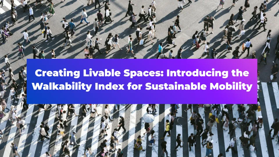
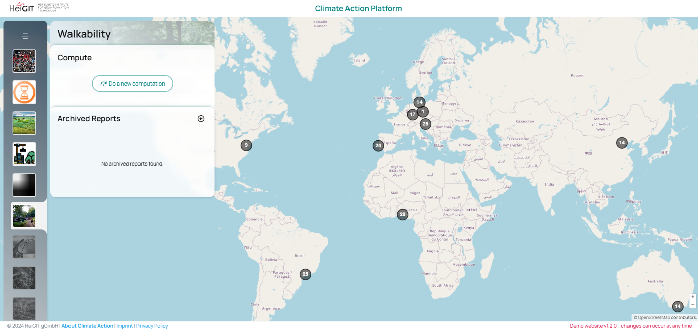
Creating Livable Spaces: Introducing the Walkability Index for Sustainable Mobility

Walkability is increasingly being recognized as essential element of healthier, more sustainable, and more livable communities. Given that the transport sector is one of the largest contributors to CO₂ emissions, and—with limited progress in reducing these emissions—promoting sustainable mobility has become an urgent priority. Walking and cycling are among the most efficient, low-impact modes of urban transportation, making their improvement essential for creating healthier, more livable cities. Furthermore, walkability is an important component of the “15-minute city” model, where essential services and amenities are accessible within a short walk from any point in the city.
What is Walkability?
Walkability refers to how friendly an area is to walking, influenced by factors such as pedestrian pathways, street safety, proximity of amenities (like benches or cafés), and the overall comfort and attractiveness of the walking environment. A walkable city encourages residents to choose walking over commuting by car, regardless of the season or time of day. This shift reduces carbon footprints, improves energy efficiency, and benefits public health. Walkability also brings economic and social advantages, such as increased business activity in walkable neighborhoods and active social interaction within the community.
![]()
Our Approach to Walkability
At the core of climate-friendly urban design is the need for practical, data-driven indicators that guide effective local action. HeiGIT, the Heidelberg Institute for Geoinformation Technology, addresses this need by developing indicators to support sustainable mobility and other urban climate action initiatives. These indicators help local stakeholders make informed decisions by visualizing key aspects of urban environments, from transportation options to patterns of land use, highlighting both community strengths and areas for improvement.
Recognizing that there is no universal approach to fostering urban mobility and reducing climate impact, HeiGIT tailors geospatial indicators to reflect the distinct walkability needs of each city. These tailored indicators enable urban planners, NGOs, and other stakeholders to address specific walkability challenges in their cities, factoring in unique cultural, environmental, and socio-economic conditions.
Using a co-creation process, we are building a walkability index that can adapt to diverse regions and contexts worldwide. Through a series of workshops, we identify which factors are most important to consider for walkability in that specific context. For example, in one city, sidewalk availability and safety might be top priorities, while in another, factors such as air quality or accessibility might take precedence. These factors can range from the presence of benches and rest areas, to the condition of surfaces and the level of traffic. Other indicators, like the proximity of essential services or the extent of lighting, may also play a critical role in enhancing walkability.
This adaptable approach is exemplified in cities like Lagos, Nigeria. Here, despite the lack of formal sidewalks, low car traffic allows pedestrians to walk comfortably on the main streets. This phenomenon is far from unique. In many parts of the world, areas with very low car traffic naturally become walkable, even without traditional sidewalks. Such contexts challenge conventional definitions of walkability and demonstrate the importance of considering local conditions when assessing what makes an environment “walkable.”
Methodology and Data Collection
We are working on a walkability index that will be globally accessible but locally adaptable, leveraging open data and additional tools. OpenStreetMap (OSM) is our primary data source, providing detailed information about urban transportation infrastructure and its properties. This crowdsourced, open-access data enables diverse cities to incorporate walkability into urban planning and design, ensuring that each city’s unique landscape and requirements are met.
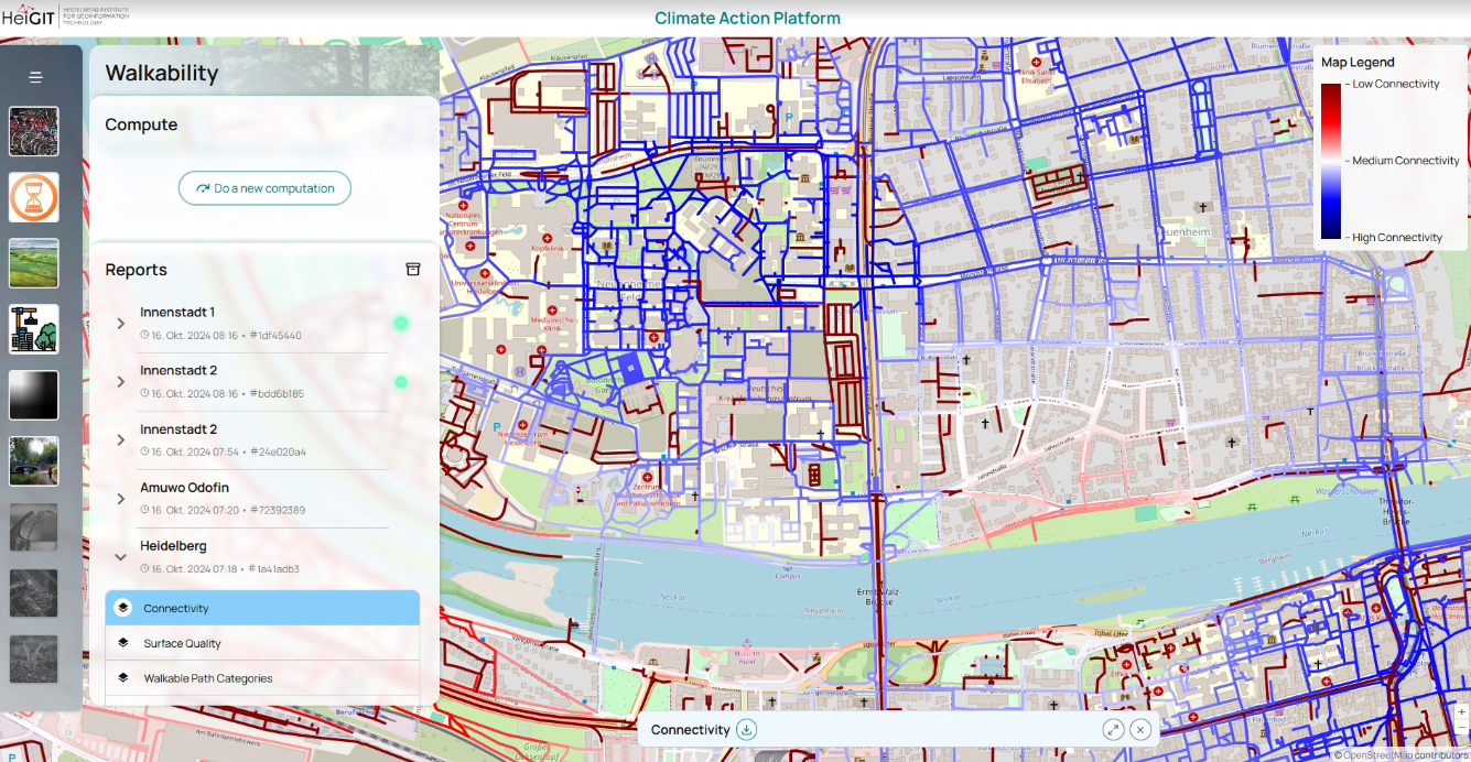
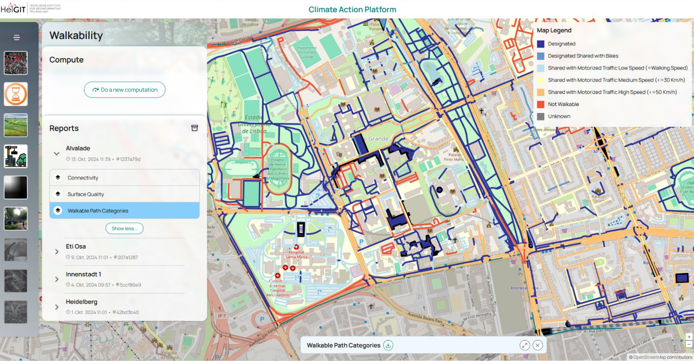
We currently have developed three separate indicators that use OSM data to assess different aspects that influence how walkable streets and paths are.
- Our first indicator, “Walkable Path Categories”, answers the question: “Who do I have to share this path with?”. It is a classification of all potentially walkable ways (OSM tag “highway=*”) and polygons (e.g., train platforms, squares, parking lots, etc.) according to whether they are designated for exclusive use by pedestrians (e.g., most sidewalks), or they are shared with bikes (e.g., paths tagged as “foot=designated & bicycle=designated & segregated=no”), or motorized traffic of different speeds (using OSM tag “maxspeed”). A street can still be relatively walkable even when shared with cars, as long as these have to drive very slowly and pedestrians have priority (e.g., “highway=living_street”). But as cars gain priority over pedestrians and drive faster, walking quickly becomes unsafe and less enjoyable.
- A second indicator, “Surface Quality”, answers the question: “How comfortable is it to walk on this surface”, and describes how smooth the surface of walkable paths is. This is also an indicator of accessibility, especially important for people with limited mobility, or those who need to use wheelchair or wheeled walking frames. The indicator classifies paths into different surface quality levels using information of “smoothness” OSM tags. When these are not available, we also use the tags “surface” (e.g., asphalt, concrete, cobblestone, gravel) and “tracktype”.
- Our third indicator, “Connectivity”, answers the question: “How directly do I get where I want to go?”, and captures how directly streets are connected to other locations in the surrounding area. Specifically, our indicator measures the fraction of nearby locations that can be reached within a short walk (e.g., 15 minutes) from a given street segment, relative to the number of locations that could be accessed “as the crow flies” (i.e., in a straight line). The better connected paths are in a street network, more locations are easily accessible by foot, which makes walking a more attractive transportation mode.
Future Developments
We continue to refine our current indicators and plan to develop new ones. For example, an upcoming indicator of “Greenness” will combine OSM-data with Sentinel-2 satellite imagery to calculate the average Normalized Difference Vegetation Index (NDVI, a proxy for vegetation density) of a small area surrounding each street. Greener streets, with more trees and surrounding parks and gardens, are more pleasant and attractive to walk through. We are also planning indicator to calculate the levels of noise and air pollution of different streets, which also impact how pleasant it is to walk through a given area.
So far, our indicators are limited by the quality and completeness of OSM data. To enhance the reliability and scalability of our walkability index, we plan to integrate remote sensing data and street-level imagery from the Mapillary platform. Remote sensing and street-view data offer complementary insights, helping confirm and correct OSM tags. Combining additional data with OSM tags will allow us to refine our classifications, ensuring that path types and traffic conditions are as accurate as possible.
Looking Ahead
The walkability index is still under development, and future research will assess how well our adapted analysis of pedestrian friendliness aligns with the real-world experiences of different population groups. Ultimately, we plan to share this index via an online platform, providing cities with the tools they need to create more climate-conscious urban environments.
If you are interested in this work, want to collaborate, or help develop new tools, contact Kirsten at kirsten.vonelverfeldt@heigit.org.

