


Welcome to our #GeoawesomeQuiz number 5 as it’s the 5th week of the year! How do you like it so far? Please comment under the post! And of course remember to take quizzes from the previous weeks.
[mlw_quizmaster quiz=5]


#Fun

Next article

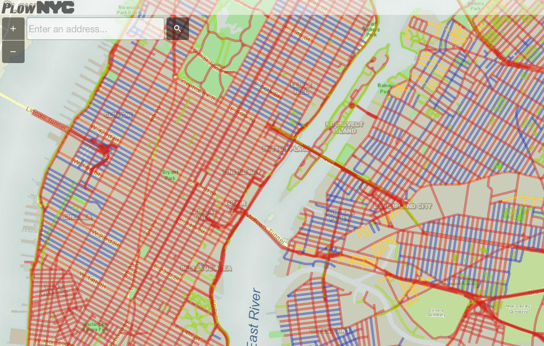
While the New York is getting ready for a massive snowfall, location-based technology again comes with a helpful solution. Rastrac, a GPS fleet tracking company has launched a website which aggregates data from 2550 plows around the city fighting with winter.
The city actually tracks all the snow plows, the tracking data is than aggregated and published on the map called PlowNYC. Green lines on the map show the roads that have been plowed in the last hour whereas the blue line shows the streets that have been plowed in the last one to three hours.
Does it actually works? We have no idea. Maybe some comments from New Yorkers?

