
Google Maps has long been a leader in digital navigation, offering directions and location insights to users worldwide. In 2023, Google introduced several new features that use geospatial technology and artificial intelligence to improve user experience. These updates not only support existing services but also introduce new abilities that promise to change how we interact with our environment.
Immersive View for Routes
One of the most notable introductions is the Immersive View for Routes. Developed in major cities, this feature allows users to visualize their entire journey in a dynamic, three-dimensional space. By combining AI with extensive Street View and aerial photography data, Google Maps can now provide a detailed, photorealistic preview of travel routes.
This 3D visualization is particularly useful for planning as it includes real-time elements like traffic conditions and weather forecasts. Users can simulate different departure times to see how conditions change, making it easier to plan trips efficiently. For cyclists and pedestrians, this feature enhances safety by allowing them to familiarize themselves with the route details, such as turns and landmarks, before heading out.
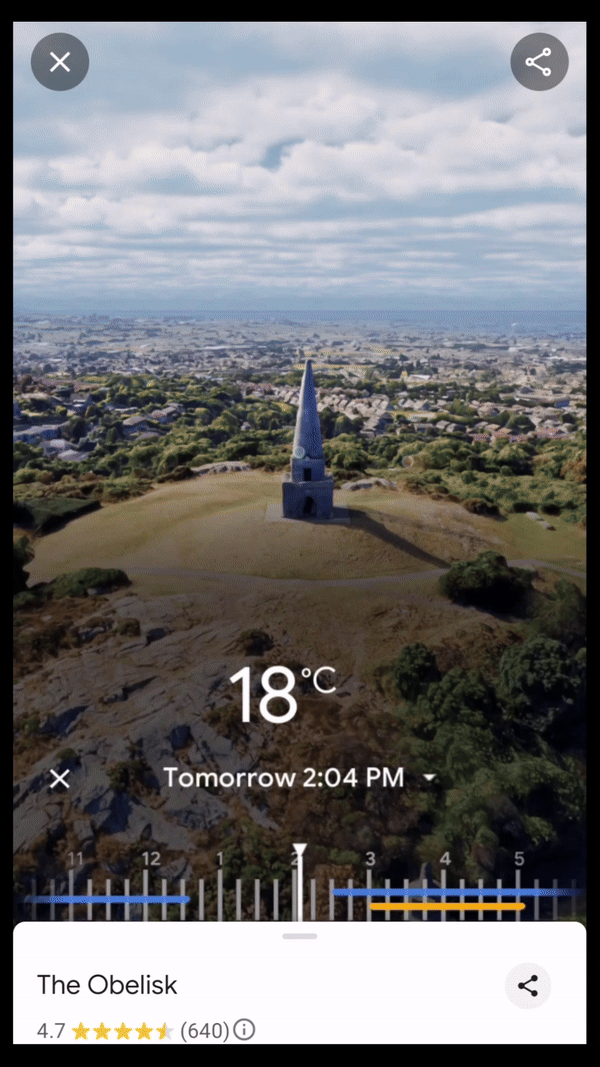
Immersive View, Dublin
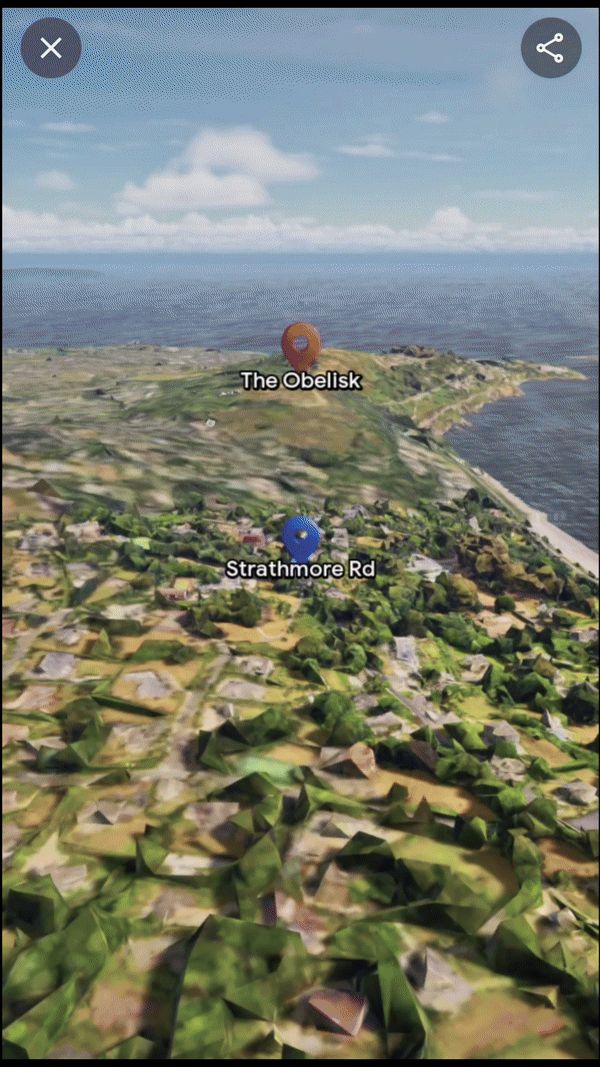
Immersive View for Routes, Dublin
Google Maps’ Immersive View for routes transforms navigation by stitching together billions of high-resolution images from aerial surveys and Street View captures. The photogrammetric technique aligns these images with existing map data, creating a precise digital visual.
AI and machine learning then label critical route details like street signs and building entrances from these images. The transformation from 2D to 3D is achieved using multi-perspective aerial cameras, which accurately model terrain and building heights. This detailed 3D map allows for dynamic route visualization with camera movements that show both overarching route plans and close-up navigational tips. Real-time data overlays such as traffic conditions and weather are added, enhancing route planning. This integration of detailed visuals and real-time information is now enhancing navigational confidence for users in cities like Amsterdam, Dublin, New York, and Tokyo.
Immersive View for Routes, Dublin
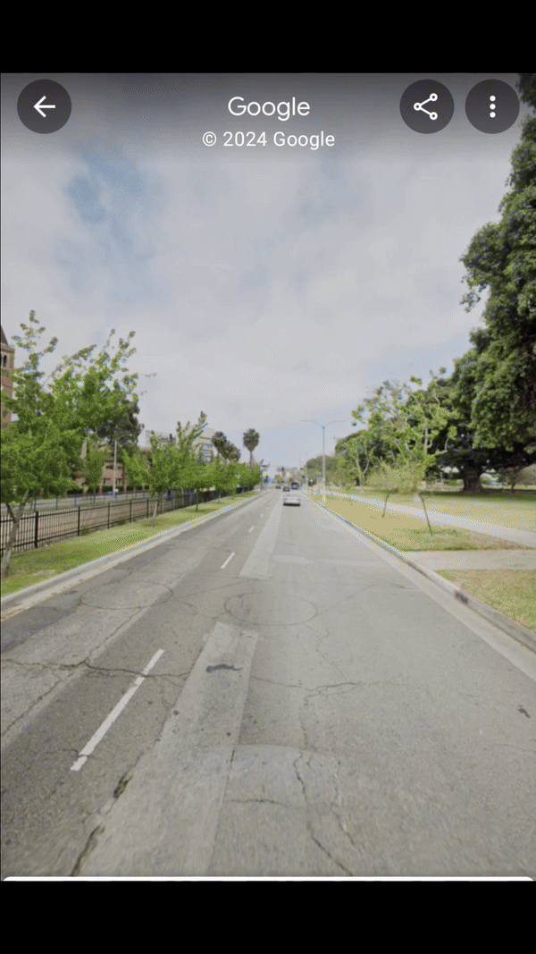
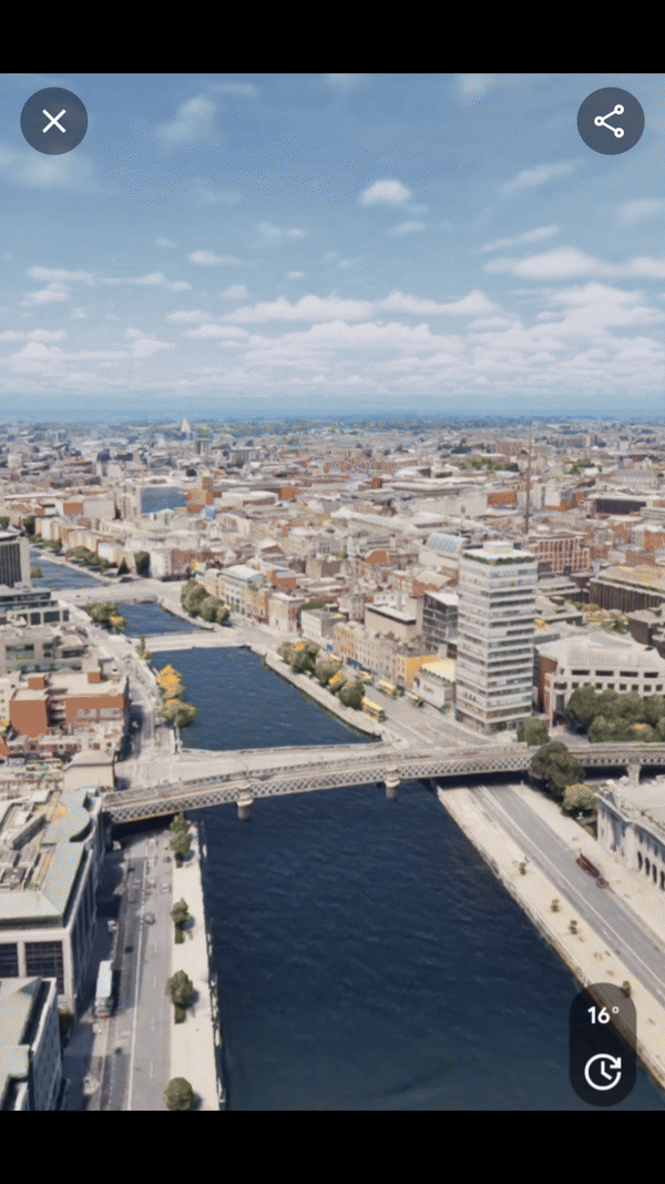
Fusion of StreetView and Immersive View, Los Angeles
AR Possibilities with Lens in Maps
Lens in Maps, formerly known as Search with Live View, has expanded its functionality. Now available in over 50 new cities, this feature utilizes augmented reality and AI to help users quickly orient themselves in unfamiliar surroundings. By simply pointing their smartphone cameras, users can get real-time information about nearby places like restaurants, ATMs, and public transport stations. This instant data layer helps users navigate spaces more confidently and efficiently.
AR Lens, Tokio
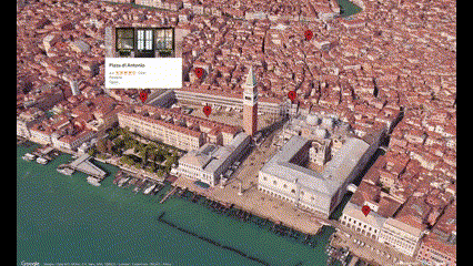
Photorealistic 3D Tiles in Google Maps Platform
The launch of Photorealistic 3D Tiles marks a significant advancement in Google Maps’ possibilities. These tiles allow developers to create more engaging map experiences. For instance, real estate companies can use these tiles to show potential buyers detailed 3D models of properties and their surroundings, enhancing the buying experience by providing a more comprehensive view of the area.
Source: 3d-tiles.web.app
Example of 3D Tiles, New York
Example: The Importance of Vegetation in Prague, Czech Republic
Prague’s use of Google Maps’ 3D Tiles to study urban vegetation showcases the practical applications of these advanced geospatial tools. By analyzing 3D models of the city enhanced with data on existing vegetation, planners can assess the impact of green spaces on urban heat islands, air quality, and biodiversity. Such insights have a huge impact on developing strategies to integrate more green areas into urban planning, which can lead to healthier, more sustainable city environments.
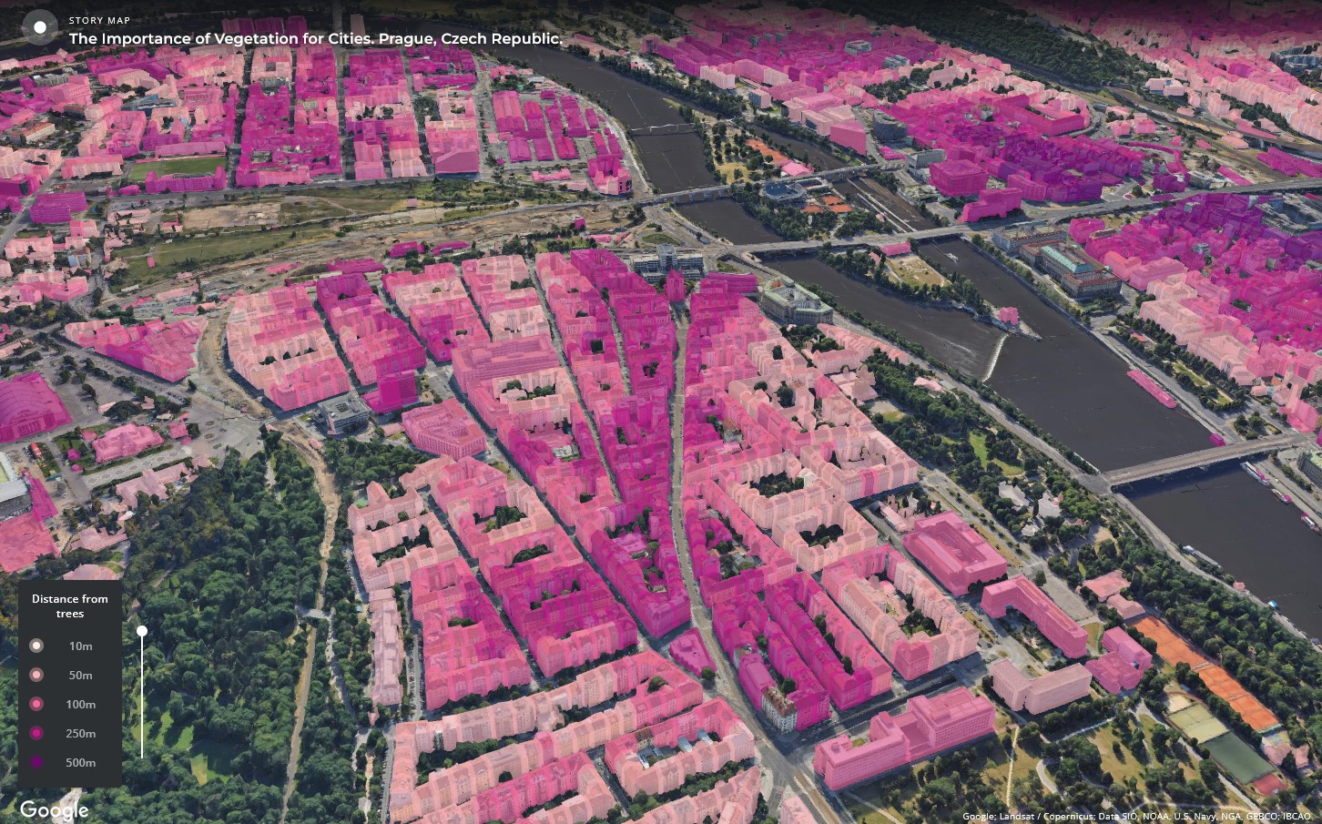
3D Tiles, Prague
Check out this project here: carto.com
Future Directions of Google Maps Features
These updates from Google Maps highlight the growing importance of geospatial technology in everyday applications. Google Maps continues to set the standard for digital mapping and navigation. Its latest updates, not only improve how we view and interact with our immediate environment but also offer tools that can help shape the future of urban landscapes worldwide. By integrating AI and 3D visualization, Google Maps is enabling more informed interaction with the places we live and visit.
Did you like this post? Read more and subscribe to our monthly newsletter!


#Contributing Writers
Next article
3D mapping is a great product for visualizing geographic data, allowing us to explore landscapes more interactively. By combining the capabilities of geospatial software (QGIS) and a 3D creation suite (Blender), you can create stunning 3D maps that bring historical and elevation data to life. In this guide, we’ll walk through the process of creating a 3D map using Digital Elevation Models (DEMs) and an old city map of Kraków and Budapest.
3D Maps by Geo-enthusiasts
BlenderNation – Owen Powell Maps Terrain Models: This page highlights Owen Powell’s work on creating terrain models using Blender, particularly focusing on his innovative methods for rendering complex landscapes.
Wesley Barr’s Blog – How to Make a 3D Map in Blender: This guide provides a step-by-step tutorial on creating 3D maps in Blender using GIS data, covering everything from importing elevation data to rendering realistic textures.
TJukanov’s Blender Maps: This site showcases the collection of 3D maps created in Blender by a cartographer named Tjukanov, featuring examples of his work and insights into his creative process.
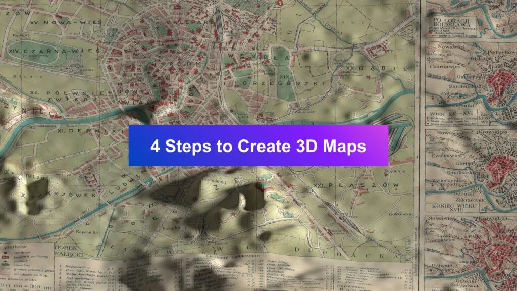
Workflow: How to Create a 3D Maps?
Step 1: DEM Layers
For 3D visualization, you need height components. For instance, Digital Elevation Models offer information about height above sea level. Find the area of your interest and download the necessary data, taking into account the geographical extent of the historical map. You can use OpenTopography website in search of your height map. Merge all DEM layers, if necessary, and make sure the final DEM raster overlaps with the historical map.
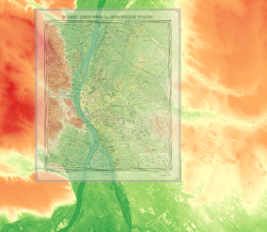
DEM extent
Step 2: Georeferencing the Old Map (optionally)
This step is to align the historical map with the DEM using QGIS’s Georeferencer tool. This process ensures that the map accurately overlays the terrain based on real-world coordinates. It’s necessary if your historical map doesn’t contain georeference.
- Load the historical map: Open the Georeferencer tool (found in QGIS under Raster > Georeferencer).
- Adding Tie Points: Tie points are crucial in georeferencing. These points link known locations on your old map to their corresponding locations on a base map (such as OpenStreetMap) or the DEM. The first task is to select a point in the historical map, and then to choose the same location in the base map in QGIS. What we suggest in this step is to try to distribute your tie points evenly in the historical map and be aware of Residual error. The smaller it is, the better the results of georeferencing are.
- Transformation Settings: After adding sufficient tie points, it is high time to choose a transformation method (such as Helmert or Polynomial) and apply the georeferencing. At last, you have to save the output as a georeferenced image.
QGIS Georeferencer allows you to check your transformation precision by calculating Residual error in pixels and presenting spatial error of georeferencing. In the image below you can see how poor precision of selecting tie points can influence the overall error.
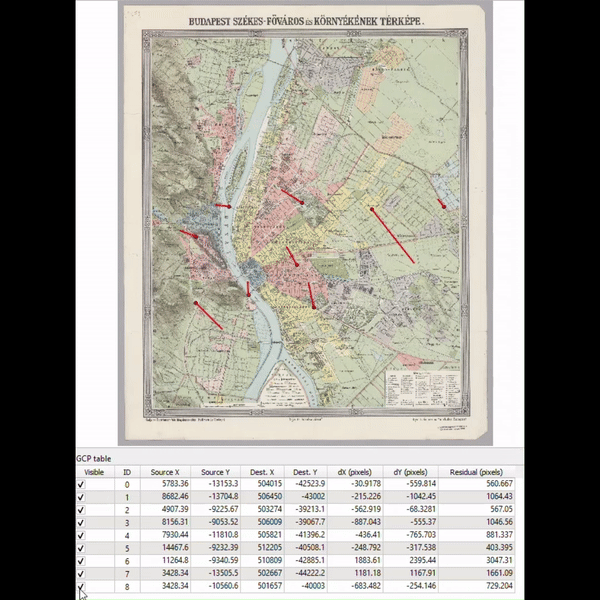
Georeferencing residuals
Step 3: Exporting Images to .jpg
For this step, we recommend using QGIS Layout Manager. Set up paper properties and the resolution of output .jpg file. Here we set up the paper size to 210×210 mm and export resolution to 600 dpi (page width and page height set up to 4960 px).
Export two images: one with elevation data and the other with a georeferenced historical map.
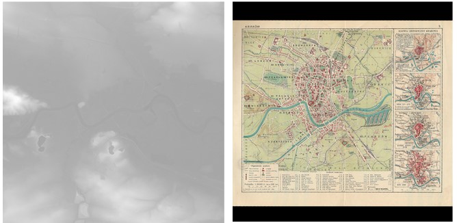
Output from QGIS: elevation map and georeferenced historical map
Step 4: Generating the Mesh & Applying the Texture
Blender software offers plenty of tools for creating a 3D mesh and model texturing. In this tutorial, we used settings similar to this workflow. You can manipulate the with the ‘Strenght’ and ‘Level Viewport’ to increase and adjust the topography appearance.
Final results
3D Map of Kraków
3D Map of Budapest
Creating 3D maps using QGIS and Blender is a way to visualize both historical and topographical data in an engaging format. By carefully preparing your DEM, choosing a historical map in QGIS, and crafting the 3D terrain and textures in Blender, you can produce detailed and visually compelling maps that bring the past and present landscapes together. This integration opens up new possibilities for 3D map creation.
Did you like the article? Read more and subscribe to our monthly newsletter!

