How the EU Space Programme is contributing to the EU Green Deal
Space – the greener frontier – is good for business
What benefits can people expect from European space commerce in the near future?
Space is the new technological revolution, and it is changing the way we live, work and play. From the navigation system in our cars to the landing of the last flight we took, to the map on our mobile phone – even though we may not know it, the benefits of satellite technology are everywhere.
All smartphones sold in the European single market (since March 2022) are using Galileo satnav signals. This improves an emergency call’s location which will result in faster response times and more lives saved.
In other words, space is a solution – an invisible infrastructure providing very visible services.
How is the business of space set to grow?
Annual sales of satnav receivers are forecast to grow from 1.8 billion to 2.5 billion devices from 2021-2031. The consumer, tourism and health markets will dominate. Smartphones and wearables account for 92% of the receivers. Over 10 billion satnav devices will be installed by 2031, globally.
Apart from the consumer market, the professional markets of agriculture, urban development, cultural heritage and infrastructure will also contribute to the revenue stream.
The Internet of Things (IoT) enabled devices and applications, data-driven services and the push for smart cities and mobility will lead to increased demand.
In terms of Earth observation, commercial revenues are set to double from roughly €2.8 billion to over €5.5 billion over the next decade.
What role does knowledge from space play to help protect our planet?
Copernicus Services monitor a number of key climate indicators, such as sea levels, temperature and air currents. This data can then be used to help develop global climate policy decisions.
Through the Copernicus Climate Change Service we provide information about the past, present, and future climate to business and policy makers.
Europe’s space programme provides a wealth of information about climate (see below).
Surveillance of climate
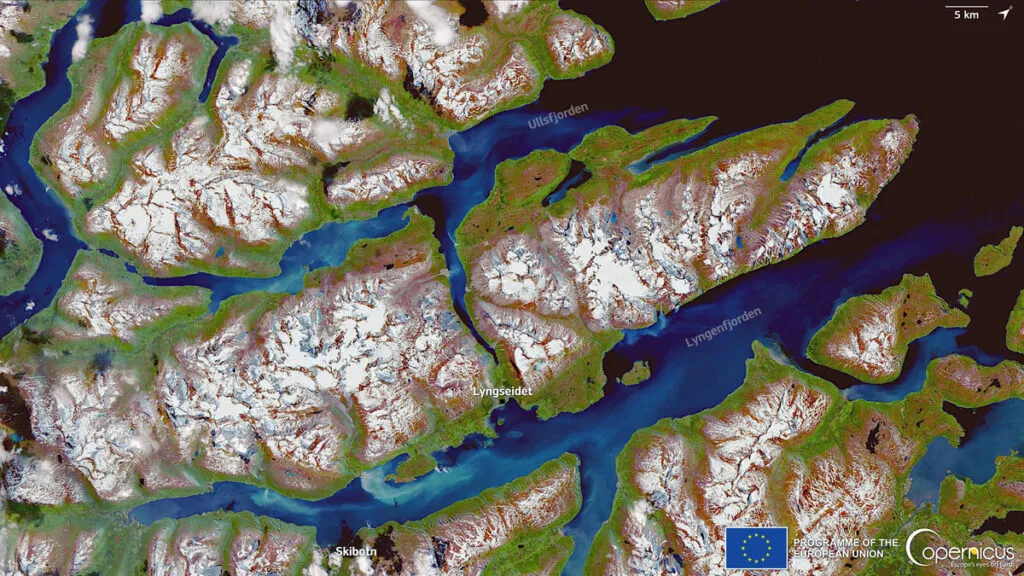
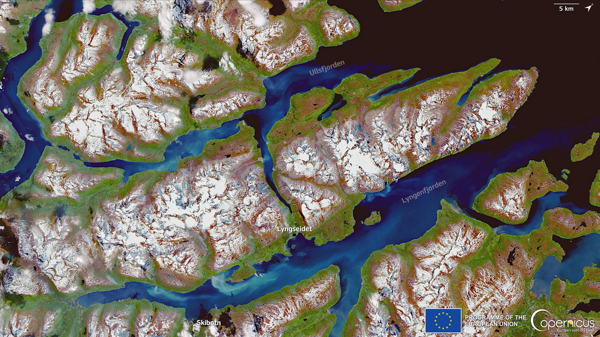
The above image of Norwegian fjords near Tromsø inside the Arctic circle shows the effects of the intense heatwave gripping much of Europe in June 2022. The darker areas of water indicate a massive sediment discharge into the fjords from melting ice.
Copernicus services are used to monitor climate change in environments such as the Arctic regions.
Dust clouds

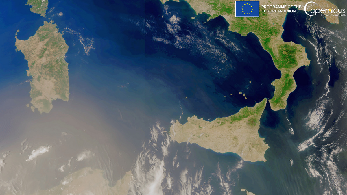
Saharan dust in the Mediterranean Sea, 30 June 2022. Credit: European Union 2022, Sentinel 3 imagery
On 30 June 2022, one of the Copernicus Sentinel-3 satellites captured this image, showing the Saharan dust cloud engulfing the skies of North Africa, South Italy and Malta. The storm is expected to persist and reach Spain in the coming days.
There have been several dust storm episodes in 2022 so far. They are bad for human health and also affect solar energy production by depositing sand on the solar panels, limiting their productivity. The Copernicus Atmosphere Monitoring Service (CAMS) provides forecasts to help plan the measures needed to limit the negative effects of dust storms.
EU space applications
Satnav navigation
Galileo is the European Union’s independent satnav system. Logistics companies use it to track shipping and aircraft use it when taking off and landing. In-car navigation is aided by the fact that Galileo is more accurate over cities than traditional GPS (US) and GLONASS (Russia) satnavs.
Galileo also boasts of better security from hackers. The resilience ensures quality and dependability. Apart from navigation services, Galileo also supports search and rescue beacons for people in distress.
Designed and built in Europe, Galileo is having a massive impact for European and world commerce. Already, the next generation of Galileo satnav is being planned.
Climate science
The Copernicus Earth Observation programme is used extensively for climate change science.
The Sentinel and other satellites are capable of monitoring temperature and sea level conditions on earth as well as other climate measurements. This data can then be fed into global climate policy decisions.
‘Because the oceans absorb carbon, their temperatures go up, which has a whole host of knock-on effects,’ da Costa said, ‘Including rising sea levels, changes in fish migration, the dying-off of coral reefs and shifts in the world’s climate patterns.’
The EU Space Programme also plays a role in limiting the impact of climate change on the Arctic environment. For example, the accurate navigation offered by Galileo can optimise shipping routes to reduce greenhouse gas emissions and fuel consumption.
Follow the link to learn how key climate indicators are monitored by the Copernicus Marine and Climate Change Services.
Emergency support
The Copernicus Emergency Management Service (EMS) provides information for emergency response to catastrophes, natural or man-made. Whether it’s fires, floods, earthquakes, volcanoes, hurricanes or other disasters, emergency services can make use of the rapid mapping service to obtain highly detailed views of conditions on the ground.
‘Last summer, when wildfires ravaged Greece, public authorities called on the Copernicus EMS to monitor the evolving situation,’ said da Costa. ‘When floods struck Germany, Belgium, the Netherlands, and Luxembourg (also in 2021), satellites provided rescue teams with the highly accurate positioning and navigation they needed to save lives.’
Copernicus Emergency Management also provides early warning of possible flood and fire risks. This image from July 2022 highlights the risk of wild fire in Europe and Mediterranean countries during summer temperatures – higher risk of fire is indicated by darker colours.
Research in this article was funded by the EU. If you liked this article, please consider sharing it on social media.
This article was originally published in Horizon, the EU Research and Innovation magazine
Did you like the article? Read more and subscribe to our monthly newsletter!


