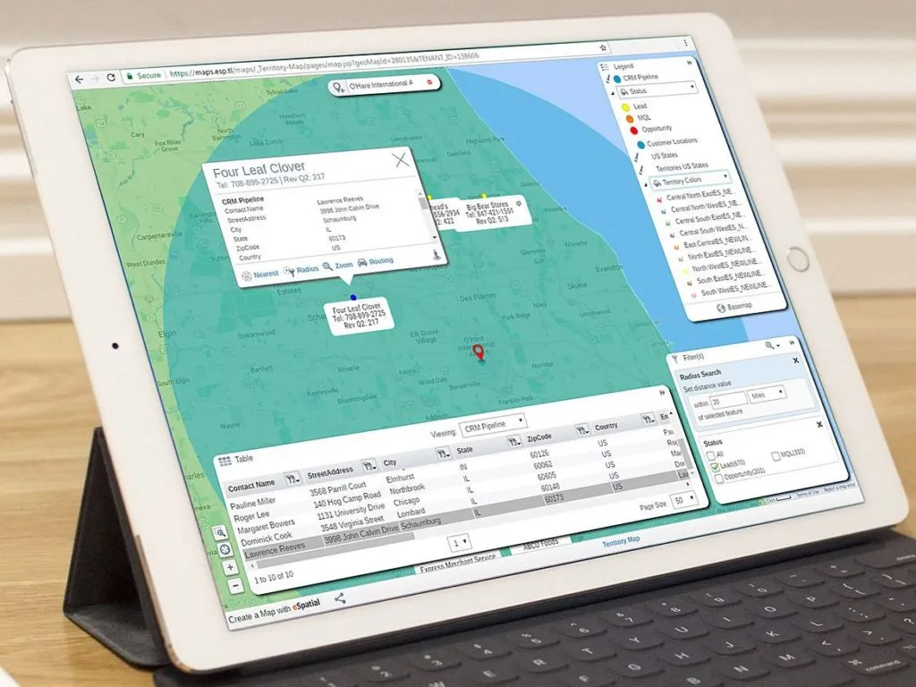
When working with location data, we have to choose which GIS software may be best for the our projects. As more GIS alternatives to ESRI’s ArcGIS are arriving to the scene with some even for free, it can be daunting to know which one is best.
Some things to think about when choosing a GIS software include:
- Type of data you will be using
- How you want to manage the data
- Number of people on your team
- Skill level of your team or yourself
- If you want to customize the software (ie. with Python extensions)
- What kind of visualizations you are going to make
- How your clients want your results to be published
- and so on
eSpatial provides an interesting approach to GIS. They focus on the sales, marketing, and operations aspects. Precisely, they aim to help organizations prospect, market more precisely, reduce delivery times, and overall, be more efficient and profitable. We tested eSpatial ourselves, and here is our review.
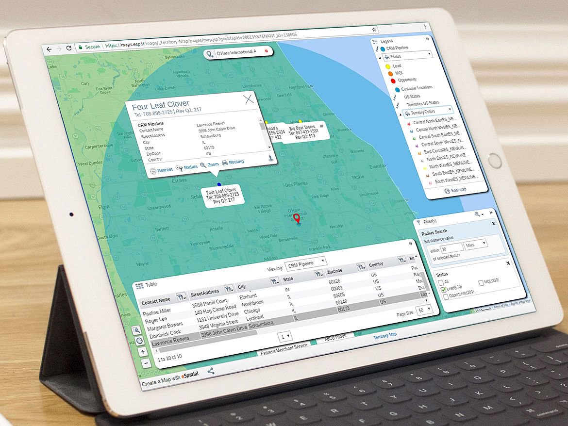
As part of a welcome industry trend, eSpatial is available as a cloud-based web app. just like CARTO, GIS Cloud, or Mapbox. It would not matter if you were on Windows, macOS or Linux. It is also available as a fully integrated Salesforce App. Read more: Salesforce bets on power of location with MapAnything acquisition
As all progress is saved online, multiple users can collaborate on a single map, and that is certainly an advantage. On the enterprise-class plan, there is even a possibility of controlling access among accounts.
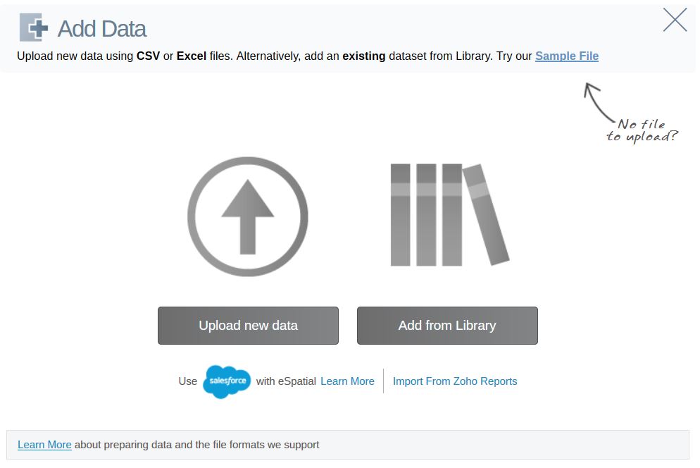 For those on a paid plan, eSpatial offers over 100 third party dataset libraries to use right out of the box. They include political boundaries, and demographic data such as population, income, education, and housing. Even just having the political boundaries would save a lot of time when doing geospatial analysis.
What can it be used for?
Some useful visualiations and analyses offered by eSpatial are:
Pin maps: to see POI data on the map
Heat maps: to identify concentrations of data, eg. where most traffic accidents occur. Both hot spot heat maps and regional heat maps are available.
Radius maps: to identify priximity from a single or multiple points of data on a map.
Route maps: for us, one of the highlights of eSpatial was that it allows employees to schedule a day of meetings and prospecting through mapping. Additionally, it will allow the user to identify pit stops, add in estimated length of time at each stop, and provide a summary of the day.
Territory Management: Territory alignment sets sales footprints and workloads, allocates customers or products to representatives, and assigns personnel to territories.
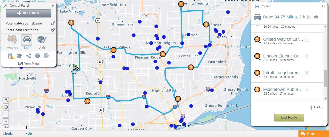
An example of planning your day with eSpatial using route maps
Additionally, eSpatial exports to PDF, PowerPoint booklet format, and provide a URL for sharing an interactive map. They also support single sign on (SSO) for enterprise accounts to ensure the security of access and data sharing.
Additionally, eSpatial comes with a mobile app, which is built for those on the go (eg. when naviating with route maps or to present a map on a tablet).
What can’t it do?
As many basic mapping operations were fast and easy because of the software and third-party datasets, the limitations of eSpatial become more apparent after using a bit more
First, it is quite a closed ecosystem and does not allow much third-party integration or customization, such as changing the projection system, or importing your base maps – not that there aren’t many to choose from.
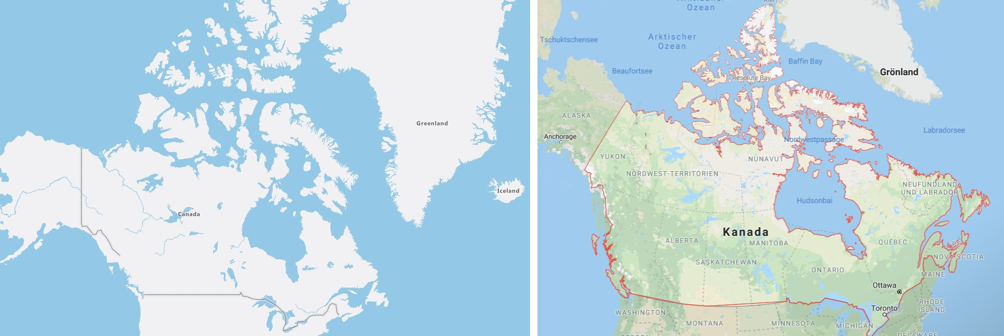
Left: Canada and Greenland projected on the Mercator system on eSpatial. Right: Canada and Greenland projected on a sphere on Google Maps. It is unclear if this will affect distance calculations further from the equator.
As eSpatial is mostly an analysis and visualization tool, it does not allow much calculations or query expressions to be used. At the moment, it seems like all of the data should be calculated and cleaned into CSV, XLS, and XLSX format (that’s right, no JSON or shapefiles, since it’s not what their target market generally asks for) before importing it to the software. Still, I would be interested to see if there are ways to integrate eSpatial with live datasets in the future. This also means that there are no ways to add remote sensing imagery or render 3D visualizations.
As with all cloud-based web apps, eSpatial cannot be used offline, so internet downtime would further hinder productivity when it comes to using eSpatial.
As mentioned before, there are many factors on why you would choose a specific GIS software. Based on what we discussed,
We would not recommend eSpatial for:
- Professionals who need their GIS software to perform a complete and robust set of data processes
- Heavy and repetitive location data processes
- Cartographers who make creative and out of the box maps
We would recommend eSpatial for:
- Businesses who want to harness the power of location to get a better understanding of the market and be more efficient on a day-to-day basis with a fast and lightweight software
- Organizations who make maps to supplement their core work and analyses
- Fresh or casual mappers who could benefit from a lower learning curve. eSpatial also comes with training and support
For the organizations who could use a geospatial boost, we would certainly recommend eSpatial for their sales and marketing efforts.
But don’t take our word for it. Try it for free yourself, and see if eSpatial can help you harness the power of location data!


